VesselConnect
  • Completed

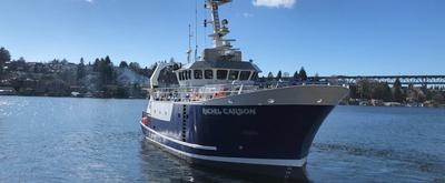
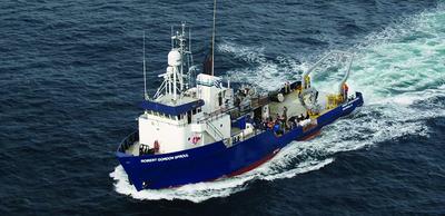
    Blue Heron · UMN

    UMN cruise 2024

    Craig Hill · UMN-TC

    These cruises utilize funding provided by the University of Minnesota. Chief Scientists will be completing seed research cruises or using their ship time to take graduate and undergraduate students on the research vessel Blue Heron.

    Jun 25, 2024 · 1 d

    Western Lake Superior

  • Completed

    BATS 2024 - 12of12

    Nicholas R. Bates · BIOS

    Long-term observations over several decades are a powerful tool for investigating ocean physics, biology, and chemistry, and the response of the oceans to environmental change. The Bermuda Atlantic Time-Series Study, known as BATS, has been running continuously since 1988. The research goals of the BATS program are: (1) to improve our understanding of the time-varying components of the ocean carbon cycle and the cycles of related nutrient elements such as nitrogen, phosphorus, and silicon; and, (2) to identify the relevant physical, chemical and ecosystem properties responsible for this variability. In addition, the BATS program has strong and diverse broader impacts, contributing to the field of ocean sciences by providing high quality ocean observations and data for seagoing scientists and modelers, and a framework through which researchers can conceive and test hypotheses. This award will support the operations of the BATS program for five more years. The primary BATS research themes are as follows: (1) Quantify the role of ocean-atmosphere coupling and climate variability on air-sea exchange of CO2, and carbon export to the ocean interior; (2) Document trends and the controls on the interannual to decadal scale variability in carbon and nutrient cycles to their coupling in the surface and deep ocean via the Redfield Ratio paradigm; (3) Quantify the response of planktonic community structure and function, and impact on biogeochemical cycles to variability in surface fluxes and dynamical processes; (4) Facilitate development, calibration and validation of next generation oceanographic sensors, tools and technologies; and, (5) Generate a dataset that can be utilized by empiricists, modelers and students. This research integrates ocean physics, chemistry and biology into a framework for understanding oceanic processes and ocean change in the North Atlantic subtropical gyre. The existing 29 years of BATS data provide robust constraints on seasonal and interannual variability, the response of the Sargasso Sea ecosystem to natural climate variability, and signal detection of potential ocean changes. This project would extend the BATS program through years 31-35 to address a series of ten interlinked questions through integrated research approaches and a multitude of collaborative efforts. In addition to the themes above, and embedded into the ten questions and approaches, the BATS team will focus on, for example, coupling of particle production and biogeochemistry; revisiting the complexities of the biological carbon pump; oxygen decline; and changes in the hydrography, physics, ocean carbon cycle and biogeochemistry of the Sargasso Sea. The highest quality data observation and collection will be maintained and used to address these questions. Importantly, a wide range of collaborations at the BATS site, spanning the physical and biogeochemical disciplines, will aid these broad goals. Strong links to community stakeholders, and close collaboration (including methods intercomparisons and personnel exchanges) with the Hawaii Ocean Time-series are proposed. This work will extend the research findings of the project into educational and training opportunities within and beyond the oceanographic community, including training and mentorship of both undergraduate and graduate students.

    Jun 24 – Jul 10, 2024 · 16 d

    Atlantic

    Sails with 2 other projects
  • Completed

    BATS 2024 - BATS Val

    Nicholas R. Bates · BIOS

    Long-term observations over several decades are a powerful tool for investigating ocean physics, biology, and chemistry, and the response of the oceans to environmental change. The Bermuda Atlantic Time-Series Study, known as BATS, has been running continuously since 1988. The research goals of the BATS program are: (1) to improve our understanding of the time-varying components of the ocean carbon cycle and the cycles of related nutrient elements such as nitrogen, phosphorus, and silicon; and, (2) to identify the relevant physical, chemical and ecosystem properties responsible for this variability. In addition, the BATS program has strong and diverse broader impacts, contributing to the field of ocean sciences by providing high quality ocean observations and data for seagoing scientists and modelers, and a framework through which researchers can conceive and test hypotheses. This award will support the operations of the BATS program for five more years. The primary BATS research themes are as follows: (1) Quantify the role of ocean-atmosphere coupling and climate variability on air-sea exchange of CO2, and carbon export to the ocean interior; (2) Document trends and the controls on the interannual to decadal scale variability in carbon and nutrient cycles to their coupling in the surface and deep ocean via the Redfield Ratio paradigm; (3) Quantify the response of planktonic community structure and function, and impact on biogeochemical cycles to variability in surface fluxes and dynamical processes; (4) Facilitate development, calibration and validation of next generation oceanographic sensors, tools and technologies; and, (5) Generate a dataset that can be utilized by empiricists, modelers and students. This research integrates ocean physics, chemistry and biology into a framework for understanding oceanic processes and ocean change in the North Atlantic subtropical gyre. The existing 29 years of BATS data provide robust constraints on seasonal and interannual variability, the response of the Sargasso Sea ecosystem to natural climate variability, and signal detection of potential ocean changes. This project would extend the BATS program through years 31-35 to address a series of ten interlinked questions through integrated research approaches and a multitude of collaborative efforts. In addition to the themes above, and embedded into the ten questions and approaches, the BATS team will focus on, for example, coupling of particle production and biogeochemistry; revisiting the complexities of the biological carbon pump; oxygen decline; and changes in the hydrography, physics, ocean carbon cycle and biogeochemistry of the Sargasso Sea. The highest quality data observation and collection will be maintained and used to address these questions. Importantly, a wide range of collaborations at the BATS site, spanning the physical and biogeochemical disciplines, will aid these broad goals. Strong links to community stakeholders, and close collaboration (including methods intercomparisons and personnel exchanges) with the Hawaii Ocean Time-series are proposed. This work will extend the research findings of the project into educational and training opportunities within and beyond the oceanographic community, including training and mentorship of both undergraduate and graduate students.

    Jun 24 – Jul 10, 2024 · 16 d

    Atlantic

    Sails with 2 other projects

  • Completed

    Hydro S - 2024 12of24

    Nicholas R. Bates · BIOS

    One of the longest open-ocean hydrographic stations in the world is maintained at the Hydrostation S site (formerly known as the Panulirus site) located ~25 km southeast of Bermuda in the North Atlantic Ocean. This program of repeat biweekly hydrographic observations began in 1954 (by Hank Stommel) and now, in its seventh decade, has proved to be the catalyst for numerous studies of ocean physics, biological processes and biogeochemistry. Hydrostation S continues to be recognized as one of the most important sustained ocean time–series. The renewal of the Hydrostation S program is proposed herein, extending this invaluable time–series of ocean hydrography to almost 70 years. The upper ocean warming trend has strengthened (about +1.4° C since the 1970's; ~+0.8°C in last decade) with significant salinification (+0.16). Deeper waters such as the Labrador Sea Water has cooled by a few tenths of a degree and freshened with a marked decadal oscillation. The signature of deoxygenation has been observed at Hydrostation S in the upper ocean (about 4 µmoles kg -1 decade -1 decrease in dissolved oxygen) as well as the oxygen minimum zone (~2.5 µmoles kg -1 decade -1 ). Hydrostation S also supports the longest global ocean CO 2 and acidification time-series (from 1983 to present) The major objective of the proposal is to continue Hydrostation S into the eighth decade with numerous questions related to warming and cooling, salinification and freshening, deoxygenation and insights on biogeochemical changes over time. This program constitutes frequent water column sampling of temperature, salinity, and dissolved oxygen (and indirectly, sampling of important ocean carbon time–series) of the North Atlantic subtropical gyre at the Hydrostation S site. Such work is complementary to other sustained observations such as the Bermuda Atlantic Time–series Study (BATS) and Ocean Flux Program (OFP). We propose to carry out a similar sampling format that has been followed for the past 68 years. As for the past ten years, we would continue to conduct two CTD profiles to better capture the deep–water variability while maintaining all the previous discrete depths. The first CTD cast will profile to full ocean depth (3,300–3,500 m) while the second CTD cast will profile to 500 m (to allow for instrumentation not rated for full ocean depth such as a PAR sensor). One indirect objective will be to continue to collaboratively evaluate a BIOS-based glider program with Hydrostation S data as critically important ground truthing data. The existing glider program has challenging issue, and the aim of this effort is to use robust and highly accurate Hydrostation S data to test the capability of emerging technologies over the next five to ten years.

    Jun 24 – Jul 10, 2024 · 16 d

    Atlantic

    Sails with 2 other projects
  • Completed

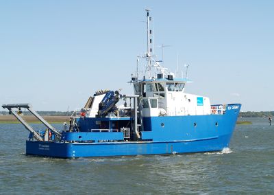
    Savannah · SkIO

    DolLAYER_3 (Sea Trial 2)

    Marc Frischer · UGA

    Organism aggregation, resource patchiness, and layering have long been recognized as fundamental ecosystem properties, especially in dynamic marine pelagic systems. However, integrating fine-scale (1-10 m) water column structure into our understanding of the forces that regulate marine ecosystems has proved challenging. Specifically, an overwhelming majority of marine organisms (plankton) experience their environment at fine spatial scales, which are difficult to sample, yet most measurements of chemical and biological parameters that define the structure of food webs and the flow of energy are averaged over much larger portions of the water column. This mismatch hinders our ability to understand the trophic consequences of fine-scale variability. Addressing this challenge will help to resolve key, and potentially predictable, sequences of events that change community structure and have trophic consequences that propagate throughout the food web in productive continental shelf environments. The trophic consequences of layers and patches depends on the proliferation of the zooplankton groups that exploit them. Conversely, other groups may proliferate in environments lacking vertical structure. One key trophic link on continental shelves is occupied by grazers such as doliolids and copepods – the relative abundance of these groups can determine if carbon is vertically exported or recycled within the microbial loop. Our long-term goals are to understand the ecological role of doliolids and the conditions that favor their proliferation (compared to copepods and other crustaceans). Because doliolids aggregate on fine spatial scales in several ecosystems, biological measurements need to be made on similar spatial scales and through time. Obtaining these measurements within different oceanographic contexts can answer several fundamental questions. For example, what are the trophic consequences of fine scale structure? Do these structures favor particular zooplankton communities above and below, and over what temporal and spatial scales do these structures persist or extend? Answering these questions requires sampling with complementary techniques, and will advance the fundamental understanding of how ecosystems will respond to changes in oceanographic structure, placing seemingly chaotic zooplankton communities into a predictive framework. We propose an ambitious field campaign in two shelf ecosystems with similar zooplankton taxa yet contrasting oceanographic regimes where doliolids are known to form blooms. The sampling will encompass two seasons (summer and winter) with contrasting degrees of stratification. Innovative molecular and stable-isotope measurements will allow for a robust coupling to oceanographic features and zooplankton abundance and community composition, elucidating the trophic consequences of vertical structure, layering, and mixing. In addition to primary research cruises, the multi-cruise plan will also include cruises that will be focused on optimizing the use of novel and proto-type equipment (sea trials) and several education cruises for graduate students and K-12 educators.

    Jun 23 – Jun 24, 2024 · 1 d

    South Atlantic Bight middle shelf

  • Completed

    Atlantis · WHOI

    Multi-Scale Geodesy-2024-1of8

    Bill Chadwick · OSU

    Axial Seamount is the most active submarine volcano in the NE Pacific, having erupted in 1998, 2011, and 2015. Because of this, it is an ideal natural laboratory for the long-term study of active processes at a submarine volcano, with periodic perturbations to hydrothermal systems and chemosynthetic biological communities. Long-term monitoring at Axial has built a remarkable time-series of bottom pressure measurements and repeated bathymetric mapping with Autonomous Underwater Vehicles (AUVs) that have documented a cycle of inflation and deflation of ±2-4 meters that has been used to forecast eruptions with increasing accuracy. Since the 2015, Axial has reinflated to >90% of its pre-eruption threshold, but over this same time period the rate of inflation has slowed by an order of magnitude. Consequently, the next eruption is still likely several years away. This project aims to continue this monitoring effort for another 5 years, while improving the techniques, survey designs, and data analysis on several fronts in order to provide improved constraints for modeling the surface deformation to better understand the magma supply and storage system at the volcano. For this project, we request support for field work with ROV Jason and AUV Sentry at Axial Seamount in 2024, 2026, and 2028. Specifically, we propose to: (1) continue the deformation surveys every other year, including both pressure measurements and AUV bathymetric re-surveys over the next 5 years, (2) modify the ROV-based pressure surveys to become more time-efficient by changing reference sites so that we can add more benchmarks in the caldera to better constrain deformation models, (3) add benchmark sites to constrain slip across the caldera faults to increase our understanding of the relationship between deformation and seismicity, and (4) continue OOI Regional Cabled Array (RCA) seafloor-CTD turn-arounds so that salinity sensors will be in place in the caldera during the next eruption to test a hypothesis about co-eruption brine release. These multi-scale monitoring efforts at Axial Seamount will be leveraged by NSF’s infrastructure investment in the OOI-RCA, which provides real-time monitoring data that greatly enhances these efforts. The results from this study will also help to increase our understanding of the shallow magma supply and storage systems at active basaltic volcanoes, the processes that lead to and trigger eruptions, and the pathways that magma takes to the surface during eruptions. This work at Axial Seamount is aimed at helping us better understand eruption processes at volcanoes on land that are more hazardous to people and property.

    Jun 21 – Jul 2, 2024 · 11 d

    Axial Seamount

    Sails with 1 other project

  • Completed

    Pelican · LUMCON

    Gulf 2024

    Max Weber · General Dynamics Mission Systems

    Offshore cruise to collect data on the gulf of mexico in June of 2024.

    Jun 21 – Jun 25, 2024 · 4 d

    Gulf of Mexico

  • Completed

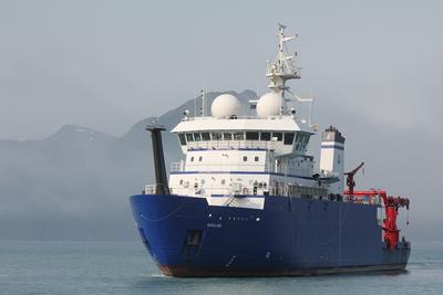
    Sikuliaq · UAF

    Alaska GNSS-A 2023

    Mark Zumberge · SIO

    Deformation of the seafloor is an important tectonic process, which can best be studied with marine geodetic techniques. The GNSS-Acoustic method is the technique chosen by a community workshop to investigate the following processes in Cascadia and Alaska: 1. Along-strike changes in coupling and relation to onshore deformation. A strong and widely spaced geodetic backbone offshore of existing on-land geodetic infrastructure, in regions not constrained by land stations could serve as the greatest return on investment for scientific and hazards understanding of megathrust subduction behavior. 2. Near-trench coupling and relation to tsunami earthquake(s) and down-dip behavior. While Alaska is the only of the two locales that has the known occurrence of a damaging tsunami earthquake (characterized by its outsized tsunami wave amplitude for earthquake magnitude) in 1946, it is understood that due to depth restrictions particularly in the 1946 rupture patch, much more of the near-trench environment off Cascadia can be evaluated using current instrument pool transponders. 3. Occurrence of shallow aseismic slip and its relation to earthquakes. The Cascadia subduction zone has clearly observable and large down-dip slow slip events, and an overall large near-trench exposure capable of observation with the geodetic instrument pool. 4. Postseismic time-dependent variations in coupling, including transients, afterslip, viscous relaxation, and recoupling. This was viewed as much more important in Alaska where recent large earthquakes allow for much greater potential for capturing discernable time-dependent variations in coupling behavior.

    Jun 20 – Jul 3, 2024 · 13 d

    Cascadia

    Sails with 1 other project

  • Completed

    Sikuliaq · UAF

    Alaska Mesh GNSS-A 2024-25

    Andrew Newman · GaTech

    Seafloor geodesy is an important tool for assessing geophysical hazards and driving forces in the off-shore environment where approximately 90% of plate boundaries exist. Long-term deformation data from such observations can aid in identifying submarine magmatic processes, off-shore loading of faults that lead to large to giant earthquakes and tsunamis, submarine landslides, and hydrocarbon movement driven by anthropogenic activity. Currently, such long-term observations can be prohibitively expensive for many needed studies, and only limited measurements are made due to costs. Similarly, because of the relative sparsity of measurements, particularly with new autonomous Wave Gliders, only optimal submarine conditions have been significantly explored, limiting the potential environments that are deemed feasible for application. This design experiment directly addresses these concerns to enable wide utilization of these tools. A three-year design experiment is planned for lower cost capabilities for dense seafloor deformation measurements, including operation in higher seafloor gradients, particularly in deep environments. The project will deploy a mesh-geometry of 10 transponders ranging between 4 and 6 km depth along a segment of the Aleutian trench in 2024, combining ship-activities with an ongoing community seafloor geodetic experiment. For GNSS ranging and acoustic interrogation of the transponders from the sea surface, a green-powered autonomous Wave Glider will be used. The deployed sites will be measured frequently through the summers of 2024 and 2025 to evaluate the repeatability of observations across the mesh geometry. The transponders will be at depths and gradients not previously tested using a Wave Glider and the planned interrogation method. To improve recovery at greater depths, ranged lower frequency acoustics will be used (14-19.5 kHz) than are used for operations in shallower water (19-34 kHz), requiring a Wave Glider with a dedicated GNSS-Acoustic unit and lower frequency acoustic transducer. The mesh-network design allows for a substantial increase in observation points over a traditional geometry that requires three transponders. While the mesh design geometry will dictate the ultimate transponder efficiency for observation, an example network may have between 4 and 10 times the number of observations may be possible, substantially reducing instrument costs, and facilitating high-density observations of seafloor deformation that can be used to discriminate shallowly seated sources including submarine magmatism, near-trench deformation, hydrocarbon withdrawal, and submarine landslides.

    Jun 20 – Jul 3, 2024 · 13 d

    Cascadia

    Sails with 1 other project

  • Completed

    C-Streams-2024-Recovery

    Lisa Beal · UMIAMI

    C-Streams addresses a key knowledge gap regarding how carbon uptake over the North Atlantic is controlled by ocean circulation. We are all aware that the Gulf Stream is important for heat supply to northern latitudes, but here we investigate how this current is crucial for setting carbon dioxide uptake from the atmosphere. Working with US partners, we will measure the strength and variability of Gulf Stream property transports in Florida Straits. We will measure the downstream evolution of Gulf Stream nutrient and carbon concentrations over 2000 miles using targeted observations by autonomous instruments, novel analyses and model simulations. We will determine how the Gulf Stream provides a far field control of North Atlantic carbon uptake, providing an alternative paradigm to the prevailing view of control by stratification. We will then assess whether climate models provide the right response of the North Atlantic carbon sink to climate change and for the right reasons. We will deploy 3 moorings with biogeochemical instrumentation at 27 N in the Florida Straits - the same latitude as the NOAA WBTS repeat stations and the new NSF FOCUS array - to continuously measure property transports of the Gulf Stream over a two-year period. In particular, these moorings will resolve the nitrate and low-carbon transports of the relatively fresh deep waters in the Straits that originate in the southern hemisphere. It is hypothesized that northward advection of these waters fuels uptake of anthropogenic carbon in the North Atlantic. We will deploy gliders and Argo floats to quantify mixing and entrainment of these waters along their northward path in the Gulf Stream

    Jun 20 – Jun 23, 2024 · 3 d

    Florida Straits

  • Completed

    Savannah · SkIO

    Bridge to Research REU

    Christopher Hintz · SSU

    This ship time request is part of an 8-week, 10-student summer REU program in marine sciences in Savannah, Georgia. Our program focuses on early undergraduate participation (freshmen and sophomore), thus targeting students during a critical time in their STEM career and providing them key experiential learning like a 2-day research cruise opportunity aboard a UNOLS vessel. Students gain valuable experience in Marine Sciences and develop knowledge about their potential career pathway.

    Jun 20, 2024 · 1 d

    Georgia bight

  • Completed

    Endeavor · URI

    ANTICIPATE

    Laurie Fialkowski · NRL

    Deploy billboard array in 1000m+ of water just of the shelf break in the NESBA area. Tow ITC2002A in radial patterns around the array, around 50km distance. Deploy EMATTs.

    Jun 18 – Jun 22, 2024 · 4 d

    New England Shelf Break Area

  • Completed

    SE-AK-2024

    Sophia Merrifield · SIO

    Using autonomous, moored, and ship-based sensors, this project will study upper ocean processes in Behm Canal, Alaska.

    Jun 17 – Jul 2, 2024 · 15 d

    Behm Canal, AK

  • Completed

    Transit Cruise

    Robert Kamphaus · UW

    Jun 17 – Jul 4, 2024 · 17 d

  • Completed

    2024 NESCAFE deployment

    Matthew Dzieciuch · SIO

    This cruise is part of the ONR Task Force Ocean Department Research Initiative. The experiment is meant to characterize the highly variable acoustic propagation that is observed in the area around the Atlantis II seamounts The variability is manifested in the acoustic impulse responses and the ambient soundscape and is caused by oceanographic and atmospheric processes as well as complex seafloor topography.

    Jun 16 – Jul 1, 2024 · 15 d

    New England Seamounts

  • Completed

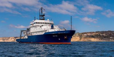
    Sally Ride · SIO

    Galápagos PlumeRidge -Recovery

    Emilie Hooft · Oregon

    On Earth there are three fundamental ways in which volcanoes form. This study will examine how two of these styles behave in proximity. The Galapagos archipelago is a well-known example of hotspot volcanism, fed by a rising plume of hot mantle, and this system is interacting with the Galapagos Spreading Center (GSC) where volcanism occurs in response to seafloor spreading at the boundary between two tectonic plates moving apart. Scientists have studied the Galapagos hotspot-GSC system for several decades and have long puzzled over persistent discrepancies between geophysical and geochemical observations and physical models for how the pair work together. This study will image how mass and temperature are transported, as well as how magma is generated beneath the Galapagos system, using a technique called seismic tomography. A network of instruments spanning a large area of the islands and adjacent seafloor will be deployed. These seismometers will record seismic waves traveling from distant earthquakes and ambient ground displacement over a period of 15 months. As the seismic waves pass beneath the study area, they respond to differences in mantle composition, temperature, deformation, and the presence of magma. Imaging these properties will allow many unanswered questions particular to the Galapagos system to be addressed. The study will also address the fundamental processes occurring in the shallow part of the mantle that is hot and weak and the interactions with the the cool, stiff overlying part that forms Earth's tectonic plates. This program will train three graduate students in marine geophysics. In addition, an Apply-to-Sail program will allow graduate students and early career scientists from other institutions and community college instructors to participate on the research cruises to gain sea-going training. Lastly, Ecuadorian scientists and graduate students will also participate on the cruises, bolstering science education and international research collaboration. To produce the first mantle seismic view of how mantle plume-ridge interaction really works, an open-access seismic dataset will be collected around the Galapagos system. The experiment and subsequent analyses are designed to address three main scientific questions: (i) At what depths, in what geographic pattern, and by what mechanism does mantle plume material flow northward to the Galapagos Spreading Center and disperse along the ridge? (ii) Do the scale and nature of heterogeneity indicate small-scale, sub-lithospheric convection? and (iii) What is the spatial distribution of melting and volatile release, as well as the associated heterogeneity in composition and rheology due to plume-ridge interaction? The Galapagos system is exceptionally well-suited for such a study given the history of previous investigations of the surface manifestations, the evidence from mantle tomography below the Galapagos Archipelago, and the favorable azimuthal distribution of seismic sources. A large number (53) ocean-bottom, broadband seismometers will be deployed for 15 months in an array spanning the area between the Galapagos Islands and the Western Galapagos Spreading Center. Data from 7 broadband stations on the islands also will be used. The data will undergo initial processing, including ambient noise cross-correlation, and be archived in the IRIS-DMC for immediate public use. Tomography models of isotropic velocity will be produced from body waves, isotropic velocity from the combination of surface waves and ambient noise, as well as radial and azimuthal anisotropy from surface waves. Receiver functions will be analyzed to identify discontinuities related to the lithosphere and melting and shear wave splitting will be used to map anisotropy. Geodynamic models of plume-ridge interaction will be used for hypothesis testing by comparing modeled and observed seismic waveforms, and by using the geodynamic models as a priori information for the tomographic inversions. The project will also substantially advance a broad understanding of mantle plume processes, the asthenosphere, and their interactions with oceanic lithosphere; specifically, the deployment will function as a unit array within the Pacific Array Initiative.

    Jun 13 – Jul 3, 2024 · 20 d

    Pacific Equator

    Sails with 1 other project

  • Completed

    Sally Ride · SIO

    GO-BGC

    Melissa Miller · SIO

    We propose to use the Sally Ride in ancillary mode for deployment of 2 biogeochemical (BGC) Argo profiling floats in the open ocean outside of the Galapago EEZ during the SR2411 cruise. The floats carry sensors for pH, oxygen, nitrate, chlorophyll, backscatter and irradiance, along with standard Argo temperature and salinity, and they profile every 10 days from the surface to 2000m. Data are fully public and available through the Argo data system.

    Jun 13 – Jul 3, 2024 · 20 d

    Pacific Equator

    Sails with 1 other project

  • Completed

    UMCES ChesBay Plume

    Ryan J. Woodland · UMCES

    This proposed study integrates observational, experimental and modeling approaches to study the effects of the Chesapeake Bay plume on benthic biomass, diversity, organic matter processing and nutrient fluxes within the inner shelf (Fig 2). We’ve identified four key Objectives that we will accomplish to address the study hypotheses. For Objective 1, we will conduct two full years of field sampling of water column and sediment conditions, nutrient concentrations, and benthic community composition at sites in the Chesapeake Bay plume region. This field design allows quantification of intra- and interannual variability of response and predictor variables. Objective 2 is to quantify spatial and seasonal changes in benthic community structure and secondary production as indexed by biomass, biodiversity and community composition. At a subset of our observational locations, we will execute Objective 3, a series of targeted laboratory experiments to test the differential assimilation of labile and refractory organic matter by benthic fauna inside, at the front, and outside of the plume. We will simultaneously measure sediment-water exchanges of nutrients and oxygen to associated patterns of benthic structure and assimilation rates to nutrient processing and metabolism. Objective 4 is to develop and validate a 3-D hydrodynamic numerical model to provide temporally-integrated estimates of plume conditions (e.g., salinity, temperature, organic matter deposition rates, near-bed physical disturbance) during the observational period. Finally, we will use the observational data and model outputs in concert to test our hypotheses and identify statistical relationships between plume influence and benthic community structure, diversity, productivity, and organic matter processing. Field cruises will be conducted seasonally (4 per year) for 2 years aboard an assigned UNOLS vessel along the Virginia inner continental shelf and just within the Chesapeake Bay mouth. Cruises will occur in the spring, summer, autumn, and winter each year to capture annual cycles of primary and secondary production (Objective 1). Each cruise, we will use a combination of underway and stationary sampling gear to collect biological and environmental data from sites ranging from c. 5–20m inside, outside and at the frontal edge of the Chesapeake Bay plume (Fig. 4A). A series of shipboard experiments will be used during all four seasons of the second field year to test hypotheses regarding spatial patterns in trophic assimilation and biogeochemistry.

    Jun 13 – Jun 17, 2024 · 4 d

    Chesapeake Bay mouth and adjacent shelf area

  • Completed

    SIOC 218/Del Mar

    Uwe Send · SIO

    Continuous, long-term monitoring of physical-biogeochemical variables at the Del Mar site is providing a multidisciplinary dataset which enables detection of both short-term events, and their relation to seasonal and interannual variability. This dataset is enhancing our understanding of complex coastal processes (e.g. Ekman transport, tides, alongshore currents, coastal trapped waves and internal waves), and interactions with basin-scale climatic variability such as the El Niño Southern Oscillation and Pacific Decadal Oscillation. Moreover, the data contribute to current ecological research in better understanding issues such as hypoxia, massive fish kills and bird population decreases. The Del Mar mooring was originally developed in 2006 in collaboration with the Scripps Hydraulics Laboratory as part of the Southern California Coastal Ocean Observing System (SCCOOS) . Instrumentation includes a suite of meteorological sensors, and sensors for water temperature, salinity, oxygen concentration, fluorescence, nutrients and currents. In addition to providing a valuable real-time coastal timeseries for these parameters, the platform has also served as a testbed for developing technologies both in-house at SIO and with partner organizations such as the Environmental Sample Processor (MBARI) and Imaging Flow Cytobot (WHOI), and since 2011 has provided hands-on training for a university class on observational techniques.

    Jun 13 – Jun 14, 2024 · 1 d

    Del Mar, CA

  • Completed

    N. Atl. Porewater

    Brian Haley · OSU

    Circulation of water is a fundamental trait of the oceans that impacts all aspects of its physics, chemistry and biology. However, understanding modern and past patterns of circulation – especially regarding the vast bodies of deep water – is challenging because global circulation defies direct measurement. The problems of direct measurement largely stem from the vast scales of both space and time that are of interest in understanding global circulation. One tool for estimating global circulation patterns that holds high promise is seen in neodymium isotopes (the same neodymium found in magnets is also found in the oceans at trace concentrations). These otherwise rather esoteric isotopes appear to be powerful tracers of deep ocean circulation, over a variety of timescales. Unfortunately, the elemental behavior of neodymium contrasts the isotopic behavior of neodymium in the oceans, a puzzle branded the “neodymium paradox.” This inconsistency of geochemical behavior opens to question the application of neodymium isotopes as a tracer of circulation. Here we propose to test a hypothesis that there is a yet unconstrained (even poorly identified) source of neodymium to the oceans that can explain the discrepancies seen between the elemental and isotopic neodymium marine budgets. We further seek to understand the mechanistic cause of this source and thus be able to start making global constraints on its influence. We argue that this understanding will fundamentally change our interpretations of neodymium data and allow us to more accurately quantify ocean circulation with a greater degree of confidence. Here, we propose the hypothesis that there is a benthic source of Nd to the oceans that exerts a primary control over the distribution of neodymium (Nd) and its isotopes (ε Nd ) in ocean waters, and that this benthic flux results from early diagenetic reactions that release rare earth elements (REEs; of which Nd is one) from the solid phase to pore fluid. We suggest that this flux will explain ε Nd distributions throughout the modern and past global oceans. Our research will be guided by three questions: (1) What are the mechanisms that control the magnitude and isotope composition of the benthic flux? (2) What are the relationships among bottom water, pore fluid, and the terminal solid phase compositions? Particularly, how and under what chemical conditions does an ε Nd signature become part of a preserved archival record of [Nd] and ε Nd ? (3) Can our understanding of the deep water benthic fluxes account for the integrated bottom water ε Nd as a function of apparent water mass age and circulation path (e.g., how do the pore fluid and solid phase values reconcile with the existing water column signature and water mass age data)? We propose to test these ideas by collecting sediments and their pore fluids from a diverse set of deep sea sites (7 North Atlantic sites) that reflect: carbonate-, terrigenous-, volcaniclastic- and siliceous-sediment. We will then fully characterize the physical and geochemical environment of the upper sediments and overlying water column at these sites. These analyses will include: major/minor/trace metal analyses; Nd isotopes; carbonate chemistry; O 2 /Nutrients/POC/PON; 14 C; porosity/grain size; etc. We will add these data to test a quantitative numeric geochemical model aimed at capturing the cardinal controls over the benthic source. Our goal is to offer an entirely new interpretive framework for Nd and ε Nd , such that we can offer quantitative estimates of benthic fluxes for use in models of global circulation. This work has potentially transformative implications on our understanding and application of REEs and Nd isotope data in both the modern and ancient oceans. Neodymium isotopes are arguably the most promising tracer of past ocean circulation and are also heavily invested in the GEOTRACES project for the modern ocean. Our work will thus further our understanding of the importance of the benthic environment on marine trace metal cycling (e.g., for iron, copper, zinc, etc.).

    Jun 12 – Jul 28, 2024 · 46 d

    North Atlantic

  • Completed

    Blue Heron · UMN

    Microplastics in Lake Superior '24

    Richard Ricketts · UMN

    Sediment trap and McLane pumping work for microplastics

    Jun 11 – Jun 13, 2024 · 2 d

    Western Lake Superior

  • Completed

    Pelican · LUMCON

    GF-Su-24

    Lance Renoux · LaWLF

    The Southeast Area Monitoring and Assessment Program (SEAMAP) Shrimp/Groundfish trawl surveys are conducted throughout the Gulf of Mexico to provide fishery-independent monitoring and assessment information on shrimp and groundfish assemblages associated with low relief soft-bottom habitats. These data are essential to the management of the fisheries resources in the Gulf of Mexico. Louisiana Department of Wildlife and Fisheries (LDWF), as well as SEAMAP state partners, sample in conjunction with the National Marine Fisheries Service (NMFS) to provide a Gulf-wide trawl survey each summer and fall.

    Jun 10 – Jun 15, 2024 · 5 d

    Territorial waters of the coast of Louisiana

  • Completed

    Sally Ride · SIO

    Transit CR - EQ

    Hannah Delapp · SIO

    Jun 7 – Jun 11, 2024 · 4 d

    USWC

  • Completed

    Savannah · SkIO

    SEFIS

    Nathan Bacheler · NOAA

    SEFIS is a fishery-independent research group that surveys reef fish using traps and video from Cape Hatteras, NC, to St. Lucie Inlet, FL, from 15-115 m deep.

    Jun 7 – Jun 16, 2024 · 9 d

    Southeast US Atlantic continental shelf between NC and the east coast of FL.

  • Completed

    Endeavor · URI

    RITAS 2023

    David Smith · URI

    This cruise is designed to give ~12 K-12 teachers from Rhode Island a research experience at sea on R/V Endeavor. The educators are presented with some research questions in oceanography as well as the methods employed to address them. The educators receive hands-on opportunities to deploy and recover instruments as well as analyze samples on board.

    Jun 7 – Jun 9, 2024 · 2 d

    Rhode Island Sound

  • Completed

    NOPP-NGIW - Cape Hatteras

    Magdalena Andres · WHOI

    As part of the National Oceanographic Partnership Program (NOPP) Global Internal Wave (NGIW) project and the SWOT Adopt a Crossover Campaign - Cape Hatteras (MAB-SWOT), 6 Current and Pressure Sensor Equipped Inverted Echo Sounders (CPIESs) were deployed in January 2023 east of Cape Hatteras where the Gulf Stream leaves the coast within a region covered by the new Surface Water Ocean Topography (SWOT) satellite launched in December 2022. During its 90-day fast-repeat phase (March-June 2023), SWOT is conducting twice daily cross-overs in a handful of regions, including this region east of Cape Hatteras The CPIESs, together with other in situ assets, will be used to ground-truth the satellite measurements and to investigate internal tide and mesoscale variability.

    Jun 6 – Jun 11, 2024 · 5 d

    Cape Hatteras

  • Completed

    Rhizaria in Oligotrophic Oceans Sept

    Leocadio Blanco Bercial · BIOS

    Our study will use cutting-edge in situ imaging (using a UVP-DEEP) of Rhizaria to bypass limitations in other sampling methods and to produce accurate estimates of Rhizaria biomass. Additionally, sampling will occur across a wide depth range (0-1200 m), at monthly intervals, and in conjunction with a wide array of other biological, chemical, and physical oceanographic measurements (as part of the Bermuda Atlantic Time-series Study, BATS). UVP imagery data will be integrated with molecular identification of Rhizaria using community metabarcoding and barcoding of individual Rhizaria collected from MOCNESS net tows taken in conjunction with UVP casts. Size-specific elemental analyses of Rhizaria and seasonally and vertically explicit estimates of Rhizaria biomass will be used to model their contributions to vertical flux in the system.

    Jun 6 – Jun 12, 2024 · 6 d

    BATS site

    Sails with 2 other projects

  • Completed

    BATS 2024 - 5of12

    Nicholas R. Bates · BIOS

    Long-term observations over several decades are a powerful tool for investigating ocean physics, biology, and chemistry, and the response of the oceans to environmental change. The Bermuda Atlantic Time-Series Study, known as BATS, has been running continuously since 1988. The research goals of the BATS program are: (1) to improve our understanding of the time-varying components of the ocean carbon cycle and the cycles of related nutrient elements such as nitrogen, phosphorus, and silicon; and, (2) to identify the relevant physical, chemical and ecosystem properties responsible for this variability. In addition, the BATS program has strong and diverse broader impacts, contributing to the field of ocean sciences by providing high quality ocean observations and data for seagoing scientists and modelers, and a framework through which researchers can conceive and test hypotheses. This award will support the operations of the BATS program for five more years. The primary BATS research themes are as follows: (1) Quantify the role of ocean-atmosphere coupling and climate variability on air-sea exchange of CO2, and carbon export to the ocean interior; (2) Document trends and the controls on the interannual to decadal scale variability in carbon and nutrient cycles to their coupling in the surface and deep ocean via the Redfield Ratio paradigm; (3) Quantify the response of planktonic community structure and function, and impact on biogeochemical cycles to variability in surface fluxes and dynamical processes; (4) Facilitate development, calibration and validation of next generation oceanographic sensors, tools and technologies; and, (5) Generate a dataset that can be utilized by empiricists, modelers and students. This research integrates ocean physics, chemistry and biology into a framework for understanding oceanic processes and ocean change in the North Atlantic subtropical gyre. The existing 29 years of BATS data provide robust constraints on seasonal and interannual variability, the response of the Sargasso Sea ecosystem to natural climate variability, and signal detection of potential ocean changes. This project would extend the BATS program through years 31-35 to address a series of ten interlinked questions through integrated research approaches and a multitude of collaborative efforts. In addition to the themes above, and embedded into the ten questions and approaches, the BATS team will focus on, for example, coupling of particle production and biogeochemistry; revisiting the complexities of the biological carbon pump; oxygen decline; and changes in the hydrography, physics, ocean carbon cycle and biogeochemistry of the Sargasso Sea. The highest quality data observation and collection will be maintained and used to address these questions. Importantly, a wide range of collaborations at the BATS site, spanning the physical and biogeochemical disciplines, will aid these broad goals. Strong links to community stakeholders, and close collaboration (including methods intercomparisons and personnel exchanges) with the Hawaii Ocean Time-series are proposed. This work will extend the research findings of the project into educational and training opportunities within and beyond the oceanographic community, including training and mentorship of both undergraduate and graduate students.

    Jun 6 – Jun 12, 2024 · 6 d

    BATS site

    Sails with 2 other projects

  • Completed

    Hydro S - 2024 10of24

    Nicholas R. Bates · BIOS

    One of the longest open-ocean hydrographic stations in the world is maintained at the Hydrostation S site (formerly known as the Panulirus site) located ~25 km southeast of Bermuda in the North Atlantic Ocean. This program of repeat biweekly hydrographic observations began in 1954 (by Hank Stommel) and now, in its seventh decade, has proved to be the catalyst for numerous studies of ocean physics, biological processes and biogeochemistry. Hydrostation S continues to be recognized as one of the most important sustained ocean time–series. The renewal of the Hydrostation S program is proposed herein, extending this invaluable time–series of ocean hydrography to almost 70 years. The upper ocean warming trend has strengthened (about +1.4° C since the 1970's; ~+0.8°C in last decade) with significant salinification (+0.16). Deeper waters such as the Labrador Sea Water has cooled by a few tenths of a degree and freshened with a marked decadal oscillation. The signature of deoxygenation has been observed at Hydrostation S in the upper ocean (about 4 µmoles kg -1 decade -1 decrease in dissolved oxygen) as well as the oxygen minimum zone (~2.5 µmoles kg -1 decade -1 ). Hydrostation S also supports the longest global ocean CO 2 and acidification time-series (from 1983 to present) The major objective of the proposal is to continue Hydrostation S into the eighth decade with numerous questions related to warming and cooling, salinification and freshening, deoxygenation and insights on biogeochemical changes over time. This program constitutes frequent water column sampling of temperature, salinity, and dissolved oxygen (and indirectly, sampling of important ocean carbon time–series) of the North Atlantic subtropical gyre at the Hydrostation S site. Such work is complementary to other sustained observations such as the Bermuda Atlantic Time–series Study (BATS) and Ocean Flux Program (OFP). We propose to carry out a similar sampling format that has been followed for the past 68 years. As for the past ten years, we would continue to conduct two CTD profiles to better capture the deep–water variability while maintaining all the previous discrete depths. The first CTD cast will profile to full ocean depth (3,300–3,500 m) while the second CTD cast will profile to 500 m (to allow for instrumentation not rated for full ocean depth such as a PAR sensor). One indirect objective will be to continue to collaboratively evaluate a BIOS-based glider program with Hydrostation S data as critically important ground truthing data. The existing glider program has challenging issue, and the aim of this effort is to use robust and highly accurate Hydrostation S data to test the capability of emerging technologies over the next five to ten years.

    Jun 6 – Jun 12, 2024 · 6 d

    BATS site

    Sails with 2 other projects

NewerPage 27 of 55Older