VesselConnect

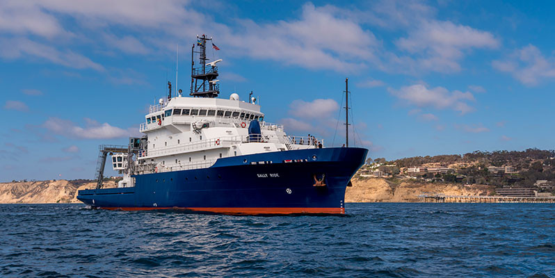
Sally Ride

UNOLS · Scripps Institution of Oceanography

Loading map…

Oct 2025 – Oct 2026 · 26 port calls · 109 at-sea periods

26

Research bunks

72.5 m

Length

10 kn

Cruise speed

10545 nm

Range

2016

Year built

Projects

16+ past · 13 upcoming

Completed

POP:ART

Lihini Aluwihare · SIO

This proposal requests ship time aboard the R/V Roger Revelle or R/V Sally Ride to perform a detailed characterization of the metabolomic and microbial succession on particles as they transit the euphotic zone of the California Current Ecosystem (CCE). This expedition will visit two sampling sites in the CCE: one coastal site within the CalCOFI sampling grid characterized by upwelling features and high levels of productivity. The second site will be located offshore in low-productivity oligotrophic waters. At each site, a drifting sediment trap array will be deployed and various shipboard operations will be conducted, including CTD casts, McLean Pump deployments, and snowcatcher deployments. Samples for sinking POM, suspended POM and dissolved organic matter will be collected for metabolomic and microbial community composition analysis. By combining nontargeted metabolomic techniques with metagenomic and metatranscriptomic analyses, we will link changes in particle composition to changes in the microbial community and microbial activity on the sinking material. This work will provide novel insights into the evolution of sinking particles and the mechanisms that control particle remineralization in the upper ocean.

Mar 7 – Mar 15, 2026 · 8 d

California Current Ecosystem

Completed

OSU Student Cruise

Miguel Goni · OSU

As in previous years, OSU's Student Oceanographic Cruise's objectives include training students on a variety of oceanographic procedures and equipment, including CTD-rosette, acoustic instrumentation for current and bathymetric measurements, nets for recover plankton samples, as well as sediment sampling using multi-core gravity coring equipment. Because of the size of the 2024 class, we expect to have two legs to the cruise. At this point we have flexibility on the embarkation/disembarkation ports and on the ship as long as it can accommodate 22-24 individuals as part of the science crew for each leg. We do not have flexibility on the dates, which need to coincide with OSU's spring break. Here is a draft of the schedule I have put together for the OSU Student Cruise: 3/20/2026 Friday MOB Day/Leg 1 3/21/2026 Saturday Leg 1 - Science day 3/22/2026 Sunday Leg 1 - Science day 3/23/2026 Monday Leg 1- Science day 3/24/2026 Tuesday Leg 1 - Science day 3/25/2026 Wednesday DEMOB Leg 1 ; MOB Leg2 3/26/2026 Thursday Leg 2 - Science day 3/27/2026 Friday Leg 2 - Science day 3/28/2026 Saturday Leg 2 - Science day 3/29/2026 Sunday Leg 2 - Science day 3/30/2026 Monday DEMOB Leg 2

Mar 21 – Mar 29, 2026 · 8 d

Southern California

Completed

CA Seabed 2

Kelly Dorgan · DISL

Our interdisciplinary team proposes to test the overarching hypothesis that organic matter input to the deep sea drives biological processes that modify geotechnical and geoacoustic properties of the surface layer of sediments. In testing this hypothesis, we will explore the spatial and temporal variability and relationships among these properties within a highly productive region of the deep sea, the central California slope. This region experiences seasonal and interannual variability in organic matter and sediment deposition to the seabed and spatial variability in the infaunal community driven by oxic conditions and organic matter input. We plan to combine seasonal sampling of geological, geotechnical, geoacoustic, biological, and biogeochemical properties along a spatial gradient with high temporal resolution sampling of the bottom boundary layer and seabed surface. Our results will provide insight on the patterns of seabed properties and the mechanisms driving those patterns and will improve our ability to predict and remotely detect changes in deep sea sediments.

Apr 2 – Apr 16, 2026 · 14 d

Central California coast

Completed

GNSS-A AK/CAS 2026 Deployment

Mark Zumberge · SIO

We request ship time to use a planned transit in order to deploy two wave gliders as part of a sea floor geodesy experiment. Under NSF grant 2232638, "Collaborative Research: Near-Trench Community Geodetic Experiment", we deploy wave glider autonomous vehicles with GNSS-Acoustic interrogation packages. Current experimental areas include subduction zones offshore Cascadia and Alaska. We note that the R/V Sally Ride transit (SR 2607) from Alameda, California to Seward, Alaska will come very close to our desired deployment locations, which are listed in the survey plan. Relatively small course deviations will permit valuable scientific observations to be made at minimal incremental costs and time. We will recover the wave gliders some 60-90 days later with other marine assessments. No consequential impact is expected on the loading or unloading time, during the normal course of logistics for the transit cruise.

Apr 21 – Apr 30, 2026 · 8 d

East Pacific Ocean

Sails with 2 other projects

Completed

STEMSEAS

Sharon Cooper · LDEO

STEMSEAS aims to provide ship-based, exploratory experiences for undergraduate students during transits of the ARF ships. We sail ~3 scientist leaders with ~12 students in a cohort to learn as much as possible about the different areas of science and technology possible through our ARF ships. We welcome collaborations with any and all others who may be sailing on the transit.

Apr 21 – Apr 30, 2026 · 8 d

East Pacific Ocean

Sails with 2 other projects

Completed

NGA-LTER Spr2026

Russ Hopcroft · UAF

The NGA is a highly resilient ecosystem, due to the intense levels of environmental variability experienced by the biological community. We define resilience as recovery of key emergent properties (a diatom-dominated spring bloom; hot spots of high summer production; high biomass of large, lipid-rich copepods; high rates of particle export to depth; efficient transfer of production to upper trophic levels) following disturbance. These properties arise from the interplay of physical and chemical properties together with the genetic repertoire of the ecosystem’s component species, and in turn are key to the maintenance of high productivity at upper trophic levels, including commercially harvested groundfish (e.g. black cod, pollock, rockfish), seabirds, and marine mammals. Our approach to evaluating resilience includes: Examining the recovery (or lack thereof) of emergent properties following disturbance (e.g., marine heatwaves); Distinguishing food web pathways that are more versus less sensitive to disturbance; Tying observations of lower trophic level responses to their consequences for higher trophic levels under different (in time and space) conditions; Examining the occurrence and consequences of strategies, such as nutritional plasticity and species redundancy, thought to promote resilience. Assessing the availability of various iron and macronutrient sources

May 3 – May 19, 2026 · 16 d

Northern Coastal Gulf of Alaska

Completed

NOPP1-AR

Drew Lucas · SIO

As part of the National Ocean Partnership Program (NOPP) Global Internal Wave (NGIW) study, Internal Wave Resolving (IWR) Arrays are being deployed to collect high-frequency in situ measurements that can resolve the energy flux associated with internal waves propagating through the deep ocean by combining high vertical- resolution moorings to resolve the waves’ modal structure with an antenna of vertically- integrated measures of variability to resolve the speed and direction of beam propagation. The IWR Arrays are re-deployable to multiple locations and this cruise aims to deploy an array in the deep ocean off the Alaskan slope. The IWR Array comprises nine current and pressure-sensor equipped inverted echo sounders (CPIESs) surrounding a densely instrumented, full-depth mooring. The CPIES antenna will allow for the detection and separation of low-mode internal waves propagating from multiple directions, while the mooring will measure velocity and vertical displacement signals of five or more vertical modes. By working in partnership will numerical modelers, the array will allow for skill-testing and direct comparison with the global internal-tide resolving models that serve as inputs to regional models of the coastal ocean.

May 22 – Jun 3, 2026 · 12 d

Offshore of the Aleutian Islands

Completed

STEMSEAS

Marina Halverson · SCC

The STEM Student Experiences Aboard Ships (STEMSEAS) project is a partnership between the Indiana University of Pennsylvania, Lamont Doherty Earth Observatory at Columbia University, and the University National Oceanographic Laboratory System (UNOLS) aimed at addressing three priorities: (1) increasing the number and diversity of students pursuing degrees and careers in geosciences; (2) preparing students for all possible career trajectories in the geosciences; and, (3) contributing to the evidence base for effective student engagement, learning and retention in STEM. The STEMSEAS project is achieving these goals by taking advantage of unused berthing capacity on UNOLS vessels as they transit between U.S. ports in preparation for their next expedition. These short transits offer a unique mobile classroom setting where undergraduate non-STEM, undecided-STEM, and geoscience majors can be exposed to geoscience professional practice and career exploration. By partnering with UNOLS and campus "champions" at universities, including minority-serving institutions (MSIs), historically black colleges and universities (HBCUs), and community/two-year colleges (2YCs), the project sends diverse cohorts of students and faculty to sea with a small team of geoscience faculty and mentors. While at sea, the students engage in a variety of hands-on activities that incorporate geoscience content, lab exercises, data collection/analysis, career exploration, and discussion/reflection.

Jun 7 – Jun 14, 2026 · 7 d

Transit from Seward, Alaska to Alameda, California.

Sails with 1 other project

Completed

Transit

Hannah Delapp · SIO

Jun 7 – Jun 14, 2026 · 7 d

Transit from Seward, Alaska to Alameda, California.

Sails with 1 other project

Completed

OOI Endurance Array 24

Edward Dever · OSU

This request is for the major infrastructure deployment and recovery of the National Science Foundation (NSF) Ocean Observatories Initiative (OOI) Coastal Endurance Array (EA) ( https://www.oceanobservatories.org ). This cruise is for the deployment and recovery of a single surface mooring off central Oregon along with the deployment and recovery of up to two gliders and the collection of supporting ship-based sampling (lowered CTD, underway oceanographic and meteorological measurements.

Jun 16 – Jun 17, 2026 · 1 d

Oregon shelf

Completed

Community Experiment

Mark Zumberge · SIO

The Near-Trench Community Geodetic Experiment is a five-year NSF funded program to collect seafloor geodetic positions using the GNSS-Acoustic method in which a surface platform (a Wave Glider) positioned with GNSS simultaneously collects the positions of seafloor transponders with acoustics.

Jun 19 – Jun 21, 2026 · 2 d

24 nm west of Port Orford, OR

Sails with 1 other project

Completed

Transit Cruise

Hannah Delapp · SIO

Sep 23 – Sep 25, 2026 · 2 d

Completed

OOI Endurance Array 25

Edward Dever · OSU

This request is for the major infrastructure deployment and recovery of the National Science Foundation (NSF) Ocean Observatories Initiative (OOI) Coastal Endurance Array (EA) ( https://www.oceanobservatories.org ). This cruise is for the deployment of up to three surface moorings off central Oregon and central Washington along with the deployment and recovery of up to two gliders and the collection of supporting ship-based sampling (lowered CTD, underway oceanographic and meteorological measurements.

Sep 27 – Sep 29, 2026 · 2 d

Oregon shelf

Completed

Transit Cruise

Hannah Delapp · SIO

Sep 30 – Oct 4, 2026 · 4 d

Scheduled

CalCOFI Fall 2026

Rasmus Swalethorp · SIO

Conduct CalCOFI surveys off Southern California quarterly, two of these on UNOLS ships.

Oct 31 – Nov 11, 2026 · 10 d

Southern California Current System.

Sails with 2 other projects

Scheduled

CalCOFI Fall 2026

Rasmus Swalethorp · SIO

Conduct CalCOFI surveys off Southern California quarterly, two of these on UNOLS ships.

Oct 31 – Nov 11, 2026 · 10 d

Southern California Current System.

Sails with 2 other projects

Scheduled

CalCOFI MarineeDNA Fall Cruise 2026

Rasmus Swalethorp · SIO

We aim to understand the transport, persistence and distribution of environmental DNA (eDNA) in marine environments from marine mammal targets. With support from the ONR Multidisciplinary University Research Initiatives (MURI) program, we will use ongoing and existing large-scale projects across the West Coast to understand eDNA on multiple spatial, vertical, and temporal scales, with a minimum of additional sampling effort. Our major objectives are: (1) to understand the fate and transport of eDNA and thereby interpret eDNA detections from marine mammals in a spatially and temporally explicit context; (2) to evaluate eDNA as a complement to -- or plausibly, as an alternative to -- traditional visual observations and acoustics detections for cetaceans; and, (3)To apply the lessons learned to map marine mammals along the US west coast using eDNA. As part of this effort we will integrate marine mammal eDNA sampling into quarterly CalCOFI ocean ecosystem monitoring cruises in the California Current Ecosystem. We will also pair eDNA marine mammal sampling with acoustic and visual surveys of marine mammals as part of the CalCOFI cruise plan. Collectively, these efforts will provide an unparalleled testbed for the validation and calibration of emerging eDNA sampling methods for cetacean detection and location prediction.

Oct 31 – Nov 11, 2026 · 10 d

Southern California Current System.

Sails with 2 other projects

Scheduled

Transit Cruise

Hannah Delapp · SIO

Nov 14 – Nov 20, 2026 · 7 d

Tentative

EPIC-recovery

Samer Naif · GaTech

This project will carry out a joint seismic and electromagnetic investigation that is designed to specifically address critical questions associated with quantifying melt distribution in the oceanic mantle. The experiment spans ~500x500 km of the Cocos Plate, centered on a sharp boundary in bathymetry that corresponds to a fracture zone (FZ) in the Guatemala Basin. The FZ has a 200–400 m depth offset that is too large to be attributed to subsidence from the 1–2 million years difference in plate age. Because intraplate volcanism and mantle melts have only been documented south of the FZ and the step in bathymetry across the FZ does not correspond with a step in the free-air gravity anomaly, this suggests the FZ also marks a sharp boundary in both the northern extent of magmatism and of melts in the mantle. Yet insufficient geophysical and geochemical data are available to confirm this hypothesis. We will collect ocean-bottom seismic and magnetotelluric data to image the seismic velocity and electrical resistivity of the lithosphere and asthenosphere in order to (1) determine the spatial and depth extent of mantle melts and (2) characterize the geophysical signature of melt-bearing mantle. We will also collect underway data to fill in data gaps and to identify sites suitable for dredging selected seamounts on both sides of the FZ to (1) determine whether the seamounts north of the FZ were also erupted intraplate and (2) constrain the provenance of the seamounts.

Nov 20 – Dec 14, 2026 · 24 d

Guatemala Basin

Tentative

GTJ_OBS 2 of 2 cruises

Zachary Eilon · UCSB

The project involves deployment of OBS instruments across two branches the Galapagos triple junction in the eastern central Pacific Ocean. The approximate geographic bounds of the deployment region are 1°S to 6°N, and 105°W to 98°W. The goal is to deploy an array of ~45 stations over a 1.25-year field season. Nominal station deployment durations will be 12-15 months, contingent on ship time and available instrumentation. Fieldwork will also include multibeam mapping, dredging, and gravimetry in the vicinity of the arrays.

Dec 18, 2026 – Jan 17, 2027 · 30 d

Galapagos TJ. Approximate geographic bounds of the deployment region are 1°S to 6°N, and 105°W to 98.5°W.

Tentative

mROV SVE

Anna Michel · UNOLS

We are proposing a science verification expedition for the new mROV vehicle. We will be testing the science capabilities of the vehicle. This will include using on-board sensors, samplers, plus the integration of user-provided equipment (e.g. samplers and sensors). Operations can be carried out at a hydrothermal vent system.

Feb 20 – Mar 11, 2027 · 20 d

East Pacific Rise 9-10˚N

Scheduled

2027 OSU Student Cruise

Miguel Goni · OSU

As in previous years, OSU's Student Oceanographic Cruise's objectives include training students on a variety of oceanographic procedures and equipment, including CTD-rosette, acoustic instrumentation for current and bathymetric measurements, nets for recover plankton samples, as well as sediment sampling using multi-core gravity coring equipment. Because of the size of the class, we expect to have two legs to the cruise. At this point we have flexibility on the embarkation/disembarkation ports and on the ship as long as it can accommodate 22-24 individuals as part of the science crew for each leg. We do not have flexibility on the dates, which need to coincide with OSU's spring break. Here is a draft of the schedule I have put together for the OSU Student Cruise: 3/19/2027 Friday MOB Day/Leg 1 3/20/2027 Saturday Leg 1 - Science day 3/21/2027 Sunday Leg 1 - Science day 3/22/2027 Monday Leg 1- Science day 3/23/2027 Tuesday Leg 1 - Science day 3/24/2027 Wednesday DEMOB Leg 1 ; MOB Leg2 3/25/2027 Thursday Leg 2 - Science day 3/26/2027 Friday Leg 2 - Science day 3/27/2027 Saturday Leg 2 - Science day 3/28/2027 Sunday Leg 2 - Science day 3/29/2027 Monday DEMOB Leg 2

Mar 20 – Mar 28, 2027 · 8 d

Around Catalina Island - off San Diego_Long Beach

Scheduled

Transit Cruise

Hannah Delapp · SIO

Mar 30 – Apr 3, 2027 · 4 d

Tentative

OOI Endurance Array 26

Edward Dever · OSU

This multi-cruise project request is for the major infrastructure deployment and recovery of the National Science Foundation (NSF) Ocean Observatories Initiative (OOI) Coastal Endurance Array (EA) ( https://www.oceanobservatories.org ). The Endurance Array includes fixed and mobile assets to observe cross-shelf and along-shelf variability in the coastal upwelling region of the Oregon and Washington coasts and provide synoptic, multi-scale observations of the eastern boundary current regime. Two lines of Endurance moorings run approximately east-west across the continental shelf north and south of the Columbia River outflow. Three different mooring types are used to capture surface meteorology along with near-surface, near-bottom and mid-water column ocean structure in the vicinity of the shelf break front. The mooring types are: Coastal Surface Mooring (SHSM, OSSM), Inshore Surface Mooring (ISSM), and Offshore Profiler Mooring (OSPM). Moorings are permitted under the United States Coast Guard (USCG) Private Aid to Navigation (PATON) program. The moored array is supplemented by gliders surveying the continental shelf and slope waters offshore of the moored array and coastal surface piercing profilers at the Oregon and Washington Inshore and Shelf sites. Like glider deployments and recoveries, CSPP deployments and recoveries can occur on mooring cruises or from small vessel cruises.

Apr 7 – Apr 22, 2027 · 15 d

The shelf and slope 1-50 nautical miles south from Waldport, OR north to Copalis Head, WA

Scheduled

Transit Cruise

Hannah Delapp · SIO

Apr 26 – May 7, 2027 · 10 d

Tentative

RhizoDiazo

Kendra Turk-Kubo · UCSC

The proposed research is designed to capture the composition, activity, and symbiotic nature of Rhizosolenia mat communities, as well as determine the significance of these communities to the N inventory in the North Pacific Subtropical Gyre. Specifically, we propose to test the following hypotheses: H 1) The composition of Rhizosolenia species creating the matrix of a mat and the associated diazotroph containing microbiome varies within and between mat fields throughout the NPSG; H2) Rhizosolenia mats obtain diazotroph-derived N; and H3) Diazotrophy within Rhizosolenia mats are a significant source of new N in the NPSG. A research cruise in the subtropical North Pacific Subtropical Gyre (NPSG) is planned where Rhizosolenia mat distribution, composition, and activity (both C/N 2 fixation) will be sampled integrating a rigorous blue water SCUBA program . We will combine traditional microscopy (light, fluorescence, electron) and molecular and 'omics techniques with stable isotopic measures at both whole mat and sub-mat scales to address these questions. The proposed research will result in the first detailed characterization of mat-forming Rhizosolenia and their associated diazotroph communities using modern molecular techniques and isotope techniques to significantly advance our understanding of these potentially important components of the biogeochemistry of the NPSG.

May 12 – Jun 16, 2027 · 34 d

North Pacific Subtropical Gyre

Scheduled

Transit Cruise

Hannah Delapp · SIO

Jun 19 – Jun 29, 2027 · 10 d


Are you the operator of this vessel?