Multi-Scale Geodesy-2024-1of8
Completed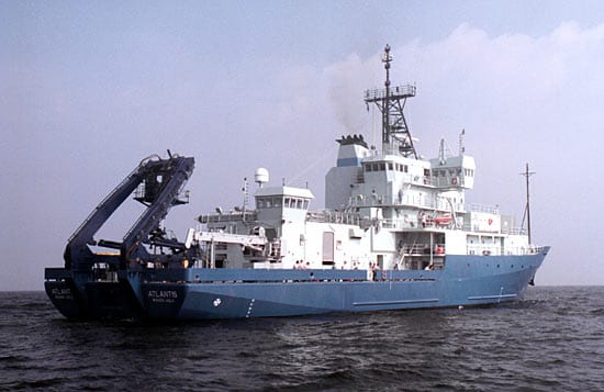
Loading map…
PortPlanned routeMooring / vehicle
Planned route: 2 segments · ~47 hours steaming · 1 station
Operating area: Axial Seamount
›2 legs· Astoria (Oregon) - United States → Astoria (Oregon) - United States
- 1Astoria (Oregon) - United States→Astoria (Oregon) - United StatesJun 21 – Jun 23, 2024 · 2 d
- 2Astoria (Oregon) - United States→Astoria (Oregon) - United StatesJun 25 – Jul 2, 2024 · 8 d
Jun 21 – Jul 2, 202411 days at seaactual: departed Jun 21, 2024, arrived Jul 2, 2024
May 2024
Jun
Jul
Atlantis
Woods Hole Oceanographic Institution
Methane footprint — Aleutian Margin Abyssal depths in Gulf of Alaska off Kodiak IslandTransit Cruise +1Multi-Scale Geodesy-2024-1of8 +1 — Axial SeamountSeafloor Strainmeter 2024 — Oregon Coast, Offshore and NW of Newport, OregonCleft Segment +1 — Cleft Segman--hydrothermal systems on the Cleft Segment of the Juan de Fuca Ridge
Projects aboard (2)
Sentry Engineering 2024
No description for this project yet.
People aboard
Sentry Engineering 2024
- Sean Kelley · Chief scientist
- Kevin Kavanagh · Principal investigator
Multi-Scale Geodesy-2024-1of8
- Bill Chadwick · Principal investigator
Party size: 15
Estimated vacant berths: 22
Equipment
Aboard the vessel
- Dynamic Positioning (DP)
- Multibeam - Deep Water (EM122, EM124)
- Multibeam - Mid-Water (EM302/304)
- Ultra-Short Base-Line Acoustic Navigation System
Pooled / portable
- CTD
- XBT
Schedule data from UNOLS Marine Facilities Planning · operator cruise code AT50-26_Chadwick_Jas · MFP references 23/3561, 22/1675 · synced Sep 30, 2026