Transit Cruise
Robert Kamphaus · UW
Aug 15 – Aug 18, 2025 · 3 d
UNOLS
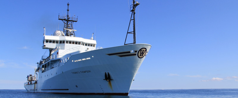 USAphoto: University of Washington
Oceanography
Nov 2025 – Oct 2026 · 18 port calls · 94 at-sea periods
35
Research bunks
84 m
Length
15 kn
Cruise speed
60
Endurance
12000 nm
Range
1991
Year built
22
Crew
17+ past · 4 upcoming
Robert Kamphaus · UW
Instrument verification cruise to test out all the newly installed and relocated science systems on R/V Thomas G. Thompson following an intermediate drydock period in Aug-Oct 2025.
Robert Kamphaus · UW
Collaborative Research in Earth System Science and Technology (CRESST) . CRESST is a one-year program funded through the Fund For Science and Technology (FFST) and is designed to retain and build capacity within four general target areas of research: atmospheric climate solutions, ocean health and climate solutions, climate disaster prediction and early warning systems, climate and environmental monitoring. CRESST includes basic and applied research in natural science (physical and life sciences) and technology directly relevant to addressing important challenges within these four areas. As part of the commitment to collaborative, interdisciplinary Earth system research, CRESST is providing an opportunity to participate in a research cruise to test technology and/or collect samples directly relevant to the 4 target research areas.
Jan 7 – Jan 18, 2026 · 12 d
Western Pacific
Ben Pietro · WHOI
24 hours of Sentry Engineering and training dives to piggy back SME 23/3771 JQZ-Phoenix AUV
Jan 29 – Mar 15, 2026 · 46 d
western equatorial Pacific/Marshall Islands/Micronesia
Masako Tominaga · UNOLS
The Jurassic Quiet Zone (JQZ) is a period in Earth’s history (>157 Ma) marked by anomalous geomagnetic field behavior with unprecedented low field intensity and high polarity reversal rate. Recent studies from the oldest oceanic crustal record give fresh insights into the onset, duration and nature of this period of time in Earth’s geomagnetic field history, but important questions remain. Marine magnetic studies of the western Pacific JQZ – arguably the largest extant expanse of intact Jurassic ocean crust – show that geomagnetic field intensity decreases monotonically from ~144 Ma (chron M19) back into the JQZ until about 167 Ma (chron M42) when field intensity abruptly increases and magnetic anomaly amplitudes return to more normal values. Furthermore, the field appears to be reversing at a high rate into the JQZ. In contrast, the Cretaceous Normal Superchron (CNS; aka Cretaceous Quiet Period) was a time of mostly strong field intensity with few reversals. This observation prompts the question: does the JQZ represent an end member in Earth’s geomagnetic field behavior that is opposite to the CNS? The answer can only be deciphered with a full understanding of Jurassic magnetic field behavior. However, there are limited marine and terrestrial records available - so it is critical to take advantage of those records where they exist. Two detailed records of magnetic anomalies from studies of the Japanese and Hawaiian lineations show similar broad patterns, but disparate behavior for a critical time period between M39 and M41 that points to a minimum in geomagnetic field intensity. We wish to verify this behavior with a survey of the concurrent record in the Phoenix lineation set in the western Pacific. The Hawaiian lineations show a good correlation of pre-M29 Jurassic anomalies with the prior near-bottom survey of coeval Japanese magnetic lineations, suggesting that we can define at a basin-scale, and perhaps globally, coherent geomagnetic field behavior for the pre-M29 period. However, the Hawaiian record has a period of disturbed chaotic anomalies immediately following Chron M42, from M41 until about M39, that are difficult to correlate with highly variable amplitudes. We have called this M39-M41 period the Hawaiian Disturbed Zone or HDZ. This HDZ sequence appears to be concurrent with a similar period of very low amplitude anomalies in the Japanese lineations, which were termed the Low Amplitude Zone (LAZ). We will conduct a detailed multiscale marine magnetic survey and investigation of the Phoenix lineations to answer questions about the nature of the JQZ and its global significance in geomagnetic field history. With this data, we will address whether the Phoenix lineations correlate with the Japanese and Hawaiian lineations, and in particular whether the Phoenix M39-M41 anomalies more closely resemble the HDZ or the LAZ. This will strengthen our understanding of geomagnetic field behavior during the Jurassic, and enable us to determine whether the differences between the Japanese and Hawaiian lineations reflects local tectonic disturbance through the influence of late stage Cretaceous volcanism that is prevalent in this region, or is due to inconsistent field behavior on a regional spatial scale.
Jan 29 – Mar 15, 2026 · 46 d
western equatorial Pacific/Marshall Islands/Micronesia
Robert Kamphaus · UW
In this 3-quarter long series of courses (OCEAN 443, 444 and 445), students are closely mentored by a faculty team to design, execute and communicate an original research project on a topic of their own choosing. This option usually includes senior cruise on our research vessel, R/V Thompson somewhere in the world's ocean. The Bachelor's of Science requires these courses. The Bachelor's of Arts does not.
Mar 22 – Mar 30, 2026 · 9 d
Western Pacific
Roxanne Beinart Beinart · URI
Hydrothermal vents are dominated by invertebrates that obligately rely on the chemosynthesis of their bacterial symbionts for nutrition in the otherwise food-limited deep-sea. Though they require their symbionts for survival, most symbiotic vent animals transmit their symbionts horizontally through the environment. In these systems, where aposymbiotic larvae disperse between geographically distant and environmentally variable island-like vent fields, the acquisition of a locally adapted symbiont strain after settlement is thought to be important to host fitness in a wide variety of conditions. However, despite its significance for understanding the ecology of the dominant fauna at vent ecosystems, local adaptation in chemosynthetic symbionts is still poorly addressed. To fill this gap, I propose to evaluate local adaptation in the bacterial symbionts associated with a foundation snail genus, Alviniconcha , at deep-sea hydrothermal vents in the western Pacific. First, using population genomics methods, we will assess the effects of adaptive and neutral processes by investigating symbiont populations across varying geochemical habitat conditions and geographic scales from meters to 1000s of kilometers. This will allow me to identify strain-level genomic variation that may contribute to local adaptation. Next, we will directly test for local adaptation using use high-pressure physiological experiments to compare chemosynthetic performance, a proxy for fitness, among snails with differing symbiont strains in simulated native and foreign conditions. These experiments will investigate adaptive phenotypes, while also linking them to symbiont genomic traits at the strain-level. Altogether, this work will test the hypothesis that the horizontally transmitted, chemosynthetic symbionts of hydrothermal vent animals can be locally adapted.
Andrew Redd · EE
Endurance Energy is developing offshore geothermal power. During the April deployment, Endurance Energy will deploy prototype wellhead equipment to a hydrothermal vent system.
Shawn Arellano · WWU
On January 15, 2022, the Hunga Volcano in the Kingdom of Tonga erupted, sending a plume of volcanic ash into the atmosphere and submarine density currents deep into the surrounding ocean. In April 2022, we visited six deep-sea hydrothermal vent fields along the Eastern Lau Spreading Center-Valu Fa Ridge in the Lau back-arc basin. There, we unexpectedly discovered a blanket of ash from the eruption up to 1.5 m thick covering four hydrothermal vent fields. Our initial research revealed a gradient of disturbance impacts, from complete burial to no apparent impacts. We will investigate the ecosystem changes that follow that catastrophic volcanic disturbance. Our study will examine regional and local factors that could limit recolonization by 1) modeling larval dispersal, 2) examining the local supply of larvae and impacts to reproductive sources at the sites, and 3) characterizing post-disturbance habitat changes, including substratum availability and ash weathering effects like increased low-density particulates and alterations to the energy available for chemosynthesis. We will also analyze succession of species and functional traits across the disturbance gradient through a post-disturbance colonization study as well as a time-series analysis of photomosaics and habitat maps over a pre- and post-disturbance period spanning nearly 20 years.
Douglas Wiens · WUSTL
Subduction initiation may be the most enduring mystery in the study of terrestrial geodynamics. Most of our knowledge of the geodynamical processes involved in subduction initiation come from study of past initiation events where some evidence of the volcanic products have been preserved. The lack of ongoing examples of subduction initiation that include the classic sequence of forearc magmatism limits our understanding of how these processes occur. However, recent studies show that subduction initiation with accompanying magmatic activity is occurring along the Matthew and Hunter Trench between the New Hebrides Trench and the Fiji Platform. In this project we will we will deploy 20 passive broadband ocean bottom seismographs to investigate the structure and seismicity of the MHSZ. We will also conduct an extensive bathymetric survey and collect gravity and magnetic data to determine the tectonic setting and isostatic compensation of the region. This study will provide important observational constraints on processes associated with the initiation of slab underthrusting and the onset of overriding plate volcanism.
May 23 – Jun 12, 2026 · 20 d
North Fiji Basin
Nicholas Makris · MIT
Instantaneous wide-area real time synoptic remote sensing of the marine environment off the coast of Japan in 2025. The emphasis is on novel large scale quantitative sensing of marine life and ecosystem dynamics from physical parameters extracted from remote acoustic measurements as well as the effects of geophysical and biological factors on such wide area acoustic sensing.
Jul 9 – Jul 31, 2026 · 21 d
South-west Japan, between Nagasaki and Goto island
Geoffrey Abers · CU
This project seeks to test several hypotheses regarding the origins of mantle-derived magmas and their volatiles beneath the Auckland Volcanic Field and other, related volcanic centers behind the arc in northwestern New Zealand. The main goals will be imaging seismic signatures of temperature, melting, and volatiles to understand better how intraplate volcanics form away from deep-mantle plumes. The target extends from the crust to base of the transition zone, so a 700-1000-km array aperture is needed, with full broadband capability. There are three major collaborator groups. A group from University of Auckland will lead collection of the onshore broadband array, densifying permanent networks. A research group at SUSTech, Shenzhen, China will deploy a 20-instrument intermediate-period OBS deployment starting late 2022, offshore northwest New Zealand, focusing on a dense region between Auckland and the southern Kermadec arc . The US OBS proposal here is for a regional fully broadband array, providing the primary tool for regional surface-wave imaging and transition-zone imaging. The US broadband OBSs are in a sparse array around the whole region. The aggregate array will have about 40-50 km station spacing on land, with sparser offshore spacing. We expect overlap with the US OBS deployment and the New Zealand on-land deployment, and hope for some overlap with the SusTech OBSs.
Sep 8 – Sep 19, 2026 · 11 d
Northwest New Zealand offshore
Glenn Carter · Hawaii
This project will conduct the first physical oceanography survey of a deep ocean trench allowing examination of spatial gradients and potential mechanisms of hadal ventilation. The Kermadec Trench, northeast of New Zealand, is the world's fifth deepest trench. The Kermadec Trench is expected to be have short residence time and detectable spatial gradients as the South Pacific Deep Western Boundary Current transporting Antarctic Bottom Water along its 1200 km length and the generation of strong internal tides on the neighboring Kermadec Ridge. Multiple collocated and overlapping deployments on free-falling 11 km depth rated instruments and the ship's 6km rated CTD will be conducted at 12 sites along the trench axis and additional 15 off-axis sites. The 11 km rated instruments are: 1) The University of Hawaii's Hadal Water Column Profiler (HWCP) records full depth vertical profiles of temperature, conductivity, dissolved oxygen, turbulent microstructure (mixing), horizontal current velocity via a geo-electromagnetic current meter, 200 kHz bioacoustic backscatter, and video. It also has a small 11 bottle water trace metal clean water sampler. 2) The University of Rhode Island's Deep Autonomous profiler (DAP) is a lander, water column profiler, and Niskin-based sampler capable of collecting environmental data (T, S, oxygen, density, camera, and sound), recording video segments, and collecting water samples throughout the water column or while resting at the seafloor. 3) At six multiday stations a small bottom mooring consisting of a single point acoustic current meter, a temperature/pressure logger and two acoustic releases will also be deployed. All three of the above 11 km rated instruments use syntactic foam for flotation. A 150 kHz upward looking and a 300 kHz downward looking Lowered ADCP will be attached to the ship's CTD frame.
Sep 27 – Nov 8, 2026 · 42 d
Kermadec Trench
UW MarOps Manager · UW
Dec 28, 2026 – Jan 6, 2027 · 9 d
South Pacific
Lynne D. Talley · SIO
The most important and basic climate system components are the heat, freshwater, and carbon content and transport of the oceans, which directly interact with other essential components of the climate system in the atmosphere and cryosphere. In turn the associated variability and trends in the ocean's carbon content, carbonate saturation state, oxygen, and nutrients impact its internal biological environment, with notable large-scale regional changes. This joint study of the ocean carbon cycle and circulation is critical to identify critical areas where changes in ocean circulation could have serious consequences for future anthropogenic carbon uptake. Global warming-induced changes in the ocean's transport of heat and freshwater, which could affect the circulation, are being followed through these long-term measurements. Results to date have shown that the abyssal ocean is warming, taking up to 30% of the excess heat in the entire Earth system, leading to changes in circulation patterns and ventilation rates in the upper ocean. The uptake of anthropogenic carbon from the atmosphere to the ocean has been mapped and shows that the oceans are acidifying. Oxygen concentrations are declining in the ocean thermocline, and tropical oxygen minimum zones are expanding. The project is based on the fundamental concept that data collected belong to the community and need to be made quickly and freely available to the community at large through a recognized international data center. The project will continue to promote training and learning for graduate students, postdoctoral scientists, and new scientists in sea-going work. Outreach activities will continue as opportunities arise. The systematic and global re-occupation of select ocean hydrographic sections conducted for the past decade (2003-2014) will be extended into the 2015-2020 period with the continued objective of quantifying changes in the full-depth ocean. The project is in support of the U.S. CLIVAR (CLImate Variability and predictability) and the Carbon Science Programs, and is a component of a global observing system for the physical climate and carbon system. This long-standing project continues to contribute to the following overlapping scientific objectives: Data for Model Calibration, Validation and Model Based Synthesis; Carbon System Studies; Heat and Freshwater Storage and Flux Studies; Deep and Shallow Water Mass and Ventilation Studies; and Calibration of Autonomous Sensors. By integrating the scientific needs of the carbon, tracer and hydrographic communities, major scientific synergies and cost savings will continue to be achieved. In addition to efficiency, the coordinated approach produces scientific advances that exceed those of having individual programs. An average of two sections will be conducted every year, sometime collaboratively with international partner. The measurements made on each section include hydrography (full-depth vertical profiles of salinity, temperature, oxygen, nutrients, currents), Underway surface temperature, salinity, partial pressure of carbon dioxide (pCO2), air-sea fluxes, bathymetry, navigation), carbon system (dissolved inorganic carbon, pCO2. Total Alkalinity, pH, dissolved organic carbon and nitrogen), and transient tracers. This project will collect the data and perform the quality control measures routinely carried out by providers of reference-quality data. Post-cruise data updates, distribution, and archive will continue to be managed by groups with separate funding. This ongoing project is integrated with a larger international effort to monitor the ocean's response to climate change.
Jan 13 – Apr 15, 2027 · 91 d
Central Pacific This is the P16S/P16C cruise.
Katherine Barbeau · SIO
The California Current Ecosystem (CCE) Long-Term Ecological Research (LTER) site is a coastal upwelling biome and the site of a 73-year (ongoing) spatially-resolved ocean timeseries (CalCOFI) that has demonstrated physical forcing on multiple spatiotemporal scales with concomitant impacts on ocean biota. The CCE is part of the larger LTER Network, founded in 1980 by the National Science Foundation. CCE-LTER studies are making excellent progress towards diagnosing mechanisms of ecosystem change in a major upwelling ecosystem and developing a quantitative framework for forecasting future changes. Our field site is in the CA Current upwelling regime, centered around Point Conception, within the CalCOFI time series station plan. The CCE LTER field program includes several different elements: experimental process cruises, time series cruises (ship time augmented on existing CalCOFI cruises) and mooring servicing cruises to maintain the deep water CCE1 and CCE2 moorings. The science carried out on these field expeditions is highly interdisciplinary, involving elements of biological, chemical, and physical oceanography.
May 2 – Jun 1, 2027 · 30 d
Southern California, within CalCOFI grid
Are you the operator of this vessel?