VesselConnect
  • Completed

    OOI-Pioneer-2023-spring

    Deidra Emrich · WHOI

    Major infrastructure deployment and servicing cruise for the Pioneer Array of the National Science Foundation’s Ocean Observatories Initiative (OOI). The Pioneer Array includes a network of moorings and autonomous robotic vehicles to monitor waters of the continental shelf and slope south of New England and the shelf break front where nutrients and other properties are exchanged between the coast and the deep ocean. Data from the Pioneer Array will provide new insights into coastal ocean processes such as shelf/slope nutrient exchange, air-sea property exchange, carbon cycling, and ocean acidification that are important to the New England shelf, and to continental shelf ecosystems around the world. For further information, see http://www.oceanobservatories.org.

    Feb 21 – Mar 1, 2023 · 8 d

    Continental shelf and slope south of New England

  • Completed

    Gulf of Mex DON dFe - Feb

    Angela Knapp · TAMU

    Motivated by three prior cruises to the West Florida Shelf (WFS), the proposed work will quantify the flux and isotopic signatures of submarine groundwater (SGD)-derived dissolved organic nitrogen (DON) and dissolved iron (dFe) to the WFS as well as evaluate the bioavailability of this temporally variable DON and dFe source using four near-shore sampling campaigns and two cross-shelf cruises. The proposed work will evaluate whether SGD stimulates nitrogen fixation, and the potential for that nitrogen fixation to further modify the chemistry of DON and dFe on the WFS. The cross-shelf cruises will sample during hypothesized periods of both maximum SGD and Trichodesmium spp. abundance (June), and reduced river discharge and SGD (Feb.), providing comparison between the two distinct regimes. The four small boat sampling campaigns will sample submarine groundwater wells and the overlying seawater, as well as Tampa Bay and the Hillsborough and Caloosahatchee Rivers. The concentration, isotopic composition of DON and dFe, and in the case of DON, the molecular composition, will be characterized. Fluxes of DON and dFe from SGD and rivers across the WFS will be quantified with radium isotope mass balance budgets. These measurements will test the hypothesis that submarine ground water discharge (SGD) is the dominant source of bioavailable dissolved organic nitrogen (DON) and dissolved iron (dFe) on the WFS. This hypothesis will also be tested with incubations of submarine groundwater with phytoplankton communities collected at the 50 and 20 m isobaths. The proposed work will evaluate the potential for SGD, rivers, and nitrogen fixers to modify the DON and dFe imported into the Gulf of Mexico from the Atlantic Ocean.

    Feb 20 – Mar 6, 2023 · 14 d

    West Florida Shelf

  • Completed

    Sally Ride · SIO

    OCB active deformation

    Andrea Fabbrizzi · SIO

    The California Continental Borderland (CCB) currently forms the offshore part of the diffuse transform plate boundary between the Pacific and North American Plates in Southern California. Despite the hazard posed to densely populated coastal regions, these offshore fault systems are less constrained than their onshore counterparts. The most distal Outer California Borderland (OCB) remains understudied, and available slip rate estimates are mostly speculative, based on the unaccounted slip fraction from the total plate motion. Even though OCB crustal deformation may considerably increase the coastal earthquake hazard potential, OCB fault systems are currently not included in seismic hazard studies for the Southern California region or in the USGS Quaternary fault database. Additionally, slip across long and continuous ruptures in the OCB could generate local tsunamis caused by submarine landslides, especially if the faults are capable of experiencing multisegment ruptures. We want to collect novel high-resolution acoustic data in the OCB to constrain the fault geometry and determine the recency of activity for OCB faults. These data are necessary to increase the resolution of the Uniform California Earthquake Rupture Forecast (UCERF) -3 model and improve seismic hazard assessments for the city of San Diego and Southern California. We would like to operate the R/V Sally Ride and its hull-mounted acoustic array, including the EM712 and EM124 multibeam bathymetry system, and the new sub-bottom profiler, SBP29. The data will be used to identify new fault systems and collect evidence of active faulting and deformation in Cortes Basin and Velero Basin, located in the OCB approximately 150 km west off San Diego Bay. The proposed cruise based on the use of high-resolution geophysical techniques will aim to: Test the new Kongsberg SBP29 sub-bottom profiler in combination with Kongsberg EM712 and EM124 multibeam bathymetry systems, from medium to deep water environments (e.g., 1.5 to 3.8 km of depth); Resolve active fault systems and seafloor deformation in depositional Outer California Borderland basins, where the stratigraphy records tectonic history; Estimate lateral and vertical fault displacement; Assess the presence of landslides and submarine canyons, useful to define fault-related seafloor deformation and recency of faulting; Understand the kinematic role of the Outer California Borderland in the tectonic evolution of the California Continental Borderland and estimate the seismogenic and tsunamigenic potential;

    Feb 18 – Mar 5, 2023 · 15 d

    Cortes and Velero basins, Outer California Borderland

    Sails with 1 other project

  • Completed

    Sally Ride · SIO

    CCBStructures-2023

    Brian Oller · SIO

    Adjacent to Southern California, the California Continental Borderland (CCB) represents the offshore component of the Pacific and North American plate boundaries. The morphology of the CCB is characterized by NW-SE trending ridges and basins, comparable to the Basin & Range of the western United States. The bathymetric highs in this region are typically oriented along normal faults with a dextral shear component. Recent advances in the fields of high-resolution bathymetry and sub-bottom data fields, have contributed significantly to our understanding of regional tectonics. These advances, specifically the Kongsberg SBP 29 and the EM124 sonar suite recently installed on the R/V Sally Ride, have allowed us to image multiple anomalous hard-rock structures not previously well imaged. These hard rock structures are possibly of volcanic origin, and have the potential to elucidate much about the CCB’s enigmatic past. Among these structures are Emory Knoll and Catalina Crater. Now, using the upgraded systems, we have the ability to identify dredge sites with a high-probability of successful sampling in near real-time, thus increasing the time efficiency of sample collection in the CCB. The objective of this cruise is a dredging campaign coupled with a seismic survey aboard the R/V Sally Ride targeting Emory Knoll and Catalina Crater making use of high-resolution bathymetry and seismic data as well as focused dredging of key 'hard rock' targets. Samples collected here will be analyzed at the Scripps Isotope Geochemistry Laboratory to determine the compositions and melt sources of these edifices and outcrops, which will advance our understanding of the evolution of the CCB.

    Feb 18 – Mar 5, 2023 · 15 d

    Cortes and Velero basins, Outer California Borderland

    Sails with 1 other project

  • Completed

    Sikuliaq · UAF

    Plankton Size Spectra - Spring 2023

    Robert Cowen · OSU

    Marine plankton form the base of most ocean food webs that support valuable fisheries. This highly diverse and complex community is composed of organisms that drift with ocean currents. Planktonic organisms remain understudied: they are difficult to sample given that their sizes span more than six orders of magnitude from less than one micron to meters. Yet, understanding how these communities will respond to climate change, and ultimately how these responses affect valuable fisheries, and therefore food security, is critical. Because many ecological and physiological processes are dictated by relative size, the theory of size spectra (i.e., the relationship between size and organism abundance as it drives ecosystem properties such as food webs) provides a valuable framework for forecasting climate change impacts on marine ecosystems. A deeper understanding of the scope and nature of variability in size spectra under contrasting environmental conditions is needed. The dynamic, highly productive northern California Current off Oregon and Washington in summer and winter seasons produce a patchwork of oceanographic conditions including those associated with hypoxia and ocean acidification. This study is sampling the plankton communities in this region to investigate how gradients of temperature, nutrients, dissolved oxygen, and pH conditions impact size spectra. The coupling of in situ plankton imagery and morphometric data allows quantifying scales of variation in plankton size spectra as well as testing predictions of how changes in environmental conditions (notably, temperature, nutrients, O 2 , pH) correlate with shifts in size spectra and revealing functional consequences to the food web. Plankton size spectra are being compared across environmental conditions by sampling in a habitat with steep environmental gradients and during two contrasting seasons. Planktonic organisms spanning 10 orders of magnitude in biomass are sampled using two complementary high-resolution imaging systems: the In Situ Ichthyoplankton Imaging System (ISIIS) and the Laser In-Situ Scattering and Transmissometry (LISST) particle imager. High-throughput image analysis software is used to generate size distributions together with taxonomic classification. Depth-discrete meso-zooplankton samples are collected in parallel to examine community shifts in carbon and for the calibration of length-to-carbon conversions based on images for use in normalized biomass size spectra. These plankton collections are also being analyzed for diet and reproductive status of gelatinous zooplankton, and diet and daily growth rate of representative larval fishes. These two groups have been historically understudied yet play central roles in ecosystem function. These data are adding to the understanding of how these important organisms at the base of the marine food web are affected by environmental conditions, and how they affect plankton size spectra. This study is foundational to the understanding of marine ecosystems within the context of climate change.

    Feb 16 – Mar 2, 2023 · 13 d

    Oregon Coast

  • Completed

    DOC CRM-2nd

    Dennis Hansell · UMIAMI

    Dissolved organic carbon (DOC) in the ocean is part of the global carbon cycle. DOC interacts with the Earth's climate system through its connection to carbon dioxide in the atmosphere. Keeping track of DOC requires the cooperation of many marine laboratories worldwide. Making sure that all of these laboratories are making accurate DOC measurements requires that each can access a standardized sample of seawater for which the DOC concentration is set by international agreement. This award funds the University of Miami to continue a consensus reference material (CRM) program that was first developed in 1998 in support of consistent, high quality measurements of dissolved organic carbon by the international ocean chemistry community. With continuation of this work, the US and international communities can make consistent measurements of a major marine carbon reservoir and advance society's ability to assess changes in the marine carbon cycle and the role of the ocean in climate change. With continued strong international efforts to investigate the marine carbon cycle, the existing CRM program provides the necessary benchmark for globally comparable marine DOC measurements. Water from the deep Florida Strait (approximately 42 umol/kg DOC) will be collected, placed in ampoules, and distributed to the US and international community. Over the time period of this program, approximately 228,000 vials of reference waters have been distributed to approximately 240 US and international laboratories in 43 nations, currently at a rate of about 23,000 vials/year. With continuation of the reference material program for a seventh 3-year period of support, distribution of deep ocean water containing biologically refractory dissolved organic carbon and low carbon reference water will continue to aid the analytical work of the community studying dissolved organic matter in the ocean. A website is maintained that provides direct and convenient links to a growing number of DOC data collected from the global ocean.

    Feb 16 – Feb 17, 2023 · 1 d

    Florida Strait just beyond Key Biscayne

  • Completed

    Savannah · SkIO

    DMON

    Jeff Pietro · WHOI

    The Woods Hole Oceanographic Institution will assemble, deploy, operate and recover a near real‐time passive acoustic whale detection buoy near Savannah, Georgia. The buoy will be assembled at WHOI, transported to Savannah, and the turnaround operations conducted in the summer of 2023. The data from the buoy will be displayed in near real time on the robots4whales.whoi.edu website and reviewed daily by an experienced analyst. The results of this analysis will be displayed on the robots4whales.whoi.edu website, delivered by text and email to interested parties, displayed in the Whale Alert app, and made available to the Whale Safe system. The buoy turned around in the summer of 2023 will operate for one year and will be recovered during summer, 2024. Shortly after recovery (within hours or days), a replacement buoy will be deployed to limit downtime. This replacement system will operate until summer 2025, when it will be recovered. Dr. Mark Baumgartner is the point of contact for WHOI and will oversee the project and participate in all project meetings.

    Feb 13 – Feb 14, 2023 · 1 d

    31.9740' N 80.0789' W

  • Completed

    Atlantis · WHOI

    OMZ rates and cells

    Maria Pachiadaki · WHOI

    Oxygen availability shapes the distributions and activities of marine organisms. Ongoing human activities and climate change are expected to lead to expansion and intensification of already large oxygen-stressed areas of the coastal and open ocean. Decreases in ocean oxygen have significant ecological consequences, including habitat loss for migratory and bottom-dwelling organisms, modification of the marine food web, and production of trace gases with pronounced feedbacks on climate, such as methane and nitrous oxide. Intense chemical cycling by microorganisms occurs in oxygen-depleted marine habitats. However, a full understanding of the consequences for marine ecosystems is hampered by limited knowledge of actual rates of key microbiological processes and dynamics of the microorganisms mediating them. This study combines novel methods and sampling techniques to understand how these processes are influenced by changes in oxygen concentration to inform predictions of important chemical exchanges within a changing ocean and its production of climate-active gases.

    Feb 7 – Mar 16, 2023 · 37 d

    ENTP OMZ Eastern North Tropical Pacific Oxygen Minimum Zone off Baja Mexico

  • Completed

    Savannah · SkIO

    TM CTD

    John Bichy · SkIO

    Field testing of new shared use trace metals (TM) CTD system. Includes first at sea testing of new TM winch, CTD, and bottle sampler. Test all functions of new TM winch including auto-render and heave compensation. Further develop and refine system operational procedures.

    Feb 7 – Feb 8, 2023 · 1 d

    Georgia Shelf and slope waters to 500 m.

  • Completed

    Endeavor · URI

    RAPID-MOCHA 2022

    William Johns · UMIAMI

    The project will continue the US contribution to the RAPID-MOCHA oceanographic mooring array at 26.5N in the Atlantic Ocean for an additional 18 months, bringing the length of data record to 20 years. This time series monitors the Atlantic meridional overturning circulation (AMOC) and meridional heat transport in the Atlantic Ocean. The RAPID-MOCHA array has yielded results that have changed widely held views about the deep ocean circulation and movement of heat across the ocean basin. Continued monitoring of the ocean structure and currents will allow oceanographers to better determine the relevant dynamics that control heat transport and to improve representations of the ocean role in climate models. The AMOC is known to be an important component of the climate system and it is believed that better understanding of the ocean dynamics that control the AMOC and its associated heat transport will lead to better fundamental understanding of the Earth's climate system and improved climate prediction. The 18-month extension of the RAPID-MOCHA will allow for longer term planning and reconsideration of the mooring array configurations.

    Feb 5 – Mar 8, 2023 · 31 d

    NA9, Bahamas

  • Completed

    BATS 2023 - 2of12

    Nicholas R. Bates · BIOS

    Long-term observations over several decades are a powerful tool for investigating ocean physics, biology, and chemistry, and the response of the oceans to environmental change. The Bermuda Atlantic Time-Series Study, known as BATS, has been running continuously since 1988. The research goals of the BATS program are: (1) to improve our understanding of the time-varying components of the ocean carbon cycle and the cycles of related nutrient elements such as nitrogen, phosphorus, and silicon; and, (2) to identify the relevant physical, chemical and ecosystem properties responsible for this variability. In addition, the BATS program has strong and diverse broader impacts, contributing to the field of ocean sciences by providing high quality ocean observations and data for seagoing scientists and modelers, and a framework through which researchers can conceive and test hypotheses. This award will support the operations of the BATS program for five more years. The primary BATS research themes are as follows: (1) Quantify the role of ocean-atmosphere coupling and climate variability on air-sea exchange of CO2, and carbon export to the ocean interior; (2) Document trends and the controls on the interannual to decadal scale variability in carbon and nutrient cycles to their coupling in the surface and deep ocean via the Redfield Ratio paradigm; (3) Quantify the response of planktonic community structure and function, and impact on biogeochemical cycles to variability in surface fluxes and dynamical processes; (4) Facilitate development, calibration and validation of next generation oceanographic sensors, tools and technologies; and, (5) Generate a dataset that can be utilized by empiricists, modelers and students. This research integrates ocean physics, chemistry and biology into a framework for understanding oceanic processes and ocean change in the North Atlantic subtropical gyre. The existing 29 years of BATS data provide robust constraints on seasonal and interannual variability, the response of the Sargasso Sea ecosystem to natural climate variability, and signal detection of potential ocean changes. This project would extend the BATS program through years 31-35 to address a series of ten interlinked questions through integrated research approaches and a multitude of collaborative efforts. In addition to the themes above, and embedded into the ten questions and approaches, the BATS team will focus on, for example, coupling of particle production and biogeochemistry; revisiting the complexities of the biological carbon pump; oxygen decline; and changes in the hydrography, physics, ocean carbon cycle and biogeochemistry of the Sargasso Sea. The highest quality data observation and collection will be maintained and used to address these questions. Importantly, a wide range of collaborations at the BATS site, spanning the physical and biogeochemical disciplines, will aid these broad goals. Strong links to community stakeholders, and close collaboration (including methods intercomparisons and personnel exchanges) with the Hawaii Ocean Time-series are proposed. This work will extend the research findings of the project into educational and training opportunities within and beyond the oceanographic community, including training and mentorship of both undergraduate and graduate students.

    Feb 3 – Feb 7, 2023 · 4 d

    Atlantic

    Sails with 1 other project

  • Completed

    Hydro S - 2023 2of24

    Nicholas R. Bates · BIOS

    One of the longest open-ocean hydrographic stations in the world is maintained at the Hydrostation S site (formerly known as the Panulirus site) located ~25 km southeast of Bermuda in the North Atlantic Ocean. This program of repeat biweekly hydrographic observations began in 1954 (by Hank Stommel) and now, in its seventh decade, has proved to be the catalyst for numerous studies of ocean physics, biological processes and biogeochemistry. Hydrostation S continues to be recognized as one of the most important sustained ocean time–series. The renewal of the Hydrostation S program is proposed herein, extending this invaluable time–series of ocean hydrography to almost 70 years. The upper ocean warming trend has strengthened (about +1.4° C since the 1970's; ~+0.8°C in last decade) with significant salinification (+0.16). Deeper waters such as the Labrador Sea Water has cooled by a few tenths of a degree and freshened with a marked decadal oscillation. The signature of deoxygenation has been observed at Hydrostation S in the upper ocean (about 4 µmoles kg -1 decade -1 decrease in dissolved oxygen) as well as the oxygen minimum zone (~2.5 µmoles kg -1 decade -1 ). Hydrostation S also supports the longest global ocean CO 2 and acidification time-series (from 1983 to present) The major objective of the proposal is to continue Hydrostation S into the eighth decade with numerous questions related to warming and cooling, salinification and freshening, deoxygenation and insights on biogeochemical changes over time. This program constitutes frequent water column sampling of temperature, salinity, and dissolved oxygen (and indirectly, sampling of important ocean carbon time–series) of the North Atlantic subtropical gyre at the Hydrostation S site. Such work is complementary to other sustained observations such as the Bermuda Atlantic Time–series Study (BATS) and Ocean Flux Program (OFP). We propose to carry out a similar sampling format that has been followed for the past 68 years. As for the past ten years, we would continue to conduct two CTD profiles to better capture the deep–water variability while maintaining all the previous discrete depths. The first CTD cast will profile to full ocean depth (3,300–3,500 m) while the second CTD cast will profile to 500 m (to allow for instrumentation not rated for full ocean depth such as a PAR sensor). One indirect objective will be to continue to collaboratively evaluate a BIOS-based glider program with Hydrostation S data as critically important ground truthing data. The existing glider program has challenging issue, and the aim of this effort is to use robust and highly accurate Hydrostation S data to test the capability of emerging technologies over the next five to ten years.

    Feb 3 – Feb 7, 2023 · 4 d

    Atlantic

    Sails with 1 other project

  • Completed

    Transit and MB Patch Test

    Jesus Gaytan · LDEO

    Relocation of vessel including Multibeam patch testing and vessel testing after shipyard work

    Feb 1 – Feb 6, 2023 · 5 d

    Gulf of Mexico

  • Completed

    Roger Revelle Sonar Calibration

    Lee Ellett · SIO

    Conduct a calibration check on the EM124 and EM712 sonars on ROGER REVELLE

    Feb 1 – Feb 23, 2023 · 22 d

    South Atlantic Current

    Sails with 3 other projects

  • Completed

    Seafloor Mapping

    Hannah Delapp · SIO

    The southern Atlantic ocean is one of the most remote and least explored regions on Earth, with severely limited multibeam bathymetric data coverage. Although the region hosts the slow-spreading Mid-Atlantic Ridge, Bouvet triple junction and several hotspots, its remote location mean that research vessels rarely visit, leaving these important examples of mantle plume-spreading ridge interactions poorly understood. Among these are the interaction between the Bouvet hotspot and the southern Mid-Atlantic Ridge, which intersect near 55°S (Figure 1). The hotspot is associated with a broad bathymetric swell, which extends over several hundreds of kilometers, yet is almost entirely unmapped. Typically, plate spreading on mid-ocean ridges generates ubiquitous frequent, low magnitude seismicity. Intriguingly, there is a ~180 km-long segment of the ridge axis centered at 51°S, with no earthquakes at least since the inception of the global seismic network in the 1970s. This seismic gap is similar in scale and setting to that seen on the Reykjanes Ridge south of Iceland (Parnell-Turner et al. 2013), which is likely due to a mantle thermal anomaly passing beneath the ridge axis and causing increased melting and volcanism, thus inhibiting brittle deformation and earthquake seismicity. The planned great-circle path transit between Punta Arenas, Chile and Cape Town, South Africa presents a unique opportunity to collect multibeam bathymetric data along the 51°S segment of the southern Mid-Atlantic Ridge, at incremental time cost. The data would enable: 1) Mapping of a seldom-visited and remote part of the ocean, which would contribute to the global Seabed2030 effort to map the oceans by 2030. 2) Testing of the hypothesis that a thermal anomaly beneath the ridge axis can explain the apparent seismic gap centered at 51°S. Bathymetric data would reveal the volcanic and tectonic fabric of the segment, and potentially provide the basis for future agency-sponsored sea-going proposals. To our knowledge, the only previous expedition to the 51°S segment was in November-December 1993, during R/V Maurice Ewing cruise EW9309 (Douglass et al. 1999). This expedition focused on dredging, but included a Hydrosweep survey that collected ~2 km-wide swaths spaced ~10 km apart extending ~60 km either side of the ridge axis from 50.5°S to 52°S. The sparse coverage of these data is inadequate to make an interpretation of the ride axis and flank morphology.

    Feb 1 – Feb 23, 2023 · 22 d

    South Atlantic Current

    Sails with 3 other projects

  • Completed

    RR-SACBird-2023

    Tammy Russell · SIO

    This survey focuses on understanding the at-sea spatial patterns of seabirds across the South Atlantic Current onboard the R/V Roger Revelle during its crossing in February, 2023. Ocean currents and processes that impact primary productivity and the spatial patterns of intermediate trophic levels (e.g. forage fishes, cephalopods, etc.) influence the at-sea distribution of marine predators, such as seabirds. Data will be collected on the species and number of seabirds within a transect along a South Atlantic crossing. In the southwestern South Atlantic, waters from the southbound Brazil Current, a western boundary current along South America, meets the northbound Falkland Current, which then goes eastward into the Polar Front coming up from the ACC. Our route would take us through these complex current systems, over the Falkland escarpment and plateau, then across the Argentine Slope, which is a known seabird density hotspot and continue eastward along the South Atlantic Current. Although we will pass near island colonies (e.g. South Georgia, Gough Island), these region provides truly open ocean habitat for pelagic species and is a region with very little data on seabirds at sea. Our survey ends at the eastern side of the South Atlantic, within the Benguela Current, a productive eastern boundary current, with a complex of fronts and eddies around South Africa. This route is ideal for testing spatial patterns of seabird abundance and diversity across a high latitude boundary of a subtropical gyre and between a corresponding western and eastern boundary current. The spatial gradients and stark fronts along this proposed transect provide a continuous evaluation of spatial patterns of seabirds in association with changing oceanographic conditions and productivity. In addition to seabird data collection, I will use the environmental data already being collected via the flow through system being operated on this cruise, including fluorescence, temperature, and salinity. Using this data on the water characteristics, I will relate the distribution of seabird density, diversity, and community composition (including functional diversity) to the oceanographic conditions. This will be the first study to investigate broad spatial patterns of marine predator abundance, diversity and functional ecology (community composition) across the South Atlantic Current and after data processing and publication, the data will become publicly available.

    Feb 1 – Feb 23, 2023 · 22 d

    South Atlantic Current

    Sails with 3 other projects

  • Completed

    HOT 2023-1 of 10

    angelicque white · UH

    Systematic long-term (greater than a few decades in length) time-series observations of aquatic and terrestrial environments have led to a more comprehensive understanding of the natural ecosystem variability and have enabled an assessment of human impacts on ecosystem dynamics. Because of their ability to store and transport large amounts of heat and to absorb carbon dioxide from the atmosphere, the world's oceans play a critical role in modulating environmental conditions for the sustained well-being of both land-based and marine organisms including humans. Despite their recognized scientific and societal importance, long-term records of key ocean processes are rare. In 1988, two ocean time-series programs were established: one in the North Atlantic near Bermuda and the other, the Hawaii Ocean Time-series (HOT) program, near Hawaii. For the past three decades, teams of scientists based at the University of Hawaii have made critical measurements of the 'state of our sea.' These long-term observations have established a baseline against which future states can be compared. The ship-based HOT program complements other diverse ocean observation programs including remote-sensing via satellites, moored buoys, profiling floats, and autonomous underwater vehicles. All HOT program data are publicly available and are frequently used by researchers and policy makers around the world.

    Jan 23 – Jan 26, 2023 · 3 d

    Station ALOHA is the long-term study site for the HOT program

  • Completed

    Gradients

    Ginger Armbrust · UW

    The overall goal of the SCOPE-Gradients program is to test and revise conceptual and mathematical/numerical models of marine biogeochemical organization and to develop complementary statistical models of microbial biogeography. The regions of focus are the northern and southern transitions between the North Pacific subtropical gyre and the two abutting ecosystems - the subpolar gyre to the north and the equatorial divergence zone to the south. This will be the fifth gradients cruise since 2016. The first three cruises (2016, 2017, 2019) transited ~25 degrees north to/from Hawaii along 158 West. The fourth gradients cruise scheduled for Nov, 2021 targets the transition between the North Pacific Subtropical Gyre and the equatorial divergence zone. The fifth gradients cruise requested here would target the same region as gradients 4. The cruises utilize multiple underway instruments that measure different components of the microbial community and tap into the seawater intake system as well using a towfish sampler to collect trace metal clean water. Approximately 12 stations will be occupied for up to 36 hrs to collect depth profiles of water properties and to collect seawater samples for analyses and on-deck incubations.

    Jan 22 – Feb 18, 2023 · 27 d

    N. Pacific subtropical gyre, equatorial divergence zone

    Sails with 1 other project

  • Completed

    AquaLab

    Jonathan Shurin · SIO

    The cruise is a part of the Aquatic Ecology Lab Class, BIEB 135 at UCSD. Students will sample physical and chemical parameters like CTD and take water samples for chlorophyll and zooplankton analysis at 4 stations along a transect of increasing distance from the Point Loma Kelp Forest. We may also collect benthic grab samples at each station. The purpose is to compare the structure of plankton and benthic communities among lakes, rivers, estuaries and the ocean. The other three habitats will be sampled on other field trips.

    Jan 21 – Jan 22, 2023 · 1 d

    San Diego, CA

  • Completed

    Puget Plumes

    Harlan Paul Johnson · UW

    Puget Sound, the largest estuary by volume in the continental United States, has recently been observed to host large fields of active methane venting from the seafloor. Although present throughout the Sound, the majority of gas emission sites are co-located over three major fault zones that fracture the entire forearc crust of the Cascadia Subduction Zone. Multibeam and single-beam sonar data from cruises conducted in years 2011, 2018, 2019, 2020 and 2021 identified the acoustic signature of over 350 individual bubble plumes. Fluid samples from adjacent terrestrial hot springs and deep-water wells surrounding the estuary contain a helium-3 isotope signature, suggesting a deep fluid source arising from the underlying Cascadia Subduction Zone plate interface. However, limited data from our previous pilot study suggests that Puget Sound emission sites appear to lack similar helium isotope signatures expected from a deep plate-interface reservoir. As an alternative hypothesis, a shallow reservoir beneath the Holocene sediments that cover Puget Sound Eocene basement, with horizontal transfer to the thinly-sedimented Alki Point and Kingston Arch anticlines, is also possible. The origin of vigorous marine methane plumes arising from areas of thin sediment cover and associated with deeply-penetrating forearc fault zones but still presenting no thermal or chemical anomalies found in other similar forearc environments, remains an important unresolved scientific paradox. Here we propose a field sampling and monitoring program that would determine the environmental parameters responsible for the variability in the gas emissions, characterize the fluid and gas composition, and identify the sub-surface reservoir and pathways for the methane gas and vent fluid. This would allow us to better understand the role that the active fluid and gas flow play within deep regional fault zones that are a continuing seismic hazard for the urban population of the western United States.

    Jan 21 – Jan 23, 2023 · 1 d

    central Puget Sound

  • Completed

    Sally Ride · SIO

    Pacific Anisotropy

    Gabi Laske · SIO

    Collaborative Research: Mapping and Understanding Seismic Anisotropy in the Northeast Pacific Ocean Understanding the structure of the seafloor and how plate tectonics, which causes plate motion, volcanism, and megathrust earthquakes in subduction zones works, is important for understanding various types of geohazards and what triggers them. This knowledge is critical in order to plan for and understand how to mitigate and/or minimize the impact of disasters, such as those that have occurred in recent years in Thailand and Japan. Global seismic tomography, which uses seismic signals from earthquakes and other earth movements to image Earth's deep structure, has long been the tool of choice to image and understand the structure of Earth's interior and how it deforms. To this end, present tomographic images indicate that the northeast Pacific plate in the area between the continental U.S. and Hawaii is more complex than predicted by present oceanic plate models. Because this apparently atypical area is far from any type of known thermal feature, such as a mid-ocean ridge or a hotspot (i.e., a concentrated upwelling of heat and thus magma from deep inside the Earth like that which formed the Hawaiian Islands) a different mechanism must be acting. Due to the current lack of seismic recording stations in the northeast Pacific, the resolution of crustal and underlying mantle structure in this area is under-resolved and may have resulted in misleading theories of how the Pacific plate has evolved over time. This research addresses this problem by deploying an array of 25 ocean bottom seismometers for 15 months to capture and record seismic signals from earth motions. These data will allow the determination of real structures and will target the part of the Pacific plate that is 40-50 million years old. These new seismic data will allow exploration of the local seismic anisotropy (the nonuniform mineral/crustal structural orientation). Anisotropy forms when mantle minerals align with mantle flow directions or when a plate, such as the Pacific plate, responds to forces tugging along its edges. The analysis of seismic anisotropy therefore allows scientists to explore mantle processes that form, move, and ultimately cause the subduction of Earth's tectonic plates. Broader impacts of the project include graduate student and postdoctoral training in state-of-the-art geophysical at-sea and onshore seismic processing and modeling. Undergraduate students will be involved with special projects. The work complements other international global seismology efforts and involves collaboration with U.K., German, and French scientists. The work broadens participation of underrepresented groups in the sciences by supporting two investigators whose gender is underrepresented in the sciences and who serve as role models for students and other geoscientists. This research provides an integrated analyses of seismic and other geophysical data that will elucidate the structure, heterogeneity, and dynamics of the ocean crust, lithosphere and asthenosphere in a 600~kilometer wide region west of the Moonless Mountain Seamounts on the Pacific plate halfway between the US mainland and Hawaii. Seismic data will be collected using an array of 25 ocean bottom seismometers. Research targets include a regional study, covering of the seismometer array deployment area which permits analysis of surface waves, receiver functions, surface wave azimuthal anisotropy, and shear-wave splitting in the area. Results provide insights into the local seismic structure of 40 to 50 million-year-old Pacific lithosphere and will answer questions about whether this area conforms to predictions from models of normal lithospheric plate cooling or if secondary processes, such as small-scale mantle convection, are impacting plate behavior and crustal/mantle structure. Results will be tested against predictions for a suite of mantle flow conditions and mineral alignment/anisotropy modes. The project will also use the newly collected surface wave data to improve global surface wave dispersion maps, reducing imaging biases in the global dataset that result, in part, from uneven data coverage in the study area. The ocean bottom seismometer array covers an area for which there is inadequate data for the Pacific Array as identified by the global community of seismologists. These data will serve a large global community of seismologists that conduct global tomographic and other studies that examine shallow and deep-Earth heterogeneity and processes that help us better understand how the Earth works and the impacts deep seated mantle-driven processes can have on Earth's surface. The work complements that recently carried out by an international, collaborative, group of US, UK, German, and French scientists in the Atlantic Ocean, which makes possible a comparison of results between both ocean basins.

    Jan 20 – Feb 13, 2023 · 24 d

    open ocean to deploy 25 long-deployment OBSs
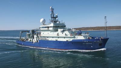
  • Completed

    PMA2020 - Revised 2023

    Steven Beaupre · Stony Brook

    Collaborative Research: Seasonal Variability in refractory dissolved organic carbon (RDOC) fluxes associated with primary marine aerosol (PMA) emitted from the oceans The oceans hold a massive quantity of organic carbon that is greater than all terrestrial organic carbon biomass combined. Nearly all marine organic carbon is dissolved. On average, it is thousands of years old, chemically stable, and carried throughout the entire ocean several times before complete removal. However, little is known about the processes that produce and remove this old carbon, referred to as refractory dissolved organic carbon (RDOC). One potential removal pathway involves RDOC adhering onto the surfaces of rising bubbles produced by breaking waves. The bubbles ultimately burst at the sea surface, ejecting tiny particles (primary marine aerosol, ?PMA?) that carry the RDOC into the atmosphere. Most of this PMA organic carbon is associated with the smallest particles (less than 1 ?m diameter) that drift in the atmosphere for several days to weeks. During this time, RDOC in these particles can be degraded photochemically (by sunlight), partially transported landward, and/or returned to the sea. When this RDOC is converted to inorganic carbon (e.g., carbon dioxide) or degraded to more reactive constituents in the atmosphere, it is effectively removed from the marine RDOC reservoir. Based on preliminary results, the annual rate at which RDOC is removed from the ocean by this process is similar to all other known RDOC losses (interactions with particles, biological degradation, and hydrothermal circulation), except for photochemical degradation in seawater. Building on this prior research, this project will identify seasonal changes in the removal of RDOC from the oceans through this process during three research cruises to the northwestern Atlantic Ocean. Results from this project will provide important findings about the coupled ocean-atmosphere loss of RDOC and improve understanding of the role of RDOC in the global carbon cycle and Earth's climate. The research will involve two early career faculty, and will provide training for undergraduate, graduate, and postdoctoral researchers. Radiocarbon (C-14) measurements indicate that RDOC comprises 19 to 40 % of the organic carbon associated with PMA produced by bursting bubbles at the sea surface. Injection of RDOC into the atmosphere in association with PMA is a potentially important process that removes as much as 2 to 20 Tg RDOC yr-1 from the oceans. This project will measure seasonal variations in the PMA-mediated emission of marine RDOC to the atmosphere by quantifying: (1) the fraction of RDOC in PMA OC and (2) its relationship to the abundance of biologically produced labile and semi-labile dissolved organic matter in near surface seawater. These relationships will be evaluated at the Bermuda Atlantic Time-series Station during three research cruises (one in July, two in January). During the cruises, the investigators will measure: (1) the natural abundance C-14 values for PMA and its organic source materials in seawater; (2) the dynamic and equilibrium surface tension and physical properties of seawater, including bubble size distributions; (3) concentrations of major ions, organic carbon, carbohydrates, peptides and proteins, and surfactants in PMA; and (4) chromophoric dissolved organic matter (CDOM) and the concentrations of dissolved organic carbon, chlorophyll a, major ions, carbohydrates, peptides and proteins, and surfactants in near-surface seawater and in the sea-surface microlayer. Based on these chemical measurements and physical properties, this study will reveal the magnitude and potential controls on RDOC inputs into the atmosphere as a component of PMA.

    Jan 19 – Jan 28, 2023 · 9 d

    BATS Station

  • Completed

    CLASI-Florida 1 of 2 Deployment

    Hans Graber · UMIAMI

    Cruise 1: January 9, 2023 from Pensacola, FL or Mobile, AL to deploy 8 ASIS buoys off Santa Rosa Island, FL in northern part of Gulf of Mexico. Cruise 3: March 20, 2023 recover all 8 ASIS buoys off Santa Rosa Island, FL in northern part of Gulf of Mexico. Multiple transects between buoy locations and Pensacola, FL or Mobile, AL or Miami, FL will be needed. Per conversation with Hans Graber 7/21/2022 The intermediate cruise will not longer be necessary. Only deployment and recovery cruise. eb

    Jan 13 – Jan 25, 2023 · 12 d

    Offshore Santa Rosa Island, FL

  • Completed

    Transit and MB Patch test and Acoustic testing

    Robert Kamphaus · UW

    Relocation of vessel to begin operations in the southern and western Pacific including multibeam patch test and ONR acoustic testing.

    Jan 13 – Jan 19, 2023 · 6 d

    Eastern Pacific

  • Completed

    Endeavor · URI

    NES-LTER - 2023 1of 2

    Heidi Sosik · WHOI

    The northwest Atlantic is renowned for productive fisheries that depend upon a complex food web of planktonic organisms that provide them energy. In these waters -- as in coastal waters around the globe -- human activities, environmental variability, and decadal-scale change intersect to have diverse effects on the planktonic food web. It is crucial to understand the structure of this web, how it functions, and how it responds to seasonal environmental change, in order to respond appropriately to long-term trends that are accelerating in this region. Our understanding, however, has been limited by a lack of systematic and detailed measurements over a sufficient length of time so that we can observe the responses of these webs to environmental perturbations and uncover the underlying causes and implications. The Northeast US Shelf (NES) Long-Term Ecological Research (LTER) project will provide such observations, analyze them with a variety of models, and improve our ability to predict how planktonic food webs change through space and time, and how those changes impact the productivity of higher trophic levels including commercially important fish. In addition, the NES-LTER project will have multifaceted broader impacts, including collaboration with the National Oceanic and Atmospheric Administration's (NOAA), Northeast Fisheries Science Center to support multispecies, ecosystem-based management on the NES. The project includes an education plan that will provide opportunities to a broad range of learners and a far-reaching public outreach component will be developed through NOAA's international Science-On-a-Sphere network. While patterns of ecosystem change over seasons to decades have already been documented in this region, the key mechanisms linking changes in the physical environment, planktonic food webs, and higher trophic levels remain poorly understood. For this reason, predictive capability is limited and management strategies are largely reactive. To address these needs, the NES-LTER strategy combines observations that provide regional-scale context, process cruises along a high gradient cross-shelf transect, high-frequency time series at inner- and outer-shelf locations, coupled biological-physical food web models, and targeted population models. The research plan is guided by an overarching science question: How is long-term environmental change impacting the pelagic NES ecosystem and, in particular, affecting the relationship between compositional (e.g., species diversity and size structure) and aggregate (e.g., rates of primary production, and transfer of energy to important forage fish species) variability? By capitalizing on high levels of seasonal and interannual variability in the NES, the research will study short-term responses to change in the environment to a) characterize low and high export food webs, b) understand the linkages and transfer of energy from the phytoplankton to pelagic fish, and c) identify the mechanisms that underlie shifts between high and low export communities. Ultimately, mechanistic knowledge will be scaled up to understand and predict the impacts and feedbacks associated with trends in decadal-scale forcing in the ecosystem.

    Jan 11 – Jan 16, 2023 · 5 d

    WH-Pioneer Cross-shelf transect south of Woods Hole, MA to OOI Pioneer Array at the shelf break

  • Completed

    SFER

    Christopher Kelble · NOAA

    AOML SFP regional surveys over the southwest Florida shelf and the Florida Keys reef tract have been routinely performed via the University of Miami's R/V F. G. Walton Smith on a bimonthly basis. Sampling methodologies similar to those utilized on AOML SFP bay surveys (discrete sampling and flow-through measurements) have been employed on these regional research cruises.

    Jan 11 – Jan 17, 2023 · 6 d

    Miami, Keys reef tract , and West Florida Shelf

  • Completed

    UMCES ChesBay Plume

    Ryan J. Woodland · UMCES

    There is a clear need to develop our understanding of how plumes affect the benthic component of shallow, temperate shelf ecosystems, particularly in regards to the benthic faunal communities. The benthos plays a key role in the dynamics of plume-shelf systems, acting to assimilate deposited allochthonous and autochthonous particulate organic matter (POM), modulate local biogeochemical fluxes and cycling, and fill a critical ecological function as forage for higher trophic levels. Despite evidence of the importance of these benthic communities in contributing to ecosystem dynamics in these shelf environments, a mechanistic understanding of how these communities are structured spatially and temporally in response to plume inputs or how biologically-mediated processes such as nutrient flux rates covary with benthic communities across plume gradients, remain critical knowledge gaps. The overarching goal for this project is to determine how the magnitude and reactivity of organic matter inputs and environmental conditions associated with a large, spatially and temporally dynamic estuarine plume affects an inner continental shelf benthic community. We specifically seek to quantify the benthic community response to seasonally and spatially variable patterns of organic matter deposition, both labile and refractory, associated with plume conditions. We will use a combination of observational and experimental approaches to quantify the history of plume-driven conditions and particle transport and deposition and then quantify through experiments and numerical model simulations how the magnitude and reactivity of POM deposited to sediments controls the structure and metabolism of the benthic community. We will use these approaches to address hypotheses that predict benthic biomass, biodiversity, and secondary production to be stimulated by POM inputs both seasonally and spatially, but this stimulation will be modulated by feeding mode, past exposure to plume influence, lability of depositing organic matter, and physical forces (e.g., temperature, salinity, bed stress) imposed by hydrodynamic variations. Our project blends aspects of benthic ecology, biogeochemistry, and coastal hydrodynamics in an effort that merges discrete observations, incubation experiments, and numerical modeling in a synthesis that will deliver new insights into the role of benthic communities in responding to – and influencing – plume-coastal ocean interactions. The proposed research will help fill these knowledge gaps by identifying key relationships between plume-associated conditions and benthic community structures and processes, and experimentally testing associated ecological and biogeochemical rates. This knowledge is central to accurately coupling estuary-ocean food web models and is becoming ever more pressing in the face of anthropogenic pressures given long-term shifts in regional climate and the changing frequency and severity of extreme weather events in many regions. In addition to advancing our scientific understanding of plume-shelf dynamics, this project will provide STEM training directly to early career scientists and students from a variety of backgrounds. The PIs will leverage an established collaborative internship program with a regional community college to offer hands-on STEM learning opportunities to students from historically underserved segments of the undergraduate population (e.g., first generation students, students of color). Non-biological STEM undergraduates in a computer science course will be engaged through a focused video game design project in which students design, program and present a video game that models a central element of the project as a tool for engaging the public. Several National Science Foundation-funded Research Experience for Undergraduates (REU) fellows will be invited to participate in this project with tailored summer projects that incorporate aspects of this proposal and the REU's own interests. Training opportunities will be provided to the graduate student to develop mentoring skills through direct interaction with undergraduate interns, and to practice science communication through public outreach activities on and off-campus. In addition to training the next generation of scientists, this research will be shared with regional fisheries management groups to ensure relevant information (e.g., drivers of inner shelf benthic forage availability) is available for ecosystem-based management applications and with the general public through seminars and structured interactive events (e.g., institutional open house events).

    Jan 9 – Jan 13, 2023 · 4 d

    Chesapeake Bay mouth and adjacent shelf waters

  • Completed

    BATS 2023 - 1of12

    Nicholas R. Bates · BIOS

    Long-term observations over several decades are a powerful tool for investigating ocean physics, biology, and chemistry, and the response of the oceans to environmental change. The Bermuda Atlantic Time-Series Study, known as BATS, has been running continuously since 1988. The research goals of the BATS program are: (1) to improve our understanding of the time-varying components of the ocean carbon cycle and the cycles of related nutrient elements such as nitrogen, phosphorus, and silicon; and, (2) to identify the relevant physical, chemical and ecosystem properties responsible for this variability. In addition, the BATS program has strong and diverse broader impacts, contributing to the field of ocean sciences by providing high quality ocean observations and data for seagoing scientists and modelers, and a framework through which researchers can conceive and test hypotheses. This award will support the operations of the BATS program for five more years. The primary BATS research themes are as follows: (1) Quantify the role of ocean-atmosphere coupling and climate variability on air-sea exchange of CO2, and carbon export to the ocean interior; (2) Document trends and the controls on the interannual to decadal scale variability in carbon and nutrient cycles to their coupling in the surface and deep ocean via the Redfield Ratio paradigm; (3) Quantify the response of planktonic community structure and function, and impact on biogeochemical cycles to variability in surface fluxes and dynamical processes; (4) Facilitate development, calibration and validation of next generation oceanographic sensors, tools and technologies; and, (5) Generate a dataset that can be utilized by empiricists, modelers and students. This research integrates ocean physics, chemistry and biology into a framework for understanding oceanic processes and ocean change in the North Atlantic subtropical gyre. The existing 29 years of BATS data provide robust constraints on seasonal and interannual variability, the response of the Sargasso Sea ecosystem to natural climate variability, and signal detection of potential ocean changes. This project would extend the BATS program through years 31-35 to address a series of ten interlinked questions through integrated research approaches and a multitude of collaborative efforts. In addition to the themes above, and embedded into the ten questions and approaches, the BATS team will focus on, for example, coupling of particle production and biogeochemistry; revisiting the complexities of the biological carbon pump; oxygen decline; and changes in the hydrography, physics, ocean carbon cycle and biogeochemistry of the Sargasso Sea. The highest quality data observation and collection will be maintained and used to address these questions. Importantly, a wide range of collaborations at the BATS site, spanning the physical and biogeochemical disciplines, will aid these broad goals. Strong links to community stakeholders, and close collaboration (including methods intercomparisons and personnel exchanges) with the Hawaii Ocean Time-series are proposed. This work will extend the research findings of the project into educational and training opportunities within and beyond the oceanographic community, including training and mentorship of both undergraduate and graduate students.

    Jan 8 – Jan 13, 2023 · 5 d

    Atlantic

    Sails with 1 other project

  • Completed

    Hydro S - 2023 1of24

    Nicholas R. Bates · BIOS

    One of the longest open-ocean hydrographic stations in the world is maintained at the Hydrostation S site (formerly known as the Panulirus site) located ~25 km southeast of Bermuda in the North Atlantic Ocean. This program of repeat biweekly hydrographic observations began in 1954 (by Hank Stommel) and now, in its seventh decade, has proved to be the catalyst for numerous studies of ocean physics, biological processes and biogeochemistry. Hydrostation S continues to be recognized as one of the most important sustained ocean time–series. The renewal of the Hydrostation S program is proposed herein, extending this invaluable time–series of ocean hydrography to almost 70 years. The upper ocean warming trend has strengthened (about +1.4° C since the 1970's; ~+0.8°C in last decade) with significant salinification (+0.16). Deeper waters such as the Labrador Sea Water has cooled by a few tenths of a degree and freshened with a marked decadal oscillation. The signature of deoxygenation has been observed at Hydrostation S in the upper ocean (about 4 µmoles kg -1 decade -1 decrease in dissolved oxygen) as well as the oxygen minimum zone (~2.5 µmoles kg -1 decade -1 ). Hydrostation S also supports the longest global ocean CO 2 and acidification time-series (from 1983 to present) The major objective of the proposal is to continue Hydrostation S into the eighth decade with numerous questions related to warming and cooling, salinification and freshening, deoxygenation and insights on biogeochemical changes over time. This program constitutes frequent water column sampling of temperature, salinity, and dissolved oxygen (and indirectly, sampling of important ocean carbon time–series) of the North Atlantic subtropical gyre at the Hydrostation S site. Such work is complementary to other sustained observations such as the Bermuda Atlantic Time–series Study (BATS) and Ocean Flux Program (OFP). We propose to carry out a similar sampling format that has been followed for the past 68 years. As for the past ten years, we would continue to conduct two CTD profiles to better capture the deep–water variability while maintaining all the previous discrete depths. The first CTD cast will profile to full ocean depth (3,300–3,500 m) while the second CTD cast will profile to 500 m (to allow for instrumentation not rated for full ocean depth such as a PAR sensor). One indirect objective will be to continue to collaboratively evaluate a BIOS-based glider program with Hydrostation S data as critically important ground truthing data. The existing glider program has challenging issue, and the aim of this effort is to use robust and highly accurate Hydrostation S data to test the capability of emerging technologies over the next five to ten years.

    Jan 8 – Jan 13, 2023 · 5 d

    Atlantic

    Sails with 1 other project

NewerPage 43 of 55Older