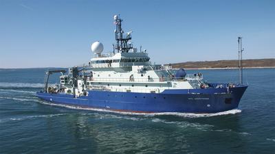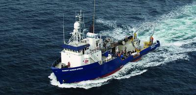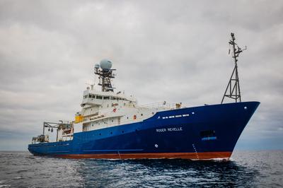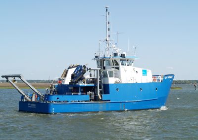
CORMP
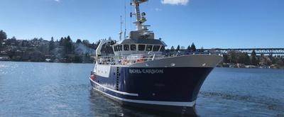
Christopher LaClair · UNCW
Cruise intent is to replace meteorological/oceanographic buoys along the coast of South Carolina and North Carolina.
Mar 17 – Mar 19, 2022 · 2 d
Coast of South Carolina, out 5 miles.
Christopher LaClair · UNCW
Cruise intent is to replace meteorological/oceanographic buoys along the coast of South Carolina and North Carolina.
Mar 17 – Mar 19, 2022 · 2 d
Coast of South Carolina, out 5 miles.
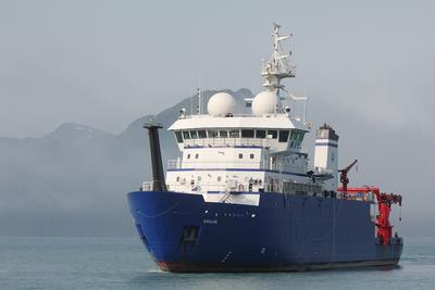
Pelican · LUMCON
Jeffrey Krause · DISL
Hurricane Ida moved through the Mississippi Delta and adjacent Louisiana shelf at the end of August 2021. The storm was similar in magnitude, areal extent, and landfall position (Cocodrie, LA) to the category 4 Hurricane Gustav in September 2008. Ida, a much stronger storm than either Hurricanes Harvey or Nate in 2017, likely introduced a significant quantity of oxygen into the sediment of the proximal coastal zone, perhaps enough to turn most of the top ~1 m of the sediment column oxic. We hypothesize that the change in redox and diagenetic conditions initially favored burial of bSi as unaltered opal rather than an authigenic aluminosilicate. Thirteen days prior to Ida’s landfall in Port Fourchon, LA (~45 km east of Cocodrie), we collected sediment cores at three sites in the topset delta sediment between the Southwest Pass (major Mississippi River distributary) and Cocodrie, LA aboard the R/V Pelican; all sites experienced Category 4 hurricane conditions from Ida with maximum sustained winds of 130 knots (67 m/s). The timing of our prior cruise provides a unique opportunity, which is near impossible to plan for with a traditional project, to revisit these sites and quantify the impact of Hurricane Ida on the fate of sediment biogenic silica (i.e., modality between sequestration types) as the system resets in the following months (e.g., single-day cruises in fall 2021, and winter, spring 2022) .
Mar 17 – Mar 19, 2022 · 2 d
Louisiana Shelf
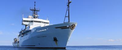
F.G. Walton Smith · UMIAMI
Christopher Kelble · NOAA
Collect coordinated measurements of coastal physics, biology, and chemistry for analytical interpretation of the coupled local, regional, and remote processes influencing the transport and exchange of South Florida coastal waters and their suspended and dissolved constituents. Thus, this research will require the use of a well calibrated flow through system measuring temperature, salinity, chlorophyll a, and Chromophoric Dissolved Organic Matter. CTD casts will be conducted at discrete section to survey the vertical structure of the water column and collect samples at depth. In addition, there will be some biological sampling. Plankton tows will be conducted at roughly ten stations to assess the zooplankton community in the area. Otter trawls will be conducted to survey the benthic juvenile fish community most likely in the area of Marquesas. To do this characterization we will conduct six five-day cruises. Each cruise will begin sampling near Fowey Rocks off of Biscayne Bay and will continue sampling along the Florida Keys to the Dry Tortugas. The survey will then head northeast to Charlotte Harbor and sample along the southwest Florida shelf south to Cape Sable before returning back to Miami. Ideal dates for cruise departures are Jan 2017, Mar 2017, May 2017, July 2017, Sep 2017, and Nov 2017.
Mar 13 – Mar 19, 2022 · 6 d
South Florida
Robert Kamphaus · UW
Relocation of vessel for Roxanne Beinart's project in the South Pacific
Mar 12 – Mar 20, 2022 · 8 d
Transit San Diego to Papeete
Piero Luigi Fernandes Mazzini · VIMS
This project will examine the interaction of a stratified coastal plume with a cape, using a combined observational and modeling approach. High-resolution shipboard surveys and moored instrumentation near Point Reyes, CA, will measure the circulation and evolution of the San Francisco Bay Plume under a range of wind and river discharge conditions. Combined numerical model simulations and observations will quantify the dynamical balances and residence times of the Plume downstream of the Cape. Idealized simulations will permit expansion of results across parameter space, to understand both the controlling dynamics and conditions affecting plume separation and retention times of stratified plumes in the lee of capes in the coastal ocean. Coastal plumes are a key component of shelf circulation, and important conduits for transport of pollutants, nutrients, water masses and the organic carbon they contain. Understanding the factors influencing plume separation and retention times will contribute to understanding fates of such societally important ocean constituents. Complex coastal geometries, such as capes and submarine banks, can lead to significant hydrodynamic disturbances of buoyant coastal flows. Such plumes are key components of shelf circulation and coastal ocean biogeochemistry and marine ecosystems, so their dynamics and fate are critical to understand. This project will quantify the interaction between the San Francisco Bay Plume in the vicinity of Point Reyes, CA, under a range of wind and river discharge conditions, using shipboard, moored, and drifter field observations, combined with realistic and idealized numerical modeling studies. The main objectives are to: (1) obtain detailed measurements of plume hydrography, along- and cross-stream velocities and transports near a cape, under a range of river discharge and wind-forcing conditions, (2) identify the conditions for plume separation from the coast and eddy generation in the lee of a cape, (3) quantify the retention time scales downstream of the cape associated with the generated eddies, and (4) investigate the dominant momentum balances that control far-field dynamics as the plume interacts with a cape. Although plumes encompass a small area of the ocean surface, they are the boundary condition for larger scale shelf circulation, and thus their evolution is critical to understand and represent realistically in models. This project will result in better understanding of the fate and transport of pollutants, nutrients and water masses in the ocean, contribute observational datasets, models, and analysis tools to the science community, and will provide critical research capacity for two early career scientists.
Mar 12 – Apr 6, 2022 · 25 d
Point Reyes Continental shelf surrounding Point Reyes, from the inner shelf (15-20m) to outer shelf (~80m). From 30 km north to 30 km east-southeast along the coast from Pt Reyes, up to 20-30 km offsh
Marc Frischer · UGA
The significance of doliolid microbial interactions: Do doliolids fundamentally alter the trophic structure and productivity of sub-tropical continental shelf food webs? The long-term goal of this project is to understand the ecological function of doliolids on subtropical continental shelves and their influence on microbial processes. In association with monthly oceanographic field expeditions on the mid-continental shelf at 31°N and two longer longitudinal expeditions complemented with experimental studies, the project investigates the relationship between doliolid abundance and life stage composition, their spatial relationships to marine snow aggregates and other zooplankton, water column microbial activity, bacterial production, and net system productivity. Utilizing a constellation of modern and classical approaches in microbial and zooplankton ecology, including deployment of an in situ zooplankton imaging system in the South Atlantic Bight, microbial metagenomics and transcriptomics, and stable isotope-based tracer experiments, these studies will allow the testing of three fundamental hypotheses. First, independent of total shelf productivity, the presence and abundance of doliolids is correlated with heterotrophy compared to periods when doliolids are not abundant. Second, doliolids predictably shape continental shelf microbial communities, activity, and function, and third, doliolids are detrital feeders benefiting nutritionally from the consumption of microbial enriched aggregated particles and fecal material - the pool to which they also contribute.
Mar 8 – Mar 10, 2022 · 1 d
Mid continental shlf of the SAB at 31 deg N between the 25 and 45 M isobaths
Hugh R. Sharp · UDel
Blake Landry · NRL
Project is to support DARPA's Ocean of Things Program: https://oceanofthings.darpa.mil/
Mar 8 – Mar 11, 2022 · 3 d
37.1, -73.25
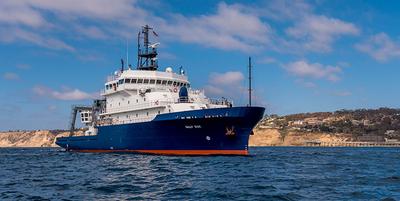
Simone Baumann-Pickering · SIO
Marine mammals inhabit a highly dynamic, mobile environment. We will document how physical oceanographic conditions drive prey distributions and cetacean response to these changes. Use of mid-frequency active sonar during US Navy training operations can invoke a cetacean behavioral response and we aim to document how a response may be shaped by underlying prey conditions. A series of 5 cruises will be conducted over the course of 2 years to record passive acoustic data on long-term moorings at sonar-impacted and minimally disturbed sites. Satellite tagging of cetaceans will provide larger spatial information on movement patterns observed outside the acoustic detection range. Information on prey will be collected with autonomous and ship-board active-acoustic systems. MOCNESS tows will provide an active acoustics ground-truth. Physical oceanographic features will be measured with autonomous sensors on the moorings and with ship-board instrumentation.
Mar 6 – Mar 10, 2022 · 4 d
SOCAL Bight San Diego trough, near shelf break offshore San Diego to south of Channel Islands
Ying-Tsong (YT) Lin · SIO
This cruise is to carry out an seafloor survey to determine the seabed properties using AUVs. The study site is the Atlantis II seamounts, and the survey equipment include acoustic sonar systems and optical camera. The acoustic data will be used to estimate the seafloor and sub-bottom properties, and the optical images are to provide visual confirmation.
Mar 4 – Mar 10, 2022 · 6 d
Atlantis II Seamount
Pelican · LUMCON
Chunyan Li Li · LSU
The main purpose of the ship usage includes: 1) deployment and retrieval of bottom mounted equipment for planned recording of data for meteotsunami events during severe weather; 2) conduct some transect surveys to verify, cross calibrate and validate the data from the deployed instruments. Since each deployment will last for a month or so (limited by battery life of the instruments), we need to have several trips to cover several months of winter storm time periods.
Mar 2 – Mar 3, 2022 · 1 d
Louisiana shelf water
Robert Cowen · OSU
Marine plankton form the base of most ocean food webs that support valuable fisheries. This highly diverse and complex community is composed of organisms that drift with ocean currents. Planktonic organisms remain understudied: they are difficult to sample given that their sizes span more than six orders of magnitude from less than one micron to meters. Yet, understanding how these communities will respond to climate change, and ultimately how these responses affect valuable fisheries, and therefore food security, is critical. Because many ecological and physiological processes are dictated by relative size, the theory of size spectra (i.e., the relationship between size and organism abundance as it drives ecosystem properties such as food webs) provides a valuable framework for forecasting climate change impacts on marine ecosystems. A deeper understanding of the scope and nature of variability in size spectra under contrasting environmental conditions is needed. The dynamic, highly productive northern California Current off Oregon and Washington in summer and winter seasons produce a patchwork of oceanographic conditions including those associated with hypoxia and ocean acidification. This study is sampling the plankton communities in this region to investigate how gradients of temperature, nutrients, dissolved oxygen, and pH conditions impact size spectra. The coupling of in situ plankton imagery and morphometric data allows quantifying scales of variation in plankton size spectra as well as testing predictions of how changes in environmental conditions (notably, temperature, nutrients, O 2 , pH) correlate with shifts in size spectra and revealing functional consequences to the food web. Plankton size spectra are being compared across environmental conditions by sampling in a habitat with steep environmental gradients and during two contrasting seasons. Planktonic organisms spanning 10 orders of magnitude in biomass are sampled using two complementary high-resolution imaging systems: the In Situ Ichthyoplankton Imaging System (ISIIS) and the Laser In-Situ Scattering and Transmissometry (LISST) particle imager. High-throughput image analysis software is used to generate size distributions together with taxonomic classification. Depth-discrete meso-zooplankton samples are collected in parallel to examine community shifts in carbon and for the calibration of length-to-carbon conversions based on images for use in normalized biomass size spectra. These plankton collections are also being analyzed for diet and reproductive status of gelatinous zooplankton, and diet and daily growth rate of representative larval fishes. These two groups have been historically understudied yet play central roles in ecosystem function. These data are adding to the understanding of how these important organisms at the base of the marine food web are affected by environmental conditions, and how they affect plankton size spectra. This study is foundational to the understanding of marine ecosystems within the context of climate change.
Mar 1 – Mar 12, 2022 · 11 d
Oregon Coast
Kilo Moana · UH
Eric Terrill · SIO
We propose to test and evaluate deep water survey, autonomy, sensors, and intervention technologies in the waters off Tinian and Saipan. The study will involve the use of multiple UUVs equipped with both acoustic and optical imaging systems. A ROV will be incorporated to test human-machine teaming at deep water. The objectives of the survey/study region are to find, locate, and dcoument multiple U.S. B-29 aircraft lost on take off from Tinian Island. The project advances multi-disciplinary, scientific methods and marine technologies for advancing seabed technical capabilities in water depths ranging from 200-600m. This proposal builds on existing oceanographic, archaeological, and historical data, most notably U.S. Navy and NOAA multibeam sonar of the seafloor surrounding Tinian and Saipan that led to the discovery of a single B-29 by the NOAA ship Okeanos Explorer in 2016.
Feb 24 – Mar 10, 2022 · 13 d
saipan channel
Heidi Sosik · WHOI
The northwest Atlantic is renowned for productive fisheries that depend upon a complex food web of planktonic organisms that provide them energy. In these waters -- as in coastal waters around the globe -- human activities, environmental variability, and decadal-scale change intersect to have diverse effects on the planktonic food web. It is crucial to understand the structure of this web, how it functions, and how it responds to seasonal environmental change, in order to respond appropriately to long-term trends that are accelerating in this region. Our understanding, however, has been limited by a lack of systematic and detailed measurements over a sufficient length of time so that we can observe the responses of these webs to environmental perturbations and uncover the underlying causes and implications. The Northeast US Shelf (NES) Long-Term Ecological Research (LTER) project will provide such observations, analyze them with a variety of models, and improve our ability to predict how planktonic food webs change through space and time, and how those changes impact the productivity of higher trophic levels including commercially important fish. In addition, the NES-LTER project will have multifaceted broader impacts, including collaboration with the National Oceanic and Atmospheric Administration's (NOAA), Northeast Fisheries Science Center to support multispecies, ecosystem-based management on the NES. The project includes an education plan that will provide opportunities to a broad range of learners and a far-reaching public outreach component will be developed through NOAA's international Science-On-a-Sphere network. While patterns of ecosystem change over seasons to decades have already been documented in this region, the key mechanisms linking changes in the physical environment, planktonic food webs, and higher trophic levels remain poorly understood. For this reason, predictive capability is limited and management strategies are largely reactive. To address these needs, the NES-LTER strategy combines observations that provide regional-scale context, process cruises along a high gradient cross-shelf transect, high-frequency time series at inner- and outer-shelf locations, coupled biological-physical food web models, and targeted population models. The research plan is guided by an overarching science question: How is long-term environmental change impacting the pelagic NES ecosystem and, in particular, affecting the relationship between compositional (e.g., species diversity and size structure) and aggregate (e.g., rates of primary production, and transfer of energy to important forage fish species) variability? By capitalizing on high levels of seasonal and interannual variability in the NES, the research will study short-term responses to change in the environment to a) characterize low and high export food webs, b) understand the linkages and transfer of energy from the phytoplankton to pelagic fish, and c) identify the mechanisms that underlie shifts between high and low export communities. Ultimately, mechanistic knowledge will be scaled up to understand and predict the impacts and feedbacks associated with trends in decadal-scale forcing in the ecosystem.
Feb 16 – Feb 21, 2022 · 5 d
WH-Pioneer
Marc Frischer · UGA
The significance of doliolid microbial interactions: Do doliolids fundamentally alter the trophic structure and productivity of sub-tropical continental shelf food webs? The long-term goal of this project is to understand the ecological function of doliolids on subtropical continental shelves and their influence on microbial processes. In association with monthly oceanographic field expeditions on the mid-continental shelf at 31°N and two longer longitudinal expeditions complemented with experimental studies, the project investigates the relationship between doliolid abundance and life stage composition, their spatial relationships to marine snow aggregates and other zooplankton, water column microbial activity, bacterial production, and net system productivity. Utilizing a constellation of modern and classical approaches in microbial and zooplankton ecology, including deployment of an in situ zooplankton imaging system in the South Atlantic Bight, microbial metagenomics and transcriptomics, and stable isotope-based tracer experiments, these studies will allow the testing of three fundamental hypotheses. First, independent of total shelf productivity, the presence and abundance of doliolids is correlated with heterotrophy compared to periods when doliolids are not abundant. Second, doliolids predictably shape continental shelf microbial communities, activity, and function, and third, doliolids are detrital feeders benefiting nutritionally from the consumption of microbial enriched aggregated particles and fecal material - the pool to which they also contribute.
Feb 15 – Feb 17, 2022 · 1 d
Mid continental shlf of the SAB at 31 deg N between the 25 and 45 M isobaths
Steven D'Hondt · URI
The fundamental objective of this project is to determine how the subseafloor microbial communities and activities across a gradient of oceanic depth zones (sublittoral, bathyal, abyssal, hadal) are impacted by the pressure of the surrounding water. The primary hypothesis being tested is that ?microbial communities in subseafloor sediment are adapted for in situ pressure.? The null hypothesis is that these ?communities are merely remnant populations introduced from shallower depths and poorly adapted for in situ pressure.? To test these hypotheses, the project compares the subseafloor communities and rates of activity that occur in anoxic subseafloor sediment at ocean depths ranging from 50 to ~8400 meters below sea level in the Puerto Rico Trench region. To collect the samples and shipboard data, the project includes a 26-day coring program. The project interrogates the genomic composition and community metabolic rates of the subseafloor sedimentary communities over this full range of ocean depths. Experiments are being conducted to determine the pressure-dependence of potential processes (sulfate reduction and methanogenesis) and genes that are preferentially expressed at in situ pressures by sublittoral, bathyal, abyssal and hadal subseafloor communities. These results are synthesized to identify the nature and extent of adaptations to in situ pressure in subseafloor communities.
Feb 15 – Mar 10, 2022 · 23 d
PR Trench
Lisa Levin · SIO
This cruise offers the students enrolled in Deep-Sea Biology (SIO 277) a rare hands-on opportunity to work with deep-sea organisms, and has become an essential part of the course. Due to Covid Restrictions and expected large class size we will repeat identical activities on two different days, ideally on 2 separate weekends. The goals of the cruise are to (1) demonstrate the different types of instrumentation used to study the biology of deep-sea organisms including CTD, multicore, Isaacs kid midwater trawl and otter trawl (2) generate hydrographic data illustrating features of the deep CA margin (e.g., thermocline, oxygen minimum zone, carbon maximum zone, nepheloid or benthic boundary layers), (3) visualize and recover deep-sea animals characteristic of midwater, continental margin and possibly methane seep environments, and (4) provide at-sea experience to students along with detailed explanations of ship operations and facilities. Work will be conducted in the San Diego Trough (1200 m), offshore of Point Loma and on the continental margin at and near the Del Mar Methane Seep (1038 m).
Feb 12 – Feb 13, 2022 · 1 d
San Diego Trough and Del Mar Seep, Southern California
Endeavor · URI
Steven Beaupre · Stony Brook
Collaborative Research: Seasonal Variability in refractory dissolved organic carbon (RDOC) fluxes associated with primary marine aerosol (PMA) emitted from the oceans The oceans hold a massive quantity of organic carbon that is greater than all terrestrial organic carbon biomass combined. Nearly all marine organic carbon is dissolved. On average, it is thousands of years old, chemically stable, and carried throughout the entire ocean several times before complete removal. However, little is known about the processes that produce and remove this old carbon, referred to as refractory dissolved organic carbon (RDOC). One potential removal pathway involves RDOC adhering onto the surfaces of rising bubbles produced by breaking waves. The bubbles ultimately burst at the sea surface, ejecting tiny particles (primary marine aerosol, ?PMA?) that carry the RDOC into the atmosphere. Most of this PMA organic carbon is associated with the smallest particles (less than 1 ?m diameter) that drift in the atmosphere for several days to weeks. During this time, RDOC in these particles can be degraded photochemically (by sunlight), partially transported landward, and/or returned to the sea. When this RDOC is converted to inorganic carbon (e.g., carbon dioxide) or degraded to more reactive constituents in the atmosphere, it is effectively removed from the marine RDOC reservoir. Based on preliminary results, the annual rate at which RDOC is removed from the ocean by this process is similar to all other known RDOC losses (interactions with particles, biological degradation, and hydrothermal circulation), except for photochemical degradation in seawater. Building on this prior research, this project will identify seasonal changes in the removal of RDOC from the oceans through this process during three research cruises to the northwestern Atlantic Ocean. Results from this project will provide important findings about the coupled ocean-atmosphere loss of RDOC and improve understanding of the role of RDOC in the global carbon cycle and Earth's climate. The research will involve two early career faculty, and will provide training for undergraduate, graduate, and postdoctoral researchers. Radiocarbon (C-14) measurements indicate that RDOC comprises 19 to 40 % of the organic carbon associated with PMA produced by bursting bubbles at the sea surface. Injection of RDOC into the atmosphere in association with PMA is a potentially important process that removes as much as 2 to 20 Tg RDOC yr-1 from the oceans. This project will measure seasonal variations in the PMA-mediated emission of marine RDOC to the atmosphere by quantifying: (1) the fraction of RDOC in PMA OC and (2) its relationship to the abundance of biologically produced labile and semi-labile dissolved organic matter in near surface seawater. These relationships will be evaluated at the Bermuda Atlantic Time-series Station during three research cruises (one in July, two in January). During the cruises, the investigators will measure: (1) the natural abundance C-14 values for PMA and its organic source materials in seawater; (2) the dynamic and equilibrium surface tension and physical properties of seawater, including bubble size distributions; (3) concentrations of major ions, organic carbon, carbohydrates, peptides and proteins, and surfactants in PMA; and (4) chromophoric dissolved organic matter (CDOM) and the concentrations of dissolved organic carbon, chlorophyll a, major ions, carbohydrates, peptides and proteins, and surfactants in near-surface seawater and in the sea-surface microlayer. Based on these chemical measurements and physical properties, this study will reveal the magnitude and potential controls on RDOC inputs into the atmosphere as a component of PMA.
Feb 8 – Feb 19, 2022 · 11 d
BATS Station
Pelican · LUMCON
Richard Funk · TT, Inc.
Environmental Sampling in OEM lease areas WD38, 39 & 68
Feb 7 – Feb 9, 2022 · 2 d
Western Delta, GOM
Lisa Levin · SIO
This cruise offers the students enrolled in Deep-Sea Biology (SIO 277) a rare hands-on opportunity to work with deep-sea organisms, and has become an essential part of the course. Due to Covid Restrictions and expected large class size we will repeat identical activities on two different days, ideally on 2 separate weekends. The goals of the cruise are to (1) demonstrate the different types of instrumentation used to study the biology of deep-sea organisms including CTD, multicore, Isaacs kid midwater trawl and otter trawl (2) generate hydrographic data illustrating features of the deep CA margin (e.g., thermocline, oxygen minimum zone, carbon maximum zone, nepheloid or benthic boundary layers), (3) visualize and recover deep-sea animals characteristic of midwater, continental margin and possibly methane seep environments, and (4) provide at-sea experience to students along with detailed explanations of ship operations and facilities. Work will be conducted in the San Diego Trough (1200 m), offshore of Point Loma and on the continental margin at and near the Del Mar Methane Seep (1038 m).
Feb 5 – Feb 6, 2022 · 1 d
San Diego Trough and Del Mar Seep, Southern California
F.G. Walton Smith · UMIAMI
Christopher Kelble · NOAA
Collect coordinated measurements of coastal physics, biology, and chemistry for analytical interpretation of the coupled local, regional, and remote processes influencing the transport and exchange of South Florida coastal waters and their suspended and dissolved constituents. Thus, this research will require the use of a well calibrated flow through system measuring temperature, salinity, chlorophyll a, and Chromophoric Dissolved Organic Matter. CTD casts will be conducted at discrete section to survey the vertical structure of the water column and collect samples at depth. In addition, there will be some biological sampling. Plankton tows will be conducted at roughly ten stations to assess the zooplankton community in the area. Otter trawls will be conducted to survey the benthic juvenile fish community most likely in the area of Marquesas. To do this characterization we will conduct six five-day cruises. Each cruise will begin sampling near Fowey Rocks off of Biscayne Bay and will continue sampling along the Florida Keys to the Dry Tortugas. The survey will then head northeast to Charlotte Harbor and sample along the southwest Florida shelf south to Cape Sable before returning back to Miami. Ideal dates for cruise departures are Jan 2017, Mar 2017, May 2017, July 2017, Sep 2017, and Nov 2017.
Jan 22 – Jan 28, 2022 · 6 d
South Florida
Michael Landry · SIO
The small area between NW Australia and Indonesia in the eastern Indian Ocean (IO) is the only known spawning ground of Southern Bluefin Tuna (SBT), a critically endangered top marine predator. Adult SBT migrate thousands of miles each year from high latitude feeding areas to lay their eggs in these tropical waters, where food concentrations on average are below levels that can support optimal feeding and growth of their larvae. Many critical aspects of this habitat are poorly known, such as the main source of nitrogen nutrient that sustains system productivity, how the planktonic food web operates to produce the unusual types of zooplankton prey that tuna larvae prefer, and how environmental differences in habitat quality associated with ocean fronts and eddies might be utilized by adult spawning tuna to give their larvae a greater chance for rapid growth and survival success. This project investigates these questions on a 38-day expedition in early 2021, during the peak time of SBT spawning. This project is a US contribution to the 2nd International Indian Ocean Expedition (IIOE-2) that advances understanding of biogeochemical and ecological dynamics in the poorly studied eastern IO. This is the first detailed study of nitrogen and carbon cycling in the region linking Pacific and IO waters. The shared dietary preferences of SBT larvae with those of other large tuna and billfish species may also make the insights gained broadly applicable to understanding larval recruitment issues for top consumers in other marine ecosystems. New information from the study will enhance international management efforts for SBT. The shared larval dietary preferences of large tuna and billfish species may also extend the insights gained broadly to many other marine top consumers, including Atlantic bluefin tuna that spawn in US waters of the Gulf of Mexico. The end-to-end study approach, highlights connections among physical environmental variability, biogeochemistry, and plankton food webs leading to charismatic and economically valuable fish production, is the theme for developing educational tools and modules through the ?scientists-in-the-schools? program of the Center for Ocean-Atmospheric Prediction Studies at Florida State University, through a program for enhancing STEM learning pathways for underrepresented students in Hawaii, and through public outreach products for display at the Birch Aquarium in San Diego. The study also aims to support an immersive field experience to introduce talented high school students to marine research, with the goal of developing a sustainable marine-related educational program for underrepresented students in rural northwestern Florida. Southern Bluefin Tuna (SBT) migrate long distances from high-latitude feeding grounds to spawn exclusively in a small oligotrophic area of the tropical eastern Indian Ocean (IO) that is rich in mesoscale structures, driven by complex currents and seasonally reversing monsoonal winds. To survive, SBT larvae must feed and grow rapidly under environmental conditions that challenge conventional understanding of food-web structure and functional relationships in poor open-ocean systems. The preferred prey of SBT larvae, cladocerans and Corycaeidae copepods, are poorly studied and have widely different implications for trophic transfer efficiencies to larvae. Differences in nitrogen sources - N fixation vs deep nitrate of Pacific origin - to sustain new production in the region also has implications for conditions that may select for prey types (notably cladocerans) that enhance transfer efficiency and growth rates of SBT larvae. The relative importance of these N sources for the IO ecosystem may affect SBT resiliency to projected increased ocean stratification. This research expedition investigates how mesoscale variability in new production, food-web structure and trophic fluxes affects feeding and growth conditions for SBT larvae. Sampling across mesoscale features tests hypothesized relationships linking variability in SBT larval feeding and prey preferences (gut contents), growth rates (otolith analyses) and trophic positions (TP) to the environmental conditions of waters selected by adult spawners. Trophic Positions of larvae and their prey are determined using Compound-Specific Isotope Analyses of Amino Acids (CSIA-AA). Lagrangian experiments investigate underlying process rates and relationships through measurements of water-column 14C productivity, N2 fixation, 15NO3- uptake and nitrification; community biomass and composition (flow cytometry, pigments, microscopy, in situ imaging, genetic analyses); and trophic fluxes through micro- and mesozooplankton grazing, remineralization and export. Biogeochemical and food web elements of the study are linked by CSIA-AA (N source, TP), 15N-constrained budgets and modeling. The project elements comprise an end-to-end coupled biogeochemistry-trophic study as has not been done previously for any pelagic ecosystem.
Jan 19 – Mar 13, 2022 · 53 d
NW Australia, south of Indonesia, Indonesian ThroughFlow area
Kilo Moana · UH
Jasper Konter · Hawaii
Earth’s oceans contain a significant number of volcanic structures, many of which remain unexplored and/or unexplained. Some of these structures form chains of progressively older volcanoes, known as seamount trails, which were originally thought to result from Earth’s tectonic plates moving over a fixed “hot” spot in the mantle, producing melt that builds the volcanoes in sequence over time. In the commonly accepted explanation for this volcanic activity, a rising mantle plume delivers material and heat that produce the melt that constructs the volcanoes. In modeling such dynamics, the initial arrival of the plume “head” generates an unusually large amount of melt represented by a large igneous province, while the plume tail generates an age-progressive chain of volcanoes that record the motion of the tectonic plate since the initial eruption of the hotspot. This understanding has led to the fundamental definition of the motions of Earth’s plates. However, in the case of the most voluminous large igneous province - the Ontong-Java Plateau in the western Pacific - a volcanic seamount trail that should be created by a plume tail has not yet been confirmed. The Louisville hotspot has been proposed as a possible candidate hotspot emerging from the Ontong-Java Plateau and generating the Louisville seamount chain, however current models for plate motion suggest a mismatch between the two. A close look at the way plate motion models for the Pacific Plate have been constructed back to the age of the Ontong-Java Plateau (~120 Ma) suggests that some of the volcanic structures, and assumptions used, introduce sufficient uncertainty to merit a reassessment of plate motion models prior to 70 Ma. Alternative plate motion models may allow for a Louisville and Ontong-Java Plateau relationship. This model is testable by studying an alternative hotspot track—with a continuous record of volcanism extending back to 120 Ma—that has recently been recognized. Results have significant implications for understanding tectonic plate motion, as well as the relationship between large igneous provinces and hotspot tracks. This project will have a significant training component for future scientists: the project will include an at-sea rock sampling expedition that will provide seagoing experience to 7 undergraduates from 3 institutions with significant under-represented student populations, 2 graduate students, 1 postdoctoral investigator, and 3 early career scientists. Post-expedition analytical work will define a significant part of the graduate students’ advanced degree work and an important part of the work of one postdoctoral investigator. The primary objective of this study is to improve our understanding of (absolute) plate motion and the relation to and evolution of plume-derived hotspot tracks. In current absolute plate motion models, the time period prior to 70 Ma heavily relies on atypical volcanic structures that do not clearly relate to long-lived hotspot tracks, including: 1) Mid-Pacific Mountains, Line Islands; 2) Shatsky, Hess Rise, Musician Seamounts, Wentworth Seamounts; and 3) Wake Seamounts, Marshall Islands, Magellan Seamounts. Reassessing new and existing data from the Mid- and West-Pacific suggests only the last of these groups may faithfully represent absolute plate motion. A preliminary (based on sparse existing data) absolute plate motion model suggests that these seamounts could be related to the current South Pacific hotspots of Samoa and Rurutu (Arago). In this project, we will test the hypotheses that 1) Wake-Marshall-Magellan relate to Samoa and Rurutu (Arago) hotspots, and that 2) the plate motion model that can be derived from the new data relates Louisville with the Ontong-Java Plateau. These hypotheses will be tested by sampling the Wake-Marshall-Magellan seamounts with a 37-day dredging expedition. Rock samples will be analyzed for their major, trace element and isotopic compositions, and their ages will be determined, in order to properly trace the Samoa and Rurutu (Arago) hotspots into the West Pacific. The resulting hotspot tracks will be used to construct a new (absolute) plate motion model, particularly for the period prior to 70 Ma, and this model will be used to evaluate the potential connection between Louisville and the Ontong-Java Plateau.
Jan 14 – Feb 22, 2022 · 38 d
Mariana/Wake Is This cruise focuses on dredging the slopes of major seamounts and islands along the the northern Marshall Islands, the seamounts between Wake and Marcus Islands, and seamounts between
Chris German · WHOI
Combined Sentry AUV dives and deep-tow electromagnetic surveys at a newly discovered off-axis submarine vent-site within the GOFAR Transform Fault Ideally, this work could be appended to the Boettcher cruise already funded to GOFAR in 2022 since the location is remote and both Sentry and the electromagnetic instruments will already be mobilized aboard ship for other work
Rob Evans · WHOI
Properties of the Gofar Transform fault zone: Using electromagnetics to map variability in structure in relation to the earthquake deformation cycle
Margaret Boettcher · UNH
Capturing 4D Variations in Stress, Slip, and Material Properties: The 2019-2021 Gofar Transform Fault Earthquake Prediction Experiment This project will determine the fault properties that control the magnitude and timing of earthquakes on Gofar Transform Fault in the equatorial Pacific Ocean. With an advanced array of ocean bottom seismometers (OBSs), rock collection, and fault imaging, this research will produce a multifaceted understanding of two magnitude 6 earthquake zones and the regions that separate them. To ensure a continuous earthquake dataset over the period that next large earthquakes are expected, this project involves three research cruises: 1) to deploy the OBSs and collect rock samples; 2) to recover, refurbish, and redeploy the OBSs and to survey the fault-zone with an autonomous underwater vehicle (AUV); and 3) to recover the OBSs. The two-year dataset is expected to record hundreds of thousands of microearthquakes in addition to hopefully capturing the next two magnitude 6 mainshocks. This research will reach 6-12th grade students, by taking two teachers from low-income school districts in New England to sea and working with these teachers to develop curricula that can be used by teachers throughout the US. The teachers will work with project scientists and the University of New Hampshire's Center for Mathematics, Science, and Engineering Education to develop a "Curriculum Kit" - a web-based set of resources that will include classroom-based earthquake investigations, background information, and periodic classroom video chats with the Gofar experiment scientists. This project will also enhance earthquake research at the university level both nationally and internationally through the support of graduate students and postdocs. Gofar fault was chosen for this project because previous work there allows for the planning of a precise experiment aimed at imaging transitions in fault behavior over just a few kilometers. This experiment will capture the temporal evolution of the fault in unprecedented detail and link these variations to the underlying geology and fault mechanics. Specifically, the aim of this project is to understand why oceanic transform faults are dominated by aseismic slip, have such repeatable seismic cycles, and nucleate hundreds of thousands of small earthquakes in the rupture barriers that stop large earthquakes. In particular, previous work at Gofar indicates that rupture barrier behavior cannot be explained by basic bimodal frictional properties and requires more sophisticated rheological descriptions of the fault zone. This project approaches these questions by recording the time dependence of earthquake stress drops with a strong-motion array and by estimating seismic velocities within the rupture barrier using 4 mini arrays of short-period OBSs that will allow us to use a seismic technique known as double beam forming to determine the space-time evolution of shear velocity. The project will determine if the pre-seismic changes in S-velocity are contained to a narrow fault-zone or spread throughout the wider damage zone and to what extent they extend to seismogenic depths. This research will compare the migration of the velocity anomalies, or lack thereof, with fault mechanics models to try to constrain the underlying rheology of the rupture barrier and investigate the role of dilatancy in stopping large ruptures. The project will also conduct the most comprehensive, high-resolution mapping of a RTF to date through a combination of AUV based bathymetry, backscatter, photomosaic imaging, and water column surveys along with rock dredging. This suite of studies will help clarify the roles of dilatancy and hydrothermal alteration in producing the contrasting seismic behavior between the rupture zones and rupture barrier regions. NSF/OCE/MGG Grant #1922528 to Rob Evans will also contribute to the third cruise.
Marc Frischer · UGA
The significance of doliolid microbial interactions: Do doliolids fundamentally alter the trophic structure and productivity of sub-tropical continental shelf food webs? The long-term goal of this project is to understand the ecological function of doliolids on subtropical continental shelves and their influence on microbial processes. In association with monthly oceanographic field expeditions on the mid-continental shelf at 31°N and two longer longitudinal expeditions complemented with experimental studies, the project investigates the relationship between doliolid abundance and life stage composition, their spatial relationships to marine snow aggregates and other zooplankton, water column microbial activity, bacterial production, and net system productivity. Utilizing a constellation of modern and classical approaches in microbial and zooplankton ecology, including deployment of an in situ zooplankton imaging system in the South Atlantic Bight, microbial metagenomics and transcriptomics, and stable isotope-based tracer experiments, these studies will allow the testing of three fundamental hypotheses. First, independent of total shelf productivity, the presence and abundance of doliolids is correlated with heterotrophy compared to periods when doliolids are not abundant. Second, doliolids predictably shape continental shelf microbial communities, activity, and function, and third, doliolids are detrital feeders benefiting nutritionally from the consumption of microbial enriched aggregated particles and fecal material - the pool to which they also contribute.
Jan 13 – Jan 26, 2022 · 13 d
SAB Shelf Mid continental shelf transect from 31 deg N to 23 deg N