VesselConnect
  • Completed

    Cascadia GNSS-A 2026

    Mark Zumberge · SIO

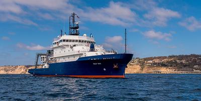
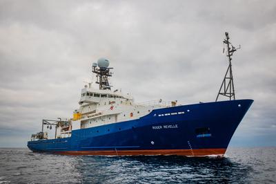
    Deformation of the seafloor is an important tectonic process, which can best be studied with marine geodetic techniques. The GNSS-Acoustic method is the technique chosen by a community workshop to investigate the following processes in Cascadia and Alaska: 1. Along-strike changes in coupling and relation to onshore deformation. A strong and widely spaced geodetic backbone offshore of existing on-land geodetic infrastructure, in regions not constrained by land stations could serve as the greatest return on investment for scientific and hazards understanding of megathrust subduction behavior. 2. Near-trench coupling and relation to tsunami earthquake(s) and down-dip behavior. While Alaska is the only of the two locales that has the known occurrence of a damaging tsunami earthquake (characterized by its outsized tsunami wave amplitude for earthquake magnitude) in 1946, it is understood that due to depth restrictions particularly in the 1946 rupture patch, much more of the near-trench environment off Cascadia can be evaluated using current instrument pool transponders. 3. Occurrence of shallow aseismic slip and its relation to earthquakes. The Cascadia subduction zone has clearly observable and large down-dip slow slip events, and an overall large near-trench exposure capable of observation with the geodetic instrument pool. 4. Postseismic time-dependent variations in coupling, including transients, afterslip, viscous relaxation, and recoupling. This was viewed as much more important in Alaska where recent large earthquakes allow for much greater potential for capturing discernable time-dependent variations in coupling behavior.
    Jul 26 – Aug 3, 2026 · 8 d

    Offshore California and Oregon

    Sails with 1 other project

  • Completed

    Low Cost GNSS-A 2026

    Surui Xie · Houston

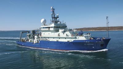
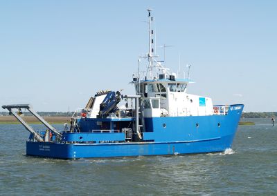
    Seafloor geodesy holds the key to providing near-field observations for an improved understanding of offshore earthquakes and many other hazards. Among all major seafloor geodetic techniques, GNSS-A is the preferred technique for long-term monitoring of seafloor velocities, which uses sea surface vessels positioned by the Global Navigation Satellite System (GNSS) to acoustically interrogate seafloor transponders (positioning beacons) for seafloor positioning. However, conventional GNSS-A surveys are extremely expensive due to the high financial cost of seafloor instruments, limiting the number of observational sites. This project develops novel, low-cost GNSS-A methods to expand the coverage of seafloor geodesy. To test the new designs, three GNSS-A sites will be deployed at water depths of about 85, 250, and 570 m offshore Oregon in the proximity of several cabled ocean profilers, and one GNSS-A site will be deployed at about 1100 m water depth in the San Diego Trough offshore San Diego, CA.

    Jul 26 – Aug 3, 2026 · 8 d

    Offshore California and Oregon

    Sails with 1 other project

  • Completed

    OSNAP

    Fiammetta Straneo · SIO

    The Overturning in the Subpolar North Atlantic Program (OSNAP) is an international program designed to measure the transport of heat, mass, and freshwater in the subpolar North Atlantic and the associated Atlantic Meridional Overturning Circulation (AMOC), and to investigate the AMOC’s variability link to dense water formation variability. It includes contributions from scientists in the U.K., Germany, Netherlands, Canada, France and the U.S. One key component of this program are moored arrays maintained across two lines that cut across the subpolar North Atlantic flow: OSNAP West, from the Labrador coast to the southern tip of Greenland, and OSNAP East from the southern tip of Greenland, across the Reykjanes Ridge, and extending all the way to Scotland.The US-contribution for OSNAP includes moorings SE and SW of Cape Farewell, respectively in the Irminger and Labrador Seas, and the collection of hydrographic and velocity data to provide context to the moored measurements. In addition to the OSNAP objectives, this project also suppors the collection of data for a complementary biogeochemistry program, GOH-SNAP (Gases in the Overturning and Horizontal circulation of the Subpolar North Atlantic Program, Lead PI Jaime Palter, URI) which has added O 2 sensors to the O-SNAP array to quantify O 2 export from the Labrador and Irminger Seas. The data will also be used to empirically model carbon concentrations, and estimate carbon export.

    Jul 26 – Sep 6, 2026 · 42 d

    Irminger Sea, Labrador Sea and Greenland

    Sails with 1 other project

  • Completed

    OSNAP-GDWBC Moorings 2026

    Amy Bower · WHOI

    Normal 0 false false false EN-US X-NONE X-NONE Variability in the transport of heat, freshwater and mass in the North Atlantic has been linked to a number of societally relevant factors including sea level change, the melting of sea and glacial ice, and anthropogenic carbon storage in the deep ocean. However, the current understanding of the drivers of such changes is limited, making an investigation of overturning in the Sub-polar region a key ocean research priority. This field program explicitly addresses this gap. Furthermore, by engaging the larger international community studying the North Atlantic, Overturning in the Sub-polar North Atlantic Program (OSNAP) is playing a key role in catalyzing scientific progress by promoting international collaborations, synthesis, and the sharing of resources and by training future generations. The overall goal of this field project, in conjunction with other measurements in the North Atlantic, is to establish determination of the linkage between intermediate and deep water formation and the overturning circulation--a connection that is present in climate models, but has yet to be observed. This project will also provide the first comprehensive view of spreading pathways for the deep waters in the Sub-polar basin. Starting in 2014, the US-led international project, Overturning in the Sub-polar North Atlantic Program (OSNAP), provides a continuous record of the full-water column, trans-basin fluxes of heat, mass and freshwater in the Sub-polar North Atlantic, in partnership with the UK, Netherlands, Canada, Germany and China. Data from the first 21 months of the full OSNAP observing system has been used to produce an initial time series of the meridional overturning, heat and freshwater fluxes for the Sub-polar basin. These preliminary results reveal a highly variable overturning in the basin, interior pathways for overflow waters, surprisingly energetic boundary current systems on timescales from days to months, and a strong overflow plume in the Iceland Basin. The additional two years of OSNAP observations will cover a time frame sufficient to make comparisons with other overturning time series and optimize the OSNAP measurement system--all necessary tasks prior to a request for longer term measurements. This component of OSNAP (OSNAP East) is for the eastern array between Greenland and Scotland in coordination with the UK and the Netherlands. The US contribution includes the East Greenland inshore and offshore arrays, the Iceland Basin array, and the integration of all OSNAP measurements. The sub-goal for OSNAP East is to quantify the structure and transport of the boundary currents off the east coast of Greenland and within the Iceland Basin, as well as determine their variability and forcing mechanisms.

    Jul 26 – Sep 6, 2026 · 42 d

    Irminger Sea, Labrador Sea and Greenland

    Sails with 1 other project

  • Completed

    HOT 2023- 5 of 10

    angelicque white · UH

    Systematic long-term (greater than a few decades in length) time-series observations of aquatic and terrestrial environments have led to a more comprehensive understanding of the natural ecosystem variability and have enabled an assessment of human impacts on ecosystem dynamics. Because of their ability to store and transport large amounts of heat and to absorb carbon dioxide from the atmosphere, the world's oceans play a critical role in modulating environmental conditions for the sustained well-being of both land-based and marine organisms including humans. Despite their recognized scientific and societal importance, long-term records of key ocean processes are rare. In 1988, two ocean time-series programs were established: one in the North Atlantic near Bermuda and the other, the Hawaii Ocean Time-series (HOT) program, near Hawaii. For the past three decades, teams of scientists based at the University of Hawaii have made critical measurements of the 'state of our sea.' These long-term observations have established a baseline against which future states can be compared. The ship-based HOT program complements other diverse ocean observation programs including remote-sensing via satellites, moored buoys, profiling floats, and autonomous underwater vehicles. All HOT program data are publicly available and are frequently used by researchers and policy makers around the world.

    Jul 25 – Jul 31, 2026 · 6 d

    Station ALOHA is the long-term study site for the HOT program

  • Completed

    Pelican · LUMCON

    NGOM-HYPOXIA-2026

    Gina Woods · LSU

    Aseries of hydrographic stations for CTD and Water collection. These data are supplied to the NCEIS and the federal/state Hypoxia Task Force for inclusion into their long-term data base dating from 1985. Hydrographic profiles will be collected using the R/V Pelican’s SeaBird 911+ CTD unit equipped with pressure sensor, altimeter, redundant pumped temperature, conductivity and dissolved oxygen sensors, % transmission, PAR and in vivo fluorescence for estimate of chlorophyll biomass. The PI will bring an EXO3 for close-to-bottom dissolved oxygen (DO) measurements and as a backup instrument if something happens to the CTD during the cruise.Oxygen titrations using the Winkler method will be used to pre-cruise check the various oxygen sensors, and post-calibrate, if necessary, the dissolved oxygen from the SeaBird CTD or the EXO3. Post cruise cross-checks of salinity will also be conducted on the two instruments’ conductivity probes for post-calibration, if necessary. Underway data from the R/V Pelican will be collected and coupled with integrated data for GPS navigational, meteorological (wind speed and direction, barometric pressure, air temperature, relative humidity and photosynthetically active radiation (PAR)), and sea surface hydrographic (temperature, conductivity, % transmission, and in vivo fluorescence) data.

    Jul 24 – Jul 30, 2026 · 7 d

    Continental Shelf of Coastal Louisiana

  • Completed

    Savannah · SkIO

    SEFIS

    Nathan Bacheler · NOAA

    SEFIS is a fishery-independent research group that surveys reef fish using traps and video from Cape Hatteras, NC, to St. Lucie Inlet, FL, from 15-115 m deep.

    Jul 22 – Jul 31, 2026 · 9 d

    Southeast US Atlantic continental shelf between NC and the east coast of FL.

  • Completed

    IRISS-USV

    Andrew Jessup · UW-APL

    The PI has developed an instrument called IRISS-OPT (InfraRed Instrument for Sea Surface temperature-Optimal Band) for measuring ocean surface skin temperature. IRISS-OPT combines a simplified one-point in situ calibration with the so-called optimal band technique. IRISS has demonstrated an accuracy comparable to the proven instrument known as ROSR (Remote Ocean Surface Radiometer). Modeled profiles of air temperature and water vapor are used to replace the sky radiance measurement. The combination of the simplified calibration and elimination of the sky measurement using IRISS-OPT now makes it practical for deployment on Uncrewed Surface Vehicles (USVs) and buoys. The proposal activity is to develop IRISS-USV, a version of IRISS-OPT for routine use on Uncrewed Surface Vehicle (USVs) and buoys. The primary activity will be to develop stand-alone versions with internal recording and optional external serial output. Two existing prototype units will be upgraded for use on a buoy. Two new units with a reduced form factor to fit on the saildrone USV will be designed and fabricated. The units will be validated at sea on a research vessel and buoys. A secondary activity will be to develop look-up tables for the atmospheric radiance needed to forego a separate sky measurement.

    Jul 21 – Jul 28, 2026 · 7 d

    Washington State Coast

  • Completed

    Sikuliaq · UAF

    WCOA

    Liza Wright-Fairbanks · NOAA

    In support of the National Oceanographic and Atmospheric Administration (NOAA) Ocean Acidification (OA) Program, this mission will OA processes along the continental shelf off the Pacific coast of North America. The West Coast Ocean Acidification Cruise is part of the North Atlantic Ocean, East and Gulf Coast ocean acidification observing network. The legislative driver for this effort is the Federal Ocean Acidification Research and Monitoring Act of 2009 (FOARAM) act. NOAA is tasked with establishing a long-term monitoring program of ocean acidification utilizing existing global and national ocean observing assets. The main cruise objectives are: 1) Characterize the status of OA; 2) Carry out calibration measurements in proximity to OA observatories, in particular buoys equipped with OA sensors; 3) Generate calibration data necessary to develop predictive models of aragonite saturation status, pH, and other important OA indicators across the entire extent of the California Current system; 4) Carry out biological measurements (plankton) in conjunction with physical and chemical measurements of OA; 5) Possibly deploy Biochemical Argo Floats in deep waters (more than 2000m deep); and 6) Provide scientific information on the conditions of OA to support decision making and the best management of natural resources

    Jul 20 – Aug 18, 2026 · 29 d

    U.S. West Coast

  • Completed

    MAS_July_Aug_2026

    Dahiana Arcila · SIO

    The SIO295 course, Introduction to Marine Biodiversity and Conservation, has scheduled a two-day research cruise on the RV Gordon Sproul for Summer 2026, set for one of the following weekends:July 19-20, or July 26-27, based on the course schedule. The cruise will accommodate approximately 24 Master of Advanced Studies (MAS) students, 1-3 PhD students, SIO faculty, MAS staff, and Research Technicians, with the total group size exceeding the Sproul’s 30-person capacity, thus requiring two days. SIO Faculty, including Greg Rouse and Dahiana Arcila, will serve as chief scientists (one per day), joined by additional faculty to be confirmed, ensuring robust leadership and guidance throughout the cruise. This cruise is designed to provide students with their first hands-on seagoing research experience, building confidence and sparking interest in marine research as they begin their graduate studies. Aligned with the course’s theme of global change impacts on marine ecosystems, the cruise will offer direct exposure to local benthic and pelagic faunas, enabling students to explore the composition and vulnerabilities of these habitats. This practical experience is integral to deepening their understanding of marine biodiversity and conservation, reinforcing the course’s focus on the ecological consequences of environmental change.

    Jul 18 – Jul 20, 2026 · 2 d

    32 40 N, 117 20W

  • Completed

    Pelican · LUMCON

    Virus_SR-2026

    Jessica Labonte · TAMU

    Viruses, more specifically phages, are considered the most abundant biological entities on our planet. Despite that all microbial populations are impacted by viral infections, little is known regarding the impact of viral infections on specific microbial populations, and the direct and indirect consequences of virus–microbe interactions for biogeochemical cycles. Dissimilatory sulfate reduction directly links the global elemental cycles of carbon and sulfur. Quantitatively, sulfate reduction is most important process to degrade organic matter in anoxic marine sediment. This project will investigate the relationship between viral activity and sediment microbial metabolism, in particular sulfate reduction through environmental observations, process-oriented biogeochemical incubations and modeling. This research will lead to novel insight into the interactions between viruses and microorganisms, and how they control early diagenetic processes by (i) determining the impact of viruses on sediment metabolism in general, (ii) quantifying the influence of viruses on microbial sulfate reduction rates, (iii) elucidating the interactions of sulfate reducing microorganisms and viruses. These results will then be incorporated in a reactive transport model to describe viral dynamics and their interactions with the C, S, and Fe cycles.

    Jul 16 – Jul 21, 2026 · 5 d

    MF2 site, located in the Gulf of America

  • Completed

    CRM-DOC 2025-2028

    Mariana Bernardi Bif · UMIAMI

    This award will fund the University of Miami to continue a consensus reference material (CRM) program in support of consistent, high-quality measurements of DOC by the international ocean chemistry community. With the continuation of this work, the US and international communities will create with confidence consistent measurements of a major marine carbon reservoir, thereby advancing society’s ability to assess changes in the marine carbon cycle and the role of the ocean in climate change. With continued strong international efforts to investigate the marine carbon cycle, the existing CRM program provides the necessary benchmark for globally comparable marine DOC measurements. Water from the deep Florida Strait (~42 mol/kg DOC) will be collected, ampoulated, and distributed to the US and international community. Since the program's launch, ~228,000 vials of reference waters have been distributed to ~240 US and international laboratories in 45 nations, currently at a rate of ~27,000 vials/year. With renewal of the reference material program for 3 years of support, distribution of deep ocean water containing biologically refractory dissolved organic carbon and low carbon reference water will continue to aid the analytical work of the DOM community.

    Jul 14 – Jul 15, 2026 · 1 d

    Florida Strait east of Key Biscayne, Florida

  • Completed

    WOAC-2026-Summer

    Anna Boyar · UW

    Oceans, estuaries and coastal habitats are changing quickly, driven by both natural processes and human activities. The Washington Ocean Acidification Center (WOAC) was established by the state legislature to advance research and monitoring of ocean acidification and its biological effects in Washington waters. One facet of that research is the WOAC cruises. We go out three times a year, April, July, and September, to monitor ocean acidification and its affect on biology. These cruises are part of a long term time Ocean Acidification time series.

    Jul 13 – Jul 18, 2026 · 4 d

    Puget Sound

  • Completed

    Sikuliaq · UAF

    SKQ Cals 2026

    Gabriel Matthias · UAF

    Sikuliaq's 2026 shipyard and drydock will affect most of the transducers on the ship. The EM710 array will be entirely removed. A new centerboard shoe, including an entirely new multibeam system, an EM2042, will be installed. This will require patch testing of the EM2042. The EM304, our primary multibeam, will also have the fasteners for the ice windows replaced which will require re-leveling the transducer arrays. A SAT test would be appropriate after doing this. One of the EK80 transducers will be replaced, and all of them will be moved, either onto the new shoe, or to a new "Ice Can" on the sonar flat. The Beaufort sea shelf, Bering sea and Chukchi seas are all relatively shallow with very little being mapped at the resolution that the EM2042 will offer. Every year we have multiple funded cruises working in these areas. This calibration cruise would ensure the new multibeam system is fully functional after installation. We're requesting 3 days for the most important tests on the two multibeam systems. This is the minimum amount of time needed for QAT testing, per discussions with the MAC.

    Jul 13 – Jul 17, 2026 · 4 d

    Pacific

  • Completed

    Puget Methane - Case Inlet

    Harlan Paul Johnson · UW

    Puget Sound has been observed to host large fields of active methane venting from the seafloor. Although present throughout the Sound, the majority of gas emission sites are co-located over three major fault zones that fracture the entire forearc crust of the Cascadia Subduction Zone (CSZ). Multibeam and single-beam sonar data from cruises conducted between 2011- 2021 identified the acoustic signature of over 350 individual bubble plumes. Fluid samples from adjacent terrestrial hot springs and deep-water wells surrounding the estuary contain a helium-3 isotope signature, suggesting a deep fluid source arising from the underlying CSZ plate interface. However, limited data from our previous pilot study suggests that Puget Sound emission sites appear to lack similar helium isotope signatures expected from a deep plate-interface reservoir. As an alternative hypothesis, a shallow reservoir beneath the Holocene sediments that cover Puget Sound Eocene basement, with horizontal transfer to the thinly-sedimented Alki Point and Kingston Arch anticlines, is also possible. The origin of vigorous marine methane plumes arising from areas of thin sediment cover and associated with deeply-penetrating forearc fault zones but still presenting no thermal or chemical anomalies found in other similar forearc environments, remains an important unresolved scientific paradox.

    Jul 10 – Jul 11, 2026 · 2 d

    Case Inlet

  • Completed

    Japan Seas 2025

    Nicholas Makris · MIT

    Instantaneous wide-area real time synoptic remote sensing of the marine environment off the coast of Japan in 2025. The emphasis is on novel large scale quantitative sensing of marine life and ecosystem dynamics from physical parameters extracted from remote acoustic measurements as well as the effects of geophysical and biological factors on such wide area acoustic sensing.

    Jul 9 – Jul 31, 2026 · 21 d

    South-west Japan, between Nagasaki and Goto island

  • Completed

    MPL intership

    Drew Lucas · SIO

    This is intended as an educational experience for the MPL internship program in 2025. Sea-going activities will include CTD with water sampling, plankton net tows, collecting data from shipboard flow-through, ADCP, and MET systems. Science party may bring aboard optical systems and microscopes.

    Jul 9, 2026 · 1 d

    Offshore of San Diego

  • Completed

    Osmolyte cycling mid-Atlantic

    Winifred Johnson · UNCW

    Each year, half of all marine primary production (25 Pg C) is remineralized by microorganisms. Both identity and abundances of the molecules and microbes involved regulate this flux. Organic osmolytes likely comprise a significant, but unconstrained, component of this carbon flux. Osmolytes regulate osmotic pressure and thus accumulate at millimolar concentrations inside the cell. Given their high intracellular concentrations, upon their release to the microbial loop osmolytes are valuable carbon substrates as well as sources of nitrogen and sulfur. In fact, a few osmolytes have been shown to fulfill up to 4-38% of bacterial carbon demand, which could translate to a significant carbon flux. The goal of our proposed work is to produce a quantitative budget of osmolyte fate in the context of the labile carbon cycle by developing a greater mechanistic understanding of the biological and environmental controls of osmolyte composition and concentrations. We will do this through culture and field experiments where production, drawdown, and assimilation of organic osmolytes will be measured and linked to transcriptional activity of the microbial producers and consumers. Our field component aims to collect osmolyte standing stock concentrations, rates, and associated microbial molecular information along a coastal to open ocean gradient extending from the Mid-Atlantic Bight out past the Gulf Stream to oligotrophic waters. This region is typified by heightened primary productivity in the in-shore region, with coastal seasonal blooms that occur annually. Based on a preliminary analysis of surface biogeochemical conditions satellite, we propose a cruise track to take place in mid-summer (July) that will transit a strong productivity and nitrogen gradient from productive coastal waters, and eastward through the Gulf Stream and into stratified open ocean waters of the North Atlantic. The intersection of biogeochemical regimes will allow us to assess the impact of changes in community composition and nitrogen availability on in situ osmolyte cycling. We will pair quantitative metabolomic and stable isotope methods with quantitative metatranscriptomics to produce a budget of standing stock concentrations of osmolytes, bounded by the activity of microbial transcription.

    Jul 9 – Jul 21, 2026 · 12 d

    mid-Atlantic Bight

  • Completed

    Hydro S - 2026 11of24

    Nicholas R. Bates · BIOS

    One of the longest open-ocean hydrographic stations in the world is maintained at the Hydrostation S site (formerly known as the Panulirus site) located ~25 km southeast of Bermuda in the North Atlantic Ocean. This program of repeat biweekly hydrographic observations began in 1954 (by Hank Stommel) and now, in its seventh decade, has proved to be the catalyst for numerous studies of ocean physics, biological processes and biogeochemistry. Hydrostation S continues to be recognized as one of the most important sustained ocean time–series. The renewal of the Hydrostation S program is proposed herein, extending this invaluable time–series of ocean hydrography to almost 70 years. The upper ocean warming trend has strengthened (about +1.4° C since the 1970's; ~+0.8°C in last decade) with significant salinification (+0.16). Deeper waters such as the Labrador Sea Water has cooled by a few tenths of a degree and freshened with a marked decadal oscillation. The signature of deoxygenation has been observed at Hydrostation S in the upper ocean (about 4 µmoles kg -1 decade -1 decrease in dissolved oxygen) as well as the oxygen minimum zone (~2.5 µmoles kg -1 decade -1 ). Hydrostation S also supports the longest global ocean CO 2 and acidification time-series (from 1983 to present)

    Jul 6 – Jul 8, 2026 · 1 d

    Appxoimately 25 nm south east of the island of Bermuda

  • Completed

    Atlantis · WHOI

    Q_TN Wrecks

    Dwight Coleman · WHOI

    We are planning a reconnaissance survey of the Quest and Terra Nova Shipwreck Sites to collect ultra-high resolution imaging data and produce photogrammetric models. Quest is located off the coast of Labrador, in Canadian waters and Terra Nova is located off the coast of Greenland in Danish waters. We will use the R/V Atlantis, HOV Alvin, and ROV Falcon to complete an archaeological inspection of the sites, assess their state of preservation, study the oceanographic and environmental context of the sites, including the benthic ecology of the wrecks as artificial reefs. Project sponsors/partners are with the Royal Canadian Geographic Society. Their collaborator, who will serve as Chief Scientist, is David Mearns, a chartered marine scientist and oceanographer who specializes in deep-water search and recovery operations, including the discovery and analysis of historic shipwrecks.

    Jul 2 – Jul 22, 2026 · 20 d

    Off the coast of southern Labrador and off the southwest coast of Greenland

  • Completed

    Savannah · SkIO

    SEFIS

    Nathan Bacheler · NOAA

    SEFIS is a fishery-independent research group that surveys reef fish using traps and video from Cape Hatteras, NC, to St. Lucie Inlet, FL, from 15-115 m deep.

    Jul 1 – Jul 10, 2026 · 9 d

    Southeast US Atlantic continental shelf between NC and the east coast of FL.

  • Completed

    Savannah · SkIO

    INST

    Clark Alexander · SkIO

    Ship time dedicated to facilitate experiential learning for UGA and USG graduate and undergraduate students.

    Jun 26 – Jun 27, 2026 · 1 d

    South Atlantic Bight - USA

  • Completed

    DONUT

    Rob Letscher · UNH

    The goal of the proposed work is to field test hypotheses concerning the biological production and consumption of marine dissolved organic nitrogen (DON) related to its role as a potential ‘organic nutrient’ source sustaining net community production within the ocean’s subtropical gyres. A North Pacific cruise will use observations of DON concentration ([DON]), chlorophyll a concentration ([chl a ]), DON d 15 N, Dd 15 N(DON-NO 3 - ), and DON molecular composition to identify regions of net DON production and consumption in the context of biological productivity evaluated using measurements of net (O 2 /Ar) and gross O 2 (Triple O isotopes) production. Novel organic geochemistry tools will be used to identify the molecular composition of the allochthonous DON sustaining biological N demand in the subtropical North Pacific. Testing previously proposed hypotheses, t he depth of DON consumption will be investigated using ship-board incubations that expose surface DON collected from three stations with gradients in surface nitrate concentration ([NO 3 - ]) to microbial communities from the mixed layer and the sub-euphotic zone. Finally, a new semi-labile DON tracer will be encoded in a global ocean biogeochemistry model, with the organic matter and isotopic data sets serving to validate the model for semi-labile DON cycling using data assimilation techniques.

    Jun 21 – Jul 22, 2026 · 31 d

    eastern subtropical North Pacific

  • Completed

    Pelican · LUMCON

    LISTEN GoMex

    Melissa Soldevilla · NOAA

    This project uses a network of underwater microphones to record marine mammals throughout U.S. and Mexican waters in the Gulf and gather information on their location and density throughout the year. The data from this comprehensive and long-term passive acoustic monitoring program will be used to understand and mitigate anthropogenic noise impacts on marine mammals. This project complements and expands prior passive acoustic monitoring in the region. Data collection is ongoing at four historic long-term reference sites and 1 additional long-term reference site, as well as two short term sites which are moved annually as needed to understand local noise conditions in key areas of interest. The project team is engaging with federal and state agencies, nongovernmental organizations, and private industry to make sure their findings are reaching the people who are making decisions that impact marine mammal management. This project is also coordinated with an oceanic marine mammal-focused project supported by the NOAA RESTORE Science Program.

    Jun 19 – Jul 12, 2026 · 22 d

    Gulf

  • Completed

    Sally Ride · SIO

    Community Experiment

    Mark Zumberge · SIO

    The Near-Trench Community Geodetic Experiment is a five-year NSF funded program to collect seafloor geodetic positions using the GNSS-Acoustic method in which a surface platform (a Wave Glider) positioned with GNSS simultaneously collects the positions of seafloor transponders with acoustics.

    Jun 19 – Jun 21, 2026 · 2 d

    24 nm west of Port Orford, OR

    Sails with 1 other project

  • Completed

    OVSN_BATS

    Clarissa Karthaeuser · NCSU

    The biological carbon pump plays a crucial role in marine carbon sequestration, yet current estimates of carbon flux come with high uncertainties due to the heterogeneous nature of sinking particles. Our project addresses this challenge by linking large-scale ocean observations with experimental analyses on the microscopic scale and numerical modeling. Underwater particle images will be collected across a transect from Bermuda to the New England slope through an autonomous vehicle. Sampling efforts and sediment trap deployments on both ends of the transect will allow for detailed particle characterizations, including respiration rates, sinking velocities, carbon contents and genetic analyses. A numerical model will combine ocean current data with particle abundances and characteristics, aiming to improve mechanistic understanding and parametrization of the biological carbon pump. We request adding a day to a BATS cruise for collaborative sampling efforts on the Bermuda end.

    Jun 18 – Jun 23, 2026 · 5 d

    BATS

    Sails with 2 other projects

  • Completed

    BATS 2026 - 8of12

    Nicholas R. Bates · BIOS

    Long-term observations over several decades are a powerful tool for investigating ocean physics, biology, and chemistry, and the response of the oceans to environmental change. The Bermuda Atlantic Time-Series Study, known as BATS, has been running continuously since 1988. The research goals of the BATS program are: (1) to improve our understanding of the time-varying components of the ocean carbon cycle and the cycles of related nutrient elements such as nitrogen, phosphorus, and silicon; and, (2) to identify the relevant physical, chemical and ecosystem properties responsible for this variability. In addition, the BATS program has strong and diverse broader impacts, contributing to the field of ocean sciences by providing high quality ocean observations and data for seagoing scientists and modelers, and a framework through which researchers can conceive and test hypotheses. This award will support operations of the BATS program for five more years. This research integrates ocean physics, chemistry and biology into a framework for understanding oceanic processes and ocean change in the North Atlantic subtropical gyre. The existing years of BATS data provide robust constraints on seasonal and interannual variability, the response of the Sargasso Sea ecosystem to natural climate variability, and signal detection of potential ocean changes.

    Jun 18 – Jun 23, 2026 · 5 d

    BATS

    Sails with 2 other projects

  • Completed

    Hydro S - 2026 10of24

    Nicholas R. Bates · BIOS

    One of the longest open-ocean hydrographic stations in the world is maintained at the Hydrostation S site (formerly known as the Panulirus site) located ~25 km southeast of Bermuda in the North Atlantic Ocean. This program of repeat biweekly hydrographic observations began in 1954 (by Hank Stommel) and now, in its seventh decade, has proved to be the catalyst for numerous studies of ocean physics, biological processes and biogeochemistry. Hydrostation S continues to be recognized as one of the most important sustained ocean time–series. The renewal of the Hydrostation S program is proposed herein, extending this invaluable time–series of ocean hydrography to almost 70 years. The upper ocean warming trend has strengthened (about +1.4° C since the 1970's; ~+0.8°C in last decade) with significant salinification (+0.16). Deeper waters such as the Labrador Sea Water has cooled by a few tenths of a degree and freshened with a marked decadal oscillation. The signature of deoxygenation has been observed at Hydrostation S in the upper ocean (about 4 µmoles kg -1 decade -1 decrease in dissolved oxygen) as well as the oxygen minimum zone (~2.5 µmoles kg -1 decade -1 ). Hydrostation S also supports the longest global ocean CO 2 and acidification time-series (from 1983 to present)

    Jun 18 – Jun 23, 2026 · 5 d

    BATS

    Sails with 2 other projects

NewerPage 4 of 55Older