Completed
F.G. Walton Smith · UMIAMI
UMiami Student Cruises 2026 - 2 of 5
Jim Happell · UMIAMI
Mar 1, 2026 · 1 d
Off Miami
F.G. Walton Smith · UMIAMI
Jim Happell · UMIAMI
Mar 1, 2026 · 1 d
Off Miami
F.G. Walton Smith · UMIAMI
Jim Happell · UMIAMI
Feb 28, 2026 · 1 d
Off Miami
F.G. Walton Smith · UMIAMI
Ryan Smith · AOML
Researchers from NOAA's Atlantic Oceanographic and Meteorological Laboratory (AOML) in Miami, FL, conduct regular bimonthly hydrographic surveys at 27N in the Florida Straits to monitor the transport and water-mass properties of the Florida Current. The Florida Current is part of the Gulf Stream system, which is the upper limb of the western boundary current system in the North Atlantic Ocean. These cruises are a part of the laboratory’s long-running Western Boundary Time Series (WBTS) project and directly measure the Florida Current at nine locations across the Straits of Florida at 27N, between Jupiter, Florida, and the Little Bahama Bank in the Bahamas. WBTS 27N hydrographic sections, conducted bimonthly throughout the year, are critical to improving our understanding of the North Atlantic Subtropical Gyre circulation and the Atlantic Meridional Overturning Circulation (AMOC). Importantly, data collected during these cruises and others are also used to calibrate the 27N submarine cable system which publicly provides daily transport estimates of the Florida Current . The AMOC is a significant factor in climate change, oceanic carbon sequestration, and sustainable fisheries.
Feb 26 – Feb 27, 2026 · 1 d
Straits of Florida
John Ruiz · EPA
The Laboratory Services and Applied Science Division of EPA will conduct a trend assessment survey at the Brunswick, GA and Fernandina, FL Ocean Dredged Material Disposal Site (ODMDS) to collect sediments to be analyzed for metals, semi-volatile organics (SVOAs), pesticides, PCBs, percent solids and macroinvertebrates. The purpose of the study will be to characterize the changes in chemical, biological and physical properties within and surrounding the disposal sites.
Feb 23 – Feb 26, 2026 · 2 d
Brunswick GA and Fernandina FL
Ross Parnell-Turner · SIO
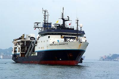
We aim to address the evolution of fast-spreading mid-ocean ridge magmatic systems, focusing on decadal changes in the magma lens properties taking place from one seafloor eruption to the next one. The 9°50’N segment of the East Pacific Rise (EPR) hosts a volcanically-active system which erupted in 1991 and in 2005-06. The decadal interval between volcanic episodes provides a unique opportunity for multidisciplinary studies of magmatic, hydrothermal, and ecological cycles on human timescales. Following the 2005-06 eruption, a 3-D seismic reflection dataset was acquired in 2008 using RV Langseth, providing a new understanding of the structure of the EPR magmatic system including unprecedented detailed 3-D images showing that the axial magma lenses are corrugated with elongated ridges and troughs from where dikes nucleate. Since the 2005-06 eruption, in-situ vent temperature observations indicate the system is approaching the end of a volcanic cycle. Rising hydrothermal exit-fluid temperatures suggest that a seafloor eruption and/or diking event could occur in the mid-2020s. We propose to investigate decadal evolution of a MOR magmatic system at the EPR by conducting a repeat of the 2008 3-D seismic survey for 4-D (time-lapse) monitoring. The survey will use the 3-D multi-streamer capabilities of R/V Marcus Langseth.
Feb 23 – Apr 5, 2026 · 41 d
Eastern Pacific Ocean
James Muller · SIO
Structural studies of the California Continental Borderlands revealed a complex tectonic terrane associated with development of the modern Pacific-North America plate boundary (e.g., Lonsdale, 1991). However, detailed studies of the submarine volcanic rocks that crop out throughout the region are limited. Many have ages constrained only broadly to the Miocene (e.g., Vedder et al., 1974). Whether these lavas originated chiefly as melts of subduction-modified mantle (Day et al., 2019) or of depleted Pacific oceanic mantle (Davis et al., 2010) is unclear. Other Borderlands topographic highs are pop-up structures (Legg et al., 2007; Rivero and Shaw, 2011). Alternately, therefore, the volcanics may be uplifted exposures of older regional strata. Evaluating these hypotheses requires new precisely located samples for petrological study. This cruise will conduct sampling across a transect of the Inner Borderlands sub-terrane, nearest the coast. High-resolution seafloor surveys of these sites while underway will establish their spatial (and therefore genetic) associations with tectonic structures. Together, these datasets will elucidate the extent to which deformation in the Borderlands during plate boundary evolution manifested magmatically. Finally, the expedition is designed as an at-sea field trip for UCSD students; it will thus also serve educational goals.
Andrea Fabbrizzi · SIO
This research cruise focuses on the Catalina Crater, a submarine volcanic structure in the Inner California Borderland off Southern California. Building on recent UC Ship Funds-supported cruises (SR2303 and SR2502), we aim to integrate newly collected high-resolution multibeam bathymetry, sub-bottom profiles, and rock samples with deep-penetration seismic data acquired aboard the R/V Roger Revelle. Using the vessel’s airgun seismic system, we will image the deeper crustal structure beneath the crater to better understand its volcanic conduit, fault architecture, and potential caldera collapse features. Preliminary results suggest the crater may represent an explosive volcanic center, differing significantly from other volcanic features in the region. Observations of pockmarks, fault scarps, and deformed sediments also indicate ongoing interactions among faulting, gas venting, and mass transport processes. These findings highlight the potential for submarine landslides and earthquake triggered sediment failure, posing hazards to coastal infrastructure. This cruise will map and characterize mass transport deposits (MTDs) and assess the volcanic and tectonic evolution of the crater. The results will fill critical data gaps and contribute to improved geohazard assessments and a better understanding of the complex geologic history of the California Continental Borderland.
Alison Murray · DRI
This project will investigate a new Antarctic marine partnership between the ascidian (“sea squirt”) Synoicum adareanum and its microbiome, which includes a specific relationship with the bacterium Candidatus Synoicihabitans palmerolidicus. This bacterium produces the natural product palmerolide A (palA), an in vitro inhibitor of the enzyme V-type H+-ATPase (VHA). The objectives include: (i) Determining the microbiome composition, metabolome complexity, palA levels, and mitochondrial DNA sequence of S. adareanum morphotypes at sites in the Antarctic Peninsula and in McMurdo Sound, (ii) Characterizing the Synoicum microbiome using a multiomics strategy, and (iii) Assessing the potential for co-occurrence of Ca. S. palmerolidicus-palAVHA in host tissues and exploring the role of palA in modulating VHA activity in vivo and its effects on ascidian-microbe ecophysiology. Through a coupled study of palA-producing and non-producing S. adareanum specimens, we will characterize structural and functional features of the ascidian microbiome metagenome to better understand the relationship between predicted secondary metabolite pathways and whether they are expressed in situ using a paired metatranscriptome sequencing and secondary metabolite detection strategy. Combined with tissue co-localization results, functional ecophysiological assays aim to determine the roles that the natural product plays in the host ecology in its native Antarctic seafloor habitat.
Feb 19 – Mar 25, 2026 · 34 d
Antarctic Peninsula
F.G. Walton Smith · UMIAMI
Mariana Bernardi Bif · UMIAMI
This award will fund the University of Miami to continue a consensus reference material (CRM) program in support of consistent, high-quality measurements of DOC by the international ocean chemistry community. With the continuation of this work, the US and international communities will create with confidence consistent measurements of a major marine carbon reservoir, thereby advancing society’s ability to assess changes in the marine carbon cycle and the role of the ocean in climate change. With continued strong international efforts to investigate the marine carbon cycle, the existing CRM program provides the necessary benchmark for globally comparable marine DOC measurements. Water from the deep Florida Strait (~42 mol/kg DOC) will be collected, ampoulated, and distributed to the US and international community. Since the program's launch, ~228,000 vials of reference waters have been distributed to ~240 US and international laboratories in 45 nations, currently at a rate of ~27,000 vials/year. With renewal of the reference material program for 3 years of support, distribution of deep ocean water containing biologically refractory dissolved organic carbon and low carbon reference water will continue to aid the analytical work of the DOM community.
Feb 18 – Feb 19, 2026 · 1 d
Florida Strait east of Key Biscayne, Florida
Atlantic Explorer · BIOS
Nicholas R. Bates · BIOS
Long-term observations over several decades are a powerful tool for investigating ocean physics, biology, and chemistry, and the response of the oceans to environmental change. The Bermuda Atlantic Time-Series Study, known as BATS, has been running continuously since 1988. The research goals of the BATS program are: (1) to improve our understanding of the time-varying components of the ocean carbon cycle and the cycles of related nutrient elements such as nitrogen, phosphorus, and silicon; and, (2) to identify the relevant physical, chemical and ecosystem properties responsible for this variability. In addition, the BATS program has strong and diverse broader impacts, contributing to the field of ocean sciences by providing high quality ocean observations and data for seagoing scientists and modelers, and a framework through which researchers can conceive and test hypotheses. This award will support operations of the BATS program for five more years. This research integrates ocean physics, chemistry and biology into a framework for understanding oceanic processes and ocean change in the North Atlantic subtropical gyre. The existing years of BATS data provide robust constraints on seasonal and interannual variability, the response of the Sargasso Sea ecosystem to natural climate variability, and signal detection of potential ocean changes.
Atlantic Explorer · BIOS
Nicholas R. Bates · BIOS
One of the longest open-ocean hydrographic stations in the world is maintained at the Hydrostation S site (formerly known as the Panulirus site) located ~25 km southeast of Bermuda in the North Atlantic Ocean. This program of repeat biweekly hydrographic observations began in 1954 (by Hank Stommel) and now, in its seventh decade, has proved to be the catalyst for numerous studies of ocean physics, biological processes and biogeochemistry. Hydrostation S continues to be recognized as one of the most important sustained ocean time–series. The renewal of the Hydrostation S program is proposed herein, extending this invaluable time–series of ocean hydrography to almost 70 years. The upper ocean warming trend has strengthened (about +1.4° C since the 1970's; ~+0.8°C in last decade) with significant salinification (+0.16). Deeper waters such as the Labrador Sea Water has cooled by a few tenths of a degree and freshened with a marked decadal oscillation. The signature of deoxygenation has been observed at Hydrostation S in the upper ocean (about 4 µmoles kg -1 decade -1 decrease in dissolved oxygen) as well as the oxygen minimum zone (~2.5 µmoles kg -1 decade -1 ). Hydrostation S also supports the longest global ocean CO 2 and acidification time-series (from 1983 to present)
Eric Benway · WHOI
Feb 4 – Feb 9, 2026 · 6 d
Atlantic Explorer · BIOS
Robert Mason · U.Conn
Air-sea exchange is the major source for, and sink for, ocean mercury (Hg) although the details of these processes are still poorly understood. The proposed research is designed to extend and enhance observations made in the North Atlantic on prior cruises as well as reinforce findings from the studies under GEOTRACES in the Pacific and Arctic Oceans. The techniques to be used on the cruises have been refined on these prior endeavors. The research project is aimed at measuring the air-sea exchange of mercury in the ocean and atmosphere in and around Bermuda. Samples will also be collected at the Bermuda atmospheric station and on the research cruises on the RV Atlantic Explorer. Some equipment will also be deployed on the regular BATS cruises on the Atlantic Explorer but these are not part of the current request. The support of BIOS has been obtained to enable the collections at the atmospheric station and for the sampling on the BATS cruises and these are not part of the current request. Samples will eb collected in air and water continuously while the ship is moving as well as at specific stations where the upper water column will eb sampled. it is expected that the majority of teh time will eb spent with the ship underway.
Feb 3 – Feb 8, 2026 · 5 d
North Atlantic northwest of Bermuda
Ben Pietro · WHOI
24 hours of Sentry Engineering and training dives to piggy back SME 23/3771 JQZ-Phoenix AUV
Jan 29 – Mar 15, 2026 · 46 d
western equatorial Pacific/Marshall Islands/Micronesia
Masako Tominaga · UNOLS
The Jurassic Quiet Zone (JQZ) is a period in Earth’s history (>157 Ma) marked by anomalous geomagnetic field behavior with unprecedented low field intensity and high polarity reversal rate. Recent studies from the oldest oceanic crustal record give fresh insights into the onset, duration and nature of this period of time in Earth’s geomagnetic field history, but important questions remain. Marine magnetic studies of the western Pacific JQZ – arguably the largest extant expanse of intact Jurassic ocean crust – show that geomagnetic field intensity decreases monotonically from ~144 Ma (chron M19) back into the JQZ until about 167 Ma (chron M42) when field intensity abruptly increases and magnetic anomaly amplitudes return to more normal values. Furthermore, the field appears to be reversing at a high rate into the JQZ. In contrast, the Cretaceous Normal Superchron (CNS; aka Cretaceous Quiet Period) was a time of mostly strong field intensity with few reversals. This observation prompts the question: does the JQZ represent an end member in Earth’s geomagnetic field behavior that is opposite to the CNS? The answer can only be deciphered with a full understanding of Jurassic magnetic field behavior. However, there are limited marine and terrestrial records available - so it is critical to take advantage of those records where they exist. Two detailed records of magnetic anomalies from studies of the Japanese and Hawaiian lineations show similar broad patterns, but disparate behavior for a critical time period between M39 and M41 that points to a minimum in geomagnetic field intensity. We wish to verify this behavior with a survey of the concurrent record in the Phoenix lineation set in the western Pacific. The Hawaiian lineations show a good correlation of pre-M29 Jurassic anomalies with the prior near-bottom survey of coeval Japanese magnetic lineations, suggesting that we can define at a basin-scale, and perhaps globally, coherent geomagnetic field behavior for the pre-M29 period. However, the Hawaiian record has a period of disturbed chaotic anomalies immediately following Chron M42, from M41 until about M39, that are difficult to correlate with highly variable amplitudes. We have called this M39-M41 period the Hawaiian Disturbed Zone or HDZ. This HDZ sequence appears to be concurrent with a similar period of very low amplitude anomalies in the Japanese lineations, which were termed the Low Amplitude Zone (LAZ). We will conduct a detailed multiscale marine magnetic survey and investigation of the Phoenix lineations to answer questions about the nature of the JQZ and its global significance in geomagnetic field history. With this data, we will address whether the Phoenix lineations correlate with the Japanese and Hawaiian lineations, and in particular whether the Phoenix M39-M41 anomalies more closely resemble the HDZ or the LAZ. This will strengthen our understanding of geomagnetic field behavior during the Jurassic, and enable us to determine whether the differences between the Japanese and Hawaiian lineations reflects local tectonic disturbance through the influence of late stage Cretaceous volcanism that is prevalent in this region, or is due to inconsistent field behavior on a regional spatial scale.
Jan 29 – Mar 15, 2026 · 46 d
western equatorial Pacific/Marshall Islands/Micronesia
Pelican · LUMCON
Eric Aronchick · WHOI
Perform seasonal, full water column CTD sampling + DO + PSD analysis and water collection, at a single offshore location with a depth of approximately 6,500 feet. A total of four quarterly cruises will be undertaken between August 2025 and May 2026. Onboard lab analysis of water samples will be measured and recorded. Water samples will be collected and brought back to shore for more intensive lab testing and chemical analysis.
Jan 28 – Jan 30, 2026 · 2 d
US GoM, Approx. 130 nm SE of Cocodrie, LA
Atlantic Explorer · BIOS
Nicholas R. Bates · BIOS
Long-term observations over several decades are a powerful tool for investigating ocean physics, biology, and chemistry, and the response of the oceans to environmental change. The Bermuda Atlantic Time-Series Study, known as BATS, has been running continuously since 1988. The research goals of the BATS program are: (1) to improve our understanding of the time-varying components of the ocean carbon cycle and the cycles of related nutrient elements such as nitrogen, phosphorus, and silicon; and, (2) to identify the relevant physical, chemical and ecosystem properties responsible for this variability. In addition, the BATS program has strong and diverse broader impacts, contributing to the field of ocean sciences by providing high quality ocean observations and data for seagoing scientists and modelers, and a framework through which researchers can conceive and test hypotheses. This award will support operations of the BATS program for five more years. This research integrates ocean physics, chemistry and biology into a framework for understanding oceanic processes and ocean change in the North Atlantic subtropical gyre. The existing years of BATS data provide robust constraints on seasonal and interannual variability, the response of the Sargasso Sea ecosystem to natural climate variability, and signal detection of potential ocean changes.
Atlantic Explorer · BIOS
Nicholas R. Bates · BIOS
One of the longest open-ocean hydrographic stations in the world is maintained at the Hydrostation S site (formerly known as the Panulirus site) located ~25 km southeast of Bermuda in the North Atlantic Ocean. This program of repeat biweekly hydrographic observations began in 1954 (by Hank Stommel) and now, in its seventh decade, has proved to be the catalyst for numerous studies of ocean physics, biological processes and biogeochemistry. Hydrostation S continues to be recognized as one of the most important sustained ocean time–series. The renewal of the Hydrostation S program is proposed herein, extending this invaluable time–series of ocean hydrography to almost 70 years. The upper ocean warming trend has strengthened (about +1.4° C since the 1970's; ~+0.8°C in last decade) with significant salinification (+0.16). Deeper waters such as the Labrador Sea Water has cooled by a few tenths of a degree and freshened with a marked decadal oscillation. The signature of deoxygenation has been observed at Hydrostation S in the upper ocean (about 4 µmoles kg -1 decade -1 decrease in dissolved oxygen) as well as the oxygen minimum zone (~2.5 µmoles kg -1 decade -1 ). Hydrostation S also supports the longest global ocean CO 2 and acidification time-series (from 1983 to present)
Pelican · LUMCON
Chris Cartellone · SEARCH
Continuation of previous survey fieldwork.
Jan 15 – Jan 25, 2026 · 10 d
GoM
Heidi Sosik · WHOI
NES-LTER cross-shelf transect cruises are conducted between Martha’s Vineyard and the continental shelf break directly south. The overarching goal of the NES-LTER is to understand and predict how planktonic food webs change through space and time in response to changes in the physical environment, and how those changes impact ecosystem productivity, including of higher trophic levels. Observations and models are focused on processes and mechanisms that structure pelagic food webs, trophic transformations, and productivity, as well as the key interactions and feedbacks that modulate relationships among them. NES-LTER transect process cruises are focused on characterizing cross-shelf distributions of physical properties, nutrients, production rates, and plankton. Approximately 11 stations will be occupied in waters depths typically less than 200 m, but up to ~1600 m. Operations will include underway sampling of biological and chemical properties with science-provided instruments, CTD/rosette casts, net tows, on-deck incubations, and deployment of a towed vehicle.
Jan 13 – Jan 18, 2026 · 5 d
New England Shelf
Atlantic Explorer · BIOS
Nicholas R. Bates · BIOS
Long-term observations over several decades are a powerful tool for investigating ocean physics, biology, and chemistry, and the response of the oceans to environmental change. The Bermuda Atlantic Time-Series Study, known as BATS, has been running continuously since 1988. The research goals of the BATS program are: (1) to improve our understanding of the time-varying components of the ocean carbon cycle and the cycles of related nutrient elements such as nitrogen, phosphorus, and silicon; and, (2) to identify the relevant physical, chemical and ecosystem properties responsible for this variability. In addition, the BATS program has strong and diverse broader impacts, contributing to the field of ocean sciences by providing high quality ocean observations and data for seagoing scientists and modelers, and a framework through which researchers can conceive and test hypotheses. This award will support operations of the BATS program for five more years. This research integrates ocean physics, chemistry and biology into a framework for understanding oceanic processes and ocean change in the North Atlantic subtropical gyre. The existing years of BATS data provide robust constraints on seasonal and interannual variability, the response of the Sargasso Sea ecosystem to natural climate variability, and signal detection of potential ocean changes.
Atlantic Explorer · BIOS
Nicholas R. Bates · BIOS
One of the longest open-ocean hydrographic stations in the world is maintained at the Hydrostation S site (formerly known as the Panulirus site) located ~25 km southeast of Bermuda in the North Atlantic Ocean. This program of repeat biweekly hydrographic observations began in 1954 (by Hank Stommel) and now, in its seventh decade, has proved to be the catalyst for numerous studies of ocean physics, biological processes and biogeochemistry. Hydrostation S continues to be recognized as one of the most important sustained ocean time–series. The renewal of the Hydrostation S program is proposed herein, extending this invaluable time–series of ocean hydrography to almost 70 years. The upper ocean warming trend has strengthened (about +1.4° C since the 1970's; ~+0.8°C in last decade) with significant salinification (+0.16). Deeper waters such as the Labrador Sea Water has cooled by a few tenths of a degree and freshened with a marked decadal oscillation. The signature of deoxygenation has been observed at Hydrostation S in the upper ocean (about 4 µmoles kg -1 decade -1 decrease in dissolved oxygen) as well as the oxygen minimum zone (~2.5 µmoles kg -1 decade -1 ). Hydrostation S also supports the longest global ocean CO 2 and acidification time-series (from 1983 to present)
Thomas Tobin · UA
Despite considerable research, debate persists about the relative importance of potential causes of the Cretaceous-Paleogene (K-Pg) mass extinction (66.0 Ma). The Coring Seymour Island project will focus on developing a more rigorous description of extinction patterns and depositional conditions during the K-Pg interval from a high paleolatitude location to better understand the nature of the K-Pg mass extinction. Macrofossils from this site are well-preserved and consequently well-studied, but sedimentary structures, geochemistry, and microfossils have all been significantly affected by recent surface oxidative and freeze-thaw weathering, and have received significantly less research. Surficial chemical and physical alteration has complicated interpretation of Seymour Island deposits, which represent the only high southern latitude K-Pg outcrop section. To move past the weathering horizon and collect more pristine material, drilling (supported by IDP) will recover sedimentary cores from high priority stratigraphic intervals. These cores will permit sampling at a much higher stratigraphic resolution and with much greater geochemical fidelity when compared with previous work attempted from surface samples. As contingency plan for any coring difficulties, rock samples from hand trenches will be recovered from previously identified areas with high erosion rates to try to access the least altered material possible.
Maggi Brisbin · USF
This project comprehensively evaluates sea ice characteristics in the Weddell Sea, and parses the effects of sea ice melt on biological systems and carbon export through a dual approach involving environmental observations and replicated factorial incubation experiments. Snow pits and ice cores will be used to characterize physical (snow density, hardness, temperature, and grain size and shape) and chemical parameters (δ¹⁸O, nitrate + nitrite, and Fe concentrations) of sea ice. Physical characteristics will be used to better calibrate satellite observations and improve future remote sensing. Chemical parameters will help determine how much meltwater is sea-ice derived and will further constrain the impact of sea ice melt on macro and micro nutrient availability in the surface mixed layer. The spatial evolution of sea ice melt across the Weddell Sea continental shelf will be quantified through conductivity, temperature, and depth transects extending from Seymour Island to the shelf break. These transects will also include seawater sampling, zooplankton tows, and deployment of an in situ particle imager to characterize microbial, phytoplankton, and zooplankton communities and calculate particle flux. Experimental incubations will constrain the impacts of changing salinity, light, and nutrient regimes associated with ice melt on biological productivity, particle formation, and export potential.
Brice Loose · URI
This project will build a new instrument to measure meltwater from glaciers in the ocean. The causes and impacts of melting glaciers are a challenge to observe and predict, because they unfold in complex and hard to reach places: beneath miles of ice, under floating ice shelves, and during the coldest times of the year. The objective of this instrument is to increase oceanographer's capacity to measure and map glacier melt in the ocean by 300-400%, while reducing costs and providing near real-time results. This increase in measurement capacity will permit comparison of regional and seasonal changes in the glacier melt from the ice-covered land masses of Antarctica and Greenland. The instrument will be field validated in Rhode Island coastal waters, and then it will be used to measure glacier melt near the US Palmer Station on the Antarctic Peninsula. The partnership between the University of Rhode Island and SRI international presents an important public-private partnership that will encourage the use of private-sector technology for open access research, and recruit the future workforce in environmental sensing technology by employing undergraduate ocean engineers and supporting a graduate student.
oscar schofield · Rutgers
The Palmer Station Antarctica Long-Term Ecological Research (PAL LTER) program seeks to understand how sea ice-influenced marine ecosystem productivity and structure is driven by local, regional, and remote physical forcing. Our current research builds on three decades of long-term research along the western side of the Antarctic Peninsula (WAP) and is focused on developing a predictive framework of the observed ecosystem changes in response to disturbances spanning long-term, sub-decadal, and higher frequency “pulses”. PAL has been documenting how these disturbances are altering food-web composition and ecological interactions across time and space scales. The ecological dynamics in the WAP differ from other marine pelagic systems given the importance of glacial/sea ice on marine food webs by modulating solar inputs to the ocean, inhibiting wind mixing, altering the freshwater balance and ocean stability, and providing a physical substrate for organisms. Current warming suggests the system may transitioning from polar sea dominated to a warmer maritime pelagic system. We organize our research efforts under three focused themes: A. Drivers of disturbance across time and space scales: ecological and latitudinal response, B. Vertical and alongshore connectivity as drivers of ecological change on local to regional scales, and C. Changing food webs and carbon cycling.
Kilo Moana · UH
Robert Feldpausch · TT, Inc.
Refer to Research/Scope of Work in Charter agreement
Jan 8 – Mar 6, 2026 · 57 d
Guam Region
Alan Chave · WHOI
This project supports the test deployment of a completed laser induced breakdown spectroscopy (LIBS) system at seafloor hydrothermal vents using the remotely operated vehicle Jason as the support platform. Jason serves to align and orient the LIBS system using a three degree-of-freedom mechanical platform, and also provides high data rate bidirectional communication with the spectrometer. The testing will be based on two scientific use cases that are highly relevant to hydrothermal vents in a generic (i.e., not site specific) sense: the study of near-critical behavior of vent fluids and understanding chemical variability over a tidal cycle. Upon validation, the LIBS system will be made available to the hydrothermal vent science community.
Jason Brent Sylvan · TAMU
In May 2025, an eruption started at this site, presenting a unique chance to understand factors governing biological production in the ocean and to observe vent ecosystems at the start of recovery, all driven by deep Earth processes. This event represents a rare opportunity to address key ecological questions that cannot be answered when the system is in its typical unperturbed state. Scientists have been monitoring this site for decades and these sustained data sets provide essential context for interpreting the influence of an eruptive perturbation. We hypothesize an eruption-related pulse of microbial production that we will test through measurement of primary productivity, exoenzyme activity rates, and biologically active chemicals (e.g., carbon dioxide (CO2 ) and methane (CH4)) in the vent fluids. We will also investigate recovery of vent communities via analysis of larve and photo imagery. We hypothesize that the larvae in the plankton will change in species composition from pre-eruption, as local source populations are eliminated and larval supply is replaced by dispersers from remote sources. We suspect that these pioneers will drive subsequent succession, possibly in a direction that differs from prior eruptions, and will collect them with benthic landers and via sampling of vent structures.
Alyssa Gurkas · EE
Endurance Energy is developing offshore geothermal energy to convert Earth's most abundant and clean energy resource into grid-scale electricity. Endurance Energy’s long-term vision for offshore geothermal energy supports solving the United States’ power shortage, grid-scale decarbonization, and providing affordable power to remote communities. We are a venture funding-backed startup based in Seattle, a short walk from the University of Washington. Hydrothermal vents serve as an ideal testing ground for our power-generating systems. We are applying to piggyback on Dr. Alan Chave's Laser Induced Breakdown Spectroscopy System from ROV Jason expedition and deploy our prototype to the hydrothermal vents at EPR in August 2026. The deployment will involve site preparation, placement of the prototype, and instrument recovery. The system should be on the hydrothermal vent for at least two hours, but ideally should be placed longer.
Jill McDermott · Lehigh
In April 2025, scientists aboard HOV Alvin made the first direct visual observation of molten lava erupting on the seafloor at a mid-ocean ridge, at 9°50′N on the East Pacific Rise. This extraordinary event, predicted by long-term monitoring of hydrothermal activity, provides a time-sensitive opportunity to study how submarine eruptions begin and how they alter the chemistry and circulation of hydrothermal systems. The eruption generated a large hydrothermal plume, offering a rare chance to track the evolution of a “megaplume” and its effects on biogeochemistry. During this cruise, our team will work alongside the funded project led by Chave (PI) and Humphris (co-PI), “Collaborative Research: Deployment of Laser Induced Breakdown Spectroscopy System from ROV Jason.” We request 1.5 additional days of ship and ROV Jason time to recover and redeploy high-temperature loggers, collect hydrothermal fluids and lava samples, and survey plume distribution. These observations will constrain changes in crustal permeability and vent fluid chemistry following the April 2025 eruption and test models for plume formation and dispersal. Together with seafloor mapping and instrument recoveries, this work will capture time-sensitive changes to the hydrothermal system and contribute new insight into the role of submarine eruptions in shaping seafloor and ocean processes.
Robert Kamphaus · UW
Collaborative Research in Earth System Science and Technology (CRESST) . CRESST is a one-year program funded through the Fund For Science and Technology (FFST) and is designed to retain and build capacity within four general target areas of research: atmospheric climate solutions, ocean health and climate solutions, climate disaster prediction and early warning systems, climate and environmental monitoring. CRESST includes basic and applied research in natural science (physical and life sciences) and technology directly relevant to addressing important challenges within these four areas. As part of the commitment to collaborative, interdisciplinary Earth system research, CRESST is providing an opportunity to participate in a research cruise to test technology and/or collect samples directly relevant to the 4 target research areas.
Jan 7 – Jan 18, 2026 · 12 d
Western Pacific
Atlantic Explorer · BIOS
Nicholas R. Bates · BIOS
One of the longest open-ocean hydrographic stations in the world is maintained at the Hydrostation S site (formerly known as the Panulirus site) located ~25 km southeast of Bermuda in the North Atlantic Ocean. This program of repeat biweekly hydrographic observations began in 1954 (by Hank Stommel) and now, in its seventh decade, has proved to be the catalyst for numerous studies of ocean physics, biological processes and biogeochemistry. Hydrostation S continues to be recognized as one of the most important sustained ocean time–series. The renewal of the Hydrostation S program is proposed herein, extending this invaluable time–series of ocean hydrography to almost 70 years. The upper ocean warming trend has strengthened (about +1.4° C since the 1970's; ~+0.8°C in last decade) with significant salinification (+0.16). Deeper waters such as the Labrador Sea Water has cooled by a few tenths of a degree and freshened with a marked decadal oscillation. The signature of deoxygenation has been observed at Hydrostation S in the upper ocean (about 4 µmoles kg -1 decade -1 decrease in dissolved oxygen) as well as the oxygen minimum zone (~2.5 µmoles kg -1 decade -1 ). Hydrostation S also supports the longest global ocean CO 2 and acidification time-series (from 1983 to present)
Jan 6, 2026 · 1 d
Appxoimately 25 nm south east of the island of Bermuda
Pelican · LUMCON
Jacob Fredrickson · Fugro GEOS Inc
Fugro Wavescan buoy mooring recovery, service, and deployment. Mob/transit day 1, recovery day 2, service/deployment day 3, return transit and demob day 4, contingency day 5.
Jan 5 – Jan 10, 2026 · 4 d
GoA