EPR 4-D seismic
Completed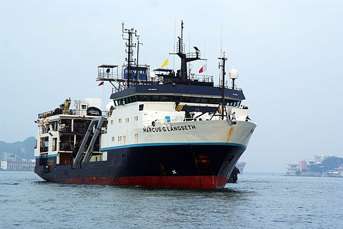
Planned route: 2 segments · ~4 days steaming
Operating area: Eastern Pacific Ocean
Route: San Diego (California) - United States → San Diego (California) - United States
Lamont-Doherty Earth Observatory
Project aboard
We aim to address the evolution of fast-spreading mid-ocean ridge magmatic systems, focusing on decadal changes in the magma lens properties taking place from one seafloor eruption to the next one. The 9°50’N segment of the East Pacific Rise (EPR) hosts a volcanically-active system which erupted in 1991 and in 2005-06. The decadal interval between volcanic episodes provides a unique opportunity for multidisciplinary studies of magmatic, hydrothermal, and ecological cycles on human timescales. Following the 2005-06 eruption, a 3-D seismic reflection dataset was acquired in 2008 using RV Langseth, providing a new understanding of the structure of the EPR magmatic system including unprecedented detailed 3-D images showing that the axial magma lenses are corrugated with elongated ridges and troughs from where dikes nucleate. Since the 2005-06 eruption, in-situ vent temperature observations indicate the system is approaching the end of a volcanic cycle. Rising hydrothermal exit-fluid temperatures suggest that a seafloor eruption and/or diking event could occur in the mid-2020s. We propose to investigate decadal evolution of a MOR magmatic system at the EPR by conducting a repeat of the 2008 3-D seismic survey for 4-D (time-lapse) monitoring. The survey will use the 3-D multi-streamer capabilities of R/V Marcus Langseth.
People aboard
- Ross Parnell-Turner · Principal investigator
Party size: 15
Estimated vacant berths: 20
Equipment
Aboard the vessel
- Ship Fitted Winches & Wires
- Navigation - Heading/Position
- Meteorological Data
- Multibeam - Deep Water (EM122, EM124)
Pooled / portable
- TowCam
- Gravimeter
- Magnetometer (towed)
Schedule data from UNOLS Marine Facilities Planning · operator cruise code NSF-MGG/Parnell-Turn · MFP reference 24/4419 · synced Sep 24, 2026