VesselConnect
  • Completed

    Hydro S - 2023 13of24

    Nicholas R. Bates · BIOS

    One of the longest open-ocean hydrographic stations in the world is maintained at the Hydrostation S site (formerly known as the Panulirus site) located ~25 km southeast of Bermuda in the North Atlantic Ocean. This program of repeat biweekly hydrographic observations began in 1954 (by Hank Stommel) and now, in its seventh decade, has proved to be the catalyst for numerous studies of ocean physics, biological processes and biogeochemistry. Hydrostation S continues to be recognized as one of the most important sustained ocean time–series. The renewal of the Hydrostation S program is proposed herein, extending this invaluable time–series of ocean hydrography to almost 70 years. The upper ocean warming trend has strengthened (about +1.4° C since the 1970's; ~+0.8°C in last decade) with significant salinification (+0.16). Deeper waters such as the Labrador Sea Water has cooled by a few tenths of a degree and freshened with a marked decadal oscillation. The signature of deoxygenation has been observed at Hydrostation S in the upper ocean (about 4 µmoles kg -1 decade -1 decrease in dissolved oxygen) as well as the oxygen minimum zone (~2.5 µmoles kg -1 decade -1 ). Hydrostation S also supports the longest global ocean CO 2 and acidification time-series (from 1983 to present) The major objective of the proposal is to continue Hydrostation S into the eighth decade with numerous questions related to warming and cooling, salinification and freshening, deoxygenation and insights on biogeochemical changes over time. This program constitutes frequent water column sampling of temperature, salinity, and dissolved oxygen (and indirectly, sampling of important ocean carbon time–series) of the North Atlantic subtropical gyre at the Hydrostation S site. Such work is complementary to other sustained observations such as the Bermuda Atlantic Time–series Study (BATS) and Ocean Flux Program (OFP). We propose to carry out a similar sampling format that has been followed for the past 68 years. As for the past ten years, we would continue to conduct two CTD profiles to better capture the deep–water variability while maintaining all the previous discrete depths. The first CTD cast will profile to full ocean depth (3,300–3,500 m) while the second CTD cast will profile to 500 m (to allow for instrumentation not rated for full ocean depth such as a PAR sensor). One indirect objective will be to continue to collaboratively evaluate a BIOS-based glider program with Hydrostation S data as critically important ground truthing data. The existing glider program has challenging issue, and the aim of this effort is to use robust and highly accurate Hydrostation S data to test the capability of emerging technologies over the next five to ten years.

    Aug 7 – Aug 8, 2023 · 1 d

    Appxoimately 25 nm south east of the island of Bermuda

    Sails with 1 other project

  • Completed

    Hydro S - 2023 12of24

    Nicholas R. Bates · BIOS

    One of the longest open-ocean hydrographic stations in the world is maintained at the Hydrostation S site (formerly known as the Panulirus site) located ~25 km southeast of Bermuda in the North Atlantic Ocean. This program of repeat biweekly hydrographic observations began in 1954 (by Hank Stommel) and now, in its seventh decade, has proved to be the catalyst for numerous studies of ocean physics, biological processes and biogeochemistry. Hydrostation S continues to be recognized as one of the most important sustained ocean time–series. The renewal of the Hydrostation S program is proposed herein, extending this invaluable time–series of ocean hydrography to almost 70 years. The upper ocean warming trend has strengthened (about +1.4° C since the 1970's; ~+0.8°C in last decade) with significant salinification (+0.16). Deeper waters such as the Labrador Sea Water has cooled by a few tenths of a degree and freshened with a marked decadal oscillation. The signature of deoxygenation has been observed at Hydrostation S in the upper ocean (about 4 µmoles kg -1 decade -1 decrease in dissolved oxygen) as well as the oxygen minimum zone (~2.5 µmoles kg -1 decade -1 ). Hydrostation S also supports the longest global ocean CO 2 and acidification time-series (from 1983 to present) The major objective of the proposal is to continue Hydrostation S into the eighth decade with numerous questions related to warming and cooling, salinification and freshening, deoxygenation and insights on biogeochemical changes over time. This program constitutes frequent water column sampling of temperature, salinity, and dissolved oxygen (and indirectly, sampling of important ocean carbon time–series) of the North Atlantic subtropical gyre at the Hydrostation S site. Such work is complementary to other sustained observations such as the Bermuda Atlantic Time–series Study (BATS) and Ocean Flux Program (OFP). We propose to carry out a similar sampling format that has been followed for the past 68 years. As for the past ten years, we would continue to conduct two CTD profiles to better capture the deep–water variability while maintaining all the previous discrete depths. The first CTD cast will profile to full ocean depth (3,300–3,500 m) while the second CTD cast will profile to 500 m (to allow for instrumentation not rated for full ocean depth such as a PAR sensor). One indirect objective will be to continue to collaboratively evaluate a BIOS-based glider program with Hydrostation S data as critically important ground truthing data. The existing glider program has challenging issue, and the aim of this effort is to use robust and highly accurate Hydrostation S data to test the capability of emerging technologies over the next five to ten years.

    Aug 7 – Aug 8, 2023 · 1 d

    Appxoimately 25 nm south east of the island of Bermuda

    Sails with 1 other project

  • Completed

    Sikuliaq · UAF

    Bering Sea Coring

    Sarah Fowell · UAF

    This award is funded in whole or in part under the American Rescue Plan Act of 2021 (Public Law 117-2) The Bering Land Bridge served as a migration corridor for plants, animals, and humans passing between Eurasia and North America during glacial stages of the Quaternary period (the last ~2.6 million years). During interglacial stages, rising sea level floods this land bridge, creating a marine gateway that connects the Pacific and Arctic oceans and modulates the global climate system. Although the Bering Sea shelf is the only place on Earth where fluctuations in Quaternary sea level repeatedly opened and closed such a gateway, sediment cores for the purpose of paleoenvironmental reconstruction have never been collected from the central and southern portions of the submerged land bridge. To determine how the most recent glacial/interglacial transition affected the ecology and climate of the Bering Land Bridge, the project team will collect, analyze, and archive terrestrial and marine sediment preserved in sedimentary basins across the Bering Sea shelf. Because these basins occupied topographic depressions on the Bering Land Bridge, they were likely to have been sites of freshwater lakes and terrestrial sediment deposition during glacial stages. Researchers will use a suite of traditional and cutting-edge paleoclimate proxies, including pollen, diatoms, and stable isotopes, to reconstruct the vegetation of interior and coastal sites on the Bering Land Bridge and evaluate the relationship between sea ice extent and aridity during and after the last glacial stage. Results will address longstanding questions regarding migration patterns of plants and animals, resources available to human populations, and the role of the marine gateway during the most recent past episode of global warming. Cores of Late Pleistocene and Holocene sediment will be collected from transects of five submarine basins located between the Bering Strait and the southern shelf edge: Norton Basin (64 N), St. Matthew Basin (62.5 N), Navarin Basin (62 N), St. George Basin (55.5 N), and the North Aleutian Basin (56 N). Existing US Geological Survey and industry seismic data suggest significant accumulation of Holocene and Pleistocene sediment fill in these basins. To maximize sediment recovery, the team will deploy a variety of coring apparatus, including a multicore system, a vibracorer, and gravity corers. New Chirp sub bottom data will be used to provide high-resolution imaging of the basin fill and subsurface topography in order to refine selection of both sites and apparatus. Pollen analysis of the Pleistocene section will permit reconstruction of the vegetation of the central and southern Bering Land Bridge and test the hypothesis that relatively humid conditions in low elevation, coastal regions provided a refugium for woody plants. Identification and dating of the transition between terrestrial and marine sediment will serve to constrain the rate and timing of Holocene sea-level rise. Micropaleontological and geochemical analyses of marine sediment will permit reconstruction of sea ice extent, primary productivity, and organic matter source. Comparison of marine records from sites near the shelf edge with coeval terrestrial records from the inner shelf will allow identification of terrestrial-marine linkages. These data will be used to test the hypothesis that when sea ice retreats during deglaciation, primary productivity on the Bering Shelf increases in sync with humidity on the Beringian continent. Results of this project will further our understanding of ocean circulation, the effect of sea ice on global climate, and the paleoecology of the migration corridor. The Beringian Standstill hypothesis suggests that ancestors of all Native Americans were isolated from Eurasian populations for thousands of years prior to migrating to North America. Fossil pollen records from terrestrial sites on the Bering Land Bridge are thus crucial to assessing the resources available to Late Pleistocene inhabitants of Beringia. Because the results of this project are likely to be of interest to Alaska Natives, the project team will collaborate with the Shared Beringian Heritage Program, the Bering Land Bridge National Preserve, and the Alaska Regional Office of the National Park Service. A PolarTREC teacher will design activities and lesson plans to promote understanding of land bridge paleoecology, and the Alaska Teen Media Institute will create video, web, and social media products during the science cruise. Curricula will be delivered in Alaskan schools, and results will be disseminated to stakeholders via public presentations and a traveling museum exhibit. This project will also provide training for multiple undergraduate and graduate students at sea, in university laboratories, and at international conferences.

    Aug 5 – Sep 4, 2023 · 31 d

    Bering Sea

  • Completed

    Atlantis · WHOI

    Perception at sea

    Thomas Stoffregen · UMN

    We will continue our research on human perception and movement at sea. As in our previous studies, participants will be members of the ship's crew who volunteer. Each individual will be asked to participate for a maximum of 30 minutes per day, at their own convenience. In our current research, we evaluate human perceptual sensitivity through participants' behavioral choices. As usual, our experimental design must be contingent on weather and sea state. With moderate seas, will ask participants (individually) to estimate how far they would be able to walk along a narrow path laid out on the deck. After making their estimate, each crewmember will attempt to walk along the path. We will compare prior estimates versus posterior performance. The central condition of our research is the fact that ship motion differs in roll versus pitch. Perceptual estimates and actual performance should differ for paths that are aligned with the roll and pitch axes.

    Aug 4 – Aug 9, 2023 · 5 d

    Pacific Ocean

  • Completed

    Optimal Band

    Andrew Jessup · UW-APL

    The importance of accurate measurements of ocean surface skin temperature is increasingly recognized. However, skin temperature measurements are made using complicated infrared radiometer systems that until now have been limited to ships. The main challenges that have limited accurate T skin measurements to ships are: the need for in situ two-point calibration using precision blackbodies the need for a separate sky measurement to correct for reflected downwelling radiance, uncertainty in emissivity, which depends on incidence angle and sea surface roughness I am currently developing a radiometer system called IRISS (InfraRed In situ Skin Sensing) for deployment on USVs and buoys with funding from the NSF Ocean Technology and Interdisciplinary Coordination Program. IRISS successfully addresses the first point by utilizing a simplified one-point calibration scheme. This project is to leverage this effort by developing an innovative and transformative technique to eliminate the need for a separate sky measurement and provide a significant reduction in the effect of emissivity. The technique uses an optimal spectral band in which the reflected sky radiance is from the atmosphere within a 1-2 km of the ship. The combination of the simplified calibration and optimal band technique will provide practical and accurate T skin measurements for USVs and buoys. Furthermore, the resulting simplicity and affordability could make it practical for widespread deployment as a standard measurement on the UNOLS fleet.

    Aug 3 – Aug 9, 2023 · 6 d

    Puget Sound and WA coast to mouth of the Columbia River and back

  • Completed

    Sally Ride · SIO

    SR23 San Diego to Newport Transit

    Hannah Delapp · SIO

    Aug 2 – Aug 8, 2023 · 5 d

    USWC

  • Completed

    Pelican · LUMCON

    Microbial DO respir - 2022 2of2

    Cameron Thrash · USC

    Decreasing marine dissolved oxygen (DO) is a widespread and growing global problem. Among the chief causes for coastal losses of DO are anthropogenic nutrient inputs that lead to seasonal hypoxia- DO concentrations below 2 mg/L. Microorganisms are the primary agents of oxygen removal, and although we have a basic mechanistic understanding of how nutrient enrichment combines with stratification to stimulate microbial metabolism and oxygen drawdown, we still do not know which microorganisms are ultimately responsible for oxygen consumption leading to, and during, coastal hypoxia in any particular region. Nor do we know the extent to which each hypoxic system arises from universal microbial mechanisms or whether there may be unique microorganisms and metabolic pathways involved in each locale. Hypoxic regions are increasing in number and size around the globe, amplifying the need to better understand the microbial processes responsible for oxygen consumption. In response, the project pursues an integrated research and education effort to study the microbial mechanisms of oxygen respiration in two coastal zones where DO depletion occurs: the northern Gulf of Mexico ?dead zone?, and the Southern California Bight. This work identifies the microorganism actively consuming oxygen in these systems, what fuels them, and whether/how those taxa respond to environmental changes. The investigators are generating microbial DO consumption rate, genetic, and taxonomic data critical to better constraining respiration models focused on water column DO depletion. In doing so, hundreds of undergraduate and students and dozens of high school STEM teachers contribute valuable data by participating in modern marine microbiological research. The project also improves integration of authentic research experiences into college and high-school classrooms in the context of a problem of global relevance. Regions of low DO take multiple forms, from vast open ocean oxygen minimum zones (OMZs) which hover in the upper water column, to shallower coastal zones of bottom water hypoxia fueled by close proximity to fluvial inputs of human supplied nutrients. Microbial respiration is primarily responsible for the ultimate consumption of DO, and therefore understanding the microorganisms that inhabit these systems and their metabolic capabilities is critical for improving our ability to predict the timing, extent, and severity of DO depletion, and how these factors relate to environmental change. While there has been substantial research into the microbiology of OMZs, we know comparatively little about the microbial dynamics, and in particular, the microorganisms responsible for oxygen consumption, in coastal hypoxia. This integrated research and education effort is framed by the following objectives: 1. Determine the microorganisms and metabolic processes responsible for actively respiring water column DO prior to, and during, hypoxia. 2. Quantify microbial respiration rates for communities and representative water column species in both the planktonic and particle-associated fractions. 3. Integrate authentic microbiology research on a globally relevant topic into undergraduate and high school classrooms. The work uses a combination of advanced cultivation-independent and pure culture measurements to discriminate between oxygen consumption by planktonic and particle-associated microbial fractions, as well as by communities at the surface and those in bottom waters, in two different systems of coastal DO depletion (the northern Gulf of Mexico hypoxic zone and the Southern California coastal shelf). Direct assessment of actively respiring taxa are connected with their metabolic potential, gene expression, and respiration rates. This project is determining, for the first time, the taxa actively consuming oxygen in these systems. The results also provide size fractionated respiration rates and bacterial growth efficiency (BGE) with depth across multiple sites and seasons, and importantly, also yield cell-specific respiration rates and BGE for active taxa within these systems. This data will constrain variable respiration across differing environmental conditions. The investigators are experimentally testing how alterations in environmental variables affect these respiration rates and BGEs, leading to greater predictive insight for the range of effects climate forcing will have on DO consumption. This information also facilitates comparisons between multiple marine systems to identify whether common or distinct organisms and metabolic processes are operating to remove DO.

    Aug 2 – Aug 6, 2023 · 5 d

    East GOM

  • Completed

    Atlantis · WHOI

    DV Dives

    Rick Chandler · WHOI

    Distinguished visitor dives for NSF and ONR funders, WHOI Directorate, etc., off San Diego during the transit from San Diego to Astoria, OR. A small boat personnel transfer would be utilized to disembark guests following the dives and before continuing the transit north.

    Aug 1 – Aug 4, 2023 · 2 d

    Two miles off La Jolla, CA

  • Completed

    Slow Life Part 2

    Beth Orcutt · Bigelow

    Two projects combined: (1) Microbial Activity in the Crustal Deep Biosphere, and (2) Collaborative research: Illuminating microbes and their viruses within the dark ocean crust through strain -level approaches This project proposes to leverage existing subsurface infrastructure on the eastern flank of the Juan de Fuca Ridge with advances in single-cell based molecular and geochemical approaches to make fundamental new discoveries about the activity of life in the deep crustal biosphere. During a two-week research cruise, the research team will incubate crustal fluids in situ and in the laboratory with labeled substrates for tracking single-cell activity, coupled with radioisotope tracer activity and potentiostat measurements, with the objective of determining in situ and potential rates of activity and cellular physiology. The research will also identify which metabolisms active microorganisms utilize under in situ and laboratory conditions, the rates of these processes, and the microorganisms involved. The results are expected to provide explicit hypothesis testing of microbial activity and in situ microbial growth rates from the crustal deep biosphere to transform understanding of microbial activity in the crustal deep biosphere and generate critical information about the ability of life to survive under low energy conditions.

    Jul 31 – Aug 8, 2023 · 8 d

    IODP Holes U1362A/B on the eastern flank of the Juan de Fuca Ridge

  • Completed

    Savannah · SkIO

    Alkalinity Flux

    Martial Taillefert · GaTech

    This project will determine how marine sediments exposed to large riverine discharge affect ocean acidification from the increasing uptake of atmospheric carbon dioxide (CO2) in coastal waters. Although ocean acidification in coastal oceans affects marine life and commercial fisheries, little is known on the feedback from the underlying sediment on water column acidification processes. The role of large deposits from rivers in these processes has also never been investigated. The Mississippi River will be used as example of a river that plays an important economic role along the southern coast of the United States and provides a high sediment load to the nearby continental shelf in the Gulf of Mexico. The geochemical and microbiological processes responsible for the transformation of particles deposited on the seafloor will be characterized near the Mississippi River mouth and along the nearby continental slope. The release of acids (CO2) and bases (alkalinity) from the sediment will be quantified using autonomous instruments deployed on the seafloor to determine whether sediments contribute to the acidity of the surrounding water column or instead provide bases to buffer the water column from atmospheric CO2 inputs. As the Mississippi River discharge during the later Winter and Spring provides much more sediment to the coastal zone compared to the rest of the year, research cruises will be taken twice a year to determine how seasonal variations in riverine discharge affect the release of acids and bases into the water column.

    Jul 29 – Aug 6, 2023 · 8 d

    NA6 from Savannah to Gulf Stream to Jekyll Island

  • Completed

    Redfield ratio 2023

    Allen J Milligan · OSU

    Characterize the phytoplankton specific Redfield ratio (C:N:P) along a natural gradient of dissolved nutrients. This work will involve a track along the US West Coast where large gradients of dissolved nutrients have been historically observed. Continuous ships flowthrough seawater will be sampled along with hydrographic casts (4-8 per day). Data collection will include bottle casts for discrete depth samples (surface to 200m). Discrete samples from bottles and flow through system for flow cytometry, Particulate C,N,P, phytoplankton pigments and total dissolved N, P. On deck incubations will be performed in plexiglass tanks with seawater cooling. Deployment of a weighted trace metal clean tubing and deck-based electric teflon bellows pump will be required for offshore (250-400 km) stations.

    Jul 28 – Aug 19, 2023 · 22 d

    Oregon Coast out to 400km. Four Transects.

  • Completed

    CA BGC

    Adam Subhas · WHOI

    Although carbon dioxide (CO2) is found both in the atmosphere and in sea water, it does not react quickly with water. This presents a problem for marine organisms that need to wait for CO2 to react with water before using it for photosynthesis. Therefore, organisms use an enzyme to greatly speed up this reaction. The enzyme, known as carbonic anhydrase (CA), is so useful that it is found across the entire tree of life. However, the role of carbonic anhydrase in the CO2 cycle has been hard to measure. In this project, a team of investigators from the Woods Hole Oceanographic Institution will use a combination of instrument techniques and laboratory experiments to investigate the role of different types of CA in marine organisms. The team will identify the different types of CA and their inherent catalytic rates. The team will then identify the metal cofactors present in these enzymes, which are key for enzyme function. This work will deepen our understanding of the biochemical basis for carbon dioxide cycling in marine phytoplankton, and will provide key insights into one of the most ubiquitous and fastest enzymes on the planet. The team will collaborate with Professor Indu Sharma and her students from Hampton University which has just launched a new marine science major program. Team members will visit Hampton University for a workshop on careers in oceanography. In Year 2, Professor Sharma and her students will accompany the team on a research expedition to the Bermuda-Atlantic Time Series and will help design a sampling campaign focused on the shared research interests of Professor Sharma and the investigators. Carbonic anhydrases (CAs) are ubiquitous enzymes involved in almost every carbon transformation in the marine environment. Every CA uses a metal cofactor in its active site, and the expression of CAs is tied to the uptake and utilization of trace metals such as zinc and cobalt in the surface ocean. We are starting to understand that organisms express many different forms of CA, all of which serve distinct physiological roles; exhibit unique catalytic rates; and can use different metal cofactors at the enzyme active site. In this proposal, the team will exploit this enzymatic diversity to investigate carbonic anhydrase kinetics in marine diatoms. By combining an isotope-based enzyme activity assay with quantitative proteomics, they will document the inherent kinetics of multiple CA isoforms. In addition, they will identify the metal cofactors associated with the most abundant CAs, therefore providing a direct linkage between enzyme activity and trace metal utilization.

    Jul 26 – Jul 31, 2023 · 5 d

    BATS

    Sails with 2 other projects

  • Completed

    BATS 2023 - 6of12

    Nicholas R. Bates · BIOS

    Long-term observations over several decades are a powerful tool for investigating ocean physics, biology, and chemistry, and the response of the oceans to environmental change. The Bermuda Atlantic Time-Series Study, known as BATS, has been running continuously since 1988. The research goals of the BATS program are: (1) to improve our understanding of the time-varying components of the ocean carbon cycle and the cycles of related nutrient elements such as nitrogen, phosphorus, and silicon; and, (2) to identify the relevant physical, chemical and ecosystem properties responsible for this variability. In addition, the BATS program has strong and diverse broader impacts, contributing to the field of ocean sciences by providing high quality ocean observations and data for seagoing scientists and modelers, and a framework through which researchers can conceive and test hypotheses. This award will support the operations of the BATS program for five more years. The primary BATS research themes are as follows: (1) Quantify the role of ocean-atmosphere coupling and climate variability on air-sea exchange of CO2, and carbon export to the ocean interior; (2) Document trends and the controls on the interannual to decadal scale variability in carbon and nutrient cycles to their coupling in the surface and deep ocean via the Redfield Ratio paradigm; (3) Quantify the response of planktonic community structure and function, and impact on biogeochemical cycles to variability in surface fluxes and dynamical processes; (4) Facilitate development, calibration and validation of next generation oceanographic sensors, tools and technologies; and, (5) Generate a dataset that can be utilized by empiricists, modelers and students. This research integrates ocean physics, chemistry and biology into a framework for understanding oceanic processes and ocean change in the North Atlantic subtropical gyre. The existing 29 years of BATS data provide robust constraints on seasonal and interannual variability, the response of the Sargasso Sea ecosystem to natural climate variability, and signal detection of potential ocean changes. This project would extend the BATS program through years 31-35 to address a series of ten interlinked questions through integrated research approaches and a multitude of collaborative efforts. In addition to the themes above, and embedded into the ten questions and approaches, the BATS team will focus on, for example, coupling of particle production and biogeochemistry; revisiting the complexities of the biological carbon pump; oxygen decline; and changes in the hydrography, physics, ocean carbon cycle and biogeochemistry of the Sargasso Sea. The highest quality data observation and collection will be maintained and used to address these questions. Importantly, a wide range of collaborations at the BATS site, spanning the physical and biogeochemical disciplines, will aid these broad goals. Strong links to community stakeholders, and close collaboration (including methods intercomparisons and personnel exchanges) with the Hawaii Ocean Time-series are proposed. This work will extend the research findings of the project into educational and training opportunities within and beyond the oceanographic community, including training and mentorship of both undergraduate and graduate students.

    Jul 26 – Jul 31, 2023 · 5 d

    BATS

    Sails with 2 other projects

  • Completed

    Hydro S - 2023 11of24

    Nicholas R. Bates · BIOS

    One of the longest open-ocean hydrographic stations in the world is maintained at the Hydrostation S site (formerly known as the Panulirus site) located ~25 km southeast of Bermuda in the North Atlantic Ocean. This program of repeat biweekly hydrographic observations began in 1954 (by Hank Stommel) and now, in its seventh decade, has proved to be the catalyst for numerous studies of ocean physics, biological processes and biogeochemistry. Hydrostation S continues to be recognized as one of the most important sustained ocean time–series. The renewal of the Hydrostation S program is proposed herein, extending this invaluable time–series of ocean hydrography to almost 70 years. The upper ocean warming trend has strengthened (about +1.4° C since the 1970's; ~+0.8°C in last decade) with significant salinification (+0.16). Deeper waters such as the Labrador Sea Water has cooled by a few tenths of a degree and freshened with a marked decadal oscillation. The signature of deoxygenation has been observed at Hydrostation S in the upper ocean (about 4 µmoles kg -1 decade -1 decrease in dissolved oxygen) as well as the oxygen minimum zone (~2.5 µmoles kg -1 decade -1 ). Hydrostation S also supports the longest global ocean CO 2 and acidification time-series (from 1983 to present) The major objective of the proposal is to continue Hydrostation S into the eighth decade with numerous questions related to warming and cooling, salinification and freshening, deoxygenation and insights on biogeochemical changes over time. This program constitutes frequent water column sampling of temperature, salinity, and dissolved oxygen (and indirectly, sampling of important ocean carbon time–series) of the North Atlantic subtropical gyre at the Hydrostation S site. Such work is complementary to other sustained observations such as the Bermuda Atlantic Time–series Study (BATS) and Ocean Flux Program (OFP). We propose to carry out a similar sampling format that has been followed for the past 68 years. As for the past ten years, we would continue to conduct two CTD profiles to better capture the deep–water variability while maintaining all the previous discrete depths. The first CTD cast will profile to full ocean depth (3,300–3,500 m) while the second CTD cast will profile to 500 m (to allow for instrumentation not rated for full ocean depth such as a PAR sensor). One indirect objective will be to continue to collaboratively evaluate a BIOS-based glider program with Hydrostation S data as critically important ground truthing data. The existing glider program has challenging issue, and the aim of this effort is to use robust and highly accurate Hydrostation S data to test the capability of emerging technologies over the next five to ten years.

    Jul 26 – Jul 31, 2023 · 5 d

    BATS

    Sails with 2 other projects

  • Completed

    Savannah · SkIO

    INST

    Traci Beamer · SkIO

    Ship time dedicated to facilitate experiential learning for UGA and USG graduate and undergraduate students.

    Jul 25, 2023 · 1 d

    South Atlantic Bight - USA

  • Completed

    Pelican · LUMCON

    NGOM-Hypoxia-2023

    Cassandra Glaspie · LSU

    These research cruises are the baseline measures for the size of the low-oxygen zone (hypoxic zone) for the Mississippi River Nutrient/Hypoxia Task Force, a federal/state interagency working group. The goal of the Task Force is to reduce nutrients within the Mississippi River watershed so that the problems of hypoxia are diminished. In order to establish improvement in the Mississippi River nutrient delivery to the northern Gulf of Mexico, there is a need to determine the size of the hypoxic area each summer. The bottom area size of the summer hypoxic area is directly related to the nutrient flux (nitrogen) from the Mississippi River in May. Efforts are underway for the states along the Mississippi River to reduce nutrients by 20% by 2025. The ultimate goal is to diminish the size of hypoxia to less than 2,000 square miles by 2035. Without a summer mapping cruise, the ability to determine progress toward the size goal cannot be made

    Jul 23 – Jul 28, 2023 · 6 d

    Northern Gulf of Mexico

  • Completed

    Sally Ride · SIO

    CCE-LTER IV - mooring 1

    Katherine Barbeau · SIO

    The California Current Ecosystem (CCE) Long-Term Ecological Research (LTER) site is a coastal upwelling biome and the site of a 73-year (ongoing) spatially-resolved ocean timeseries (CalCOFI) that has demonstrated physical forcing on multiple spatiotemporal scales with concomitant impacts on ocean biota. The CCE is part of the larger LTER Network, founded in 1980 by the National Science Foundation. CCE-LTER studies are making excellent progress towards diagnosing mechanisms of ecosystem change in a major upwelling ecosystem and developing a quantitative framework for forecasting future changes. Our field site is in the CA Current upwelling regime, centered around Point Conception, within the CalCOFI time series station plan. The CCE LTER field program includes several different elements: experimental process cruises, time series cruises (ship time augmented on existing CalCOFI cruises) and mooring servicing cruises to maintain the deep water CCE1 and CCE2 moorings. The science carried out on these field expeditions is highly interdisciplinary, involving elements of biological, chemical, and physical oceanography.

    Jul 22 – Jul 29, 2023 · 7 d

    Southern California

  • Completed

    Summer cruise Marine Biodiversity and Conservation

    Greg Rouse · SIO

    We propose two 1 day cruises on the RV Robert Gordon Sproul to introduce students to different aspects of oceanographic research and to provide samples for laboratory study during shore-based part of the course. The cruises need to be on the same weekend with the following elements (1) Plankton (bongo net) haul; (2) Otter trawl near the Coronado bank ~ 400 meters, (depth switched each day); (3) Multicore near Coronado Banks at ~700 meters, (depth switched each day); (4) Midwater trawl.; (5) Van Veen grab/s on Coronado Bank at 450-500 m.

    Jul 22 – Jul 24, 2023 · 2 d

    Off San Diego

  • Completed

    SFER 2023 4 of 6

    Christopher Kelble · NOAA

    AOML SFP regional surveys over the southwest Florida shelf and the Florida Keys reef tract have been routinely performed via the University of Miami's R/V F. G. Walton Smith on a bimonthly basis. Sampling methodologies similar to those utilized on AOML SFP bay surveys (discrete sampling and flow-through measurements) have been employed on these regional research cruises.

    Jul 22 – Jul 28, 2023 · 6 d

    Miami, Keys reef tract , and West Florida Shelf

  • Completed

    US GO-SHIP I05

    Lynne D. Talley · SIO

    The most important and basic climate system components are the heat, freshwater, and carbon content and transport of the oceans, which directly interact with other essential components of the climate system in the atmosphere and cryosphere. In turn the associated variability and trends in the ocean's carbon content, carbonate saturation state, oxygen, and nutrients impact its internal biological environment, with notable large-scale regional changes. This joint study of the ocean carbon cycle and circulation is critical to identify critical areas where changes in ocean circulation could have serious consequences for future anthropogenic carbon uptake. Global warming-induced changes in the ocean's transport of heat and freshwater, which could affect the circulation, are being followed through these long-term measurements. Results to date have shown that the abyssal ocean is warming, taking up to 30% of the excess heat in the entire Earth system, leading to changes in circulation patterns and ventilation rates in the upper ocean. The uptake of anthropogenic carbon from the atmosphere to the ocean has been mapped and shows that the oceans are acidifying. Oxygen concentrations are declining in the ocean thermocline, and tropical oxygen minimum zones are expanding. The project is based on the fundamental concept that data collected belong to the community and need to be made quickly and freely available to the community at large through a recognized international data center. The project will continue to promote training and learning for graduate students, postdoctoral scientists, and new scientists in sea-going work. Outreach activities will continue as opportunities arise. The systematic and global re-occupation of select ocean hydrographic sections conducted for the past decade (2003-2014) will be extended into the 2015-2020 period with the continued objective of quantifying changes in the full-depth ocean. The project is in support of the U.S. CLIVAR (CLImate Variability and predictability) and the Carbon Science Programs, and is a component of a global observing system for the physical climate and carbon system. This long-standing project continues to contribute to the following overlapping scientific objectives: Data for Model Calibration, Validation and Model Based Synthesis; Carbon System Studies; Heat and Freshwater Storage and Flux Studies; Deep and Shallow Water Mass and Ventilation Studies; and Calibration of Autonomous Sensors. By integrating the scientific needs of the carbon, tracer and hydrographic communities, major scientific synergies and cost savings will continue to be achieved. In addition to efficiency, the coordinated approach produces scientific advances that exceed those of having individual programs. An average of two sections will be conducted every year, sometime collaboratively with international partner. The measurements made on each section include hydrography (full-depth vertical profiles of salinity, temperature, oxygen, nutrients, currents), Underway surface temperature, salinity, partial pressure of carbon dioxide (pCO2), air-sea fluxes, bathymetry, navigation), carbon system (dissolved inorganic carbon, pCO2. Total Alkalinity, pH, dissolved organic carbon and nitrogen), and transient tracers. This project will collect the data and perform the quality control measures routinely carried out by providers of reference-quality data. Post-cruise data updates, distribution, and archive will continue to be managed by groups with separate funding. This ongoing project is integrated with a larger international effort to monitor the ocean's response to climate change.

    Jul 22 – Sep 14, 2023 · 54 d

    South Indian This is the I05 cruise. This is a transect across the South Indian Ocean at ca. 32 degrees South.

    Sails with 1 other project

  • Completed

    squid1

    James Girton · UW

    SQUID (Sampling Quantitative Internal-wave Distributions) will be part of the NOPP "Global Multi-agency Experiment on Internal Wave Energy, Mixing, and Interactions in the Ocean and Their Representation in Global Ocean Models and Operational Forecasts." The principal field activity will be to deploy 50 velocity and microstructure profiling floats (EM-APEX) from 6 cruises over the 3-year program (from mid-2022 through mid-2025). UNOLS cruises of opportunity will be sought out in suitable locations and times to launch 5-10 floats over the course of the cruise. Although we do have the ability to send personnel on a few of these, it is anticipated that ship or science party personnel will be able to accomplish these launches. We are also happy to provide training to personnel beforehand. Overall, we are looking to collect profiling float internal wave measurements over a range of values of the following parameters: (a) latitude, (b) topographic roughness, (c) internal tide amplitude, (d) high-frequency wind variability, (e) mean current speed, (f) mesoscale eddy kinetic energy, and (g) proximity to the coast. Each float will operate for somewhat over a year, drifting at depth and collecting bursts of 3-4 profiles every 5-10 days. This request (squid1) is for the first of 6 cruises and describes deployment of 8 floats from GO-SHIP repeat hydrography cruise I05, anticipated to take place in the Indian Ocean during 2023. GO-SHIP cruises are ideal for EM-APEX launches in SQUID because they tend to span a large geographical (and, hence, internal wave parameter) range.

    Jul 22 – Sep 14, 2023 · 54 d

    South Indian This is the I05 cruise. This is a transect across the South Indian Ocean at ca. 32 degrees South.

    Sails with 1 other project

  • Completed

    Optical Velocimeter

    Jules Jaffe · SIO

    To test an optical velocimeter and provide hands on field experience for the Marine Physical Laboratory’s (MPL) summer undergraduate interns.

    Jul 20 – Jul 21, 2023 · 1 d

    SoCal

  • Completed

    Blue Heron · UMN

    Methane Oxidation II

    John D. Kessler · Rochester

    The goal of this project is to first identify and then quantify the variables exerting the most influence on the kinetics of aerobic methane oxidation (MOx). This will be accomplished through systemic investigations of MOx in the laboratory and in the field (Great Lakes and US Atlantic Margin) and how it is influenced by changes in physical and chemical variables. While rates of MOx are measured relatively routinely by several research groups with this analytical expertise, the inter-laboratory comparability of results remains poor. This largely prohibits the integration and upscaling of these measurements for the regional and global quantification of the magnitude of this CH4 sink. Despite this considerable shortcoming, local studies have proven extremely valuable at displaying the variable potential for MOx to be a microbial biofilter with the ability to diminish oceanic emissions of this greenhouse gas to the atmosphere. The results of the investigations proposed here will lead to a fundamental understanding of the dominant physical and chemical controls on MOx kinetics, enabling protocols to be developed for greater inter-laboratory comparability of future measurements of MOx. In addition, the fundamental understanding uncovered here will aid in the regional and global extrapolation of MOx rates so that the influences exerted on seawater chemistry and atmospheric greenhouse gas budgets can be more precisely constrained.

    Jul 18 – Jul 22, 2023 · 4 d

    Any US waters in the western half of Lake Superior not influenced by river plumes.

  • Completed

    Grazing at Axial

    Julie Huber · WHOI

    Microorganisms are the ancestral forms of life on our planet and have been instrumental in shaping all of Earth?s environments into what they are today. In the ocean, microbial prokaryotes and eukaryotes form the foundation of marine food webs through their activity and interactions. Single-celled microbial eukaryotes (or protists) are some of the most important species on the planet, yet our understanding of how their activities influence and regulate the ocean ecosystem is poorly constrained. At deep-sea hydrothermal vents in particular, our understanding of microbial food web dynamics is incomplete without including the role of microbial eukaryotes. This project provides quantification of phagotrophic protistan grazing on the microbial communities inhabiting the highly productive diffuse vent mixing zone at hydrothermal vents, where the vent fluid-seawater interface promotes an increase in biological activity compared to the surrounding deep seawater. The results are contributing novel insights into the diversity and metabolic activities of the microbial eukaryotic community at vent fluid-seawater interfaces, establish the extent to which microbial eukaryotes impact primary production in the deep ocean by quantifying predation pressure, and estimate the amount of carbon transferred from primary producers to larger organisms.

    Jul 17 – Jul 27, 2023 · 9 d

    Axial Seamount in the summit caldera

  • Completed

    NGA LTER 2023 2 of 2 Transit

    Anita Lopez · UH

    The research focus of the NGA LTER site will be on mechanistic understanding of processes that underlie environmental variability, and the role of the latter in promoting high productivity and resilience. Building on prior knowledge, the investigators will test three hypotheses centered on ecosystem emergent properties: 1. Changes in the hydrologic cycle affect spring bloom production through changes in cloud cover, the stratification/mixing balance, macro- and micronutrient supplies, and transport pathways. 2. Hot-spots of high summer primary and secondary production result from interactions between the fresher Alaska Coastal Current and more saline offshore waters as promoted by shelf morphology and regional winds; hot spot timing and magnitude will be influenced by changes in the hydrologic cycle. 3. Nutritional and life history patterns of NGA consumers minimize trophic mismatch, buffering spatial and temporal variability in lower trophic level production and leading to resilience in the face of long-term climate change. The investigators will address these hypotheses with an integrated research program that includes: a) seasonal time series studies addressing short- and long-term environmental and ecosystem variability through a spring-to-fall field cruise- and mooring-based observational program, building upon and enhancing the Seward Line times series, and leveraging existing collaborations to obtain higher trophic level data; b) process studies that focus on hypothesized mechanisms leading to variability and enhancement of NGA production in time and space; c) modeling studies that incorporate physical and biogeochemical observations, provide a framework for testing hypotheses, and predict ecosystem responses to projected environmental changes; d) a data management component that provides a public platform for data visualization and synthesis by LTER colleagues, educators & students, and resource managers. This SME is only for the return transit to Honolulu.

    Jul 17 – Jul 31, 2023 · 13 d

    Northern Gulf of Alaska to Honolulu, HI

    Sails with 1 other project

  • Completed

    Gulf of Alaska Mapping

    Kasey Cantwell · NOAA

    This expedition will opportunistically take advantage of the Kilo Moana's EM122 system to map the seafloor during a planned transit from Seward, AK to Honolulu, HI. From May through September 2023, NOAA and partners will conduct a series of ocean exploration expeditions to improve knowledge about unexplored and poorly understood deepwater areas offshore Alaska, with a particular focus on the Aleutian Islands and Gulf of Alaska. Data collected during the Alaska expeditions will establish a baseline in explored areas to catalyze further exploration, research, and management activities. Data will also contribute to Seascape Alaska , a regional campaign aimed at fully mapping U.S. waters off Alaska, creating accessible, high-quality modern seabed data for Alaskan waters to support U.S. research, resource management, sustainable economic growth, and the health and security of Americans. Data collected during this expedition will be available in NOAA’s public data archives within approximately 4-8 months from of the end of the expedition and accessible via the NOAA Ocean Exploration Data Atlas .

    Jul 17 – Jul 31, 2023 · 13 d

    Northern Gulf of Alaska to Honolulu, HI

    Sails with 1 other project

  • Completed

    Atlantis · WHOI

    Methane footprint 2023

    Lisa Levin · SIO

    This research examines the role of deep-sea organisms in determining the fate and footprint of methane, a potent greenhouse gas, on Pacific continental margins. The investigators are evaluating the deep ocean methanosphere defined by the microbial communities that consume methane and the animals that directly feed on or form symbioses with methane-consuming microbes. They are also investigating animal communities that gain energy indirectly from methane, as well as those that take advantage of carbonate rocks, the physical manifestation of methane consumption in seafloor sediments. The study of methane seeps in the deep waters of both Alaska (4400-5500 meters) and Southern California (450-1040 meters) is enabling comparisons of the methanosphere under different food-limitation and oxygen regimes. By applying diverse chemical, isotopic, microscopy, and genetic-based analyses to seep microbes and fauna, this study is advancing understanding of the contribution of methane to deep-sea biodiversity and ecosystem function, information that can inform management and conservation actions in US waters. In addition to training for graduate and undergraduate students at their home institutions, the investigators are collaborating with the Alaska Native Science and Engineering Program (ANSEP). They are recruiting Alaskan undergraduates to participate in the research, contributing to ANSEP?s online resources that promote interaction between scientists and middle and high school students, and participating in ANSEP?s annual residential Career Exploration in Marine Science programs to engage middle school students in learning about deep-sea ecosystems and the variety of career pathways available in marine related fields.

    Jul 16 – Jul 29, 2023 · 12 d

    So. California Off San Diego (5 h steam from SD Bay)

  • Completed

    Endeavor · URI

    RAPID-MOCHA 2023

    William Johns · UMIAMI

    The project will continue the US contribution to the RAPID-MOCHA oceanographic mooring array at 26.5N in the Atlantic Ocean for an additional 42 months, bringing the length of data record to 22.3 years. This time series monitors the Atlantic meridional overturning circulation (AMOC) and meridional heat transport in the Atlantic Ocean. The RAPID-MOCHA array has yielded results that have changed widely held views about the deep ocean circulation and movement of heat across the ocean basin. Continued monitoring of the ocean structure and currents will allow oceanographers to better determine the relevant dynamics that control heat transport and to improve representations of the ocean role in climate models. The AMOC is known to be an important component of the climate system and it is believed that better understanding of the ocean dynamics that control the AMOC and its associated heat transport will lead to better fundamental understanding of the Earth's climate system and improved climate prediction. The 18-month extension of the RAPID-MOCHA will allow for longer term planning and reconsideration of the mooring array configurations.

    Jul 16 – Jul 24, 2023 · 8 d

    NA9, Bahamas

  • Completed

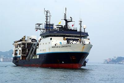
    Blake Plateau rift -Langseth

    Harm Van Avendonk · UT Austin

    In this project scientists will investigate the deep layers of sediments and bedrock offshore the southeastern United States to better understand how the Atlantic Ocean started opening approximately 190 million years ago. In early Jurassic times, the continental margins of the Carolina Trough and Blake Plateau separated from northwest Africa by mechanical stretching and/or excessive volcanism, before the Mid-Atlantic Ridge started to accommodate extension by seafloor spreading. Old fault lines and sutures of the Appalachian basement may have been reactivated during this continental stretching phase, and lava flows may have filled the early rift basin. Whether this episode of volcanism was a cause or consequence of the breakup between North America and Africa is not yet clear. This question can be addressed with new marine geophysical data. With seismic images of the deep sediments and basement, the scientists can determine the relationship between basement faults and lava flows on the Carolina Trough and Blake Plateau. These two sections of the Atlantic continental margin are of particular interest because the Blake Plateau is much wider than the Carolina Trough. Either the Blake Plateau forms a block of continental crust that did not stretch much during continental rifting, or it is a plateau that largely consists of volcanic rock that formed during rupture of the continents.

    Jul 16 – Aug 20, 2023 · 35 d

    Blake Plateau, Carolina Trough, Outer Blake Ridge, Blake-Bahamas Basin

NewerPage 37 of 55Older