Blake Plateau rift -Langseth
Completed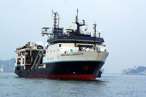
Operating area: Blake Plateau, Carolina Trough, Outer Blake Ridge, Blake-Bahamas Basin
Route: Port Canaveral (Florida) - United States → Charleston (South Carolina) - United States
Lamont-Doherty Earth Observatory
Project aboard
In this project scientists will investigate the deep layers of sediments and bedrock offshore the southeastern United States to better understand how the Atlantic Ocean started opening approximately 190 million years ago. In early Jurassic times, the continental margins of the Carolina Trough and Blake Plateau separated from northwest Africa by mechanical stretching and/or excessive volcanism, before the Mid-Atlantic Ridge started to accommodate extension by seafloor spreading. Old fault lines and sutures of the Appalachian basement may have been reactivated during this continental stretching phase, and lava flows may have filled the early rift basin. Whether this episode of volcanism was a cause or consequence of the breakup between North America and Africa is not yet clear. This question can be addressed with new marine geophysical data. With seismic images of the deep sediments and basement, the scientists can determine the relationship between basement faults and lava flows on the Carolina Trough and Blake Plateau. These two sections of the Atlantic continental margin are of particular interest because the Blake Plateau is much wider than the Carolina Trough. Either the Blake Plateau forms a block of continental crust that did not stretch much during continental rifting, or it is a plateau that largely consists of volcanic rock that formed during rupture of the continents.
People aboard
- Harm Van Avendonk · Principal investigator
Party size: 24
Estimated vacant berths: 11
Equipment
Aboard the vessel
- Dynamic Positioning (DP)
- Echosounder, 3.5kHz CHIRP
- Gravimeter
- Multibeam - Deep Water (EM122, EM124)
Pooled / portable
- Magnetometer (towed)
Schedule data from UNOLS Marine Facilities Planning · MFP reference 22/1651 · synced Sep 24, 2026