VesselConnect
  • Completed

    Pelican · LUMCON

    NGOM-HYPOXIA-2024

    Cassandra Glaspie · LSU

    A series of hydrographic stations for CTD and Water collection. The stations range from the Mississippi River Delta to the Texas/Louisiana border, and sometimes as far as Freeport Texas. These data are supplied to the NCEIS and the federal/state Hypoxia Task Force for inclusion into their long-term data base dating from 1985

    Jul 21 – Aug 1, 2024 · 11 d

    Northern Gulf of Mexico

  • Completed

    Savannah · SkIO

    Benthic Iron Flux

    Martial Taillefert · GaTech

    This project will measure the benthic flux of iron and its distribution at three sites along the western Atlantic margin to test the main hypothesis that a benthic flux of iron exists even in non-upwelling margins and that this flux is controlled by the input of organic carbon to the seafloor. The project will also test the hypothesis that the benthic flux in these margins is mainly due to the shear stress on the seabed by local currents. Finally, the project will test the hypothesis that the distribution of iron chemical species, and their fate depends on the carbon input flux to the sediment.

    Jul 18 – Aug 14, 2024 · 27 d

    Cape Lookout Bight to MAB

  • Completed

    DID-NOW

    Andrew Jessup · UW-APL

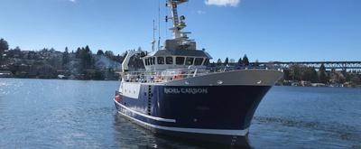
    This proposal addresses the need to engage STEM students in Navy-centric educational opportunities in order to develop pathways to the Department of the Navy’s current and future workforce. The geosciences, and oceanography in particular, have significant underrepresentation of women and minorities with regard to recruitment, retention, and promotion in academic and research positions. Undergraduate internships can be especially effective in directing students to pursue new career paths because the participants tend to be eager to learn, open to new opportunities, and uncertain of their direction. APL-UW’s extensive and wide-ranging research programs can provide stimulating and life-changing experiences that broaden education beyond the classroom and motivate students to pursue STEM careers with Navy relevance. Our approach will be to establish the DID-NOW (Developing an Inclusive and Diverse Naval Oceanographic Workforce) program, a comprehensive summer undergraduate fellowship program that will provide (1) project-based research experience, (2) mentoring and support outside the research activity, (3) community building and support opportunities through peer-to-peer relationships, and (4) tools and strategies to navigate the pathways to a Navy-relevant career. This broad-based strategy is intended to go beyond the research experience itself by providing supplemental perspectives and resources to participants. Recruitment will target racial and ethnic minority students and military-connected students through community and Navy partnerships. Weekly meetings will include guest speakers in Navy-related jobs, tours of APL-UW laboratories and facilities, and career counselors familiar with DON STEM pathways. The program will include community-building activities to enable the intern cohort to strengthen peer to peer relationships. All interns will be given the opportunity to participate in a one-day training cruise on the UW research vessel R/V Rachel Carson in Puget Sound.

    Jul 16 – Jul 19, 2024 · 3 d

    Puget Sound

  • Completed

    BATS 2024 - 6of12

    Nicholas R. Bates · BIOS

    Long-term observations over several decades are a powerful tool for investigating ocean physics, biology, and chemistry, and the response of the oceans to environmental change. The Bermuda Atlantic Time-Series Study, known as BATS, has been running continuously since 1988. The research goals of the BATS program are: (1) to improve our understanding of the time-varying components of the ocean carbon cycle and the cycles of related nutrient elements such as nitrogen, phosphorus, and silicon; and, (2) to identify the relevant physical, chemical and ecosystem properties responsible for this variability. In addition, the BATS program has strong and diverse broader impacts, contributing to the field of ocean sciences by providing high quality ocean observations and data for seagoing scientists and modelers, and a framework through which researchers can conceive and test hypotheses. This award will support the operations of the BATS program for five more years. The primary BATS research themes are as follows: (1) Quantify the role of ocean-atmosphere coupling and climate variability on air-sea exchange of CO2, and carbon export to the ocean interior; (2) Document trends and the controls on the interannual to decadal scale variability in carbon and nutrient cycles to their coupling in the surface and deep ocean via the Redfield Ratio paradigm; (3) Quantify the response of planktonic community structure and function, and impact on biogeochemical cycles to variability in surface fluxes and dynamical processes; (4) Facilitate development, calibration and validation of next generation oceanographic sensors, tools and technologies; and, (5) Generate a dataset that can be utilized by empiricists, modelers and students. This research integrates ocean physics, chemistry and biology into a framework for understanding oceanic processes and ocean change in the North Atlantic subtropical gyre. The existing 29 years of BATS data provide robust constraints on seasonal and interannual variability, the response of the Sargasso Sea ecosystem to natural climate variability, and signal detection of potential ocean changes. This project would extend the BATS program through years 31-35 to address a series of ten interlinked questions through integrated research approaches and a multitude of collaborative efforts. In addition to the themes above, and embedded into the ten questions and approaches, the BATS team will focus on, for example, coupling of particle production and biogeochemistry; revisiting the complexities of the biological carbon pump; oxygen decline; and changes in the hydrography, physics, ocean carbon cycle and biogeochemistry of the Sargasso Sea. The highest quality data observation and collection will be maintained and used to address these questions. Importantly, a wide range of collaborations at the BATS site, spanning the physical and biogeochemical disciplines, will aid these broad goals. Strong links to community stakeholders, and close collaboration (including methods intercomparisons and personnel exchanges) with the Hawaii Ocean Time-series are proposed. This work will extend the research findings of the project into educational and training opportunities within and beyond the oceanographic community, including training and mentorship of both undergraduate and graduate students.

    Jul 16 – Jul 21, 2024 · 5 d

    Atlantic

    Sails with 2 other projects

  • Completed

    Hydro S - 2024 13of24

    Nicholas R. Bates · BIOS

    One of the longest open-ocean hydrographic stations in the world is maintained at the Hydrostation S site (formerly known as the Panulirus site) located ~25 km southeast of Bermuda in the North Atlantic Ocean. This program of repeat biweekly hydrographic observations began in 1954 (by Hank Stommel) and now, in its seventh decade, has proved to be the catalyst for numerous studies of ocean physics, biological processes and biogeochemistry. Hydrostation S continues to be recognized as one of the most important sustained ocean time–series. The renewal of the Hydrostation S program is proposed herein, extending this invaluable time–series of ocean hydrography to almost 70 years. The upper ocean warming trend has strengthened (about +1.4° C since the 1970's; ~+0.8°C in last decade) with significant salinification (+0.16). Deeper waters such as the Labrador Sea Water has cooled by a few tenths of a degree and freshened with a marked decadal oscillation. The signature of deoxygenation has been observed at Hydrostation S in the upper ocean (about 4 µmoles kg -1 decade -1 decrease in dissolved oxygen) as well as the oxygen minimum zone (~2.5 µmoles kg -1 decade -1 ). Hydrostation S also supports the longest global ocean CO 2 and acidification time-series (from 1983 to present) The major objective of the proposal is to continue Hydrostation S into the eighth decade with numerous questions related to warming and cooling, salinification and freshening, deoxygenation and insights on biogeochemical changes over time. This program constitutes frequent water column sampling of temperature, salinity, and dissolved oxygen (and indirectly, sampling of important ocean carbon time–series) of the North Atlantic subtropical gyre at the Hydrostation S site. Such work is complementary to other sustained observations such as the Bermuda Atlantic Time–series Study (BATS) and Ocean Flux Program (OFP). We propose to carry out a similar sampling format that has been followed for the past 68 years. As for the past ten years, we would continue to conduct two CTD profiles to better capture the deep–water variability while maintaining all the previous discrete depths. The first CTD cast will profile to full ocean depth (3,300–3,500 m) while the second CTD cast will profile to 500 m (to allow for instrumentation not rated for full ocean depth such as a PAR sensor). One indirect objective will be to continue to collaboratively evaluate a BIOS-based glider program with Hydrostation S data as critically important ground truthing data. The existing glider program has challenging issue, and the aim of this effort is to use robust and highly accurate Hydrostation S data to test the capability of emerging technologies over the next five to ten years.

    Jul 16 – Jul 21, 2024 · 5 d

    Atlantic

    Sails with 2 other projects

  • Completed

    HOT 4 2024

    angelicque white · UH

    Systematic long-term (greater than a few decades in length) time-series observations of aquatic and terrestrial environments have led to a more comprehensive understanding of the natural ecosystem variability and have enabled an assessment of human impacts on ecosystem dynamics. Because of their ability to store and transport large amounts of heat and to absorb carbon dioxide from the atmosphere, the world's oceans play a critical role in modulating environmental conditions for the sustained well-being of both land-based and marine organisms including humans. Despite their recognized scientific and societal importance, long-term records of key ocean processes are rare. In 1988, the Hawaii Ocean Time-series (HOT) program, near Hawaii was established. For over three decades, teams of scientists based at the University of Hawaii have made critical measurements of the 'state of our sea.' These long-term observations have established a baseline against which future states can be compared. The ship-based HOT program complements other diverse ocean observation programs including remote-sensing via satellites, moored buoys, profiling floats, and autonomous underwater vehicles. All HOT program data are publicly available and are frequently used by researchers and policy makers around the world.

    Jul 15 – Jul 21, 2024 · 6 d

    Station ALOHA (22.75N, 158W)

  • Completed

    Atlantis · WHOI

    Cleft Segment

    Charles Wheat · UAF

    A 14-day research expedition with an ROV or submersible is proposed for year 2 of this study. During the research expedition we will sample discharging fluids using gas-tight isobaric fluid samplers (Seewald et al., 2001) from eight previously sampled sites, each with multiple structures and some with focused and diffuse discharge, two new sites that were discovered in the 1984 and were active in 2016, and other possible sites related to topographic highs within the “Cleft”. One dive is required for each site to survey the site, locate active discharge, measure the temperature of active discharge, collect hydrothermal and “background” fluids, deploy continuous fluid samplers (OsmoSamplers) and temperature probes at four representative sites for week-long deployments, and deploy temperature probes for legacy opportunities.

    Jul 15 – Aug 2, 2024 · 18 d

    Cleft Segman--hydrothermal systems on the Cleft Segment of the Juan de Fuca Ridge

    Sails with 1 other project

  • Completed

    Atlantis · WHOI

    seeDOM

    Laura Lapham · UMCES

    In August 2023, we deployed 2 OsmoSampler milk crates in Astoria Canyon, offshore Astoria Oregon. The purpose of these instruments is to continuously collect porewater samples over time to measure for dissolved organic carbon (DOC). These instruments support one of the 4 questions we posed for the project: How does the flux of DOC to the water column vary over time? The instruments are intended to remain on the seafloor for one year. For this cruise in 2024, Jason will recover these instruments, and collect a few push cores and bottom water with niskin sampler.

    Jul 15 – Aug 2, 2024 · 18 d

    Cleft Segman--hydrothermal systems on the Cleft Segment of the Juan de Fuca Ridge

    Sails with 1 other project

  • Completed

    MAS-MBC 2024 Summer

    Greg Rouse · SIO

    We would like to introduce the students to oceanographic techniques: plankton net tow, mid-water and bottom trawling, soft sediment multi-corer, and Van Veen grab as well as whale and seabird observations and basic ship operations. Data from the sampling is generated by the students and used for an assessable biodiversity exercise. Specimens are also archived into the SIO Collections.

    Jul 13 – Jul 15, 2024 · 2 d

    San Diego Trough

  • Completed

    Pacific connectivity 2 of 2 2023

    Peter Marko · Hawaii

    Larval dispersal capacity and realized connectivity: integration of physical transport models, larval plasticity, and gene flow in the north central Pacific The central goal of this project is to understand rates and patterns of long-distance connectivity between the Hawaiian archipelago and other remote island chains of the tropical north central Pacific. Specifically, the investigators are integrating empirically-derived data on larval life histories, biophysical transport models, and population genetic inferences about gene flow to understand how patterns of dispersal and connectivity in marine systems are affected by the capacity of larvae of many species to prolong development and delay metamorphosis. They are measuring planktonic larval duration under environmentally relevant conditions to test the capacity of larvae to extend development in the dispersal pathways leading to and from the Hawaiian Islands. Results from these laboratory experiments, as well as water-column data gathered over the past two decades, will be used in larval transport models that incorporate estimates of temperature, food availability, and varying life-history traits. Population genomic data gathered from the same species in the field will assess the role of gene flow in shaping genomic structure between Hawai'i and other isolated archipelagos and islands in the region, identify larval dispersal pathways to and from Hawai'i, test contrasting historical models of gene flow, and estimate rates of larval dispersal in and out of Hawai'i.

    Jul 13 – Jul 31, 2024 · 18 d

    Wake Island

  • Completed

    MPL intership

    Drew Lucas · SIO

    This is intended as an educational experience for the MPL internship program in 2024. Sea-going activities will include CTD with water sampling, plankton net tows, collecting data from shipboard flow-through, ADCP, and MET systems. Science party may bring aboard optical systems and microscopes.

    Jul 11 – Jul 12, 2024 · 1 d

    Offshore of San Diego

  • Completed

    Pelican · LUMCON

    unleak

    Marshall Wayne Bowles · LUMCON

    Coastal marine sediments are thought to be a substantial source of methane to the overlying water, with the potential for escape through the shallow water column to the atmosphere. Such effluxes are reduced by the oxidation of methane by methanotrophic microorganisms in both aerobic and anaerobic conditions. In marine sediments the primary electron acceptors for methane oxidation are oxygen and sulfate, respectively. Much of the focus on methane oxidation has been on anaerobic methane oxidation due to the great abundance of sulfate in sea- and pore-water and the co-location of the electron acceptor (sulfate) and electron donor (methane). As a result, comparatively little attention has been given to situations wherein anaerobic methane oxidation is overwhelmed and 1) aerobic methane oxidation must account for significant methane oxidation and 2) methane escapes from sediment into the water column. We will address this topic through a combination of in situ flux and chemical gradient analysis, geochemistry, microbial rate analysis, and reactive transport modeling.

    Jul 9 – Jul 18, 2024 · 9 d

    Gulf of Mexico

    Sails with 2 other projects

  • Completed

    Pelican · LUMCON

    REU-OTO

    Jessica Fitzsimmons · TAMU

    The primary purpose of this research cruise is to train summer Research Experience for Undergraduate (REU) students in shipboard sampling methods of ocean observing. We bring ~11 undergraduate students to sea with us each cruise. We have been doing these cruises annually (barring pandemic) since 2016 and have used this time-series oceanographically to characterize the extent of hypoxia in the northern Gulf of Mexico (Texas-Louisiana Shelf). Other scientific interests on these cruises include tracking phytoplankton community composition across the study region, measuring contaminants in the water column and sediments, sampling for trace metal concentrations from surface waters, and in some years deploying ocean observing sensors systems (Acrobat, glider deployment). Some of the undergraduates use the data or samples from the cruise as a basis for their summer research projects during the REU program. We have a set of 14 stations that we sample each year, which are in the shape of a triangle from Galveston, TX to Flower Garden Banks National Marine Sanctuary on the shelf-break, to a site near Louisiana. REU students will be trained of field observation methods: CTD hydrocasts, water sampling, shipboard oxygen measurements, sediment grab sampling, and surface trace metal sampling (using a towed pump). There is also sometimes Acrobat deployments. We also make use of the shipboard seawater supply system to monitor phytoplankton composition (using a FlowCytobot plumbed to the ship's flow-through seawater), and we also collect some large carboys of surface water at select stations.

    Jul 9 – Jul 18, 2024 · 9 d

    Gulf of Mexico

    Sails with 2 other projects

  • Completed

    Pelican · LUMCON

    UGOS-TRW Array Launch Leg 2: 7/2024

    D R. Watts · URI

    Strong near-bottom currents have been observed in deep water approaching the northern Gulf of Mexico. They have characteristics like Topographic Rossby Waves (TRWs) and intensify particularly along Sigsbee Escarpment, where oil and gas (O&G) operations are impacted. The strong near-bottom currents are undetectable or difficult to detect from observations near the sea surface. We are funded to deploy an array of ten bottom-mounted CPIES and ADCP-PIES arranged within the incoming pathway for TRWs, and to demonstrate a method to retrieve the data adaptively when needed in near real time. From the propagation group speed of TRWs and the distance to the "moored TRW-antenna" back along the pathways of propagation of TRWs, we estimate that energetic packets of TRWs will take 10-14 days to reach the north-eastern Sigsbee Escarpment and an additional 10-17 days to the south-western Sigsbee Escarpment. This can potentially provide 10-20 days warning of approaching strong-current packets to O&G rigs along the Sigsbee Escarpment.

    Jul 9 – Jul 18, 2024 · 9 d

    Gulf of Mexico

    Sails with 2 other projects

  • Completed

    Blue Heron · UMN

    LGL biogeochemical cycling

    Dalton Hardisty · MSU

    By collecting piston cores from Lakes Superior, Huron, and Erie, we propose to reconstruct LGL biogeochemical evolution over the Holocene. These 3 lakes are targeted because they span a range of trophic and redox conditions, display 2 orders of magnitude of water residence time and have evidence for past changes. We specifically aim to assess the following: Research Questions: Q1. How has natural climate change impacted productivity and the availability of bio-essential TEs through the Holocene? Alongside classic C, N, and P approaches, our spearhead proxies for this task will be barium (Ba), nickel (Ni), and cadmium (Cd) systematics. Q2. How has natural climate change impacted LGL redox conditions through the Holocene? Our spearhead proxy for this task will be iron (Fe), molybdenum (Mo), uranium (U), vanadium (V) and other redox-sensitive TE systematics. Q3. Do intra and inter-lake heterogeneity of Q1-Q2 reflect larger regional environmental feedbacks? We will apply Hg isotopes to constrain TE sources (atmosphere, watersheds), lake clarity, and ice cover. Q4. What role do diagenesis and other local variations play in proxy dynamics at each site? We propose a control approach (2 sites/Lake) in order to recognize local versus broader variations. Broader Impacts: B1. Shared resources and synergies. The cores will be archived at the Continental Scientific Drilling core facility at the University of Minnesota for future research, included already identified synergies in Lake Huron. B2. Community Outreach. We will communicate our results within the framework of LGL natural history at already established and popular outreach events at MSU’s Science Museum, via Michigan Sea Grant, and at the Thunder Bay National Marine Sanctuary. B3. Student Education and Training. Graduate and undergraduate students from both MSU and CMU will be involved in all aspects of the proposed research, including the cruise and sampling party. B4. Policy. We will annually attend the International Association of Great Lakes Research and the summit meeting for the NOAA’s Center for Integrative Great Lakes Research to provide policy perspectives on modern hypoxia management based on our novel records of natural hypoxia.

    Jul 9 – Jul 22, 2024 · 13 d

    Great Lakes

  • Completed

    OSNAP West

    Leah McRaven · WHOI

    A US-led international effort, Overturning in the Subpolar North Atlantic Program (OSNAP), has provided a continuous record of the full-water column, trans-basin fluxes of heat, mass, and freshwater in the subpolar North Atlantic since 2014, in partnership with the UK, Netherlands, Canada and Germany. Results from the first four years of OSNAP observations have challenged the current understanding of overturning circulation in the subpolar North Atlantic. This grant provides funding for an additional four years of observations in order to deliver to the community a ten-year time series of the meridional overturning, heat and freshwater fluxes in the subpolar basin. Variations in these quantities have been invoked to explain changes in a wide range of physical, chemical and biological parameters in the North Atlantic, Nordic Seas, and Arctic Ocean. Thus, by quantifying Atlantic meridional overturning variability and understanding its drivers, OSNAP is providing a critical first step towards addressing societally-relevant, interdisciplinary questions concerning the melting of Greenland ice and Arctic sea-ice, heat content in the Arctic Ocean, climate of the Nordic Seas, and anthropogenic carbon storage. The researchers will actively engage the broader international communities through four workshops, each targeting a societally relevant theme: 1) ocean biogeochemistry and carbon sequestration; 2) overturning in ocean models; 3) Arctic cryosphere; and 4) Nordic Seas variability. Two new postdocs and one graduate student will be supported in this phase of OSNAP and will benefit from the diversity of methodologies and exposure to the large number of OSNAP international scientists. In addition, approximately 20 graduate students from different US and international institutions will receive field training through participation in OSNAP cruises through 2024.

    Jul 9 – Aug 13, 2024 · 35 d

    Labrador and Irminger Seas

  • Completed

    Sikuliaq · UAF

    EnzStab1

    Andrew Steen · UTK

    Microbes in deep subsurface marine sediments comprise one of the largest and most diverse ecosystems in the planet, rivaling those found in the global ocean and in soils. However, almost nothing is known about the factors that drive community assembly for these organisms. What adaptations allow such a broad range of microbial species to persist in an environment that is severely limited by energy availability? We hypothesize that organisms with more stable enzymes have a major competitive advantage in the deep subsurface. To test this hypothesis, we will perform geochemical measurements, extract DNA for metagenomes and 16S rRNA gene surveys, and perform extracellular enzyme assays on samples from surface and "deep" (up to 30 meters below seafloor) sediments from four sites in the Northern Gulf of Alaska: a fjord, a site within a delta on the continental shelf, a non-deltaic continental shelf site, and a site on the continental slope. These measurements will allow us to test the hypothesis that enzymes in subsurface sediments are more stable than those in surface sediments, and that enzyme stability is a major driver of community assembly in the subsurface.

    Jul 8 – Jul 22, 2024 · 14 d

    GULF OF ALASKA

    Sails with 1 other project

  • Completed

    Sikuliaq · UAF

    Gulf of Alaska benthic Fe-2024

    Allyson Tessin · Kent State

    The proposed research aims to investigate the benthic processes that control remobilization of iron from the seafloor in the northeastern Gulf of Alaska. Iron acts as the limiting nutrient to this region of the subarctic North Pacific and the continental margins have been identified as an important source of iron to fuel primary productivity within the region. However, despite evidence for the importance of continental iron sources, the spatially variability, benthic processes, and sensitivity of these processes to future oceanographic change are poorly constrained. Additionally, we will study the role that iron plays in organic carbon preservation within sediments. Sampling will target a transect of sites from a fjord to the rise, capturing a variety of water depths and sediment organic carbon contents. Post-expedition work will include a paired porewater and sediment geochemical methodology to constrain the active cycling of organic carbon and iron within the seafloor. This project will be completed in parallel with the work of Dr. Andrew Steen , whose group will be studying deep microbial life.

    Jul 8 – Jul 22, 2024 · 14 d

    GULF OF ALASKA

    Sails with 1 other project

  • Completed

    WOAC-2024-Summer

    Jan Newton · UW

    Oceans, estuaries and coastal habitats are changing quickly, driven by both natural processes and human activities. The Washington Ocean Acidification Center (WOAC) was established by the state legislature to advance research and monitoring of ocean acidification and its biological effects in Washington waters. One facet of that research is the WOAC cruises. We go out three times a year, April, July, and September, to monitor ocean acidification and its affect on biology. These cruises are part of a long term time Ocean Acidification time series.

    Jul 8 – Jul 13, 2024 · 4 d

    Puget Sound

  • Completed

    Endeavor · URI

    NESM 24

    Chad Smith · PSU

    New England Seamount Acoustics Experiment will study the impact of the Gulf Stream and complex bathymetry on acoustic propagation/

    Jul 8 – Jul 30, 2024 · 22 d

    Atlantis II Seamount

  • Completed

    TFO Seamounts Main Expr IOP

    Ying-Tsong (YT) Lin · SIO

    The research objectives of this project include investigating three-dimensional (3D) propagation, scattering and ambient sound of the acoustic field in the low to mid-frequency range around the Atlantis II Seamounts using an integrated network of sensors.

    Jul 7 – Jul 30, 2024 · 23 d

    Atlantics II Seamounts at 38.5N 63.15W

  • Completed

    Atlantis · WHOI

    Seafloor Strainmeter 2024

    Mark Zumberge · SIO

    Convective forces deep below Earth?s surface cause tectonic plates (continents and seafloor) to slowly move at many centimeters (several inches) each year. In places, the plate boundaries must slide past one another to accommodate this motion. Sometimes this occurs smoothly, but sometimes the plate edges are stuck together by friction and don't slide at all until enough stress builds to the point where the plates slip past each other suddenly in an earthquake. Over the past two decades, a different form of tectonic boundary slip has been studied in which built up stress is relaxed episodically, as in an earthquake, but at a much slower rate taking days, weeks, months, or even years to gradually slip. These events are called "slow slip events" or "slow earthquakes." Because the motions are gradual they do not generate seismic shaking (as normal earthquakes do), making them far less dangerous. However, slow slip events occurring near areas that are frictionally stuck may trigger large earthquakes, a phenomenon that requires further study. This study focuses on searching for slow slip events in the offshore, shallow part of the Cascadia subduction zone, which lies offshore the western United States stretching from northern California to north of the Canadian border. Here an oceanic tectonic plate is colliding with North America, producing very large destructive earthquakes and tsunamis every few hundred years. The lack of seismic shaking associated with slow slip events makes these events difficult to detect, especially offshore. On land they are evident in precise, continuous GPS records which show plate motions of several centimeters that start and stop over a few weeks. Such motions are much more difficult to observe on the seafloor because GPS signals do not penetrate sea water. Consequently alternative methods must be devised to detect offshore slow slip events. This research project will record very precisely the lengths of optical fibers stretched across the seafloor near the Oregon coast. If a slow slip event occurs in the region near the optical fibers, the associated optical length change will be recorded by a battery powered laser system at the end of each optical fiber. Studying such events offshore will help to build models of their influence on the timing and location of great earthquakes, and may lead to future advances in earthquake forecasting. The project supports the training of a student. Widespread deployments of GPS sensors in the past decade have helped identify Slow Slip Events (SSEs), especially near subduction zone faults in Cascadia, Costa Rica, Japan, and New Zealand. Understanding SSEs presents an opportunity to gain new insights into the mechanism governing locking and unlocking of subduction zone and other faults, and may be important in assessing the hazard levels presented from potential great earthquakes and tsunami. In particular, SSEs occurring at the downdip limit of the strongly locked zone may pose a risk of triggering large earthquake ruptures. It is therefore critical to search for SSEs occurring at the base of the locked zone, which in Cascadia (as in most subduction zones) lies offshore. In this study, two orthogonal optical fiber strainmeters will be installed on the seafloor above the Cascadia subduction zone to detect offshore SSEs. A recent study of the cumulative effect of SSEs in Cascadia using onshore GPS data indicates possible offshore slow slip at the base of the locked zone which is hypothesized to occur simultaneously with onshore SSEs. However, the detection of this slip using onshore GPS is very weak. Confirming the presence or absence of offshore slow slip in Cascadia is important for understanding the potential role of SSEs in influencing the timing and location of the next great earthquake. While GPS networks have sufficient sensitivity to map the location of SSEs onshore, they do not cover that portion of the crust under the oceans, nor are they able to distinguish the timing of sub-events because of the need for averaging over daily periods. In contrast, optical fiber strainmeters can be deployed offshore and have their best signal to noise ratio at shorter periods, complementing onshore GPS both in location and frequency band. Because SSEs evolve in complex patterns indicative of propagating stress fronts, it is important to resolve, both in scale and time, the deformation signals in order to understand more fully the evolution of the rupture plane. In conjunction with GPS, the availability of highly sensitive and stable strainmeters offshore will enable such characterizations. The measurements in this study will be timed with an expected onshore SSE to capture the hypothesized offshore slip, testing this model and others that address the extent of an offshore locked zone. In addition to the detection of SSEs, a number of other studies will become feasible following the deployment of this offshore strainmeter, including investigation of strain from traveling seismic waves and tidal observations for inferring local Earth structure. In addition, the work will advance the technology of optical fiber sensors and likely find applications in other disciplines

    Jul 5 – Jul 10, 2024 · 5 d

    Oregon Coast, Offshore and NW of Newport, Oregon
  • Completed

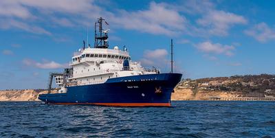
    Sally Ride · SIO

    GO-BGC

    Melissa Miller · SIO

    We propose to use the Sally Ride in ancillary mode for deployment of 2 biogeochemical (BGC) Argo profiling floats in the open ocean outside of the Galapagos EEZ during the SR2412 transit. The floats carry sensors for pH, oxygen, nitrate, chlorophyll, backscatter and irradiance, along with standard Argo temperature and salinity, and they profile every 10 days from the surface to 2000m. Data are fully public and available through the Argo data system.

    Jul 4 – Jul 15, 2024 · 11 d

    Galapagos

    Sails with 1 other project

  • Completed

    Savannah · SkIO

    SEFIS

    Nathan Bacheler · NOAA

    SEFIS is a fishery-independent research group that surveys reef fish using traps and video from Cape Hatteras, NC, to St. Lucie Inlet, FL, from 15-115 m deep.

    Jul 4 – Jul 13, 2024 · 9 d

    Southeast US Atlantic continental shelf between NC and the east coast of FL.

  • Completed

    STEMSEAS

    Christopher Hintz · SSU

    Experiential cruise for undergraduate students, particularly oriented for persons of color, non-traditional, and teaching-based higher education (CC and MSIs). Will conduct sampling of opportunity with available ship equipment (e.g., CTD casts; net tows; acoustic; flow through system sampling) during ship transit from San Francisco, CA to Honolulu HI.

    Jun 30 – Jul 9, 2024 · 9 d

    Western Pacific

  • Completed

    C-Streams-2024-Redeploy

    Lisa Beal · UMIAMI

    C-Streams addresses a key knowledge gap regarding how carbon uptake over the North Atlantic is controlled by ocean circulation. We are all aware that the Gulf Stream is important for heat supply to northern latitudes, but here we investigate how this current is crucial for setting carbon dioxide uptake from the atmosphere. Working with US partners, we will measure the strength and variability of Gulf Stream property transports in Florida Straits. We will measure the downstream evolution of Gulf Stream nutrient and carbon concentrations over 2000 miles using targeted observations by autonomous instruments, novel analyses and model simulations. We will determine how the Gulf Stream provides a far field control of North Atlantic carbon uptake, providing an alternative paradigm to the prevailing view of control by stratification. We will then assess whether climate models provide the right response of the North Atlantic carbon sink to climate change and for the right reasons. We will deploy 3 moorings with biogeochemical instrumentation at 27 N in the Florida Straits - the same latitude as the NOAA WBTS repeat stations and the new NSF FOCUS array - to continuously measure property transports of the Gulf Stream over a two-year period. In particular, these moorings will resolve the nitrate and low-carbon transports of the relatively fresh deep waters in the Straits that originate in the southern hemisphere. It is hypothesized that northward advection of these waters fuels uptake of anthropogenic carbon in the North Atlantic. We will deploy gliders and Argo floats to quantify mixing and entrainment of these waters along their northward path in the Gulf Stream

    Jun 29 – Jul 3, 2024 · 4 d

    Florida Straits

  • Completed

    Savannah · SkIO

    DolLAYER_3 (Sea Trial 2)

    Marc Frischer · UGA

    Organism aggregation, resource patchiness, and layering have long been recognized as fundamental ecosystem properties, especially in dynamic marine pelagic systems. However, integrating fine-scale (1-10 m) water column structure into our understanding of the forces that regulate marine ecosystems has proved challenging. Specifically, an overwhelming majority of marine organisms (plankton) experience their environment at fine spatial scales, which are difficult to sample, yet most measurements of chemical and biological parameters that define the structure of food webs and the flow of energy are averaged over much larger portions of the water column. This mismatch hinders our ability to understand the trophic consequences of fine-scale variability. Addressing this challenge will help to resolve key, and potentially predictable, sequences of events that change community structure and have trophic consequences that propagate throughout the food web in productive continental shelf environments.

    Jun 27 – Jun 28, 2024 · 1 d

    South Atlantic Bight middle shelf

  • Completed

    SLO-dynamics-1

    Tom Connolly · SJSU

    Small coastal embayments are ubiquitous features of coastal upwelling systems and play a disproportionately large role in local ecosystem dynamics. In these upwelling bays, persistent nearshore thermal fronts form downstream of coastal topographic features. Due to their small scales, these fronts are dominated by submesoscale dynamics and likely facilitate strong cross-shelf exchange. While these coastal fronts are frequently observed, there have been no targeted observational studies or systematic modeling studies that resolve submesoscale dynamics and turbulence processes that govern exchange across these fronts. Moreover, observational studies of submesoscale features have generally lagged behind numerical modeling efforts due to their small size and transient nature. Small upwelling bays offer a rare opportunity to study the dynamics of submesoscale fronts in the shallow coastal ocean because their formation is often predictably linked to coastal topographic features. This project is targeted in San Luis Obispo Bay in central California, a small embayment whose length scale is on the order of the local Rossby deformation radius, where previous research from our team has revealed the presence of a persistent and narrow front characterized by sharp temperature gradients, convergence downstream of the upwelling jet, and a strong impact on local hypoxia and harmful algal bloom development. This study integrates field observations and numerical modeling experiments to explore the links between submesoscale fronts, turbulent mixing, and bay-ocean exchange. Repeated observations of the persistent front across various dynamical regimes will allow for a broader understanding of the parameters that drive the evolution of the submesoscale front, overcoming traditional observational barriers of these ephemeral features.

    Jun 26 – Jul 8, 2024 · 12 d

    San Luis Obispo Bay, CA

  • Completed

    Blue Heron · UMN

    UMN cruise 2024

    Craig Hill · UMN-TC

    These cruises utilize funding provided by the University of Minnesota. Chief Scientists will be completing seed research cruises or using their ship time to take graduate and undergraduate students on the research vessel Blue Heron.

    Jun 25, 2024 · 1 d

    Western Lake Superior

NewerPage 26 of 55Older