VesselConnect
  • Completed

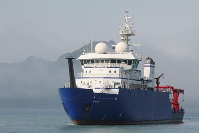
    Sally Ride · SIO

    West Coast SBP (Orange)

    Daniel Orange · UCSC

    This cruise is part of a multi-year effort to use the R/V “SALLY RIDE” to acquire SBP29 data over sites surveyed in 2021 and 2023, features we were not able to survey in 2021, and to return to and to acquire SBP29 data offshore Northern California and offshore Oregon to compare to other sub-bottom profilers. In 2024 we will concentrate on areas offshore Central California including MBARI ROV sites around Davidson Seamount (e.g.: “Octopus Garden”), the Monterey Submarine Canyon and Fan, a known cold seep location on “Smooth Ridge” in Monterey Bay, and the San Gregorio Fault. We will survey sites offshore northern California and Oregon including cold seep sites and Hydrate Ridge on the Cascadia Accretionary Complex, the “Humboldt Slide” and Table Bluff Anticline in the STRATAFORM study area, and the San Andreas Fault.

    Aug 16 – Sep 4, 2024 · 19 d

    Eel River shelf and Cascadia Margin

    Sails with 1 other project

  • Completed

    Sally Ride · SIO

    SBP-29 mapping

    Charles Holland · PDX

    The goal of this 3-year project is to develop and test methods of exploiting multibeam data (SBP-29) to measure quantitative seabed properties including sediment interval velocity, density and attenuation.The cruise goals are to collect multibeam data in regions of interest in order to test the theoretical/modeling approach. We will also collect independent data (e.g., seabed wide-angle reflection data) to verify the multibeam derived quantitative properties.

    Aug 16 – Sep 4, 2024 · 19 d

    Eel River shelf and Cascadia Margin

    Sails with 1 other project

  • Completed

    Blue Heron · UMN

    Methane Oxidation II

    John D. Kessler · Rochester

    The goal of this project is to first identify and then quantify the variables exerting the most influence on the kinetics of aerobic methane oxidation (MOx). This will be accomplished through systemic investigations of MOx in the laboratory and in the field (Great Lakes and US Atlantic Margin) and how it is influenced by changes in physical and chemical variables. While rates of MOx are measured relatively routinely by several research groups with this analytical expertise, the inter-laboratory comparability of results remains poor. This largely prohibits the integration and upscaling of these measurements for the regional and global quantification of the magnitude of this CH4 sink. Despite this considerable shortcoming, local studies have proven extremely valuable at displaying the variable potential for MOx to be a microbial biofilter with the ability to diminish oceanic emissions of this greenhouse gas to the atmosphere. The results of the investigations proposed here will lead to a fundamental understanding of the dominant physical and chemical controls on MOx kinetics, enabling protocols to be developed for greater inter-laboratory comparability of future measurements of MOx. In addition, the fundamental understanding uncovered here will aid in the regional and global extrapolation of MOx rates so that the influences exerted on seawater chemistry and atmospheric greenhouse gas budgets can be more precisely constrained.

    Aug 16 – Aug 25, 2024 · 9 d

    Lake Erie and Lake Ontario. In US waters.

  • Completed

    CSP 2024

    Mark Merrifield · SIO

    We request one day of ship time on the R/V Sproul to provide student instruction at sea for students in the Masters of Advanced Studies Climate Science and Policy (MAS CSP) Program. CSP seeks to train the next generation of leaders in climate change mitigation and adaptation. The one-year program provides a comprehensive overview of the scientific basis for climate change, including a detailed description of the ocean's role in the climate system. A one-day cruise in April/May 2024 would provide an invaluable opportunity to learn firsthand how oceanographic measurements are made, and to connect concepts learned in the classroom with the fieldwork that drives scientific advances. A cruise is proposed in local waters to demonstrate how hydrographic measurements are made. The CTD casts will include a PAR, fluorometer, and O2 sensor. Trawls will be conducted using a small-mesh plankton net for phytoplankton and other protists, a large-mesh net for zooplankton, and an otter trawl for an assortment of organisms. Participants will include 13 CSP students, 2 SIO PhD students, and 3 members of the MAS CSP Leadership Team.

    Aug 13 – Aug 14, 2024 · 1 d

    San Diego

  • Completed

    BATS 2024 - 7of12

    Nicholas R. Bates · BIOS

    Long-term observations over several decades are a powerful tool for investigating ocean physics, biology, and chemistry, and the response of the oceans to environmental change. The Bermuda Atlantic Time-Series Study, known as BATS, has been running continuously since 1988. The research goals of the BATS program are: (1) to improve our understanding of the time-varying components of the ocean carbon cycle and the cycles of related nutrient elements such as nitrogen, phosphorus, and silicon; and, (2) to identify the relevant physical, chemical and ecosystem properties responsible for this variability. In addition, the BATS program has strong and diverse broader impacts, contributing to the field of ocean sciences by providing high quality ocean observations and data for seagoing scientists and modelers, and a framework through which researchers can conceive and test hypotheses. This award will support the operations of the BATS program for five more years. The primary BATS research themes are as follows: (1) Quantify the role of ocean-atmosphere coupling and climate variability on air-sea exchange of CO2, and carbon export to the ocean interior; (2) Document trends and the controls on the interannual to decadal scale variability in carbon and nutrient cycles to their coupling in the surface and deep ocean via the Redfield Ratio paradigm; (3) Quantify the response of planktonic community structure and function, and impact on biogeochemical cycles to variability in surface fluxes and dynamical processes; (4) Facilitate development, calibration and validation of next generation oceanographic sensors, tools and technologies; and, (5) Generate a dataset that can be utilized by empiricists, modelers and students. This research integrates ocean physics, chemistry and biology into a framework for understanding oceanic processes and ocean change in the North Atlantic subtropical gyre. The existing 29 years of BATS data provide robust constraints on seasonal and interannual variability, the response of the Sargasso Sea ecosystem to natural climate variability, and signal detection of potential ocean changes. This project would extend the BATS program through years 31-35 to address a series of ten interlinked questions through integrated research approaches and a multitude of collaborative efforts. In addition to the themes above, and embedded into the ten questions and approaches, the BATS team will focus on, for example, coupling of particle production and biogeochemistry; revisiting the complexities of the biological carbon pump; oxygen decline; and changes in the hydrography, physics, ocean carbon cycle and biogeochemistry of the Sargasso Sea. The highest quality data observation and collection will be maintained and used to address these questions. Importantly, a wide range of collaborations at the BATS site, spanning the physical and biogeochemical disciplines, will aid these broad goals. Strong links to community stakeholders, and close collaboration (including methods intercomparisons and personnel exchanges) with the Hawaii Ocean Time-series are proposed. This work will extend the research findings of the project into educational and training opportunities within and beyond the oceanographic community, including training and mentorship of both undergraduate and graduate students.

    Aug 12 – Aug 23, 2024 · 11 d

    Atlantic

    Sails with 1 other project

  • Completed

    Hydro S - 2024 15of24

    Nicholas R. Bates · BIOS

    One of the longest open-ocean hydrographic stations in the world is maintained at the Hydrostation S site (formerly known as the Panulirus site) located ~25 km southeast of Bermuda in the North Atlantic Ocean. This program of repeat biweekly hydrographic observations began in 1954 (by Hank Stommel) and now, in its seventh decade, has proved to be the catalyst for numerous studies of ocean physics, biological processes and biogeochemistry. Hydrostation S continues to be recognized as one of the most important sustained ocean time–series. The renewal of the Hydrostation S program is proposed herein, extending this invaluable time–series of ocean hydrography to almost 70 years. The upper ocean warming trend has strengthened (about +1.4° C since the 1970's; ~+0.8°C in last decade) with significant salinification (+0.16). Deeper waters such as the Labrador Sea Water has cooled by a few tenths of a degree and freshened with a marked decadal oscillation. The signature of deoxygenation has been observed at Hydrostation S in the upper ocean (about 4 µmoles kg -1 decade -1 decrease in dissolved oxygen) as well as the oxygen minimum zone (~2.5 µmoles kg -1 decade -1 ). Hydrostation S also supports the longest global ocean CO 2 and acidification time-series (from 1983 to present) The major objective of the proposal is to continue Hydrostation S into the eighth decade with numerous questions related to warming and cooling, salinification and freshening, deoxygenation and insights on biogeochemical changes over time. This program constitutes frequent water column sampling of temperature, salinity, and dissolved oxygen (and indirectly, sampling of important ocean carbon time–series) of the North Atlantic subtropical gyre at the Hydrostation S site. Such work is complementary to other sustained observations such as the Bermuda Atlantic Time–series Study (BATS) and Ocean Flux Program (OFP). We propose to carry out a similar sampling format that has been followed for the past 68 years. As for the past ten years, we would continue to conduct two CTD profiles to better capture the deep–water variability while maintaining all the previous discrete depths. The first CTD cast will profile to full ocean depth (3,300–3,500 m) while the second CTD cast will profile to 500 m (to allow for instrumentation not rated for full ocean depth such as a PAR sensor). One indirect objective will be to continue to collaboratively evaluate a BIOS-based glider program with Hydrostation S data as critically important ground truthing data. The existing glider program has challenging issue, and the aim of this effort is to use robust and highly accurate Hydrostation S data to test the capability of emerging technologies over the next five to ten years.

    Aug 12 – Aug 23, 2024 · 11 d

    Atlantic

    Sails with 1 other project

  • Completed

    Surfactant OM

    Andrew Wozniak · UDel

    The air-sea interface mediates the exchange of materials between the atmosphere and ocean thereby profoundly impacting ocean-atmosphere biogeochemical cycles and global climate. Surfactant organic matter accumulates at this interface, in the surface microlayer (SML), influencing both the chemistry of materials available for exchange and the physical environment (e.g., surface tension, turbulence) for gas and particle transfers between air and sea. Biological and photochemical production and degradation processes represent surfactant sources and sinks, but the relative importance of those processes for determining surfactant quantities and molecular composition remains unclear. Similarly, the exact relationships between surfactant molecular classes and SML surface tension have not been established. As a result, the spatiotemporal variability of SML properties cannot currently be predicted. This project addresses these knowledge gaps through a logical set of field collections and lab experiments paired with high resolution chemical, biological, and physical analyses. SML and subsurface waters will be collected from estuarine, coastal ocean, and open ocean sites during high and low productivity conditions to establish surfactant molecular characteristics over a range of space, time, and ocean biological activity. The effects of irradiation will be assessed via diurnal sampling efforts and laboratory photochemical irradiations. Samples will be analyzed for their chemical (via colorimetry and UV-vis spectroscopy; Fourier transform ion cyclotron resonance mass spectrometry; high resolution liquid chromatograph mass spectrometry), biological (via next-generation DNA sequencing), and physical (via dynamic and equilibrium surface tension) characteristics.

    Aug 11 – Aug 21, 2024 · 9 d

    Offshore of Delaware Bay at 1 coastal and 2 offshore sites.

  • Completed

    DWS 1 2024

    Jeff Book · NRL

    Deep water instrument tests and experiments.

    Aug 10 – Aug 13, 2024 · 3 d

    abyssal plain at depths > 4000 m

  • Completed

    Atlantis · WHOI

    Axial Acoustic Array

    William Wilcock · UW

    Axial Volcano is one of the most extensively studied sites on the global network of mid-ocean ridges. Three eruptions have been observed in 1998, 2011 and 2015 with a near continuous 20-year record of vertical geodesy from bottom pressure sensors in the caldera recording cycles of inflation and rapid syn-eruptive deflation. Axial volcano has also been the focus of several seismic imaging studies including a recent three-dimensional seismic reflection experiment that provide a remarkably detailed view of the magmatic system. In comparison, the geodetic models of inflation are limited in complexity and resolution by the small number of geodetic sites and the difficulty distinguishing distributed inflation from fault motion on the buried outward dipping ring faults using vertical geodesy alone. Here we propose to install a 10-year 4 station acoustic network at Axial that range between each pair of transponders and include a pressure gauge, temperature, salinity and velocimetry sensors. One station will be connected to the OOI Regional Cabled Array enabling real time acquisition of data. The primary scientific objective is to measure horizontal extension rates across and within the caldera that can be combined with the other geodetic observations to (1) discriminate between distributed inflation and motion on the buried outward dipping faults beneath the east and west caldera walls and thus, understand the pattern of seismic coupling on these faults throughout the eruptive cycle; (2) contribute data that can enable more complex models of inflation and (3) obtain measurement of the dike with for dikes that propagate across the acoustic baseline. A secondary objective is to provide an acoustic network that can support future efforts to demonstrate and optimize remote communication and navigation of autonomous underwater vehicles. _____ The A-0-A method is a relatively new approach to calibrating pressure sensors to remove drift. Periodically, a valve is used to switch the pressure sensor for a short interval from measuring the pressure in the ocean to measuring the pressure inside the instrument housing. The drift can then be determined by comparing the pressure readings to an accurate barometer. The A-0-A method has the potential to substantially reduce the drift of long-term seafloor pressure records in a much more economical way than current approaches. The first non-proprietary seafloor tests at 900 m in Monterey Bay on the MARS cabled observatory suggests that A-0-A calibrations may reduce pressure sensor drift to as little as 1-2 mm/year in 1000 m of water. However, design improvements are required to remove known sources of error and a side-by-side seafloor test is essential to verify the technique against established methods of drift removal. The deployment of a redesigned instrument on Axial Seamount will allow comparisons with the absolute pressure measurements of the Scripps Institution of Oceanography Self-Calibrating Pressure Recorder (an instrument that uses a dead weight tester for periodic calibrations), the Sonardyne AZA calibrated pressure recorder on a cabled FETCH unit and the relative pressure measurements obtained from repeat closed-loop mobile pressure recorder surveys, all of which have an uncertainty of ~1 cm of water. The cabled sensor can then be used for future vertical geodetic studies elsewhere, such as those in subduction zones aimed at understanding patterns of fault locking, creep and slow slip.

    Aug 8 – Sep 8, 2024 · 31 d

    Oregon Margin out to the Juan de Fuca Ridge at Axial Seamount

    Sails with 5 other projects

  • Completed

    Atlantis · WHOI

    CAREER Vent Micro 2024

    Rika Anderson · Carleton

    Characterization of microbial and viral evolutionary dynamics in diffuse flow hydrothermal vent fluids at Axial Seamount. This work will consist of two ancillary science days for three years in a row as part of the Ocean Observatories Initiative (OOI) cruises that are scheduled annually to Axial Seamount on the Juan de Fuca Ridge off the coast of Oregon and Washington for maintenance of the cabled array. During these ancillary science days, a fluid sampler will be mounted on an ROV/HOV to collect filters and whole water from diffuse fluids at hydrothermal vents. Ideally, hydrothermal fluids will be collected from vents at the International District in Axial Seamount. These fluids will be preserved for cell counts, viral counts, and metagenomic analysis.

    Aug 8 – Sep 8, 2024 · 31 d

    Oregon Margin out to the Juan de Fuca Ridge at Axial Seamount

    Sails with 5 other projects

  • Completed

    Atlantis · WHOI

    Ancillary-OOI-RCA-2024 (Multi-Scale Geodesy-4of8)

    Bill Chadwick · OSU

    Axial Seamount is the most active submarine volcano in the NE Pacific, having erupted in 1998, 2011, and 2015. Because of this, it is an ideal natural laboratory for the long-term study of active processes at a submarine volcano, with periodic perturbations to hydrothermal systems and chemosynthetic biological communities. Long-term monitoring at Axial has built a remarkable time-series of bottom pressure measurements and repeated bathymetric mapping with Autonomous Underwater Vehicles (AUVs) that have documented a cycle of inflation and deflation of ±2-4 meters that has been used to forecast eruptions with increasing accuracy. Since the 2015, Axial has reinflated to >90% of its pre-eruption threshold, but over this same time period the rate of inflation has slowed by an order of magnitude. Consequently, the next eruption is still likely several years away. This project aims to continue this monitoring effort for another 5 years, while improving the techniques, survey designs, and data analysis on several fronts in order to provide improved constraints for modeling the surface deformation to better understand the magma supply and storage system at the volcano. For this project, we request support for field work with ROV Jason and AUV Sentry at Axial Seamount in 2024, 2026, and 2028. Specifically, we propose to: (1) continue the deformation surveys every other year, including both pressure measurements and AUV bathymetric re-surveys over the next 5 years, (2) modify the ROV-based pressure surveys to become more time-efficient by changing reference sites so that we can add more benchmarks in the caldera to better constrain deformation models, (3) add benchmark sites to constrain slip across the caldera faults to increase our understanding of the relationship between deformation and seismicity, and (4) continue OOI Regional Cabled Array (RCA) seafloor-CTD turn-arounds so that salinity sensors will be in place in the caldera during the next eruption to test a hypothesis about co-eruption brine release. These multi-scale monitoring efforts at Axial Seamount will be leveraged by NSF’s infrastructure investment in the OOI-RCA, which provides real-time monitoring data that greatly enhances these efforts. The results from this study will also help to increase our understanding of the shallow magma supply and storage systems at active basaltic volcanoes, the processes that lead to and trigger eruptions, and the pathways that magma takes to the surface during eruptions. This work at Axial Seamount is aimed at helping us better understand eruption processes at volcanoes on land that are more hazardous to people and property.

    Aug 8 – Sep 8, 2024 · 31 d

    Oregon Margin out to the Juan de Fuca Ridge at Axial Seamount

    Sails with 5 other projects

  • Completed

    Atlantis · WHOI

    OBS_Rescue

    John Collins · UNOLS

    Goal is to use Jason to recover an OBSIC (Ocean Bottom Seismometer Instrument Center) OBS (Ocean Bottom Seismograph) deployed at Axial Seamount that OBSIC was unable to recover via acoustics on Cruise SR-2318 in August 2023. The OBS was part of a 15 station array that OBSIC deployed at Axial Seamount for William Wilcock in September 2022. Wilcock's experiment consists of back-to-back, one-year deployments, and on the recovery/re-deployment cruise on Sally Ride in August/September 2023, we failed to recover one OBS. The OBS is located just outside the south-eastern end of Axial caldera. The OBS responded to acoustic commands but did not release. The OBS was successfully surveyed after deployment in 2022, so we know its location to ~10 m. The OBS has primary lithium batteries in each of two pressure housings, and these represent a potential hazard. However, given that the acoustics are working, and that the acoustic release board is located in the battery pressure case, it seems unlikely that the battery housing has flooded. We don’t know anything about the condition of the pressure housing holding the data-logger and a small battery pack, but a flooded housing is only one of many possible failure mechanisms. Again, a visual inspection of the end-cap on this housing prior to a recovery attempt might be diagnostic. We do have on-deck procedures for dealing with a leaking pressure housing. The OBS has syntactic foam floatation, i.e. no glass balls that might represent a hazard to Jason.

    Aug 8 – Sep 8, 2024 · 31 d

    Oregon Margin out to the Juan de Fuca Ridge at Axial Seamount

    Sails with 5 other projects

  • Completed

    Atlantis · WHOI

    OOI-RCA 2024

    Deborah Kelley · UW

    This cruise is in support of the National Science Foundations Ocean Observatories Initiative Regional Cabled Array (RCA) annual operations and maintenance cruise and will require an ROV (either ROPOS or Jason ). It is anticipated that over 100 instruments will be turned (recovered with refurbished instruments reinstalled). Operations will visit all of the RCA sites located west of Newport along the Cascadia Margin (80 m - 2900 m water depth) and ~300 miles off shore at Axial Seamount (~ 2600 m to 1500 m water depth). It is likely that at least one Deep Profiler (DP) mooring will be turned and or a Shallow Profiler Mooring. In addition, 6 science pods on the three 2-legged Shallow Profiler moorings at the Slope Base, Axial Base, and the Oregon Offshore sites will be turned. A medium lift winch will be required for turning of the DP mooring, and both a medium and heavy lift winch if a Shallow Profiler Mooring is turned. The field program will also turn multiple secondary junction boxes (maximum weight ~ 3200 lbs). The cruise will be hosted on the interactiveoceans website with live streaming of deck and ROV operations and will include the undergraduate students that participate in the UW at-sea experiential learning program VISIONS (VISIONS'24). Similar to past cruises, additional NSF and ONR-funded days will be added onto the RCA field program through PI ship requests. Three to five legs will be required with 2-3 days in port between legs (Newport, OR).

    Aug 8 – Sep 8, 2024 · 31 d

    Oregon Margin out to the Juan de Fuca Ridge at Axial Seamount

    Sails with 5 other projects

  • Completed

    Atlantis · WHOI

    seepDOC

    Laura Lapham · UMCES

    Dissolved organic carbon (DOC) is a key component of the ocean’s food web and carbon cycle, and carbon exchanged between oceanic DOC and the atmosphere has influenced atmospheric CO 2 levels on timescales ranging from recent decades to the geologic past. Production by marine algae in the surface ocean is the largest source of DOC and its effects on the ocean carbon cycle are widely appreciated. However, the magnitude of external sources such as rivers, hydrothermal vents, and methane seeps and their impact on ocean ecology and chemistry are not well understood. Each source differs in terms of its biological utilization and age, which affects the storage and distribution of this material among the ocean basins. Methane seeps located along continental margins are particularly significant because they may transfer globally significant quantities of carbon stored below the seafloor as natural gas and gas hydrate to the oceans. This project will investigate the production, flux, composition and potential for biological utilization of DOC at Hydrate Ridge, located offshore Oregon. Hydrate Ridge is a prominent methane seep with massive accumulations of gas hydrate and a node of the Ocean Observatories Initiative cabled array on the Juan De Fuca plate. We will sample and chemically characterize methane, DOC and other materials to provide information about where the materials originated (deep vs shallow), how they have been chemically altered and to what extent they may feed deep ocean biota or contribute to the long term storage of DOC in the ocean. Experiments and analysis will be conducted using sediment cores and bottom water samples collected using either the remotely operated vehicle Jason or the human occupied vehicle Alvin during a 7-day ocean expedition. Additionally, we will place osmotically-driven pumps on the seafloor to continuously sample fluids for approximately one year, thereby allowing us to monitor the flux of methane and DOC expelled from the seafloor and constrain processes that regulate the release of carbon to the oceans at methane seeps. This award will support one graduate student and several undergraduates from a community college in Maryland and a college located in a lower-income urban center in southeastern Massachusetts. We will disseminate project findings to the public with a series of videos for public TV.

    Aug 8 – Sep 8, 2024 · 31 d

    Oregon Margin out to the Juan de Fuca Ridge at Axial Seamount

    Sails with 5 other projects

  • Completed

    MATE Floats

    Sasha Seroy · UW

    This is a student training cruise to expose technical community college students to oceanography and ocean instrumentation. The one-day cruise is part of a week-long workshop hosted at UW where community college students will learn about basic oceanography, sensors, instrumentation and data analysis. The goal of the cruise is to give these students hands on experience on a research vessel working with various tools and sampling protocols on board. Students will conduct a CTD cast, collect water samples to run chlorophyll and oxygen on board, collect plankton, and complete a sediment grab. After the cruise, students will work on data analysis as a part of the workshop.

    Aug 8 – Aug 9, 2024 · 1 d

    Seattle

  • Completed

    TFO Seamounts: ocean physics

    Matthew Alford · SIO

    Our program will measure physical oceanographic and acoustic quantities near the Atlantis II seamounts in order to better understand i) mixed-layer dynamics; ii) turbulence and vertical motions due to tidal and mean flows past the seamounts and iii) ambient noise and acoustic propagation. We will measure the oceanographic quantities from the ship with our Fast CTD and epsilometer winched profilers, and by deploying several profiling moorings. Dr. Hodgkiss will simultaneously deploy his acoustic source and billboard receive array.

    Aug 8 – Sep 5, 2024 · 28 d

    North Atlantic

  • Completed

    Mid-Pac and Hess

    Kevin Konrad · OSU

    Earth’s surface is composed of numerous rigid ‘plates’ that move with the flow of a highly viscous interior mantle. Individual plate movements can be determined if their past motions are compared to a fixed source on Earth, such as so-called “mantle hotspots”. These hotspots are generated by mantle plumes, large thermo-chemical uprisings of material that originate on or near the core-mantle boundary. These upwellings of hot material can produce volcanism on Earth’s surface that remains relatively stationary while plates move over them, generating chains of compositionally distinct volcanoes that are progressively older the further they are from the hotspot. This work, through tracing ages, compositions, and morphologies of several poorly-documented volcanic chains, seeks to better understand the timing and drivers of global scale plate reorganization events that took place in the Mid-Cretaceous (120-80 Ma). The target locations include the Liliuokalani Ridge, Hess Rise and Mid-Pacific Mountains in the Central Pacific region. The team will be able to test whether the features were built by mantle plumes that are currently underlying the Northern French Polynesia region. The combined age and chemistry results will then be used to constrain the timing of a major plate reorganization event at ca. 100 Ma. This project supports three early-career scientists, two PhD, and one MSc student. In addition, the seagoing expedition will include eight undergraduate research participants from the minority serving institutions of University of Nevada, Las Vegas and California State University, Long Beach. The project involves a 31-day seagoing expedition to dredge seamounts, ridges and rises within and near Hess Rise and the Mid-Pacific Mountains. In addition, the team will analyze basalts recovered on NOAA-Ocean Exploration and Research expeditions from Karin Ridge and samples from an upcoming E/V Nautilus expedition to the Liliuokalani Seamounts. Onshore work will include obtaining 40 Ar/ 39 Ar age determinations and geochemical tracers (major and trace elements; Sr-Nd-Pb-Hf isotopes) from representative lava flows. These new samples and comprehensive datasets will allow for the testing of the following hypotheses: H1) The Liliuokalani Seamounts and Hess Rise were formed by the Marquesas Mantle Plume. H2) The Pitcairn Mantle Plume is the primary source of the Karin Ridge and Mid-Pacific Mountains. H3) The Mid-Pacific Mountains record the timing and orientation of Cretaceous plate motion changes. H4) The structure of the Mid-Pacific Mountains and Hess Rise are controlled by plume – (distal) ridge interaction through the generation of asthenospheric melt channels. Testing these hypotheses will lead to an improved understanding of mantle plume dynamics and ‘bottom-up’ controls on oceanic geomorphology and large igneous province construction. Furthermore, mapping the long-lived expressions of mantle plumes allows for unparalleled insight into the mantle source reservoirs that feed hotspot volcanism. The combination of geo-chronology, chemistry and morphology will allow for a significantly improved Pacific absolute plate motion model during the Cretaceous Normal Superchron (122-83 Ma).

    Aug 7 – Sep 6, 2024 · 30 d

    Hess and MPM

  • Completed

    Blue Heron · UMN

    Microplastics in Lake Superior '24

    Richard Ricketts · UMN

    Sediment trap and McLane pumping work for microplastics

    Aug 6 – Aug 8, 2024 · 2 d

    Western Lake Superior

  • Completed

    Sikuliaq · UAF

    DBO-EcoFOCI 2024

    Jacqueline Grebmeier · UMCES

    The two-fold mission of the DBO-EcoFOCI 2024 cruise and planned 2025-2027 research cruises on the RV Sikuliaq are to: 1) occupy the Distributed Biological Observatory (DBO) standard stations for the purpose of hydrographic CTD/rosette sampling, vertical zooplankton net tows, and benthic and sediment sampling using Van Veen grabs, Haps benthic corer, and beam trawl, and 2) turn around a suite of NOAA moorings and the Chukchi Ecosystem Observatory (CEO) mooring in the Chukchi and northern Bering Seas. These cruises are a partnership of the DBO with NOAA’s Ecosystems and Fisheries Oceanography (EcoFOCI) program, Arctic Marine Biodiversity Observation Network (AMBON), and the Chukchi Ecosystem Observatory (CEO) to achieve objectives of all participating programs. The Alaska Ocean Observing System (AOOS), North Pacific Research Board (NPRB) and AMBON through the National Ocean Partnership Program (NOPP) all contribute to the CEO mooring operations near DBO4, with the NPRB supporting a sediment trap mooring at the M8 NOAA mooring cluster near DBO1 in the northern Bering Sea. AMBON supports eDNA collections at DBO stations and epibenthic trawling as well as cross-data evaluation through the NOAA Arctic Research Program water column and benthic DBO data collections. The Alaska Harmful Algal Bloom (HAB) network (NOAA and NSF funding) supports water column and sediment studies. EcoFOCI and the NOAA Marine Mammal Lab maintain a large number of mooring sites across the Bering and Chukchi seas, some of which were serviced during this cruise. The US Fish &Wildlife Service normally provide a seabird observer for the cruise and we recruit a marine mammal observer, such as from UW in 2023.

    Aug 6 – Aug 27, 2024 · 22 d

    Northern Bering and Chukchi Seas

  • Completed

    IMPULSE

    Stephen Jones · Birmingham

    The mantle is the largest component of the Earth, comprising 84% of our planet's volume. Although the mantle is solid, over geological time it churns vigorously like a fluid in a process known as mantle convection, driven by heating from radioactive decay in Earth's interior and cooling from above. Mantle convection deforms the Earth's entire surface into an interlocking pattern of swells and depressions known as "dynamic topography", with diameters of several thousand km and heights of several km. Dynamic topography influences oceanic current patterns, land surface erosion and accumulation of the eroded sediment, and these effects are known to control the distribution of valuable natural mineral resources. Volcanic activity also usually occurs in association with the hot, rising elements of the convective circulation, known as mantle plumes. The most vigorous mantle plumes give rise to Large Igneous Provinces (LIPs) - episodic huge outpourings of lava accompanied by voluminous release of greenhouse gases to the atmosphere. LIPs coincide in time with some of the most remarkable perturbations to global climate, ecosystems and the carbon cycle in Earth's history, including mass extinctions, Ocean Anoxic Events, and the largest natural global warming event of Cenozoic time. Whilst it is widely accepted that mantle convection has influenced Earth's surface and climate processes over geological time periods (tens of millions of years or more), these time frames are too slow to explain the rapid onset and short duration of the environmental changes that usually coincide with LIPs. But growing evidence now suggests that patterns of mantle convection, dynamic topography and igneous outpouring can evolve in less than a million years. Key to this theory is a process known as "Thermal Plume Pulsing", in which hotter and cooler blobs of mantle are carried along with the convective circulation within a mantle plume. The hottest pulses within the biggest mantle plumes, such as the Icelandic Mantle Plume, can rise at speeds in excess of 200 mm/yr, which is faster than the motion of tectonic plates, and can cause changes in local sea-level of over 1 mm/yr, similar to modern mean global sea-level change. At such speeds, past pulsing of the Icelandic Mantle Plume could have activated greenhouse gas generation from the North Atlantic LIP rapidly enough to explain the Paleocene-Eocene Thermal Maximum extreme global climate change event, the best natural analogue to anthropogenic climate change. However, the Plume Pulsing hypothesis is not universally accepted for Iceland or Earth's other major mantle plumes as key data is lacking. High-quality measurements of seafloor features near Iceland known as the "V-Shaped Ridges" (VSRs) that comprise the world's best record of the suggested hot pulses will address this gap. Working with the lead advocates of the alternative models for VSRs, we have devised an experiment to determine the origin of the VSRs by measuring both the thickness and the chemical composition of the crust that builds the VSRs. High-quality geochemical surveys of the basaltic seafloor were made recently by dredge sampling and drilling (International Ocean Discovery Program Expedition 395). Now, IMPULSE will measure the variation in thickness and seismic velocity (hence bulk composition) of the entire crust beneath several VSRs for the first time. Joint modelling of the co-located seismic data and geochemical data will then allow the first definitive test of the Mantle Plume Pulsing hypothesis. Furthermore, by formally correcting for the complicating effect of mid-ocean ridge tectonic processes on VSR crustal thickness for the first time, our new VSR record will determine the shortest time period for fluctuations in mantle temperature. These results are crucial to test hypotheses for how mantle convection has influenced Earth's surface and climate proceses.

    Aug 4 – Sep 9, 2024 · 36 d

    North Atlantic, Reykjanes Ridge

  • Completed

    Pelican · LUMCON

    LISTEN GoMex

    Melissa Soldevilla · NOAA

    This project uses a network of underwater microphones to record marine mammals throughout U.S. and Mexican waters in the Gulf of Mexico and gather information on their location and density throughout the year. The data from this comprehensive and long-term passive acoustic monitoring program will be used to identify the conditions that could be driving seasonal, annual, and decadal trends in the abundance of marine mammals, where they are located, and how densely they aggregate when they are there. This project will complement existing vessel-based surveys and expand on prior passive acoustic monitoring in the region. This project uses a multifaceted sampling approach. One part consists of acoustic data collection at four historic long-term reference sites and four additional long-term reference sites in the northwestern and southern Gulf of Mexico to obtain long-term trends in marine mammal distribution over time. The second part consists of random acoustic sampling across a grid of 20 short-term sites to obtain additional location information. The third part uses acoustic tracking arrays for short durations at long-term sites to measure acoustic animal behavior. This third part collects the information necessary to convert acoustic detections into estimated densities of marine mammal species. The project team is engaging with federal and state agencies, non-governmental organizations, and private industry to make sure their findings are reaching the people who are making decisions that impact marine mammal management. This project is also coordinated with the Reduce Impacts of Anthropogenic Noise on Cetaceans project supported by the Deepwater Horizon Natural Resources Damage Assessment Trustees. This project will 1) characterize seasonal, annual, and decadal trends and variability in marine mammal species in the Gulf of Mexico, 2) determine whether the processes driving the apparent declining trends are due to animal movements or population declines, 3) quantify the relationships between marine mammal density and ocean conditions and evaluate the oceanographic processes driving short-term and long-term variability in marine mammal density, and 4) quantify the relationships between marine mammal density and ambient noise conditions and evaluate the role of human activities in driving short-term and long-term trends in marine mammal density.

    Aug 3 – Aug 24, 2024 · 21 d

    Gulf of Mexico

  • Completed

    IWS 4

    Jeff Book · NRL

    Conduct basic research on benthic microbial fuel cells.

    Aug 2, 2024 · 1 d

    San Diego shelf

  • Completed

    Blue Heron · UMN

    UMN cruise 2024

    Richard Ricketts · UMN

    These cruises utilize funding provided by the University of Minnesota. Chief Scientists will be completing seed research cruises or using their ship time to take graduate and undergraduate students on the research vessel Blue Heron.

    Jul 31, 2024 · 1 d

    Western Lake Superior

  • Completed

    Hydro S - 2024 14of24

    Nicholas R. Bates · BIOS

    One of the longest open-ocean hydrographic stations in the world is maintained at the Hydrostation S site (formerly known as the Panulirus site) located ~25 km southeast of Bermuda in the North Atlantic Ocean. This program of repeat biweekly hydrographic observations began in 1954 (by Hank Stommel) and now, in its seventh decade, has proved to be the catalyst for numerous studies of ocean physics, biological processes and biogeochemistry. Hydrostation S continues to be recognized as one of the most important sustained ocean time–series. The renewal of the Hydrostation S program is proposed herein, extending this invaluable time–series of ocean hydrography to almost 70 years. The upper ocean warming trend has strengthened (about +1.4° C since the 1970's; ~+0.8°C in last decade) with significant salinification (+0.16). Deeper waters such as the Labrador Sea Water has cooled by a few tenths of a degree and freshened with a marked decadal oscillation. The signature of deoxygenation has been observed at Hydrostation S in the upper ocean (about 4 µmoles kg -1 decade -1 decrease in dissolved oxygen) as well as the oxygen minimum zone (~2.5 µmoles kg -1 decade -1 ). Hydrostation S also supports the longest global ocean CO 2 and acidification time-series (from 1983 to present) The major objective of the proposal is to continue Hydrostation S into the eighth decade with numerous questions related to warming and cooling, salinification and freshening, deoxygenation and insights on biogeochemical changes over time. This program constitutes frequent water column sampling of temperature, salinity, and dissolved oxygen (and indirectly, sampling of important ocean carbon time–series) of the North Atlantic subtropical gyre at the Hydrostation S site. Such work is complementary to other sustained observations such as the Bermuda Atlantic Time–series Study (BATS) and Ocean Flux Program (OFP). We propose to carry out a similar sampling format that has been followed for the past 68 years. As for the past ten years, we would continue to conduct two CTD profiles to better capture the deep–water variability while maintaining all the previous discrete depths. The first CTD cast will profile to full ocean depth (3,300–3,500 m) while the second CTD cast will profile to 500 m (to allow for instrumentation not rated for full ocean depth such as a PAR sensor). One indirect objective will be to continue to collaboratively evaluate a BIOS-based glider program with Hydrostation S data as critically important ground truthing data. The existing glider program has challenging issue, and the aim of this effort is to use robust and highly accurate Hydrostation S data to test the capability of emerging technologies over the next five to ten years.

    Jul 31 – Aug 1, 2024 · 1 d

    Appxoimately 25 nm south east of the island of Bermuda

  • Completed

    Sikuliaq · UAF

    Transit Cruise

    Ethan Roth · UAF

    Jul 30 – Aug 5, 2024 · 5 d

  • Completed

    LMP-02

    Robert Morris · UW

    Bacteria and their viruses dominate the ocean and are important drivers of elemental cycles. Spatial and temporal differences observed in the abundances of bacteria and their viruses are the primary factor underlying hypotheses to explain the host-virus interactions that maintain these large and genetically diverse populations. Here we propose to identify additional factors that drive host-virus dynamics in the ocean by using metagenomics, cultivated systems, and models to predict conditions that activate latent phages. SAR11 are the most abundant heterotrophic bacteria in the ocean. We recently isolated the first known SAR11 cells with latent bacterial viruses (temperate phages) in their genomes (prophages). Our analyses indicate that similar phages are common in the global ocean and that they become active under carbon-limiting conditions. While this supports a growing body of evidence that temperate phages have essential roles in marine microbial ecology and biogeochemistry, it also underscores the need to identify additional variables governing host-virus relationships. This study seeks to identify specific chemical and physical parameters that activate latent phages in SAR11 cells, to elucidate the effects of these variables on the genetic networks that regulate inactive (lysogenic) and active (lytic) switching, and to model the outcomes of similar latent phages in diverse marine ecosystems. This project also represents a unique opportunity for training of a new principal investigator, a graduate student, and several underrepresented, under-privileged, and non-traditional undergraduate students from the GenOM Project at the University of Washington and the BIG Summer and PEERS programs at the University of California, Los Angeles. Oceanography is currently low-diversity and has significant barriers to entry for underrepresented students. Empowering undergraduate student collaborations and providing hands-on experience has great potential to enhance diversity in the coming years. The outreach activity we propose will introduce under-represented and non-traditional undergraduate students from both institutions to seagoing research. The educational component will also give students with computational and laboratory backgrounds an opportunity to share results and form new collaborations. This is a unique opportunity to expose students from disadvantaged communities to potentially life-changing ‘hands-on’ oceanography.

    Jul 29 – Aug 2, 2024 · 4 d

    Puget Sound Main Basin and the Hood Canal

  • Completed

    Sally Ride · SIO

    CalCOFI Summer Fall 2024

    Rasmus Swalethorp · SIO

    Conduct CalCOFI surveys off Southern California quarterly, two of these on UNOLS ships.

    Jul 27 – Aug 11, 2024 · 15 d

    Southern California Current System.

    Sails with 2 other projects

  • Completed

    Sally Ride · SIO

    CalCOFI MMARINeDNA Summer cruise 2024

    Rasmus Swalethorp · SIO

    We aim to understand the transport, persistence and distribution of environmental DNA (eDNA) in marine environments from marine mammal targets. With support from the ONR Multidisciplinary University Research Initiatives (MURI) program, we will use ongoing and existing large-scale projects across the West Coast to understand eDNA on multiple spatial, vertical, and temporal scales, with a minimum of additional sampling effort. Our major objectives are: (1) to understand the fate and transport of eDNA and thereby interpret eDNA detections from marine mammals in a spatially and temporally explicit context; (2) to evaluate eDNA as a complement to -- or plausibly, as an alternative to -- traditional visual observations and acoustics detections for cetaceans; and, (3)To apply the lessons learned to map marine mammals along the US west coast using eDNA. As part of this effort we will integrate marine mammal eDNA sampling and detection protocols into quarterly CalCOFI (California Cooperative Oceanic Fisheries Investigations) ocean ecosystem monitoring cruises in the California Current Ecosystem. We will also pair eDNA marine mammal sampling with ongoing acoustic and visual surveys of marine mammals as part of the CalCOFI cruise plan. Collectively, these efforts will provide an unparalleled testbed for the validation and calibration of emerging eDNA sampling methods for cetacean detection and location prediction.

    Jul 27 – Aug 11, 2024 · 15 d

    Southern California Current System.

    Sails with 2 other projects

  • Completed

    Sally Ride · SIO

    CCE-LTER IV - CalCOFI Summer24

    Katherine Barbeau · SIO

    The California Current Ecosystem (CCE) Long-Term Ecological Research (LTER) site is a coastal upwelling biome and the site of a 73-year (ongoing) spatially-resolved ocean timeseries (CalCOFI) that has demonstrated physical forcing on multiple spatiotemporal scales with concomitant impacts on ocean biota. The CCE is part of the larger LTER Network, founded in 1980 by the National Science Foundation. CCE-LTER studies are making excellent progress towards diagnosing mechanisms of ecosystem change in a major upwelling ecosystem and developing a quantitative framework for forecasting future changes. Our field site is in the CA Current upwelling regime, centered around Point Conception, within the CalCOFI time series station plan. The CCE LTER field program includes several different elements: experimental process cruises, time series cruises (ship time augmented on existing CalCOFI cruises) and mooring servicing cruises to maintain the deep water CCE1 and CCE2 moorings. The science carried out on these field expeditions is highly interdisciplinary, involving elements of biological, chemical, and physical oceanography.

    Jul 27 – Aug 11, 2024 · 15 d

    Southern California Current System.

    Sails with 2 other projects

  • Completed

    IWISTx

    Carter DuVal · NRL

    Our objective is to understand and quantify sediment transport processes on continental shelves and slopes by internal solitary waves (ISW) using in-situ observations and physics-based modeling. We hypothesize that internal waves may generate strong near-bed flows that are capable of generating sediment transport to alter seafloor roughness and create bedforms across the continental shelf. Our long-term goal is to develop a new modeling capability to estimate sediment transport across continental shelf driven by ISW. We will use field observations and physics-based models to improve our understanding of sediment transport by shoaling ISW in continental shelf waters deeper than 50 m. Our study will be composed of 3 main tasks: 1) field experiment to collect in-situ observations of water-column and near-bed morphodynamics where ISW occur in continental shelf waters, 2) quantify ISW contribution to bottom stress (which drives sediment transport) from near-bed velocity, and 3) estimate near-bed velocities from thermocline oscillations of ISW. These tasks are structured to arrive at the project deliverable of a new modeling capability to estimate sediment transport across continental shelf driven by ISW.

    Jul 25 – Jul 31, 2024 · 6 d

    Off Point Sal, CA

  • Completed

    SFER 2024 - 4 of 6

    Ian Smith · NOAA

    AOML SFP regional surveys over the southwest Florida shelf and the Florida Keys reef tract have been routinely performed via the University of Miami's R/V F. G. Walton Smith on a bimonthly basis. Sampling methodologies similar to those utilized on AOML SFP bay surveys (discrete sampling and flow-through measurements) have been employed on these regional research cruises.

    Jul 23 – Aug 1, 2024 · 9 d

    Miami, Keys reef tract , and West Florida Shelf

  • Completed

    REU SOEST

    Bridget R. Smith-Konter · Hawaii

    The NSF Research Experience for Undergraduates (REU) Site Earth Science on Volcanic Islands (ESVI) at the University of Hawai?i at M?noa?s (UHM) School of Ocean and Earth Science and Technology (SOEST) aims to support the education, training, and professional development of thirty emerging science, technology, engineering, and mathematics (STEM) undergraduate students from across the nation. The ESVI REU Site provides a place-based learning and research environment supported by field excursions, thematic workshops and seminars, and research projects that target the significance of Earth science on volcanic islands. Students will have the opportunity to participate in a 10-week internship and conduct independent research on environmental, (bio)geochemical, geophysical, and oceanographic topics. Hawai?i?s rich geologic setting allows students to explore geologic and environmental challenges of interest to society, including coastal erosion, sea level rise, landslides, volcanic eruptions, tsunamis, hurricanes, floods, and drought compounded by urban stresses. Recruitment will focus on engaging a diverse cohort of students, including students who are from historically underrepresented groups, such as Native Hawaiian and Pacific Islander (NHPI) and students who are attending institutions that are STEM-limited. The goal of this REU is to provide students with a first-time exposure to field work and research, that will encourage them to consider future career opportunities in the geosciences. Emphasizing the unique place-based learning opportunities that the Hawaiian Islands provide, the NSF Research Experience for Undergraduates (REU) Site Earth Science on Volcanic Islands (ESVI) at the University of Hawai?i at M?noa?s (UHM) School of Ocean and Earth Science and Technology (SOEST) is structured around a wide range of environmental, (bio)geochemical, geophysical, and oceanographic research. The objectives of the ESVI REU Site are to provide cutting-edge STEM research and professional development opportunities that will (1) Promote an increased participation of underrepresented groups, including NHPI students, as well as those from STEM-limited institutions, in the geosciences; (2) Expose students to extraordinary field excursions that illuminate the pioneering efforts of geoscientists studying Earth science on volcanic islands; (3) Strengthen students? writing and presentation skills; (4) Foster a supportive, collegial, and connected relationship to enable long-term tracking of our REU students and follow their progress through graduate school and beyond. To meet these objectives, the ESVI REU Site requires a broad range of programmatic elements: (1) Maintenance of a strong REU site presence online and via social media that promotes the solicitation of applications from students with diverse backgrounds and levels of experience; (2) Collection of geophysical and geological data on a multi-day marine research expedition aboard the R/V Kilo Moana and organization of a multi-day field trip to Hawai?i Island to observe active or very recent volcanism; (3) Provision of writing workshops and mentoring to assist with the development of oral/poster presentations and research reports; and (4) Facilitation of team-building activities throughout the REU program to promote a healthy, collegial, connected, and motivated cohort. Anticipated outcomes are a diverse cohort of students that will gain invaluable exposure to geoscience research and career opportunities, receive personal mentoring and skillset development on scientific writing and presentation delivery, perceive a beneficial and collegial association with the ESVI ?ohana (family), and remain socially active with the ESVI program for many years to come

    Jul 23 – Jul 24, 2024 · 2 d

    Hawaiian Island Area centered on Oahu reachable during a 5 day cruise.
  • Completed

    Outreach

    Richard Keil · UW

    Jul 22 – Jul 24, 2024 · 1 d

NewerPage 25 of 55Older