ALVIN Engineering Dive
Rick Chandler · WHOI
ALVIN engineering dive on Sheryl Murdoch cruise
Rick Chandler · WHOI
ALVIN engineering dive on Sheryl Murdoch cruise
Sheryl Murdock · ASU
The Endeavour N-cycling under pressure project will measure rates of microbially-mediated nitrogen cycling processes in a deep-sea hydrothermal vent ecosystem. Rate measurements will occur using diffusely venting hydrothermal fluids, prioritizing fluids colonized by Ridgeia tubeworms. Along the Eastern Pacific, these tubeworm assemblages are known to slow the dispersal of hydrothermal fluids and provide habitat for other species of invertebrates and microbes. Tubeworm bushes expand the spatial extent of reduction-oxidation gradients and favor nitrogen recycling processes that have not been measured in these vent environments. We will collect venting fluids using two methods - one that allows fluid depressurization during ascent and one that maintains deep-sea pressure. Rate measurements will be performed shipboard under atmospheric and in-situ pressures using stable isotope (15N) labeled tracers. We aim to adjust previous estimates of losses of bioavailable nitrogen in these systems by running experiments at deep-sea pressures and including previously overlooked nitrogen recycling pathways.
Pelican · LUMCON
Eric Aronchick · WHOI
Four metocean moorings were deployed in August 2024 in the western GoM to monitor and record subsea and near-bed current profiles.
Sep 3 – Sep 7, 2025 · 3 d
US GoM, Approx. 200 nm SW Cocodrie, LA
F.G. Walton Smith · UMIAMI
Ryan Smith · AOML
Researchers from NOAA's Atlantic Oceanographic and Meteorological Laboratory (AOML) in Miami, FL, conduct regular bimonthly hydrographic surveys at 27N in the Florida Straits to monitor the transport and water-mass properties of the Florida Current. The Florida Current is part of the Gulf Stream system, which is the upper limb of the western boundary current system in the North Atlantic Ocean. These cruises are a part of the laboratory’s long-running Western Boundary Time Series (WBTS) project and directly measure the Florida Current at nine locations across the Straits of Florida at 27N, between Jupiter, Florida, and the Little Bahama Bank in the Bahamas. WBTS 27N hydrographic sections, conducted bimonthly throughout the year, are critical to improving our understanding of the North Atlantic Subtropical Gyre circulation and the Atlantic Meridional Overturning Circulation (AMOC). Importantly, data collected during these cruises and others are also used to calibrate the 27N submarine cable system which publicly provides daily transport estimates of the Florida Current . The AMOC is a significant factor in climate change, oceanic carbon sequestration, and sustainable fisheries.
Sep 3 – Sep 4, 2025 · 2 d
Straits of Florida
Atlantic Explorer · BIOS
Elizabeth B. Kujawinski · WHOI
Functions carried out by microscopic inhabitants of the surface ocean affect every aspect of life on our planet, regardless of distance from the coast. Ocean phytoplankton are responsible for half of the photosynthesis on Earth, the first step in a complex system that annually withdraws 50 billion metric tons of carbon from the atmosphere to sustain their growth. Of this, 25 billion metric tons participate in a rapid cycle in which biologically reactive material is released into seawater and converted back into carbon dioxide by marine bacteria within hours to days. The chemical-microbe network at the heart of this fast cycle remains poorly constrained; consequently, its primary currencies and controls remain elusive; its sensitivities to changing ocean conditions are unknown; and its responses to future climate scenarios are not predictable. The Center for Chemical Currencies of a Microbial Planet (C-CoMP) integrates research, education and knowledge transfer activities to develop a mechanistic understanding of surface ocean carbon flux within the context of a changing ocean and through increased participation in ocean sciences. C-CoMP supports science teams that merge biology, chemistry, modeling, and informatics to close long-standing knowledge gaps in the identities and dynamics of organic molecules that serve as the currencies of elemental transfer between the ocean and atmosphere. C-CoMP fosters education, outreach, and knowledge transfer activities that engage students of all ages, broaden participation in the next generation of ocean scientists, and extend novel open-science approaches into complementary academic and industrial communities. The Center framework is critical to this mission, uniquely facilitating an open exchange of experimental and computational science, methodological and conceptual challenges, and collaborations that establish integrated science and education partnerships. With expanded participation in ocean science research and ocean literacy across the US society, the next generation of ocean scientists will better reflect the diverse US population. Climate-carbon feedbacks on the marine carbon reservoir are major uncertainties for future climate projections, and the trajectory and rate of ocean changes depend directly on microbial responses to temperature increases, ocean acidification, and other perturbations driven by climate change. C-CoMP research closes an urgent knowledge gap in the mechanisms driving carbon flow between ocean and atmosphere, with global implications for predictive climate models. The Center supports interdisciplinary science teams following open and reproducible science practices to address: (1) the chemical currencies of surface ocean carbon flux; (2) the structure and regulation of the chemical-microbe network that mediates this flux; and (3) sensitivity of the network and its feedbacks on climate. C-CoMP leverages emerging tools and technologies to tackle critical challenges in these themes, in synergy with existing ocean programs and consistent with NSF’s Big Ideas. C-CoMP education and outreach activities seek to overcome barriers to ocean literacy and diversify participation in ocean research. The Center is developing (1) initiatives to expand ocean literacy in K-12 and the broader public, (2) ocean sciences undergraduate curricula and research opportunities that provide multiple entry points into research experiences, (3) post-baccalaureate programs to transition undergraduates into graduate education and careers in ocean science, and (4) interdisciplinary graduate student and postdoctoral programs that prepare the next generation of ocean scientists. The C-CoMP team includes education faculty who evaluate the impacts of education and outreach activities and export successful STEM initiatives to the education community. C-CoMP is revolutionizing the technologies for studying chemical transformations in microbial systems to build understanding of the outsized impact of microbes on elemental cycles. Open science, cross-disciplinary collaborations, community engagement, and inclusive practices foster strategic advances in critical science problems and STEM initiatives. C-CoMP science, education, and knowledge-transfer themes are efficiently addressed through a sustained network of scientists addressing critical research challenges while broadening the workforce that will tackle multi-disciplinary problems with academic, industrial and policy partners.
Sep 1 – Sep 15, 2025 · 14 d
Atlantic ocean, Transect between Bermuda and Woods Hole
Mark Zumberge · SIO
Deformation of the seafloor is an important tectonic process, which can best be studied with marine geodetic techniques. The GNSS-Acoustic method is the technique chosen by a community workshop to investigate the following processes in Cascadia and Alaska: 1. Along-strike changes in coupling and relation to onshore deformation. A strong and widely spaced geodetic backbone offshore of existing on-land geodetic infrastructure, in regions not constrained by land stations could serve as the greatest return on investment for scientific and hazards understanding of megathrust subduction behavior. 2. Near-trench coupling and relation to tsunami earthquake(s) and down-dip behavior. While Alaska is the only of the two locales that has the known occurrence of a damaging tsunami earthquake (characterized by its outsized tsunami wave amplitude for earthquake magnitude) in 1946, it is understood that due to depth restrictions particularly in the 1946 rupture patch, much more of the near-trench environment off Cascadia can be evaluated using current instrument pool transponders. 3. Occurrence of shallow aseismic slip and its relation to earthquakes. The Cascadia subduction zone has clearly observable and large down-dip slow slip events, and an overall large near-trench exposure capable of observation with the geodetic instrument pool. 4. Postseismic time-dependent variations in coupling, including transients, afterslip, viscous relaxation, and recoupling. This was viewed as much more important in Alaska where recent large earthquakes allow for much greater potential for capturing discernable time-dependent variations in coupling behavior.
Aug 30 – Sep 7, 2025 · 8 d
Cascadia
Endeavor · URI
Alice Ortmann · DFO
Over the decades, several well sites for extraction of oil and gas have been developed, exploited and decommissioned off the northeastern coast of Newfoundland. Exploration and development of new sites continues, with both active extraction and approved future projects. The approach to decommissioning wells has changed over time, but the likelihood of leakage or residual contamination of sediments has not been well characterized. Both of these processes have the potential to impact different components of the ecosystem, both in the sediments and water column. This mission aims to take a multi-disciplinary approach to measuring oil and gas impacts around decommissioned well sites and compare them to control locations. We also aim to collect samples as close to active sites as possible and include sampling of the future production sites in the Bay du Nord region. Recognizing that microplastics interact with hydrocarbons, we aim to quantify abundances of microplastics within these areas.
Aug 30 – Sep 14, 2025 · 15 d
Western North Atlantic - St Johns to the Flemish Cap, Sable Island, Scotian Slope
Atlantic Explorer · BIOS
Nicholas R. Bates · BIOS
One of the longest open-ocean hydrographic stations in the world is maintained at the Hydrostation S site (formerly known as the Panulirus site) located ~25 km southeast of Bermuda in the North Atlantic Ocean. This program of repeat biweekly hydrographic observations began in 1954 (by Hank Stommel) and now, in its seventh decade, has proved to be the catalyst for numerous studies of ocean physics, biological processes and biogeochemistry. Hydrostation S continues to be recognized as one of the most important sustained ocean time–series. The renewal of the Hydrostation S program is proposed herein, extending this invaluable time–series of ocean hydrography to almost 70 years. The upper ocean warming trend has strengthened (about +1.4° C since the 1970's; ~+0.8°C in last decade) with significant salinification (+0.16). Deeper waters such as the Labrador Sea Water has cooled by a few tenths of a degree and freshened with a marked decadal oscillation. The signature of deoxygenation has been observed at Hydrostation S in the upper ocean (about 4 µmoles kg -1 decade -1 decrease in dissolved oxygen) as well as the oxygen minimum zone (~2.5 µmoles kg -1 decade -1 ). Hydrostation S also supports the longest global ocean CO 2 and acidification time-series (from 1983 to present) The major objective of the proposal is to continue Hydrostation S into the eighth decade with numerous questions related to warming and cooling, salinification and freshening, deoxygenation and insights on biogeochemical changes over time. This program constitutes frequent water column sampling of temperature, salinity, and dissolved oxygen (and indirectly, sampling of important ocean carbon time–series) of the North Atlantic subtropical gyre at the Hydrostation S site. Such work is complementary to other sustained observations such as the Bermuda Atlantic Time–series Study (BATS) and Ocean Flux Program (OFP). We propose to carry out a similar sampling format that has been followed for the past 68 years. As for the past ten years, we would continue to conduct two CTD profiles to better capture the deep–water variability while maintaining all the previous discrete depths. The first CTD cast will profile to full ocean depth (3,300–3,500 m) while the second CTD cast will profile to 500 m (to allow for instrumentation not rated for full ocean depth such as a PAR sensor). One indirect objective will be to continue to collaboratively evaluate a BIOS-based glider program with Hydrostation S data as critically important ground truthing data. The existing glider program has challenging issue, and the aim of this effort is to use robust and highly accurate Hydrostation S data to test the capability of emerging technologies over the next five to ten years.
Aug 29 – Aug 30, 2025 · 1 d
Appxoimately 25 nm south east of the island of Bermuda
Hugh R. Sharp · UDel
Nicole Millette · VIMS
Aug 27 – Sep 1, 2025 · 5 d
Chesapeake Bay and Mid-Atlantic shelf
Pelican · LUMCON
Eric Aronchick · WHOI
Perform seasonal, full water column CTD sampling + DO + PSD analysis and water collection, at a single offshore location with a depth of approximately 6,500 feet. A total of four quarterly cruises will be undertaken between August 2025 and May 2026. Onboard lab analysis of water samples will be measured and recorded. Water samples will be collected and brought back to shore for more intensive lab testing and chemical analysis.
Aug 26 – Aug 28, 2025 · 2 d
US GoM, Approx. 130 nm SE of Cocodrie, LA
Ferrell Paul · GA
This project will be conducted to support 5 days of testing of the ZRay vehicle. The vehicle will be run through a variety of speed and depth profiles while using the Sproul as the launch and recovery ship.
Aug 26 – Aug 29, 2025 · 3 d
12 miles west of San Diego: 32d 41m N, 117d 29m W
Deidra Emrich · WHOI
Recovery of the suface buoy of SEPM-2 which broke free during Hurricane Erin (August 2025) R/V Neil Armstrong was able to recover the adrift mooring buoy on 28 August 2025.
Laura Motta · WHOI
This cruise will investigate the impact of climate change on the chemical-microbial network of the Northeast U.S. Shelf and Gulf Stream. A multidisciplinary team from the Marine Chemistry and Geochemistry and Geology and Geophysics Departments will examine how climate-driven physical processes influence chemical and microbial community dynamics, particularly at the shelf-break front. The proposed research will focus on key processes, including air-sea exchange, the characterization of dissolved organic matter, particulate flux, microbial activity, and food web structure. In addition to the proposed fieldwork, we will leverage biogeochemical data from the OOI Pioneer Array and ecological observations from the NES-LTER to achieve our goal of understanding the chemical-microbial network. Our results will also inform the Ocean Vital Signs Network. The research will be conducted during a 7-day cruise, sampling stations from the Martha's Vineyard Coastal Observatory to the Gulf Stream. Dr. Seltzer will use noble gas isotopic measurements to quantify air–sea exchange and ocean advection across the NES. Dr. Ward will employ an innovative approach to assess the reactivity and cycling of DOM. Drs. Motta and Horner will examine particulate organic matter dynamics using mercury and cadmium isotopes. Drs. Saito and Seltzer will analyze microbial activity and communities.
F.G. Walton Smith · UMIAMI
Don Cucchiara · UMIAMI
National Geographic needs video filming of an empty horizon while out at sea for both sunrise and sunset for video documentation with marine biologist narrating information for their project.
Aug 22 – Aug 23, 2025 · 1 d
Off the Miami coast, out in the Gulf Stream
Atlantic Explorer · BIOS
Robert Mason · U.Conn
Air-sea exchange is the major source for, and sink for, ocean mercury (Hg) although the details of these processes are still poorly understood. The proposed research is designed to extend and enhance observations made in the North Atlantic on prior cruises as well as reinforce findings from the studies under GEOTRACES in the Pacific and Arctic Oceans. The techniques to be used on the cruises have been refined on these prior endeavors. The research project is aimed at measuring the air-sea exchange of mercury in the ocean and atmosphere in and around Bermuda. Samples will also be collected at the Bermuda atmospheric station and on the research cruises on the RV Atlantic Explorer. Some equipment will also be deployed on the regular BATS cruises on the Atlantic Explorer but these are not part of the current request. The support of BIOS has been obtained to enable the collections at the atmospheric station and for the sampling on the BATS cruises and these are not part of the current request. Samples will eb collected in air and water continuously while the ship is moving as well as at specific stations where the upper water column will eb sampled. it is expected that the majority of teh time will eb spent with the ship underway.
Aug 21 – Aug 26, 2025 · 5 d
North Atlantic northwest of Bermuda
Deborah Kelley · UW
We are requesting use of the R/V Sally Ride to recover and install three Deep Profiler Moorings as part of the annual Operations and Maintenance cruise for the National Science Foundations Ocean Observatories Initiative Regional Cabled Array. This work was postponed in 2024 due because the moorings could not be turned on the R/V Atlantis . This will require a two-ship operation utilizing the Sally Ride for the mooring turns and the Atlantis with Jason to unplug and plug in the moorings.
Aug 18 – Aug 23, 2025 · 4 d
Cascadia Margin and
Robert Pickart · WHOI
This project will maintain a high-resolution mooring array to quantitatively measure, for the first time, what appears to be the main conduit of dense water feeding the Faroe Bank Channel overflow. Accompanying shipboard surveys will trace the flow upstream to its source region(s), and also document its downstream evolution to where it overflows in the Faroe Bank Channel. We will augment the observations with modeling and simple theory to provide dynamical context. The work is part of a larger international program to address the pathways and mechanisms by which dense water is supplied to the eastern Greenland-Scotland Ridge, through coordinated observations and modeling. Researchers from seven institutions comprise the team, each bringing considerable resources and expertise. Together, this will fundamentally advance our understanding of this important component of the AMOC. The name of the collaborative program is “Upstream Pathways of the Faroe Overflow” (UFO).
Aug 15 – Sep 18, 2025 · 34 d
Nordic Seas - Extending from eastern Iceland to western Norway in the general vicinity of the Greenland-Scotland Ridge
Robert Kamphaus · UW
Aug 15 – Aug 18, 2025 · 3 d
Sasha Seroy · UW
This is a student training cruise to expose technical community college students to oceanography and ocean instrumentation. The one-day cruise is part of a week-long workshop hosted at UW where community college students will learn about basic oceanography, sensors, instrumentation and data analysis. The goal of the cruise is to give these students hands on experience on a research vessel working with various tools and sampling protocols on board. Students will conduct a CTD cast, collect water samples to run chlorophyll and oxygen on board, collect plankton, and complete a sediment grab. After the cruise, students will work on data analysis as a part of the workshop.
Aug 14 – Aug 15, 2025 · 1 d
Seattle
Heidi Sosik · WHOI
NES-LTER cross-shelf transect cruises are conducted between Martha’s Vineyard and the continental shelf break directly south. The overarching goal of the NES-LTER is to understand and predict how planktonic food webs change through space and time in response to changes in the physical environment, and how those changes impact ecosystem productivity, including of higher trophic levels. Observations and models are focused on processes and mechanisms that structure pelagic food webs, trophic transformations, and productivity, as well as the key interactions and feedbacks that modulate relationships among them. NES-LTER transect process cruises are focused on characterizing cross-shelf distributions of physical properties, nutrients, production rates, and plankton. Approximately 11 stations will be occupied in waters depths typically less than 200 m, but up to ~1600 m. Operations will include underway sampling of biological and chemical properties with science-provided instruments, CTD/rosette casts, net tows, on-deck incubations, and deployment of a towed vehicle.
Aug 14 – Aug 19, 2025 · 5 d
New England Shelf
Kelsey Lane · OSU
This transit is an opportunity for undergraduate student researchers in a NSF-funded Research Experience for Undergraduate program in the Ocean Sciences to get some hands-on experience with oceanographic sampling and life on a research vessel. Students will learn about and log continuous, underway sampling systems like the flow-through, echosounders, and ADCP. They will also observe for marine mammals, seabirds and other charismatic megafauna. As available within the transit objectives, we will do some oceanographic sampling. Specifically, we will bring some plankton nets and a microscope for biological sampling. We would also like to do some CTD casts and collect water samples to explore changes in water column structure, chemistry, and productivity. Our priority would be a single early station in the Southern California Bight or Southern California Current, and then a few later stations close to Newport targeting the longitudinal, cross shelf variability of the Northern California Current region during upwelling season. Students will also get to learn from and engage with the ship's crew to learn about life and work at sea.
Jacqueline Grebmeier · UMCES
The two-fold mission of the 2025 cruise and planned 2026-2027 research cruises on the RV Sikuliaq are to: 1) occupy the Distributed Biological Observatory (DBO) standard stations for the purpose of hydrographic CTD/rosette sampling, vertical zooplankton net tows, and benthic and sediment sampling using Van Veen grabs, Haps benthic corer, and beam trawl, and 2) turn around a suite of NOAA moorings and the Chukchi Ecosystem Observatory (CEO) mooring in the Chukchi and northern Bering Seas. These cruises are a partnership of the DBO with NOAA’s Ecosystems and Fisheries Oceanography (EcoFOCI) program, Arctic Marine Biodiversity Observation Network (AMBON), and the Chukchi Ecosystem Observatory (CEO) to achieve objectives of all participating programs. The Alaska Ocean Observing System (AOOS), North Pacific Research Board (NPRB) and AMBON through the National Ocean Partnership Program (NOPP) all contribute to the CEO mooring operations near DBO4, with the NPRB supporting a sediment trap mooring at the M8 NOAA mooring cluster near DBO1 in the northern Bering Sea. AMBON supports eDNA collections at DBO stations and epibenthic trawling as well as cross-data evaluation through the NOAA Arctic Research Program water column and benthic DBO data collections. The Alaska Harmful Algal Bloom (HAB) network (NOAA and NSF funding) supports water column and sediment studies. EcoFOCI and the NOAA Marine Mammal Lab maintain a large number of mooring sites across the Bering and Chukchi seas, some of which were serviced during this cruise. The US Fish &Wildlife Service normally provide a seabird observer for the cruise and we are also recruiting a marine mammal observer.
Aug 11 – Aug 29, 2025 · 18 d
Northern Bering and Chukchi Seas
Atlantic Explorer · BIOS
Nicholas R. Bates · BIOS
Long-term observations over several decades are a powerful tool for investigating ocean physics, biology, and chemistry, and the response of the oceans to environmental change. The Bermuda Atlantic Time-Series Study, known as BATS, has been running continuously since 1988. The research goals of the BATS program are: (1) to improve our understanding of the time-varying components of the ocean carbon cycle and the cycles of related nutrient elements such as nitrogen, phosphorus, and silicon; and, (2) to identify the relevant physical, chemical and ecosystem properties responsible for this variability. In addition, the BATS program has strong and diverse broader impacts, contributing to the field of ocean sciences by providing high quality ocean observations and data for seagoing scientists and modelers, and a framework through which researchers can conceive and test hypotheses. This award will support the operations of the BATS program for five more years. The primary BATS research themes are as follows: (1) Quantify the role of ocean-atmosphere coupling and climate variability on air-sea exchange of CO2, and carbon export to the ocean interior; (2) Document trends and the controls on the interannual to decadal scale variability in carbon and nutrient cycles to their coupling in the surface and deep ocean via the Redfield Ratio paradigm; (3) Quantify the response of planktonic community structure and function, and impact on biogeochemical cycles to variability in surface fluxes and dynamical processes; (4) Facilitate development, calibration and validation of next generation oceanographic sensors, tools and technologies; and, (5) Generate a dataset that can be utilized by empiricists, modelers and students. This research integrates ocean physics, chemistry and biology into a framework for understanding oceanic processes and ocean change in the North Atlantic subtropical gyre. The existing 29 years of BATS data provide robust constraints on seasonal and interannual variability, the response of the Sargasso Sea ecosystem to natural climate variability, and signal detection of potential ocean changes. This project would extend the BATS program through years 31-35 to address a series of ten interlinked questions through integrated research approaches and a multitude of collaborative efforts. In addition to the themes above, and embedded into the ten questions and approaches, the BATS team will focus on, for example, coupling of particle production and biogeochemistry; revisiting the complexities of the biological carbon pump; oxygen decline; and changes in the hydrography, physics, ocean carbon cycle and biogeochemistry of the Sargasso Sea. The highest quality data observation and collection will be maintained and used to address these questions. Importantly, a wide range of collaborations at the BATS site, spanning the physical and biogeochemical disciplines, will aid these broad goals. Strong links to community stakeholders, and close collaboration (including methods intercomparisons and personnel exchanges) with the Hawaii Ocean Time-series are proposed. This work will extend the research findings of the project into educational and training opportunities within and beyond the oceanographic community, including training and mentorship of both undergraduate and graduate students.
Aug 11 – Aug 16, 2025 · 5 d
Appxoimately 25 nm south east of the island of Bermuda
Atlantic Explorer · BIOS
Nicholas R. Bates · BIOS
One of the longest open-ocean hydrographic stations in the world is maintained at the Hydrostation S site (formerly known as the Panulirus site) located ~25 km southeast of Bermuda in the North Atlantic Ocean. This program of repeat biweekly hydrographic observations began in 1954 (by Hank Stommel) and now, in its seventh decade, has proved to be the catalyst for numerous studies of ocean physics, biological processes and biogeochemistry. Hydrostation S continues to be recognized as one of the most important sustained ocean time–series. The renewal of the Hydrostation S program is proposed herein, extending this invaluable time–series of ocean hydrography to almost 70 years. The upper ocean warming trend has strengthened (about +1.4° C since the 1970's; ~+0.8°C in last decade) with significant salinification (+0.16). Deeper waters such as the Labrador Sea Water has cooled by a few tenths of a degree and freshened with a marked decadal oscillation. The signature of deoxygenation has been observed at Hydrostation S in the upper ocean (about 4 µmoles kg -1 decade -1 decrease in dissolved oxygen) as well as the oxygen minimum zone (~2.5 µmoles kg -1 decade -1 ). Hydrostation S also supports the longest global ocean CO 2 and acidification time-series (from 1983 to present) The major objective of the proposal is to continue Hydrostation S into the eighth decade with numerous questions related to warming and cooling, salinification and freshening, deoxygenation and insights on biogeochemical changes over time. This program constitutes frequent water column sampling of temperature, salinity, and dissolved oxygen (and indirectly, sampling of important ocean carbon time–series) of the North Atlantic subtropical gyre at the Hydrostation S site. Such work is complementary to other sustained observations such as the Bermuda Atlantic Time–series Study (BATS) and Ocean Flux Program (OFP). We propose to carry out a similar sampling format that has been followed for the past 68 years. As for the past ten years, we would continue to conduct two CTD profiles to better capture the deep–water variability while maintaining all the previous discrete depths. The first CTD cast will profile to full ocean depth (3,300–3,500 m) while the second CTD cast will profile to 500 m (to allow for instrumentation not rated for full ocean depth such as a PAR sensor). One indirect objective will be to continue to collaboratively evaluate a BIOS-based glider program with Hydrostation S data as critically important ground truthing data. The existing glider program has challenging issue, and the aim of this effort is to use robust and highly accurate Hydrostation S data to test the capability of emerging technologies over the next five to ten years.
Aug 11 – Aug 16, 2025 · 5 d
Appxoimately 25 nm south east of the island of Bermuda
F.G. Walton Smith · UMIAMI
Ian Smith · NOAA
AOML SFP regional surveys over the southwest Florida shelf and the Florida Keys reef tract have been routinely performed via the University of Miami's R/V F. G. Walton Smith on a bimonthly basis. Sampling methodologies similar to those utilized on AOML SFP bay surveys (discrete sampling and flow-through measurements) have been employed on these regional research cruises.
Aug 9 – Aug 17, 2025 · 8 d
Miami, Keys reef tract , and West Florida Shelf
Marc Frischer · UGA
Organism aggregation, resource patchiness, and layering have long been recognized as fundamental ecosystem properties, especially in dynamic marine pelagic systems. However, integrating fine-scale (1-10 m) water column structure into our understanding of the forces that regulate marine ecosystems has proved challenging. Specifically, an overwhelming majority of marine organisms (plankton) experience their environment at fine spatial scales, which are difficult to sample, yet most measurements of chemical and biological parameters that define the structure of food webs and the flow of energy are averaged over much larger portions of the water column. This mismatch hinders our ability to understand the trophic consequences of fine-scale variability. Addressing this challenge will help to resolve key, and potentially predictable, sequences of events that change community structure and have trophic consequences that propagate throughout the food web in productive continental shelf environments. The trophic consequences of layers and patches depends on the proliferation of the zooplankton groups that exploit them. Conversely, other groups may proliferate in environments lacking vertical structure. One key trophic link on continental shelves is occupied by grazers such as doliolids and copepods – the relative abundance of these groups can determine if carbon is vertically exported or recycled within the microbial loop. Our long-term goals are to understand the ecological role of doliolids and the conditions that favor their proliferation (compared to copepods and other crustaceans). Because doliolids aggregate on fine spatial scales in several ecosystems, biological measurements need to be made on similar spatial scales and through time. Obtaining these measurements within different oceanographic contexts can answer several fundamental questions. For example, what are the trophic consequences of fine scale structure? Do these structures favor particular zooplankton communities above and below, and over what temporal and spatial scales do these structures persist or extend? Answering these questions requires sampling with complementary techniques, and will advance the fundamental understanding of how ecosystems will respond to changes in oceanographic structure, placing seemingly chaotic zooplankton communities into a predictive framework. We propose an ambitious field campaign in two shelf ecosystems with similar zooplankton taxa yet contrasting oceanographic regimes where doliolids are known to form blooms. The sampling will encompass two seasons (summer and winter) with contrasting degrees of stratification. Innovative molecular and stable-isotope measurements will allow for a robust coupling to oceanographic features and zooplankton abundance and community composition, elucidating the trophic consequences of vertical structure, layering, and mixing. In addition to primary research cruises, the multi-cruise plan will also include cruises that will be focused on optimizing the use of novel and proto-type equipment (sea trials) and several education cruises for graduate students and K-12 educators.
Aug 7 – Aug 31, 2025 · 24 d
Northern Gulf of Mexico between Biloxi, MS and the West Florida Shelf
Amanda Labrado · UW-APL
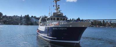
This proposal addresses the need to engage STEM students in Navy-centric educational opportunities in order to develop pathways to the Department of the Navy’s current and future workforce. The geosciences, and oceanography in particular, have been shown to have significant issues with retention and promotion in academic and research positions. Undergraduate internships can be especially effective in directing students to pursue new career paths because the participants tend to be eager to learn, open to new opportunities, and uncertain of their direction. APL-UW’s extensive and wide-ranging research programs can provide stimulating and life-changing experiences that broaden education beyond the classroom and motivate students to pursue STEM careers with Navy relevance.The APL Summer Undergraduate Reseach Program (APL SURP) provides (1) project-based research experience, (2) mentoring and support outside the research activity, (3) community building and support opportunities through peer-to-peer relationships, and (4) tools and strategies to navigate the pathways to a Navy-relevant career. This broad-based strategy is intended to go beyond the research experience itself by providing supplemental perspectives and resources to participants, such as a one-day training cruise on the UW research vessel R/V Rachel Carson in Puget Sound.
Aug 5 – Aug 8, 2025 · 3 d
Puget Sound, Seatlle, WA, USA