VesselConnect
  • Completed

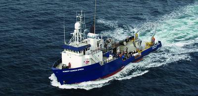
    Sally Ride · SIO

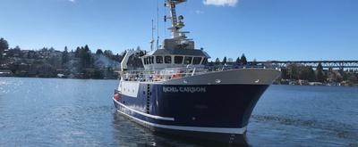
    OOI Endurance Array 24

    Edward Dever · OSU

    This request is for the major infrastructure deployment and recovery of the National Science Foundation (NSF) Ocean Observatories Initiative (OOI) Coastal Endurance Array (EA) ( https://www.oceanobservatories.org ). This cruise is for the deployment and recovery of a single surface mooring off central Oregon along with the deployment and recovery of up to two gliders and the collection of supporting ship-based sampling (lowered CTD, underway oceanographic and meteorological measurements.

    Jun 16 – Jun 17, 2026 · 1 d

    Oregon shelf

  • Completed

    TN-454 Transit Cruise

    Gregory Higgins · UW

    Jun 15 – Jul 3, 2026 · 18 d

  • Completed

    FWRI June 2026

    Matthew Garrett · FWRI

    The role of the benthic environment in the life history of red tide blooms ( Karenia brevis ) remains poorly understood. The goal of this effort it to continue a termed data series and reoccupy multiple stations surveyed from previous surveys, in collected benthic material (sediments, cores) and sample the overlying water column.

    Jun 15 – Jun 21, 2026 · 6 d

    West central coast of Florida

  • Completed

    Pelican · LUMCON

    REU-OTO

    Jessica Fitzsimmons · TAMU

    The primary purpose of this research cruise is to train summer Research Experience for Undergraduate (REU) students in shipboard sampling methods of ocean observing. We bring ~11 undergraduate students to sea with us each cruise. We have been doing these cruises annually (barring pandemic) since 2016 and have used this time-series oceanographically to characterize the extent of hypoxia in the northern Gulf of Mexico (Texas-Louisiana Shelf). Other scientific interests on these cruises include tracking phytoplankton community composition across the study region, measuring contaminants in the water column and sediments, sampling for trace metal concentrations from surface waters, and in some years deploying ocean observing sensors systems (Acrobat, glider deployment). Some of the undergraduates use the data or samples from the cruise as a basis for their summer research projects during the REU program. We have a set of 14 stations that we sample each year, which are in the shape of a triangle from Galveston, TX to Flower Garden Banks National Marine Sanctuary on the shelf-break, to a site near Louisiana. REU students will be trained of field observation methods: CTD hydrocasts, water sampling, shipboard oxygen measurements, sediment grab sampling, and surface trace metal sampling (using a towed pump). There is also sometimes Acrobat deployments. We also make use of the shipboard seawater supply system to monitor phytoplankton composition (using a FlowCytobot plumbed to the ship's flow-through seawater), and we also collect some large carboys of surface water at select stations.

    Jun 14 – Jun 17, 2026 · 2 d

    Northern Gulf of Mexico, Texas-Louisiana Shelf

  • Completed

    Tehuantepec MT

    Steven Constable · SIO

    The Gulf of Tehuantepec is considered a "seismic gap", in that there have been no recorded large thrust earthquakes associated with the tectonic plates slipping past each other. There are two possible reasons for this. The first is that the rocks of the Tehuantepec Ridge, which is being subducted with the Cocos plate, may be releasing water that lubricates the fault zone, allowing the plates to slowly slide past each other without producing large earthquakes. The second is that the topography of the ridge is mechanically locking the two plates together, in which case a very large earthquake is inevitable when the stress finally builds up to breaking point. Do the people of Mexico plan for a strong, damaging earthquake that will likely create a large tsunami, or rest assured that the plate is slipping benignly? This project will answer this question with an amphibious magnetotelluric (MT) sounding survey sensitive to the presence of water deep in the subduction zone. Land MT sites have already been collected. This ship time application will support the offshore component.

    Jun 12 – Jun 30, 2026 · 18 d

    Gulf of Tehuantepec

    Sails with 1 other project

  • Completed

    Savannah · SkIO

    SEFIS

    Nathan Bacheler · NOAA

    SEFIS is a fishery-independent research group that surveys reef fish using traps and video from Cape Hatteras, NC, to St. Lucie Inlet, FL, from 15-115 m deep.

    Jun 10 – Jun 19, 2026 · 9 d

    Southeast US Atlantic continental shelf between NC and the east coast of FL.

  • Completed

    MWREU2026

    Ana Arellano · USF

    All REU participants will have the opportunity to participate in a research cruise to Tampa Bay for the collection of research samples and deployment of research instruments. The primary objective of this research cruise is to investigate turbidity dynamics in Tampa Bay, assess sediment characteristics at key locations inside and outside the bay, and conduct vibracoring of relict coastal features on the West Florida Shelf. The cruise aims to provide insights into sedimentary processes, water quality, and geological features in the study area.

    Jun 10 – Jun 14, 2026 · 5 d

    Tampa Bay Area

  • Completed

    Pelican · LUMCON

    GF-Su-26

    Lance Renoux · LaWLF

    The Southeast Area Monitoring and Assessment Program (SEAMAP) Shrimp/Groundfish trawl surveys are conducted throughout the Gulf of Mexico to provide fishery-independent monitoring and assessment information on shrimp and groundfish assemblages associated with low relief soft bottom habitats. These data are essential to the management of the fisheries resources in the Gulf of Mexico. Louisiana Department of Wildlife and Fisheries (LDWF), as well as SEAMAP state partners, sample in conjunction with the National Marine Fisheries Service (NMFS) to provide a Gulf-wide trawl survey each summer and fall.

    Jun 8 – Jun 13, 2026 · 4 d

    Coastal waters of Louisiana

  • Completed

    Atlantis · WHOI

    ALVIN Sea Trials

    Rick Chandler · WHOI

    Conduct post-overhaul ALVIN sea trials between Woods Hole and Norfolk VA with an intermediate stop in Bermuda

    Jun 8 – Jun 28, 2026 · 20 d

    SE of Bermuda

  • Completed

    Sally Ride · SIO

    STEMSEAS

    Marina Halverson · SCC

    The STEM Student Experiences Aboard Ships (STEMSEAS) project is a partnership between the Indiana University of Pennsylvania, Lamont Doherty Earth Observatory at Columbia University, and the University National Oceanographic Laboratory System (UNOLS) aimed at addressing three priorities: (1) increasing the number and diversity of students pursuing degrees and careers in geosciences; (2) preparing students for all possible career trajectories in the geosciences; and, (3) contributing to the evidence base for effective student engagement, learning and retention in STEM. The STEMSEAS project is achieving these goals by taking advantage of unused berthing capacity on UNOLS vessels as they transit between U.S. ports in preparation for their next expedition. These short transits offer a unique mobile classroom setting where undergraduate non-STEM, undecided-STEM, and geoscience majors can be exposed to geoscience professional practice and career exploration. By partnering with UNOLS and campus "champions" at universities, including minority-serving institutions (MSIs), historically black colleges and universities (HBCUs), and community/two-year colleges (2YCs), the project sends diverse cohorts of students and faculty to sea with a small team of geoscience faculty and mentors. While at sea, the students engage in a variety of hands-on activities that incorporate geoscience content, lab exercises, data collection/analysis, career exploration, and discussion/reflection.

    Jun 7 – Jun 14, 2026 · 7 d

    Transit from Seward, Alaska to Alameda, California.

    Sails with 1 other project

  • Completed

    OSNAP 2026

    Tiago Carrilho Bilo · Maine

    OSNAP is an international program designed to provide a continuous record of the full-water column, trans-basin fluxes of heat, mass and freshwater in the subpolar North Atlantic. The OSNAP observing system consists of two legs: one extending from southern Labrador to the southwestern tip of Greenland across the mouth of the Labrador Sea (OSNAP West), and the second from the southeastern tip of Greenland to Scotland (OSNAP East). The observing system also includes subsurface floats (OSNAP Floats) in order to trace the pathways of overflow waters in the basin and to assess the connectivity of currents crossing the OSNAP line.

    Jun 7 – Jul 16, 2026 · 39 d

    Iceland Basin

    Sails with 2 other projects

  • Completed

    Crossroads - Deployment: 2 of 2

    Heather Furey · WHOI

    Crossroads is a Lagrangian (float) field program combined with numerical modeling aimed at describing the processes that break or maintain connectivity of the lower limb of the Atlantic Meridional Overturning Circulation (AMOC). Crossroads will be embedded in highly complementary field projects by Canadian and European researchers with the same fundamental question regarding connectivity. Specific objective is to determine the processes governing the deep circulation along the western boundary between the subpolar and subtropical North Atlantic—the so-called "transition zone" (TZ), thought to be critical to the latitudinal coherence of the AMOC. We will directly observe the interaction between the deepest layers of the Deep Western Boundary Current (DWBC) with the North Atlantic Current through the TZ by releasing acoustically tracked RAFOS floats in the DWBC east of the Grand Banks at 3000-3800-m depth and track them for two years as they drift through the TZ. The field program is embedded in a complementary hydrographic, Eulerian, and modeling investigation also focused on the connectivity of the DWBC through the TZ funded by the EU "Explaining and Predicting Overturning Circulation" (EPOC) and French "Crossroads" programs, which will be leveraged scientifically and logistically.

    Jun 7 – Jul 16, 2026 · 39 d

    Iceland Basin

    Sails with 2 other projects

  • Completed

    OOI-Irminger Sea 2026

    Deidra Emrich · WHOI

    To carry out the recovery and redeployment of part of the NSF Ocean Observatories Initiative (OOI) Irminger Sea Array, servicing two of four moorings an area southeast of Greenland (38-41W, 58-61N). The platforms will carry multidisciplinary instrumentation and provide the capability for real time communication of data and control of sampling. Taut moorings, Flanking Mooring A and Flanking Mooring B will be deployed and the old moorings recovered. 2 CTD casts are requested. One at each flanking mooring site.

    Jun 7 – Jul 16, 2026 · 39 d

    Iceland Basin

    Sails with 2 other projects

  • Completed

    Savannah · SkIO

    SSU REU 2026

    Laura Treible · SSU

    This project is part of a summer REU program in marine sciences in Savannah, Georgia, that emphasizes early undergraduate participation (freshmen and sophomore), to target students during a critical time in their STEM career. The project includes a 2-day research cruise opportunity for these undergraduate students aboard a UNOLS vessel for estuarine and pelagic research experience. This REU provides a first research experience to bright young scientists who are not traditionally considered for an REU. Moreover, this opportunity to conduct high-quality oceanographic research is in an environment that is accommodating, nurturing, and educationally diverse. In targeting students with no prior research experience, the SSU REU provides them with the necessary skills to successfully complete their project. This will yield small cohorts of students who will become the next generation of research oceanographers. The broad range of faculty mentor qualifications, experience, and facilities at SSU and its research partners provides additional intellectual merit for every REU project, thus broadening each participant’s experience. The cruise will include all the participants, PI, co-PI, graduate assistant, and additional faculty mentors whose research utilizes coastal/estuarine field sampling. The cruise provides participants with direct, collaborative experience working with the science and ship’s crew, off-shore sampling and data collection, and common oceanographic instrumentation and equipment (e.g., CTD, grab core, plankton nets). These experiences provide opportunities for some interns to develop research ideas for their own projects but serve also as a common bonding experience for all the students conducting science together. This is annually rated highest in the post-program assessments. The 91-foot UNOLS research vessel Savannah operated by SkIO has space for 18 and provides the ideal platform for short-term/ offshore research cruises.

    Jun 5 – Jun 6, 2026 · 1 d

    Georgia Bight

  • Completed

    SIOC 218/Del Mar

    Uwe Send · SIO

    Two days of ship time are requested on R/V Sproul in late April to late May 2026 as part of the formal class sequence SIOC 223/218B “Proposal writing and experiment design” and “At-sea course for timeseries and mooring techniques,” similar to classes held successfully in earlier years. The sequence provides hands-on experience to SIO graduate students in writing proposals and designing experiments, planning a research cruise, designing a mooring observation system, operating instruments at sea, and calibrating and analyzing obtained time-series and other data. A scientific report with results analyzed by students, and/or an outreach article about this field-focused at-sea course is expected to be published. We request two separate (24-hour) days of ship time on R/V Sproul, one in April and one in May 2026 for the mooring operations. All cruises depart San Diego Nimitz Marine Facility (MARFAC) tentatively at 07:00. Transit to the Del Mar site takes three hours each way. Recent cruises have also included CTD calibration cast(s) at a deeper site west of Point Loma. This SME corresponds to the second portion of the project, in May 2026.

    Jun 3 – Jun 4, 2026 · 1 d

    San Diego

  • Completed

    Pelican · LUMCON

    Murphy WS Buoy 2024 SV

    Jacob Fredrickson · Fugro GEOS Inc

    Topside service and maintenance for a Fugro Wavescan Buoy. Buoys measure wind, waves, and currents. Data is transmitted to erddap and distributed.

    Jun 1 – Jun 4, 2026 · 3 d

    GoM

  • Completed

    CAMO - 2026 Sharp Maping and recovery with USNA and UD

    Chris Martens · UNC

    The project will test key hypotheses about deep-sea methane dynamics including determining if there are significant lags in microbial responses after exposure to elevated methane concentrations, determining the relationships of AMOR to methane and DIN concentrations and investigating the response times and magnitude of methanotrophs to spatial and temporal variability in methane concentration. Successful collection of in situ AMOR and associated microbial community data will prove important for modeling ocean methane dynamics over a range of oceanographic conditions including seep-enriched bottom waters and accidental hydrocarbon releases. This will be used to Map the Primary T1 site of Delaware near Washington Canyon and recovery the final Lander. Will be working together with The US Naval Academy and University of Delaware.

    May 30 – Jun 5, 2026 · 6 d

    GC185

  • Completed

    Subduction Initiation

    Douglas Wiens · WUSTL

    Subduction initiation may be the most enduring mystery in the study of terrestrial geodynamics. Most of our knowledge of the geodynamical processes involved in subduction initiation come from study of past initiation events where some evidence of the volcanic products have been preserved. The lack of ongoing examples of subduction initiation that include the classic sequence of forearc magmatism limits our understanding of how these processes occur. However, recent studies show that subduction initiation with accompanying magmatic activity is occurring along the Matthew and Hunter Trench between the New Hebrides Trench and the Fiji Platform. In this project we will we will deploy 20 passive broadband ocean bottom seismographs to investigate the structure and seismicity of the MHSZ. We will also conduct an extensive bathymetric survey and collect gravity and magnetic data to determine the tectonic setting and isostatic compensation of the region. This study will provide important observational constraints on processes associated with the initiation of slab underthrusting and the onset of overriding plate volcanism.

    May 23 – Jun 12, 2026 · 20 d

    North Fiji Basin

  • Completed

    Sally Ride · SIO

    NOPP1-AR

    Drew Lucas · SIO

    As part of the National Ocean Partnership Program (NOPP) Global Internal Wave (NGIW) study, Internal Wave Resolving (IWR) Arrays are being deployed to collect high-frequency in situ measurements that can resolve the energy flux associated with internal waves propagating through the deep ocean by combining high vertical- resolution moorings to resolve the waves’ modal structure with an antenna of vertically- integrated measures of variability to resolve the speed and direction of beam propagation. The IWR Arrays are re-deployable to multiple locations and this cruise aims to deploy an array in the deep ocean off the Alaskan slope. The IWR Array comprises nine current and pressure-sensor equipped inverted echo sounders (CPIESs) surrounding a densely instrumented, full-depth mooring. The CPIES antenna will allow for the detection and separation of low-mode internal waves propagating from multiple directions, while the mooring will measure velocity and vertical displacement signals of five or more vertical modes. By working in partnership will numerical modelers, the array will allow for skill-testing and direct comparison with the global internal-tide resolving models that serve as inputs to regional models of the coastal ocean.

    May 22 – Jun 3, 2026 · 12 d

    Offshore of the Aleutian Islands

  • Completed

    Blue Heron · UMN

    GLaME 2026 Spring

    John D. Kessler · Rochester

    This project will make high-resolution measurements of dissolved CH4 partial pressure in surface waters of all five Great Lakes on three new research cruises, using a novel underway system that calibrates a Gas Membrane Contactor (GMC) against equilibrator and discrete vial measurements. The new measurements will be merged with existing data collected using a similar system on previous cruises, yielding a CH4 archive that captures the seasonal cycle and covers potential hotspots associated with river discharge and gas wells. This archive will be used to train machine learning models to map CH4 disequilibrium between the lake surface and air, allowing the lake-atmosphere CH4 flux to be calculated at high resolution across the Great Lakes. We will also conduct incubation experiments and stable isotope analyses to construct mixed layer CH4 budgets for each Great Lake, and employ radiocarbon fingerprinting to trace the contribution of fossil CH4 through the Lake Erie water column. These analyses will allow us to partition the roles of in situ aerobic methanogenesis, leakage from oil and gas wells, and other external CH4 sources (sediments, runoff), in driving CH4 emissions.

    May 21 – Jun 6, 2026 · 16 d

    Lakes Superior, Michigan, Huron, Erie, and Ontario
  • Completed

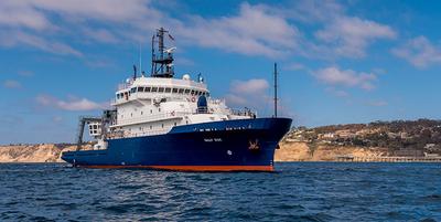
    Blue Heron · UMN

    DARPA Neutrino

    Richard Ricketts · UMN

    Placement of a neutrino detector in Western Lake Superior

    May 18, 2026 · 1 d

    Western Lake Superior

  • Completed

    Fisheries Alliance

    Glen Gawarkiewicz · WHOI

    This is an inter-disciplinary effort to study shelfbreak processes, and if possible a shelf streamer around a Warm Core Ring, to investigate circulation and ecosystem connections south of New England. Previous work has shown that streamers of shelf water aggregate marine species, including squid, around the periphery of Warm Core Rings. We would like to test some hypotheses regarding how streamers of shelf water form, their connection to the Shelfbreak Jet upstream, and how acoustic backscatter patterns can be used to define biota within and around the shelf streamer. We will be in close communication with the commercial fishing industry via the Commercial Fisheries Research Foundation and the Cooperative Research Branch at NOAA. Results will be shared after the cruise with the Commercial Fisheries Research Foundation, the Cooperative Research Branch, and the Cape Cod Commercial Fishermen's Alliance. A key motivation is the pattern of upwelling as the streamer forms. A recent Ph.D. thesis (by Jacob Forsyth) suggests that large Warm Core Rings that are in close proximity to the shelfbreak can generate large upwelling rates. Recent tagging efforts led by C. Braun at WHOI have also shown billfish moving within a streamer for large distances.

    May 17 – May 23, 2026 · 5 d

    Shelfbreak south of New England on eastern side of Warm Core Ring

  • Completed

    Salish GasEx

    David Ho · UH

    Marine carbon dioxide removal (mCDR) has the potential to contribute to climate change mitigation; however, the rate at which the mCDR industry must scale to enable meaningful removals presents substantial challenges. The next decade will be pivotal; it is now critical to establish pilot projects that demonstrate proof of concept and provide a basis for scaling. This project will conduct an ocean alkalinity enhancement (OAE) pilot project in partnership with an mCDR startup company in the Salish Sea. The investigators will utilize a numerical modeling framework to design this experiment, including a release strategy and a sampling plan that enable tracking of environmental impacts. The project will consist of a research cruise planned for the summer of 2026, consisting of a 3 He and SF₆ tracer release experiment to determine gas transfer velocities and mixing rates, important yet uncertain factors determining the spread of alkalinity and CO₂ uptake rates in coastal environments.

    May 16 – May 25, 2026 · 9 d

    Salish Sea

  • Completed

    SIO 60

    Drew Lucas · SIO

    Starting in the 2016-2017 academic year, Scripps Institution of Oceanography and UCSD began an undergraduate major in Oceanic and Atmospheric science. This interdisciplinary major is intended to prepare students for careers in government, environmental policy, management, and consulting, primary and secondary education, and academia. The curriculum combines rigorous classroom training based on mathematics, physics, chemistry, and data analysis with hands-on experience using cutting edge data collection techniques for the ocean and atmosphere. SIO 60, co-taught annually by SIO/UCSD Associate Professors Drew Lucas and Kate Ricke, is the required introductory course for the O & A major. SIO 60 covers basic concepts in oceanic and atmospheric dynamics with instruction and hands-on activities, with an aim towards future academic, government, and industry scientists as well as professionals in maritime and environmental science fields.

    May 16 – May 17, 2026 · 1 d

    Offshore of San Diego

  • Completed

    Oligohaline Dispersion

    Robert Chant · Rutgers

    We have two moorings that need to be recovered in the Delaware River. One is near the Delaware Memorial Bridge and the second near the Commodor Barry Bridge. The moorings have no surface signature and we would like to use the R/V Sharp's multibeam to image the moorings and its dynamic positioning to guide their recoverty via trawling or divers. The moorings have ~200 feet of line that runs from the frame to an anchor (75 lb doormoor) that provides a target to grab with a grappling hook. However, one of the moorings is entangled in a debris field (based on an earlier attempt to retrieve it), and we might need to send divers down to retrieve it.

    May 14 – May 16, 2026 · 1 d

    Delaware River near Delaware Memorial Bridge

  • Completed

    ICONIC - 3 of 5 w CVOO

    Kristen Buck · OSU

    Our joint NSF-NERC collaborative research project will integrate field observations from the Bermuda Atlantic Time-series Study (BATS) and Cape Verde Ocean Observatory (CVOO) study regions with targeted experimental studies and a state-of-the-art ocean biogeochemical model to constrain the processes that modulate interactions of iron with dissolved and particulate organic matter, and advance our ability to model the global iron cycle and the vertical export of iron and carbon in the upper ocean. We will collect seasonally resolved water column (upper 3,500 m) datasets from BATS during five cruises, shared with the monthly BATS program, spanning a full annual cycle. In late spring (cruise 3 of 5), we will augment the work at BATS with additional water column sampling along the way to, and at, the Cape Verde Ocean Observatory in the eastern North Atlantic, which provides a natural laboratory for contrasting iron speciation and subsurface oxygen conditions with the BATS region. Laboratory-based and shipboard incubation experiments will target the role that specific pools of organic ligands, dissolved organic carbon, and detrital particulate organic carbon play in water-column iron cycling. The resulting data, together with ancillary data provided by the BATS program, will be used to inform the biogeochemical model, thereby advancing our ability to model the global ocean cycling of iron and carbon, and better predict their sensitivity to environmental changes.

    May 14 – Jun 12, 2026 · 29 d

    North Atlantic near Bermuda and along GEOTRACES GA03 to Cape Verde

    Sails with 2 other projects

  • Completed

    BATS 2025 - 11of12 carry forward

    Nicholas R. Bates · BIOS

    Long-term observations over several decades are a powerful tool for investigating ocean physics, biology, and chemistry, and the response of the oceans to environmental change. The Bermuda Atlantic Time-Series Study, known as BATS, has been running continuously since 1988. The research goals of the BATS program are: (1) to improve our understanding of the time-varying components of the ocean carbon cycle and the cycles of related nutrient elements such as nitrogen, phosphorus, and silicon; and, (2) to identify the relevant physical, chemical and ecosystem properties responsible for this variability. In addition, the BATS program has strong and diverse broader impacts, contributing to the field of ocean sciences by providing high quality ocean observations and data for seagoing scientists and modelers, and a framework through which researchers can conceive and test hypotheses. This award will support the operations of the BATS program for five more years.

    May 14 – Jun 12, 2026 · 29 d

    North Atlantic near Bermuda and along GEOTRACES GA03 to Cape Verde

    Sails with 2 other projects

  • Completed

    Hydro S - 2026 22of24

    Nicholas R. Bates · BIOS

    One of the longest open-ocean hydrographic stations in the world is maintained at the Hydrostation S site (formerly known as the Panulirus site) located ~25 km southeast of Bermuda in the North Atlantic Ocean. This program of repeat biweekly hydrographic observations began in 1954 (by Hank Stommel) and now, in its seventh decade, has proved to be the catalyst for numerous studies of ocean physics, biological processes and biogeochemistry. Hydrostation S continues to be recognized as one of the most important sustained ocean time–series. The renewal of the Hydrostation S program is proposed herein, extending this invaluable time–series of ocean hydrography to almost 70 years. The upper ocean warming trend has strengthened (about +1.4° C since the 1970's; ~+0.8°C in last decade) with significant salinification (+0.16). Deeper waters such as the Labrador Sea Water has cooled by a few tenths of a degree and freshened with a marked decadal oscillation. The signature of deoxygenation has been observed at Hydrostation S in the upper ocean (about 4 µmoles kg -1 decade -1 decrease in dissolved oxygen) as well as the oxygen minimum zone (~2.5 µmoles kg -1 decade -1 ). Hydrostation S also supports the longest global ocean CO 2 and acidification time-series (from 1983 to present)

    May 14 – Jun 12, 2026 · 29 d

    North Atlantic near Bermuda and along GEOTRACES GA03 to Cape Verde

    Sails with 2 other projects

NewerPage 5 of 55Older