VesselConnect
  • Completed

    STEMSEAS

    Sharon Cooper · LDEO

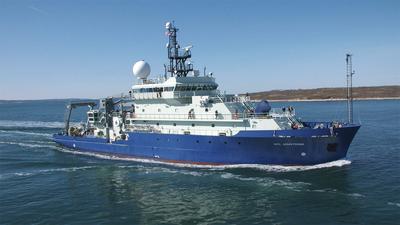
    STEMSEAS will be doing training, sampling and investigating in the Chesapeake and Delaware Bays. Fair weather plan: Sample Norfolk, Washington, Wilmington, and Baltimore canyons. Within each canyon, we would like to sample at 2-3 sites. Foul weather plan: Circumnavigational sampling of Delaware and Chesapeake bays. Additionally, a transect up the Potomac River up to near Quantico, VA. Additionally, we would like to visit 1-2 canyons for sampling. Mon, 17 OCT Wilmington Canyon in AM Collect 10-20 gallons of water before starting sampling…needed at SSU for another project Manta tow Whole water via pump Hopefully 2-3 stations for canyon sediment (1 near head and 2 within canyon…time/conditions- dependent) Steam to Baltimore Canyon for late (?) afternoon Manta tow Whole water via trash pump Hopefully 2-3 stations for canyon sediment (1 near head and 2 within canyon…time/conditions- dependent) Steam overnight South to Washington Canyon Tue, 18 OCT Washington Canyon in AM Collect 10-20 gallons of water before starting sampling…needed at SSU for another project Manta tow Whole water via pump Aim for 2-3 stations for canyon sediment (1 near head and 2 within canyon…time/conditions- dependent) Steam to Norfolk Canyon for late(?) afternoon Manta tow Whole water via trash pump Hopefully 2-3 stations for canyon sediment (1 near head and 2 within canyon…time/conditions- dependent) Steam overnight South to Chesapeake Bay Wed, 19 OCT If possible, Jon Cohen’s stations in Chesapeake Bay for sediment and water…morning high approximately during 4a hour, so it would still be ebbing at first light. If not, at least mouth of Potomac (and time dependent-before tide turns: upriver beyond military restricted zone), alternatively upstream of Patuxent R. During daytime flood, sediment sampling full remainder of the day in Chesapeake working our way up the Chesapeake to Susquehanna R/ Elk R to get to the C&D Canal * Sample Processing * during the daytime steaming OR spend the day coring in the Chesapeake . Thu, 20 OCT Depending on where we are with the above, doing sediment all day and water collections at a regular interval (every 5 ppt change in salinity?) during ebb in the Susquehanna R. or Elk R. then to the C&D Canal and down the Delaware Bay overnight to Lewes, DE for 0630 end on Fri, 21 OCT would be great, if possible.

    Oct 16 – Oct 21, 2022 · 5 d

    Chesapeake and Delaware Bays
  • Completed

    Blue Heron · UMN

    UMN cruise 2022 Minor2

    Richard Ricketts · UMN

    These cruises utilize funding provided by the University of Minnesota. Chief Scientists will be completing seed research cruises or using their ship time to take graduate and undergraduate students on the research vessel Blue Heron.

    Oct 15, 2022 · 1 d

    Western Lake Superior

  • Completed

    Savannah · SkIO

    INST

    Clark Alexander · SkIO

    Ship time dedicated to facilitate experiential learning for UGA and USG graduate and undergraduate students.

    Oct 15, 2022 · 1 d

    South Atlantic Bight - USA

  • Completed

    Atlantis · WHOI

    Seep larval dispersa

    Craig Young · Oregon

    Ever since hydrothermal vents and methane seeps were first discovered in the deep ocean more than 40 years ago, scientists have wondered how these isolated communities, fully dependent on underwater "islands" of toxic chemicals, are first colonized by organisms, and how the populations of these specialized animals are exchanged and maintained. These fundamental processes depend on the transport of babies (larvae) by the ocean currents, yet because the larvae are microscopic and diluted in the vastness of the ocean, it is very difficult to determine where and how they drift. This project uses an autonomous underwater vehicle to collect larvae from precise regions of the water column. Larval traps on the bottom and chemical analyses of larval shells will also be used to determine the depths where larvae swim. These findings will provide realistic estimates for mathematical models that show how biology interacts with ocean currents to predict which methane seeps will be colonized by larvae originating at different depths. A detailed knowledge of larval dispersal is needed for conservation and management of the deep sea. Without such information, we cannot know the best placement of marine protected areas, nor can we facilitate the reestablishment of communities impacted by deep-sea mining, drilling, or other human activities. This project will provide hands-on at-sea training for college students to learn the rapidly vanishing skills needed for studies of larvae and embryos in their natural habitats. Learning opportunities will also be available to individuals of all ages through new, interactive exhibits on deep-sea biology and larval ecology produced for small museums and aquaria on the coasts of Oregon, Washington and North Carolina.

    Oct 13 – Nov 2, 2022 · 20 d

    GOM and WAM

  • Completed

    Cetaceans and Sonar

    Simone Baumann-Pickering · SIO

    Marine mammals inhabit a highly dynamic, mobile environment. We will document how physical oceanographic conditions drive prey distributions and cetacean response to these changes. Use of mid-frequency active sonar during US Navy training operations can invoke a cetacean behavioral response and we aim to document how a response may be shaped by underlying prey conditions. A series of 5 cruises will be conducted over the course of 2 years to record passive acoustic data on long-term moorings at sonar-impacted and minimally disturbed sites. Satellite tagging of cetaceans will provide larger spatial information on movement patterns observed outside the acoustic detection range. Information on prey will be collected with autonomous and ship-board active-acoustic systems. MOCNESS tows will provide an active acoustics ground-truth. Physical oceanographic features will be measured with autonomous sensors on the moorings and with ship-board instrumentation.

    Oct 12 – Oct 21, 2022 · 9 d

    SOCAL Bight San Diego trough, near shelf break offshore San Diego to south of Channel Islands

  • Completed

    Pelican · LUMCON

    Buoy Cruise

    Kevin Martin · USM

    Recover buoy and swap out sensors systems. Once complete relaunch the buoy.

    Oct 12, 2022 · 1 d

    Gulf of Mexico

  • Completed

    HS - 2022 - 21

    Nicholas R. Bates · BIOS

    he physical properties of the ocean from the surface layers to the abyssal water masses are changing in concert with natural and anthropogenically influenced physical forcing and sustained observations of the ocean are critically important to establish these rates of change. One of the longest open-ocean hydrographic stations in the world is maintained at the Hydrostation S site (formerly known as the Panulirus site) located about 25 km southeast of Bermuda in the North Atlantic Ocean. This repeat biweekly hydrographic observations was initiated by Henry Stommel and co-workers in 1954. Now, in its seventh decade, it continues to be recognized as one of the most important sustained ocean time-series and provides an invaluable metric for the long-term state of the North Atlantic subtropical gyre in relation to the meridional overturning circulation, western boundary transport, and gyre recirculation. For example, the upper ocean warming trend has strengthened (about 0.8° C since the 1970's) while the deep Labrador Sea has cooled by a few tenths of a degree. The signature of deoxygenation has been observed at Hydrostation S in the upper ocean (about 7 micro-moles/kg/decade decrease in dissolved oxygen) as well as an intensification and expansion of the oxygen minimum zone. These changes suggest that the North Atlantic subtropical gyre is experiencing deoxygenation as in the Pacific Ocean as a result of increased upper ocean stratification and reduced solubility of oxygen in warmer waters. The Hydrostation S program and its data set are managed as a service to the ocean community, being openly distributed and used as a resource in understanding processes and patterns of variability in the ocean, as well as for education, mentorship and outreach activities. The Hydrostation S project will contribute to the research and training of six research specialists and research technicians at BIOS and contribute to the research projects of at least three Ph.D. students through on-going educational partnership with Princeton University and the University of Southampton in the U.K. The one-day Hydrostation S research cruises are an ideal platform for testing new sensors and for providing hand-on training to undergraduate students enrolled in summer programs. The Hydrostation S project is designed to address the overarching hypothesis that the physical properties of the upper-ocean to deep-ocean are changing in concert with natural and anthropogenically influenced physical forcing. Sustained observations of the ocean, such as those from Hydrostation S, remain critically important to establish rates of change to provide quantitative empirical data for myriad regional and global ocean synthesis and modeling of ocean processes and future ocean change. The major objective of Hydrostation S into the seventh decade is to continue the frequent water column sampling of temperature, salinity, and dissolved oxygen (and indirectly, sampling of important ocean carbon time?series) of the North Atlantic subtropical gyre. Such work is complementary to other sustained observations such as the Bermuda Atlantic Time-series Study (BATS) and Ocean Flux Program (OFP). As for the past five years, two CTD profiles will be conducted to better capture the deep-water variability while maintaining all the previous discrete depths. The first CTD cast will profile to full ocean depth (3,200-3,500 m) while the second CTD cast will profile from the surface to 500 m to allow for biogeochemical instrumentation not rated for full ocean depth and to support ancillary studies of ocean physics, biological processes and biogeochemistry. A secondary objective will be to build upon the collaborative comparison of physical data collected as part of two autonomous sensor projects. In the latter stages of the project, as ocean glider deployment becomes more sustainable and reliable, collaborative and comparative efforts will be used to test the capability of ocean gliders to provide data of sufficient quality to detect long-term oceanic change in a "virtual" mooring time-series mode. The robust and highly accurate Hydrostation S data will be used to test the capability of emerging technologies over the next five to ten years.

    Oct 11 – Oct 16, 2022 · 5 d

    Off of Bermuda

    Sails with 2 other projects

  • Completed

    HS - 2022 - 20

    Nicholas R. Bates · BIOS

    he physical properties of the ocean from the surface layers to the abyssal water masses are changing in concert with natural and anthropogenically influenced physical forcing and sustained observations of the ocean are critically important to establish these rates of change. One of the longest open-ocean hydrographic stations in the world is maintained at the Hydrostation S site (formerly known as the Panulirus site) located about 25 km southeast of Bermuda in the North Atlantic Ocean. This repeat biweekly hydrographic observations was initiated by Henry Stommel and co-workers in 1954. Now, in its seventh decade, it continues to be recognized as one of the most important sustained ocean time-series and provides an invaluable metric for the long-term state of the North Atlantic subtropical gyre in relation to the meridional overturning circulation, western boundary transport, and gyre recirculation. For example, the upper ocean warming trend has strengthened (about 0.8° C since the 1970's) while the deep Labrador Sea has cooled by a few tenths of a degree. The signature of deoxygenation has been observed at Hydrostation S in the upper ocean (about 7 micro-moles/kg/decade decrease in dissolved oxygen) as well as an intensification and expansion of the oxygen minimum zone. These changes suggest that the North Atlantic subtropical gyre is experiencing deoxygenation as in the Pacific Ocean as a result of increased upper ocean stratification and reduced solubility of oxygen in warmer waters. The Hydrostation S program and its data set are managed as a service to the ocean community, being openly distributed and used as a resource in understanding processes and patterns of variability in the ocean, as well as for education, mentorship and outreach activities. The Hydrostation S project will contribute to the research and training of six research specialists and research technicians at BIOS and contribute to the research projects of at least three Ph.D. students through on-going educational partnership with Princeton University and the University of Southampton in the U.K. The one-day Hydrostation S research cruises are an ideal platform for testing new sensors and for providing hand-on training to undergraduate students enrolled in summer programs. The Hydrostation S project is designed to address the overarching hypothesis that the physical properties of the upper-ocean to deep-ocean are changing in concert with natural and anthropogenically influenced physical forcing. Sustained observations of the ocean, such as those from Hydrostation S, remain critically important to establish rates of change to provide quantitative empirical data for myriad regional and global ocean synthesis and modeling of ocean processes and future ocean change. The major objective of Hydrostation S into the seventh decade is to continue the frequent water column sampling of temperature, salinity, and dissolved oxygen (and indirectly, sampling of important ocean carbon time?series) of the North Atlantic subtropical gyre. Such work is complementary to other sustained observations such as the Bermuda Atlantic Time-series Study (BATS) and Ocean Flux Program (OFP). As for the past five years, two CTD profiles will be conducted to better capture the deep-water variability while maintaining all the previous discrete depths. The first CTD cast will profile to full ocean depth (3,200-3,500 m) while the second CTD cast will profile from the surface to 500 m to allow for biogeochemical instrumentation not rated for full ocean depth and to support ancillary studies of ocean physics, biological processes and biogeochemistry. A secondary objective will be to build upon the collaborative comparison of physical data collected as part of two autonomous sensor projects. In the latter stages of the project, as ocean glider deployment becomes more sustainable and reliable, collaborative and comparative efforts will be used to test the capability of ocean gliders to provide data of sufficient quality to detect long-term oceanic change in a "virtual" mooring time-series mode. The robust and highly accurate Hydrostation S data will be used to test the capability of emerging technologies over the next five to ten years.

    Oct 11 – Oct 16, 2022 · 5 d

    Off of Bermuda

    Sails with 2 other projects

  • Completed

    BATS 2022 - 10of12

    Nicholas R. Bates · BIOS

    Long-term observations over several decades are a powerful tool for investigating ocean physics, biology, and chemistry, and the response of the oceans to environmental change. The Bermuda Atlantic Time-Series Study, known as BATS, has been running continuously since 1988. The research goals of the BATS program are: (1) to improve our understanding of the time-varying components of the ocean carbon cycle and the cycles of related nutrient elements such as nitrogen, phosphorus, and silicon; and, (2) to identify the relevant physical, chemical and ecosystem properties responsible for this variability. In addition, the BATS program has strong and diverse broader impacts, contributing to the field of ocean sciences by providing high quality ocean observations and data for seagoing scientists and modelers, and a framework through which researchers can conceive and test hypotheses. This award will support the operations of the BATS program for five more years. The primary BATS research themes are as follows: (1) Quantify the role of ocean-atmosphere coupling and climate variability on air-sea exchange of CO2, and carbon export to the ocean interior; (2) Document trends and the controls on the interannual to decadal scale variability in carbon and nutrient cycles to their coupling in the surface and deep ocean via the Redfield Ratio paradigm; (3) Quantify the response of planktonic community structure and function, and impact on biogeochemical cycles to variability in surface fluxes and dynamical processes; (4) Facilitate development, calibration and validation of next generation oceanographic sensors, tools and technologies; and, (5) Generate a dataset that can be utilized by empiricists, modelers and students. This research integrates ocean physics, chemistry and biology into a framework for understanding oceanic processes and ocean change in the North Atlantic subtropical gyre. The existing 29 years of BATS data provide robust constraints on seasonal and interannual variability, the response of the Sargasso Sea ecosystem to natural climate variability, and signal detection of potential ocean changes. This project would extend the BATS program through years 31-35 to address a series of ten interlinked questions through integrated research approaches and a multitude of collaborative efforts. In addition to the themes above, and embedded into the ten questions and approaches, the BATS team will focus on, for example, coupling of particle production and biogeochemistry; revisiting the complexities of the biological carbon pump; oxygen decline; and changes in the hydrography, physics, ocean carbon cycle and biogeochemistry of the Sargasso Sea. The highest quality data observation and collection will be maintained and used to address these questions. Importantly, a wide range of collaborations at the BATS site, spanning the physical and biogeochemical disciplines, will aid these broad goals. Strong links to community stakeholders, and close collaboration (including methods intercomparisons and personnel exchanges) with the Hawaii Ocean Time-series are proposed. This work will extend the research findings of the project into educational and training opportunities within and beyond the oceanographic community, including training and mentorship of both undergraduate and graduate students.

    Oct 11 – Oct 16, 2022 · 5 d

    Off of Bermuda

    Sails with 2 other projects

  • Completed

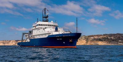
    Sally Ride · SIO

    CLASI - Recovery

    Hans Graber · UMIAMI

    The Coastal Land Air-Sea Interaction (CLASI) experiments describes a full scale experimental effort by deploying multiple air-sea interaction spar (ASIS) buoys in conjunction with other nearshore buoys and land-based tower to measure the air-sea interaction exchange in the coastal ocean from the land dunes to the beach to the surf zone and over the inner shelf into shallow water. The full experiment plan was developed by the CLASI team and includes previous results from the CLASI Pilot Experiment and lessons learned as well as shortcomings missed during the Pilot experiment. The goal is to deploy, operate and recover the five existing ASIS buoys and build three additional ASIS buoys to accommodate specialized measurements (EM/qT) in support electromagnetic ducting in the coastal region. These buoys constitute the core asset of the CLASI plan since they together with the shallower version I-SPAR buoys can measure directly the air-sea fluxes and turbulence both on the atmospheric and oceanic side of the air-water interface. From this unique set of observations, we propose to develop coast-aware parameterizations of air-sea coupling. In addition, we will operate two X-band radar systems on the land near the coast to continuously record the coastal wave climate and dynamics as well as wind speed and direction.

    Oct 10 – Oct 21, 2022 · 11 d

    Monterey Bay

  • Completed

    Blue Heron · UMN

    Great Lakes Cyanos 2022 (2021) 2 of 3

    Josef P. Werne · UPT

    The Great Lakes hold about 20% of the freshwater on Earth and have been increasingly impacted by human activities in recent decades. Lake Erie suffers from large, annually recurring, toxic cyanobacterial blooms in summer, whereas Lake Superior experiences smaller, localized cyanobacterial blooms after storm events. Cyanobacterial blooms have harmful ecological, human health, and economic implications. These blooms are a global phenomenon, observed in lakes and oceans, and can lead to low oxygen conditions and the production of toxins, both of which can be harmful for ecosystems. Understanding how different types of cyanobacteria influence nutrient cycling remains a major knowledge gap. This project aims to provide a deeper understanding of the long-term state of the Great Lakes ecosystem. The research approach combines new and established methods. Project results and implications will be shared with local and regional water interests in partnership with the Pittsburgh Collaboratory for Water Research, Education, and Outreach, the Great Lakes Commission Harmful Algal Blooms Collaborative, and the Lake Erie Area Research Network. Education is a central part of this project and training opportunities target next generation of scientists, including postdoctoral, graduate, and undergraduate students. The students and postdoc will receive state-of-the-art training in the rapidly developing fields of biogeochemistry and geomicrobiology, while working with an interdisciplinary team of scientists.

    Oct 10 – Oct 12, 2022 · 2 d

    Western arm of Lake Superior, between Isle Royale and Apostle Islands

  • Completed

    NSF GEOPATHS

    Sarah Gray · USD

    The research has four primary objectives/goals: A) to investigate the factors that affect near-offshore marine sedimentation in the geographically unique, tectonically-active southern California continental margin (California Continental Borderland); B) to understand the biological and ecological relationships between modern benthic foraminifera and their environment (particularly with respect to dissolved oxygen) in order to develop a better modern analog to use fossil foraminifera to assess past climate change; C) to continue an decadal time series of sea-floor sedimentation and microfossils, and D) to recruit and retain students in marine geosciences, in part, by giving students and teachers hands-on experiences at sea and research opportunities. We will have both experienced and inexperienced students on board, and will be training them, and exposing students and teachers to research techniques, life at sea, and potential career paths. The sampling objectives of the cruise include obtaining seafloor geologic samples (multicores, grabs and gravity cores) across a bottom water oxygen gradient, obtaining plankton samples (plankton tow) and water samples and hydrographic properties (CTD). We have sampled in this area previously (2000-2012 and 2018, 2019 and 2021) and will revisit some sites and may target additional sites. Our educational/outreach objectives be accomplished through student participation and collecting samples and data that will be integrated in courses and used in research conducted by diverse students mentored by scientists and educators from three collaborative institutions (California State University, Bakersfield (CSUB), the University of San Diego (USD), and Scripps Institution of Oceanography (SIO)).

    Oct 8 – Oct 10, 2022 · 1 d

    Shelf and flanks of San Diego Trough, Southern California

  • Completed

    Savannah · SkIO

    INST

    Clark Alexander · SkIO

    Ship time dedicated to facilitate experiential learning for UGA and USG graduate and undergraduate students.

    Oct 8 – Oct 9, 2022 · 1 d

    South Atlantic Bight - USA

  • Completed

    SFER - 2022 - 5of6

    Christopher Kelble · NOAA

    Collect coordinated measurements of coastal physics, biology, and chemistry for analytical interpretation of the coupled local, regional, and remote processes influencing the transport and exchange of South Florida coastal waters and their suspended and dissolved constituents. Thus, this research will require the use of a well calibrated flow through system measuring temperature, salinity, chlorophyll a, and Chromophoric Dissolved Organic Matter. CTD casts will be conducted at discrete section to survey the vertical structure of the water column and collect samples at depth. In addition, there will be some biological sampling. Plankton tows will be conducted at roughly ten stations to assess the zooplankton community in the area. Otter trawls will be conducted to survey the benthic juvenile fish community most likely in the area of Marquesas. To do this characterization we will conduct six five-day cruises. Each cruise will begin sampling near Fowey Rocks off of Biscayne Bay and will continue sampling along the Florida Keys to the Dry Tortugas. The survey will then head northeast to Charlotte Harbor and sample along the southwest Florida shelf south to Cape Sable before returning back to Miami. Ideal dates for cruise departures are Jan 2017, Mar 2017, May 2017, July 2017, Sep 2017, and Nov 2017.

    Oct 8 – Oct 14, 2022 · 6 d

    South Florida

  • Completed

    Endeavor · URI

    C & P fluxes along NE shelf

    Rainer Lohmann · URI

    Our research into the transport and fate of black carbon and persistent organic pollutants (POPs) focuses on the importance of riverine/freshwater sources relative to atmospheric transport. Results from samples we took on EN 545 and EN 592 imply that atmospheric transport can be important for delivering black carbon to remote, deep sediments, while riverine transport likely dominates for coastal regions. The proposed RIEP cruise would help us constrain the role of estuaries (Narragansett Bay, Mass Bay and Gulf of Maine). It would complement RIEP cruise EN 592, which covered five estuaries (Rhode Island and Long Island Sound, Hudson River, Delaware and Chesapeake Bay), but we would extend our focus on organophosphorous compounds, and how the delivery of organic phosphorous might impact phosphorous cycling in offshore regions. Here, we propose to use the R/V Endeavor to measure these newer organic contaminants in water and air along the northeastern seashore with a special focus on much and which compounds are transported into the North Atlantic Ocean. Simultaneous air and water samples will be taken on-board and analyzed for combustion byproducts like black carbon and PAHs as well as P-containing chemicals, in particular organophosphate esters (OPEs), which are extensively used as flame retardants, perfluorinated alkyl substances (PFAS) and mercury (Hg) dynamics. This research will contribute to our understanding of the global significance of estuaries such as our own Narragansett Bay, Massachusetts Bay and the Gulf of Maine act as sources of persistent pollutants and carbon to the Atlantic.

    Oct 7 – Oct 12, 2022 · 5 d

    Northeast Atlantic shelf

  • Completed

    Blue Heron · UMN

    UMN cruise 2022 Savage3

    Richard Ricketts · UMN

    These cruises utilize funding provided by the University of Minnesota. Chief Scientists will be completing seed research cruises or using their ship time to take graduate and undergraduate students on the research vessel Blue Heron.

    Oct 6, 2022 · 1 d

    Western Lake Superior

  • Completed

    Blue Heron · UMN

    UMN cruise 2022 Savage2

    Richard Ricketts · UMN

    These cruises utilize funding provided by the University of Minnesota. Chief Scientists will be completing seed research cruises or using their ship time to take graduate and undergraduate students on the research vessel Blue Heron.

    Oct 4, 2022 · 1 d

    Western Lake Superior

  • Completed

    OFP time-series Fall 22

    Maureen Conte · BIOS

    This award provides an additional three years of support for the Oceanic Flux Program (OFP). This program was first established in 1978 to measure the export flux of particles from the surface to the deep ocean in the deep Sargasso Sea and represents the longest and most continuous particle flux time-series of its kind. This program and the time-series record will continue to help the oceanographic community to answer questions about the relationship between deep ocean particle flux and climate and biological, physical, and chemical oceanographic processes. In the past, the OFP has provided evidence for coupling between the upper and deep ocean processes linked to seasonal, episodic (e.g., physical and meteorological forcing) and climate patterns. Looking to the future, this program will utilize increasingly advanced instrumentation and analytical tools to address questions about the material that sinks from the surface to deep ocean and its controls. The OFP provides education and training for students from the high school to Ph.D. level and supports early career researchers. The OFP time-series represents a 43-year, nearly continuous record focused on particle fluxes in the deep ocean. With increasingly more data available from the lengthening record, investigators can put observed biogeochemical patterns into perspective to understand the interplay between climate and ocean functioning. The availability of data from complementary nearby Hydrostation S, the Bermuda Atlantic Time-Series (BATS), the Bermuda Testbed Mooring (1994-2007), the Tudor Hill atmospheric tower and other Bermuda sampling programs provide additional opportunities to study upper ocean physics and biogeochemistry coupled with deep ocean biogeochemical processes. The OFP record is becoming long enough to study deep flux linkages with gyre circulation and advective processes. The OFP’s archive is an unparalleled resource for retrospective studies of temporal trends and the biogeochemical consequences of a changing ocean, including future impacts of ocean acidification. As the OFP heads into the future, increasingly sophisticated OFP mooring instrumentation (ADCP current profiling and backscatter; MicroCAT temperature, salinity, and oxygen measurements) and advances in digital imaging and analytical tools (both chemical and genomic) to probe the recovered flux materials continue to reveal novel, fundamental information about the oceanic particle flux and its controls.

    Oct 3 – Oct 8, 2022 · 5 d

    OFP Site Sargasso Sea

  • Completed

    Blue Heron · UMN

    UMN cruise 2022 Savage1

    Richard Ricketts · UMN

    These cruises utilize funding provided by the University of Minnesota. Chief Scientists will be completing seed research cruises or using their ship time to take graduate and undergraduate students on the research vessel Blue Heron.

    Oct 3, 2022 · 1 d

    Western Lake Superior

  • Completed

    RC Seabed Mapping Charter

    Robert Kamphaus · UW

    6 days underway charter for seabed mapping in Strait of JdF and Puget Sound

    Sep 30 – Oct 6, 2022 · 6 d

    Strait of Juan de Fuca

  • Completed

    Pelican · LUMCON

    Argo float deployments

    D R. Watts · URI

    Argo floats will be deployed to maintain a steady population in the eastern Gulf of Mexico.

    Sep 30 – Oct 5, 2022 · 5 d

    Gulf of Mexico

  • Completed

    Ships and Whales

    Vanessa ZoBell · SIO

    Low-frequency (< 500 Hz) noise in the ocean is made up of natural abiotic sounds such as wind, biological sounds such as whale song, and anthropogenic noise such as commercial shipping (Hildebrand, 2009; Wenz, 1962). In areas exposed to commercial shipping, ship noise overtakes other sound sources in amplitude and is the dominant source of low-frequency noise. Over the past several decades, increases in the number, gross tonnage, and horsepower of commercial vessels have led to higher ambient sound levels in the ocean (McDonald et al., 2006; Ross, 2005). Sound travels extremely efficiently in the ocean and marine organisms use sound for vital life functions including communication, foraging, and mating (Bass & McKibben, 2003; Simpson et al., 2008; Wartzok & Ketten, 2014). Because of this, increases in anthropogenic noise may have profound impacts on marine organisms (Erbe et al. 2019, Weilgart 2018) . Studies of anthropogenic noise impacts on marine species have identified acoustic communication masking, increased stress hormone levels, decreased reproductive success, behavioral changes, and mortality as direct results of noise generated by ships (Erbe et al., 2019; Weilgart, 2018). The Santa Barbara Channel (SBC) is an ideal region to investigate underwater noise pollution because of the heavily trafficked shipping lanes in the region. The Port of Los Angeles, in particular, is the busiest shipping port in the Western Hemisphere (Zhang et al. 2019), and is facing change as demand for goods and services increase post-pandemic and dock workers move to a 24/7 work schedule. In addition to the economic importance of the SBC, it is also a sensitive ecological region. The endangered Northeastern Pacific blue whale migrates from the Costa Rica dome calving region to an important foraging region in the Santa Barbara Channel (Fiedler et al. 1998). By analyzing how baseline geophysical ocean noise levels (wind-driven noise) compares to the reality of ship noise seen today we will be able to more strategically focus noise reduction management efforts to protect large whales from chronic noise exposure. For this project, we will be taking sediment cores, CTD casts, and recovering long-term acoustic moorings (HARPs) to generate and validate spatiotemporal ship noise maps that will be used in marine spatial planning efforts to protect large whales.

    Sep 30 – Oct 4, 2022 · 4 d

    Santa Barbara Channel

  • Completed

    Blue Heron · UMN

    UMN cruise 2022 Wattrus

    Richard Ricketts · UMN

    These cruises utilize funding provided by the University of Minnesota. Chief Scientists will be completing seed research cruises or using their ship time to take graduate and undergraduate students on the research vessel Blue Heron.

    Sep 30, 2022 · 1 d

    Western Lake Superior

  • Completed

    Davis Strait 2022

    Craig Lee · UW

    This project will renew the integrated observational program at Davis Strait, delivering data to the community and matching ongoing collections at Bering Strait, Utqiagvik, Alaska, and Fram Strait to extend the time series of concurrent measurements across the major Arctic Gateways. The extended timeseries will document changes in freshwater and heat fluxes, and will be combined with numerical modeling to investigate the processes that control variability in the strait and the potential impacts. The backbone system relies on the tested combination of moorings instrumented with sensors to measure ice thickness and motion, ocean currents, temperature and salinity, and biennial ship-based sampling of chemical and biological properties that have successfully delivered core measurements for the past decade. Bottom pressure sensors augment the system to quantify sea surface height gradients, which will support investigations of the primary forcing mechanisms. Integrated marine ecosystem observing includes biogeochemical and marine mammal passive acoustic measurements augmented with tracking of key fish species, and zooplankton and phytoplankton observations. These observations will launch the Davis Strait/Baffin Bay Distributed Biological Observatory (DBO) in Davis Strait, complementing the developing Atlantic DBO that includes transect lines in Fram Strait and Barents Sea, and the existing Pacific DBO in the northern Bering, Chukchi and Beaufort Seas.

    Sep 30 – Oct 22, 2022 · 22 d

    Davis Strait N. Labrador Sea to central Baffin Bay 200nm across

  • Completed

    Blue Heron · UMN

    UMN cruise 2022 Sharp2

    Richard Ricketts · UMN

    These cruises utilize funding provided by the University of Minnesota. Chief Scientists will be completing seed research cruises or using their ship time to take graduate and undergraduate students on the research vessel Blue Heron.

    Sep 29, 2022 · 1 d

    Western Lake Superior

NewerPage 46 of 55Older