VesselConnect
  • Completed

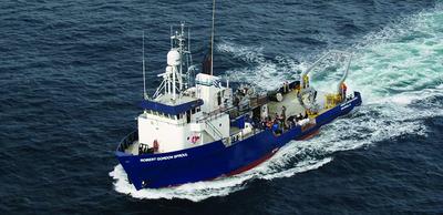
    KM26-10

    Christopher Sabine · UH

    From August 26–31, 2026, the R/V Kilo Mauna will host an instructional and research cruise around Oahu and Kauai, offering University of Hawaii undergraduate and graduate students hands-on experience with cutting-edge oceanographic methodology. Participants will experience a suite of multidisciplinary measurements, including Shipboard ADCP and multibeam bathymetry, CTD/Rosette system water column profiling, sediment collection, and eDNA sampling. The scientific team will also monitor continuous underway carbon metrics (pCO 2 , total alkalinity, and pH), deploy 10 fish aggregating devices (FADs), and conduct evening squid collections for downstream DNA characterization. This cruise serves as a critical academic springboard: the datasets generated will directly support Global Environmental Science (GES) undergraduate theses, while simultaneously allowing graduate students to fulfill their mandatory ship time requirements. Beyond its academic utility, the cruise is designed to broaden students' horizons regarding the multiple career opportunities within marine science. Students will gain firsthand exposure to vital, non-academic professional paths. The close quarters of the R/V Kilo Mauna also break down traditional campus barriers, offering a unique, informal setting where undergraduates, graduate students, and faculty can network, share mentorship, and build lasting professional relationships.

    Aug 27 – Aug 31, 2026 · 5 d

    Hawaii
  • Completed

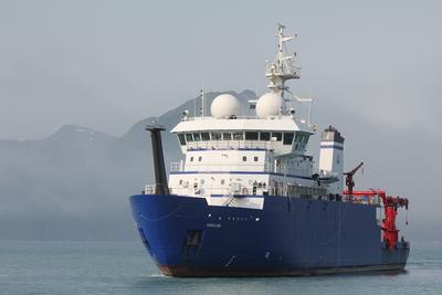
    NICO 1

    Jeff Book · NRL

    Take field measurements and conduct numerical experiments to determine the relative roles of wind shear inputs, coastally trapped waves, vertical energy fluxes, frictional decay, and nonlinear processes in the spin-up, energy transfer, and decay of near-inertial oscillations near a coastline. A better understanding of the roles of these dynamical terms will inform techniques for assimilation of high-frequency currents and lead to improved coastal predictions.

    Aug 26 – Aug 31, 2026 · 5 d

    NE US East Coast

  • Completed

    Pelican · LUMCON

    CAMO - 2026 PELICAN 1 of 2

    Chris Martens · UNC

    The project will test key hypotheses about deep-sea methane dynamics including determining if there are significant lags in microbial responses after exposure to elevated methane concentrations, determining the relationships of AMOR to methane and DIN concentrations and investigating the response times and magnitude of methanotrophs to spatial and temporal variability in methane concentration. Successful collection of in situ AMOR and associated microbial community data will prove important for modeling ocean methane dynamics over a range of oceanographic conditions including seep-enriched bottom waters and accidental hydrocarbon releases.

    Aug 25 – Aug 29, 2026 · 5 d

    GC185

  • Completed

    Sikuliaq · UAF

    Transit Cruise

    Tara Clemente · UNOLS

    Aug 21 – Aug 31, 2026 · 10 d

  • Completed

    HOT4 25

    angelicque white · UH

    Systematic long-term (greater than a few decades in length) time-series observations of aquatic and terrestrial environments have led to a more comprehensive understanding of the natural ecosystem variability and have enabled an assessment of human impacts on ecosystem dynamics. Because of their ability to store and transport large amounts of heat and to absorb carbon dioxide from the atmosphere, the world's oceans play a critical role in modulating environmental conditions for the sustained well-being of both land-based and marine organisms including humans. Despite their recognized scientific and societal importance, long-term records of key ocean processes are rare. In 1988, the Hawaii Ocean Time-series (HOT) program, near Hawaii was established. For over three decades, teams of scientists based at the University of Hawaii have made critical measurements of the 'state of our sea.' These long-term observations have established a baseline against which future states can be compared. The ship-based HOT program complements other diverse ocean observation programs including remote-sensing via satellites, moored buoys, profiling floats, and autonomous underwater vehicles. All HOT program data are publicly available and are frequently used by researchers and policy makers around the world.

    Aug 20 – Aug 25, 2026 · 5 d

    Station ALOHA (22.75N, 158W)

  • Completed

    MATE Floats 2026

    Sasha Seroy · UW

    This is a student training cruise to expose technical community college students to oceanography and ocean instrumentation. The one-day cruise is part of a week-long workshop hosted at UW where community college students will learn about basic oceanography, sensors, instrumentation and data analysis. The goal of the cruise is to give these students hands on experience on a research vessel working with various tools and sampling protocols on board. Students will conduct a CTD cast, collect water samples to run chlorophyll and oxygen on board, collect plankton, and complete a sediment grab. After the cruise, students will work on data analysis as a part of the workshop.

    Aug 20 – Aug 21, 2026 · 1 d

    Seattle

  • Completed

    Savannah · SkIO

    SEFIS

    Nathan Bacheler · NOAA

    SEFIS is a fishery-independent research group that surveys reef fish using traps and video from Cape Hatteras, NC, to St. Lucie Inlet, FL, from 15-115 m deep.

    Aug 19 – Aug 28, 2026 · 9 d

    Southeast US Atlantic continental shelf between NC and the east coast of FL.

  • Completed

    FOCUS 2026 (1 of 2) Recover array

    Lisa Beal · UMIAMI

    FOCUS will investigate the relationship between sea-level changes in coastal Florida and variations in Gulf Stream transport of water and heat through Florida Straits. To address this goal, the project will use in-situ measurements of velocity, pressure and sound signals along a cross-section between Florida and The Bahamas. These measurements will lead to a better understanding of how 'sunny-day' flooding events in South Florida are linked to oceanic conditions offshore. Results will also illuminate links between variations in different components of Gulf Stream transport and the gyre and overturning circulation and heat content at basin scale. Investigators will interact closely with resilience program managers of a county in southeast Florida that is affected by increasingly frequent flooding from the ocean.

    Aug 17 – Aug 21, 2026 · 4 d

    Florida Straits

  • Completed

    Pelican · LUMCON

    Amino acids

    Zhanfei Liu · UT Austin

    We propose to use on-deck/laboratory incubations to trace the fate of N in amino acids in the ocean. We will trace the fate of 9 different amino acids, including phenylalanine (Phe), glutamic acid (Glu), arginine (Arg), leucine (Leu), methionine (Met), tryptophan (Trp), aspartic acid (Asp), proline (Pro), and serine (Ser), and monitor their transformation in surface ocean. Our overarching hypothesis is that a higher percentage of N from essential amino acids will contribute to the production of refractory DON than those non-essential ones. The main approach to test the hypothesis is through our recently developed methods for 15N analysis. We will quantitatively measure each 15N form (NH4, NO2, NO3, PON, and DON) during the amino acid degradation, and identify 15N-DON molecules using advanced mass spectrometry. Through on-deck incubation of 15N-labeled amino acids, our two specific objectives are to: (1) Quantify the proportions of amino acid N that is remineralized to inorganic N, labile DON, and relatively refractory DON throughout the incubation, and (2) Characterize the amino acid-derived DON on a molecular level, which will be further used to expand the established amino acid-derived DON database, and to determine whether the amino acid derived DON is present in natural samples.

    Aug 16 – Aug 21, 2026 · 6 d

    Northern Gulf of Mexico

  • Completed

    Savannah · SkIO

    EduBenthicFeFlux

    Martial Taillefert · GaTech

    Collect sediment, water samples, and CTD data, deploy ring net tows, and collect sea surface data around Skidaway Island, the Savannah River, and along an offshore transect (weather and time permitting). Graduate students of this interdisciplinary Ocean Science and Engineering (OSE) group will be learning how samples are collected at sea and explore some of the physical, biological, and chemical variations in the South Atlantic Bight.

    Aug 15 – Aug 16, 2026 · 1 d

    NA-6 - kidaway River; Wilmington River; Continental shelf off Georgia; Savannah River; Bull River and return

  • Completed

    NES-LTER-2026-3of4

    Heidi Sosik · WHOI

    NES-LTER cross-shelf transect cruises are conducted between Martha’s Vineyard and the continental shelf break directly south. The overarching goal of the NES-LTER is to understand and predict how planktonic food webs change through space and time in response to changes in the physical environment, and how those changes impact ecosystem productivity, including of higher trophic levels. Observations and models are focused on processes and mechanisms that structure pelagic food webs, trophic transformations, and productivity, as well as the key interactions and feedbacks that modulate relationships among them. NES-LTER transect process cruises are focused on characterizing cross-shelf distributions of physical properties, nutrients, production rates, and plankton. Approximately 11 stations will be occupied in waters depths typically less than 200 m, but up to ~1600 m. Operations will include underway sampling of biological and chemical properties with science-provided instruments, CTD/rosette casts, net tows, on-deck incubations, and deployment of a towed vehicle.

    Aug 14 – Aug 19, 2026 · 5 d

    New England Shelf

  • Completed

    Ancillary-OOI-RCA-2026 (Multi-Scale Geodesy-6of8)

    Bill Chadwick · OSU

    Axial Seamount is the most active submarine volcano in the NE Pacific, having erupted in 1998, 2011, and 2015. Because of this, it is an ideal natural laboratory for the long-term study of active processes at a submarine volcano, with periodic perturbations to hydrothermal systems and chemosynthetic biological communities. Long-term monitoring at Axial has built a remarkable time-series of bottom pressure measurements and repeated bathymetric mapping with Autonomous Underwater Vehicles (AUVs) that have documented a cycle of inflation and deflation of ±2-4 meters that has been used to forecast eruptions with increasing accuracy. Since the 2015, Axial has reinflated to >90% of its pre-eruption threshold, but over this same time period the rate of inflation has slowed by an order of magnitude. Consequently, the next eruption is still likely several years away. This project aims to continue this monitoring effort for another 5 years, while improving the techniques, survey designs, and data analysis on several fronts in order to provide improved constraints for modeling the surface deformation to better understand the magma supply and storage system at the volcano. For this project, we request support for field work with ROV Jason and AUV Sentry at Axial Seamount in 2024, 2026, and 2028. Specifically, we propose to: (1) continue the deformation surveys every other year, including both pressure measurements and AUV bathymetric re-surveys over the next 5 years, (2) modify the ROV-based pressure surveys to become more time-efficient by changing reference sites so that we can add more benchmarks in the caldera to better constrain deformation models, (3) add benchmark sites to constrain slip across the caldera faults to increase our understanding of the relationship between deformation and seismicity, and (4) continue OOI Regional Cabled Array (RCA) seafloor-CTD turn-arounds so that salinity sensors will be in place in the caldera during the next eruption to test a hypothesis about co-eruption brine release. These multi-scale monitoring efforts at Axial Seamount will be leveraged by NSF’s infrastructure investment in the OOI-RCA, which provides real-time monitoring data that greatly enhances these efforts. The results from this study will also help to increase our understanding of the shallow magma supply and storage systems at active basaltic volcanoes, the processes that lead to and trigger eruptions, and the pathways that magma takes to the surface during eruptions. This work at Axial Seamount is aimed at helping us better understand eruption processes at volcanoes on land that are more hazardous to people and property.

    Aug 9 – Aug 19, 2026 · 9 d

    NE Pacific Cascadia Margin and Axial Seamount

    Sails with 1 other project

  • Completed

    RCA-VISIONS'26

    Deborah Kelley · UW

    This cruise is in support of NSF's Ocean Observatories Initiative Regional Cabled Array annual operations and maintenance cruise requiring the ROV Jason . The cruise will focus on turning junction boxes, seafloor instruments and instruments that have failed. Work sites include the Cascadia Margin (80 m - 2900 m water depth) west of Newport Oregon, and the Axial Seamount (1500 m water depth). It is anticipated that cruise activities will be streamed live on the interactiveoceans website and include a contingent of undergraduate students that will participate in the UW at-sea experiential learning VISIONS '26 program.

    Aug 9 – Aug 19, 2026 · 9 d

    NE Pacific Cascadia Margin and Axial Seamount

    Sails with 1 other project

  • Completed

    Transit Cruise

    Gregory Higgins · UW

    Aug 8 – Aug 27, 2026 · 19 d

  • Completed

    Trace Metal Consensus Seawater - ALOHA2

    Jessica Fitzsimmons · TAMU

    Jessica Fitzsimmons, James Moffett, and Nicholas Hawco propose to collect four large volume (1000 L) seawater samples to develop an archive of consensus materials for trace metal analysis. Samples will be collected from the surface and 1000m at the Station ALOHA, and from two stations in the Gulf of Mexico influenced by the Mississippi River outflow. Samples will be collected and filtered using trace metal clean techniques into large-volume tanks, homogenized, and then dispensed into 500mL bottles for archiving and distribution to the community. Samples will be analyzed by groups worldwide for a suite of dissolved trace metals. Their data will be analyzed in collaboration with Antonio Possolo, of the National Institute of Standards and Technology (NIST). Consensus values derived from this synthesis for each element will be reported on the US GEOTRACES Web Site and in a peer-reviewed publication. The majority of samples will be archived for distribution, replacing the exhausted archives of previous intercomparison projects. The last two decades have seen great advances in our knowledge about the distribution and biogeochemical cycles of trace elements in the ocean. This was possible because laboratories worldwide had confidence that their analyses were producing consistent results. The establishment and distribution of consensus standards, from the SAFe (2004) and GEOTRACES (2008-2009) programs, were critical in this development. We propose to collect samples from Station ALOHA, where water chemistry will be very similar to the valuable samples collected in those former consensus-building programs. Those earlier efforts also revealed that there were some intercalibration issues that need to be addressed. For example, copper displays surprising variability in reported values that did not appear to arise from contamination, but could reflect artifacts arising from Cu complexation by organic matter for specific protocols. Cobalt shows similar issues, while vanishingly low surface oligotrophic concentrations of cadmium, zinc, and iron can prevent strong consensus against significant blanks at the picomolar level. These issues and others will be explored by Fitzsimmons, Moffett, Hawco, and other participants in the course of consensus building. Recent field campaigns in margins and estuaries have underscored the importance of a consensus standard in waters containing high concentrations of dissolved organic matter, which may create analytical artifacts for copper and other metals. It also needs to be determined what the constraints on long term storage are for such samples. This is the rationale for collecting a high-organics, lower salinity sample in the Gulf of Mexico.

    Aug 6 – Aug 11, 2026 · 4 d

    Station ALOHA (Hawaii Ocean Time Series)

  • Completed

    WBTS - FLS 27N - 2026 2 of 6

    Ryan Smith · AOML

    Researchers from NOAA's Atlantic Oceanographic and Meteorological Laboratory (AOML) in Miami, FL, conduct regular bimonthly hydrographic surveys at 27N in the Florida Straits to monitor the transport and water-mass properties of the Florida Current. The Florida Current is part of the Gulf Stream system, which is the upper limb of the western boundary current system in the North Atlantic Ocean. These cruises are a part of the laboratory’s long-running Western Boundary Time Series (WBTS) project and directly measure the Florida Current at nine locations across the Straits of Florida at 27N, between Jupiter, Florida, and the Little Bahama Bank in the Bahamas. WBTS 27N hydrographic sections, conducted bimonthly throughout the year, are critical to improving our understanding of the North Atlantic Subtropical Gyre circulation and the Atlantic Meridional Overturning Circulation (AMOC). Importantly, data collected during these cruises and others are also used to calibrate the 27N submarine cable system which publicly provides daily transport estimates of the Florida Current . The AMOC is a significant factor in climate change, oceanic carbon sequestration, and sustainable fisheries.

    Aug 6 – Aug 8, 2026 · 2 d

    Straits of Florida

  • Completed

    Photooxidation DOM- Carboxylic acids

    Hussain Abdulla · TAMU

    Photochemical reactions are affected not only by the DOM reactants but also by key inorganic species (such as carbonate, halogen radicals, nitrate, and nitrite). Therefore we propose to investigate DOM photochemistry in two different aquatic systems with differing salinities and nitrate and nitrite levels, but similar concentration ranges of dissolved organic carbon and chromophoric dissolved organic matter, and similar pH ranges. Using these two transects from highly allochthonous to autochthonous DOM, which cover a wide range of DOM quantity and quality, we propose to study the photochemical transformations of DOM carboxyl groups. We will investigate how the phototransformations of these carboxyl groups vary along the two environmental-effect axes of salinity and DOM source.

    Aug 4 – Aug 12, 2026 · 8 d

    Gulf of Main

  • Completed

    Blue Heron · UMN

    GLaME 2026 Summer

    John D. Kessler · Rochester

    This project will make high-resolution measurements of dissolved CH4 partial pressure in surface waters of all five Great Lakes on three new research cruises, using a novel underway system that calibrates a Gas Membrane Contactor (GMC) against equilibrator and discrete vial measurements. The new measurements will be merged with existing data collected using a similar system on previous cruises, yielding a CH4 archive that captures the seasonal cycle and covers potential hotspots associated with river discharge and gas wells. This archive will be used to train machine learning models to map CH4 disequilibrium between the lake surface and air, allowing the lake-atmosphere CH4 flux to be calculated at high resolution across the Great Lakes. We will also conduct incubation experiments and stable isotope analyses to construct mixed layer CH4 budgets for each Great Lake, and employ radiocarbon fingerprinting to trace the contribution of fossil CH4 through the Lake Erie water column. These analyses will allow us to partition the roles of in situ aerobic methanogenesis, leakage from oil and gas wells, and other external CH4 sources (sediments, runoff), in driving CH4 emissions.

    Aug 4 – Aug 19, 2026 · 15 d

    Lakes Superior, Michigan, Huron, Erie, and Ontario

  • Completed

    Savannah · SkIO

    DolLAYER_12 (Stratified SAB_2)

    Marc Frischer · UGA

    Organism aggregation, resource patchiness, and layering have long been recognized as fundamental ecosystem properties, especially in dynamic marine pelagic systems. However, integrating fine-scale (1-10 m) water column structure into our understanding of the forces that regulate marine ecosystems has proved challenging. Specifically, an overwhelming majority of marine organisms (plankton) experience their environment at fine spatial scales, which are difficult to sample, yet most measurements of chemical and biological parameters that define the structure of food webs and the flow of energy are averaged over much larger portions of the water column. This mismatch hinders our ability to understand the trophic consequences of fine-scale variability. Addressing this challenge will help to resolve key, and potentially predictable, sequences of events that change community structure and have trophic consequences that propagate throughout the food web in productive continental shelf environments. To address this knowledge gap will conduct ambitious field campaign in two shelf ecosystems with similar zooplankton taxa yet contrasting oceanographic regimes. Sampling will encompass two seasons (summer and winter) with contrasting degrees of stratification. Innovative molecular and stable-isotope measurements will allow for a robust coupling to oceanographic features and zooplankton abundance and community composition, elucidating the trophic consequences of wather column structure.

    Aug 4 – Aug 12, 2026 · 8 d

    South Atlantic Bight middle shelf

  • Completed

    Endeavour EXTEND

    William Wilcock · UW

    This is a collaborative project involving scientists from the University of Washington (Wiliam Wilcock, Marine Denolle), Dalhousie University (Miao Zhang, Mladen Nedimovic, Alexandre Plourde) and Ocean Networks Canada - University of Victoria (Martin Heesemann). The proposal seeks to operate autonomous broadband ocean bottom seismometers (OBSs) from the Canadian National Facility for Seismological Investigations (NSFI) at the Endeavour segment of Juan de Fuca Ridge to complement the Ocean Networks Canada cabled seismic network. The experiment is motivated by the observation that seismicity rates on the Endeavour have been increasing in recent years and it is likely that the segment will experience another ridge spreading event that similar to the sequence of diking events that ruptured the entire segment between 1999-2005. The OBSs will be used to obtained improved earthquake catalogs, search for temporal changes in crustal velocity so as to address questions regarding the stresses that trigger diking events, the impact of propagating rift tips on the Endeavour hydrothermal vent fields, the impact of carbon dioxide exsolution on off axis seismicity, and the temporal patterns of aseismic strain surrounding diking events.

    Aug 3 – Aug 18, 2026 · 14 d

    Endeavour Segment of the Juan de Fuca Ridge, Northeast Pacific Ocean

  • Completed

    Pelican · LUMCON

    PE-26-MERCI 6

    Jennifer Kraus · NOAA

    The MERCI cruises are multi-mission expeditions co-sponsored by both the NOAA Coral Propagation Techniques (CPT) as well as Habitat Assessment and Evaluation (HAE) projects to support coral propagation activities as well as documenting and mesophotic and deep benthic communities and habitats under the Mesophotic and Deep Benthic Communities portfolio (MDBC). MERCI (Mesophotic Expeditions for the Restoration of Coral and other Invertebrates) missions began in 2022 to support coral husbandry and propagation as well as habitat and community assessment in reference areas not affected by the Deepwater Horizon Oil spill. Thus far, the expeditions have been conducted in and around the Flower Garden’s National Marine Sanctuary (FGBNMS) West of the Mississippi River. The MERCI-6 expedition will follow upon previous expeditions, working in the mesophotic depth zone (50 - 400 m) of the northwestern Gulf of America with an observation-class ROV. The vehicle will conduct exploratory transects, building on knowledge in and around the FGBNMS expansion area. The ROV will collect coral samples for live aquaria, coral husbandry, reproduction, genetic, and microbiome studies.

    Aug 3 – Aug 13, 2026 · 10 d

    Gulf of America

  • Completed

    RIOT IOP 1 support vessel

    Jesse Cusack · OSU

    The overriding science goal of the Researching Interior Ocean Trajectories DRI is to improve our understanding of interior submesoscale currents (iSMC). These features are the interior analogs to the strong surface submesoscale features that have been studied for several decades but are more poorly understood. They are characterized by horizontal scales of 100 m to 10 kilometers, vertical scales of 0.1 to 100 meters and time scales of minutes to days. We expect that they are important in setting the vertical and horizontal mixing rates in the interior and may even form a crucial nexus between geostrophic (balanced) flows, internal waves, and mixing. We plan to study iSMC in at a separation point of the California Undercurrent in the vicinity of the Southern California Channel Islands.

    Aug 2 – Aug 29, 2026 · 27 d

    California Channel Islands

  • Completed

    GRay3

    Scott Mahar · GA

    Jul 29 – Jul 30, 2026 · 1 d

    15-20 miles west of point loma

  • Completed

    EAGER: RadPlastics-GoM

    Erin Black · Rochester

    The aim of this project is to investigate how the fate of marine microplastics (MPs) could be impacting ocean tracer systems now and with future additions of plastic to the marine environment. Plastics are ubiquitous in the marine environment but estimates of their contribution to the total suspended mass present throughout the water column are sparse. Furthermore, because of their relative resistance to degradation and buoyancy compared to bulk particulates in the oceans, plastics have the potential to act as a persistent transport mechanism for adsorbed constituents and plastics-associated tracers (e.g., radioisotopes) that could be carried from areas of high concentration (e.g., coastal zones) to lower concentration regions (e.g., gyres). Key particle-reactive radioisotope tracers (e.g., isotopes of Th, Be, Pb, etc.) provide ‘rates and dates’ for chemical oceanography studies, but currently no data on how these specific chemical constituents have been and could be impacted by the abundance of suspended plastics. This project sets out to fill these gaps in our understanding and address the following hypotheses: (H0) there is little or no predicted impact of MPs on radioisotope distributions in the marine environment due to low partition coefficients (K d s) for MPs with respect to typical marine particles and/or low amounts of plastics, (H1) MPs have the potential for some impact on radioisotope distributions due to K d s ≥ those of typical marine particles, and (H2) MPs have the largest potential for impacting radioisotope distributions due to K d s ≥ those of typical marine particles and observations of cross location or depth gradients suggesting ‘inherited’ tracer signals can be transported via plastics. To achieve these scientific goals, laboratory experiments and coastal sediment sampling will be followed by two proposed cruise campaigns in the North Atlantic. The first cruise is a short, 3 station transect through the Gulf of Maine to acquire potential coastal shelf to offshore gradients in plastics and radioisotopes. The second cruise will be a two-day BATS add on to obtain open ocean gyre estimates. On both campaigns, high-volume McLane pumping will be utilized at 5 depths <1000 m to collect size-fractionated particulate radioisotope activities, plastics counts, and suspended particulate matter estimates.

    Jul 29 – Aug 1, 2026 · 3 d

    Gulf of Maine and adjacent waters

  • Completed

    Atlantis · WHOI

    Hydrothermal vent shrimp vision

    Tamara Frank · Nova

    Decapod shrimp in the family Alvinocarididae are some of the most abundant mobile fauna at hydrothermal vents, occurring in massive swarms at Pacific, Indian and Atlantic vent sites. Originally described as eyeless, vent shrimp are now known to undergo dramatic transformations in eye morphology with some species having massive fused eyes on their backs (dorsal eyes), which may be correlated to their feeding preferences. Previous studies have demonstrated that some vent shrimp species with dorsal eyes rely primarily on carbon provided by epibiotic bacteria, while others with fused anterior eyes are predators/scavengers, and suggested that there may be a correlation between eye structure and feeding modality. Due to the different local habitats where these shrimp are found in (water column for post-larval, on black smoker sides for the species that graze on bacterial mats, out in the periphery for species that rely on predation) the eye morphology and visual pigments may also be adapted for finding the correct habitat. However, all the structural studies that have been undertaken on the benthic adults to date suggest that they are blind or the eyes are degenerating. These results are contradicted by studies demonstrating that the pelagic post-larvae/juveniles with stalked eyes appear to be visually competent. It is unlikely that the metamorphosis from a normal stalked eyes (post-larvae) to the huge dorsal eyes (adults) results in a degenerated eye. As all earlier studies utilized adult shrimp that had been collected under bright submersible lights, it is likely that degeneration” resulted from significant photoreceptor destruction caused by too much light. An additional challenge of vent shrimp visual ecology is that the eyes were considered degenerate due to lack of enough ambient light to make the metabolic costs of vision worthwhile. However, there may be several sources of sufficient ambient light produced by both abiotic triboluminescence/chemiluminescence as well as biological bioluminescence. Although several studies suggest bioluminescence does not exist at these vent sites, incorrect methodology may have resulted in this conclusion. Using molecular, physiological, and structural methods the PIs have developed over decades to study vision and bioluminescence in deep-sea crustaceans, the visual capabilities of vent shrimp (postlarvae, juvenile and adults) will be tested against hypotheses related to both feeding modality and habitat selection. These measurements will be coupled with a systematic survey of pelagic and benthic luminescence at the vents to determine if these are viable visual stimul

    Jul 27 – Aug 21, 2026 · 25 d

    Mid Atlantic Ridge

    Sails with 1 other project

NewerPage 3 of 55Older