Completed
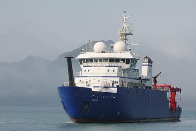
Pelican · LUMCON
Buoy
Kevin Martin · USM
Go out and pick up the USM buoy, Swap sensors and deploy buoy.
Jun 6, 2024 · 1 d
Gulf of Mexico
Pelican · LUMCON
Kevin Martin · USM
Go out and pick up the USM buoy, Swap sensors and deploy buoy.
Jun 6, 2024 · 1 d
Gulf of Mexico
Amy Bower · WHOI
Variability in the transport of heat, freshwater and mass in the North Atlantic has been linked to a number of societally relevant factors including sea level change, the melting of sea and glacial ice, and anthropogenic carbon storage in the deep ocean. However, the current understanding of the drivers of such changes is limited, making an investigation of overturning in the Sub-polar region a key ocean research priority. This field program explicitly addresses this gap. Furthermore, by engaging the larger international community studying the North Atlantic, Overturning in the Sub-polar North Atlantic Program (OSNAP) is playing a key role in catalyzing scientific progress by promoting international collaborations, synthesis, and the sharing of resources and by training future generations. The overall goal of this field project, in conjunction with other measurements in the North Atlantic, is to establish determination of the linkage between intermediate and deep water formation and the overturning circulation--a connection that is present in climate models, but has yet to be observed. This project will also provide the first comprehensive view of spreading pathways for the deep waters in the Sub-polar basin. Starting in 2014, the US-led international project, Overturning in the Sub-polar North Atlantic Program (OSNAP), provides a continuous record of the full-water column, trans-basin fluxes of heat, mass and freshwater in the Sub-polar North Atlantic, in partnership with the UK, Netherlands, Canada, Germany and China. Data from the first 21 months of the full OSNAP observing system has been used to produce an initial time series of the meridional overturning, heat and freshwater fluxes for the Sub-polar basin. These preliminary results reveal a highly variable overturning in the basin, interior pathways for overflow waters, surprisingly energetic boundary current systems on timescales from days to months, and a strong overflow plume in the Iceland Basin. The additional two years of OSNAP observations will cover a time frame sufficient to make comparisons with other overturning time series and optimize the OSNAP measurement system--all necessary tasks prior to a request for longer term measurements. This component of OSNAP (OSNAP East) is for the eastern array between Greenland and Scotland in coordination with the UK and the Netherlands. The US contribution includes the East Greenland inshore and offshore arrays, the Iceland Basin array, and the integration of all OSNAP measurements. The sub-goal for OSNAP East is to quantify the structure and transport of the boundary currents off the east coast of Greenland and within the Iceland Basin, as well as determine their variability and forcing mechanisms.
Deidra Emrich · WHOI
To carry out the recovery and redeployment of the NSF Ocean Observatories Initiative (OOI) Irminger Sea Array, servicing four moorings and up to five gliders in an area southeast of Greenland (38-41W, 58-61N) The platforms will carry multidisciplinary instrumentation and provide the capability for real time communication of data and control of sampling. A surface mooring will instrument the sea surface and upper ocean, capturing the surface forcing and upper ocean variability. A profiling mooring will measure through the water column. Two additional taut subsurface moorings and the gliders will complete the capabilities to obtain vertical profiles and sample the mesoscale (10s-100km) variability at the site. Shipboard date will be obtained to assess the performance of the instrumentation.
Jillian Maloney · SDSU
This research studies the potential for submerged paleolandforms and archaeological sites along the Washington coast. We will develop a new GIS model that projects paleolandscape extents under changing relative sea level since the last local glacial maximum. This model will also make projections for submerged archaeological site potential within this coastal paleolandscape. This model will be informed by the latest glacioisostatic adjustment model data, traditional knowledge of coastal landscape use and settlement by Quinault peoples and neighboring Tribes that have interest in participating in this effort, and current archaeological sites knowledge for the Washington coast. Working from this model, a geophysical survey plan will be developed and implemented to collect sidescan sonar and subbottom profiler data on the Washington continental shelf. These data will be studied to identify remnant submerged paleolandforms and any potential archaeological sites that they may contain.
Jun 2 – Jun 12, 2024 · 10 d
Between Queets & Quinault river mouths and the Quinault canyon head
F.G. Walton Smith · UMIAMI
Ana Arellano · USF
All REU participants will have the opportunity to participate in a research cruise to Tampa Bay for the collection of research samples and deployment of research instruments. The primary objective of this research cruise is to investigate turbidity dynamics in Tampa Bay, assess sediment characteristics at key locations inside and outside the bay, and conduct vibracoring of relict coastal features on the West Florida Shelf. The cruise aims to provide insights into sedimentary processes, water quality, and geological features in the study area.
Jun 2 – Jun 6, 2024 · 4 d
Tampa Bay Area
Hannah Delapp · SIO
Jun 1 – Jun 5, 2024 · 4 d
USEC
Mark Zumberge · SIO
GNSS-A (Global Navigation Satellite System-Acoustic ranging) is the leading method currently advancing seafloor geodesy. In this technique, the position of a sea surface platform is recorded with GNSS while acoustic ranges between it and seafloor transponders enable the position of benchmarks on the seafloor to be determined in a global reference frame with centimeter accuracy. We believe that in a shallow (few hundred meters) water environment only a single transponder and a day of surveying are needed to achieve 1 cm accuracy. We propose to test this hypothesis by siting a single transponder offshore San Diego and surveying it multiple times over a one year period to establish the accuracy of the single-transponder short-term-survey approach. As part of this we will design and construct a trawl-proof housing for the transponder and sample the water column sound velocity profile with CTD measurements to assess the possibility of any potential bias caused by deviations from the sound-speed stratification assumption.
May 30 – May 31, 2024 · 1 d
La Jolla, CA
Deidra Emrich · WHOI
This is the tenth cruise (ninth turnaround) for the Global Station Papa Array of the National Science Foundation’s Ocean Observatories Initiative (OOI; http://www.oceanobservatories.org). The Station Papa Array includes a network of moorings and gliders to monitor waters in the data sparse high latitudes of the Gulf of Alaska. The moorings and the gliders give the array the capability to address the role of the mesoscale flow field in ocean dynamics
Jim Thomson · UW
A combined observational and forecast modeling study will address the coupling between ocean surface waves and rain. The observations will extend an existing time series at Ocean Weather Station Papa (OWS-P) and complement those observations with more detailed measurements using drifting buoys. The observations will be used to improve parameterizations in spectral wind-wave models, as well as fundamental understanding of surface turbulence in the presence of rain and the related changes to air-sea fluxes. The intellectual merit of this research is addressing a knowledge gap in the suppression of ocean surface waves by rain and the associated changes in surface roughness and surface turbulence. The work will address this gap through long-term field observations at OWS-P, combined with a short-term process study using deployments of opportunity in the same region. The results will improve understanding of air-sea interactions for coupled climate and forecast models. In particular, this work will enable existing spectral wind-wave forecast models (e.g., WAVEWATCH III, SWAN, etc) to account for the effect of rain on wave generation and dissipation. The broader impacts of this work are in the continuation of a time series of surface waves at a key reference site, as well as improvements to wave forecasting and bulk formulae for air-sea interactions. Other impacts include undergraduate education, through paid internships each summer (funded directly by the project) and participation in the NSF Research Experiences for Undergraduate program (funded separately). Outreach will be conducted through an updated web site and short videos produced for an existing Applied Physics Lab YouTube channel, as well as booths at public events like Discovery Days (over 10,000 attendees). The project will test the following hypotheses: 1. Rain suppresses ocean surface waves, especially the short waves in the `tail' of the spectrum. 2. The suppression, together with a reduction in wind input to waves, leads to a reduction in wave breaking. 3. The reduction in wave breaking reduces both the surface roughness (with implications for drag coefficients) and the surface turbulence (with implications for fluxes). 4. Rain may increase the surface turbulence through a direct injection of turbulence by raindrops, especially in low to moderate winds, competing with the indirect effect of the surface turbulence damping through a reduction in wave breaking.
Hugh R. Sharp · UDel
Chris Martens · UNC
The project will test key hypotheses about deep-sea methane dynamics including determining if there are significant lags in microbial responses after exposure to elevated methane concentrations, determining the relationships of AMOR to methane and DIN concentrations and investigating the response times and magnitude of methanotrophs to spatial and temporal variability in methane concentration. Successful collection of in situ AMOR and associated microbial community data will prove important for modeling ocean methane dynamics over a range of oceanographic conditions including seep-enriched bottom waters and accidental hydrocarbon releases.
May 29 – Jun 1, 2024 · 3 d
Washington and Baltimore canyon area
Kilo Moana · UH
Kay Bidle · Rutgers
A convergent team of experts in biology, chemistry, physics, engineering, mathematics, and computational modeling examine how dynamic and coupled phytoplankton-pathogen-particle-predator linkages coalesce to explain the observed high spatial variability in the efficiency of the export of particulate organic carbon (POC) to the deep ocean. They elucidate and quantify the linkages between viruses and ballast minerals to increase understanding of carbon cycling in the oceanic biological carbon pump and the impact of viruses within it. By providing knowledge than can be used to improve the parameterization of carbon export in Earth system models, the project will help reduce uncertainty in regional marine biogeochemical projections, potentially improving marine ecosystem and fisheries management on timescales from seasons to decades. The project includes activities that provide teaching resources and hands-on training to educators within a ‘Tools of Science’ program that provides a simple and succinct way to communicate the process of scientific research to students in a way that is useful to teachers. The project couples laboratory-based experiments on model host-virus-grazer systems with extensive field based observational and manipulative studies on natural populations of diatoms and coccolithophores, the two phytoplankton groups that account for most of the estimated particulate organic matter flux to the deep ocean. Experiments and measurements integrate diagnostic biological and chemical controls on infection and particle coagulation theory with microscale physics and grazing to quantify links to each hypothesized export mechanism under field-relevant turbulent conditions. Cutting-edge engineering and analytical tools are used to diagnose and track infection dynamics while characterizing and quantifying particle aggregation and disaggregation, mineral dissolution, sinking dynamics, grazing rates, and fecal pellet production at unprecedented resolution and under well-defined, microscale physical regimes. Field campaigns elucidate the relative efficiency of hypothesized mechanisms in stimulating POC export in natural blooms, while providing bulk and size-resolved estimates of POC flux.
May 28 – Jun 26, 2024 · 29 d
CA Coast -
Hannah Delapp · SIO
May 25 – Jun 3, 2024 · 9 d
USWC
Pelican · LUMCON
Allison Matzelle · CFA
This cruise is one of several Carboniferous Inc. and UCSB science team research cruises to evaluate the feasibility of placing biomass in the Orca Basin area in the Gulf of Mexico as a potential net-negative Carbon Dioxide Removal (CDR) pathway. Cruise objectives generally include lander recovery, engineering tests, temporary biomass placement, environmental monitoring (CTD casts and water sampling), and experiment recovery.
May 23 – May 28, 2024 · 5 d
Orca Basin
Diane Fribance · CCU
A study of the dynamics of a coastal buoyant plume, fed by a riverine discharge, that crosses a wide continental shelf at an oblique angle and with minimal lateral spreading. This type of plume delivers coastal low-salinity water offshore, possibly all the way to the shelf-break, where it can be entrained by major oceanic currents (e.g., the Gulf Stream on the US east coast). The plume’s formation is the result of tidally-modulated estuarine outflow and a balance between upwelling wind and buoyancy forcing, something not uncommon in a variety of environments around the globe, and yet it deviates from the traditional plume types commonly referred to in the literature. We hypothesize that under such wind/buoyancy conditions the tidal pulses of brackish water produce individual tidal sub-plumes, which are subsequently advected offshore by Ekman drift without being dispersed or mixed by excessive wind-induced shear stresses. The freshwater discharge is assumed to be sufficiently high so that geostrophic adjustment can occur within the tidal pulse of buoyant water. Under this scenario, the width of the resulting plume is simply the scale of the individual tidal sub-plume, while its total length is a sum of multiple tidal sub-plumes, roughly aligned with the surface wind-driven currents. The result of this process is a filament-like plume with an unusually high length-to-width aspect ratio, which breaks away from coastal trapping and protrudes far offshore. A number of field experiments will resolve mixing, wind and other forcings near the sea surface to develop an accurate description of the conditions favoring the development and persistence of these dynamics.
May 21 – May 27, 2024 · 6 d
Mouth of Winyah Bay, SC, off Georgetown in Long Bay
Endeavor · URI
Laurie Fialkowski · NRL
Time-coincident oceanographic and acoustic measurements will be carried out for the validation of the information content of ocean noise as well as its tactical utility.
May 20 – May 22, 2024 · 2 d
New England Shelf Break Area or New England Sea Mount Area
Greg Rouse · SIO
We will sample using coring/dredge equipment (multicore, sleds and box cores) the sediments of the San Pedro and Santa Monica basins off Los Angeles. Areas of these basins are known to have high levels of DDT and breakdown products. We will document the animal and microbial diversity at these sites and compare them to uncontaminated sites as well as further documenting the chemistry of the sediments. Assessing microbial remediation of the sediments is one goal of the sampling. Another is to see if the animal communities are different at the contaminated sites and if they are accumulating DDT and breakdown products and so potentially becoming available to other trophic levels on the food web.
May 19 – May 23, 2024 · 4 d
San Pedro and Santa Monica Basins
Daniela Di Iorio · UGA
Collaborative Research: Temporal Variability of Vertical Upwelling of a Natural Hydrocarbon Seep and its Connection to the Ocean Surface
May 18 – May 28, 2024 · 10 d
GC185 lease block in the Gulf of Mexico 2 nautical mile radius
F.G. Walton Smith · UMIAMI
Ian Smith · NOAA
AOML SFP regional surveys over the southwest Florida shelf and the Florida Keys reef tract have been routinely performed via the University of Miami's R/V F. G. Walton Smith on a bimonthly basis. Sampling methodologies similar to those utilized on AOML SFP bay surveys (discrete sampling and flow-through measurements) have been employed on these regional research cruises.
May 18 – May 24, 2024 · 6 d
Miami, Keys reef tract , and West Florida Shelf
Kilo Moana · UH
Catherine Davis · NCSU
The overall goal of this project is to understand the strategies planktic foraminifera use to survive in low-oxygen environments in the pelagic ocean, and if relevant, assess the contribution of planktic foraminifera to nitrogen cycling. To accomplish that goal, the proposed research would test three interrelated hypotheses: (1) OMZ-dwelling planktic foraminifera are capable of performing denitrification; (2) Denitrification is widespread among planktic foraminifera, within and beyond OMZ-affiliated taxa; and (3) Planktic foraminifera capable of nitrate respiration do so regardless of macroenvironmental oxygen concentrations. These hypotheses would be addressed via materials collected on two short research cruises sampling four stations from Monterey Bay to the California Borderlands in two different seasons. Three OMZ-associated species will be targeted (Hastigerinella digitata, Hastigerina parapelagica, Globorotaloides hexagonus) along with one species associated with marine snow (Neogloboquadrina incompta) and one species not associated with low-oxygen conditions (Globigerina bulloides). Metatranscriptomics will be used to gather information on the metabolic capabilities of each species and their symbionts, if present. Shipboard incubations testing for active denitrification under three conditions (anoxic, dysoxic, and normoxic) and analyses of intracellular nitrate content and stable N and O ratios of the foraminiferal intracellular nitrate will be carried out on all five species (H. digitata, H. parapelagica, G. hexagonus and N. incompta) and cellular ultrastructural analysis on the three OMZ-associated species. Additionally, the latitudinal and onshore/offshore populations of the full planktic foraminiferal assemblages will be determined through the water column from ~1200 m to the surface.
May 17 – May 24, 2024 · 7 d
California
Uwe Send · SIO
Continuous, long-term monitoring of physical-biogeochemical variables at the Del Mar site is providing a multidisciplinary dataset which enables detection of both short-term events, and their relation to seasonal and interannual variability. This dataset is enhancing our understanding of complex coastal processes (e.g. Ekman transport, tides, alongshore currents, coastal trapped waves and internal waves), and interactions with basin-scale climatic variability such as the El Niño Southern Oscillation and Pacific Decadal Oscillation. Moreover, the data contribute to current ecological research in better understanding issues such as hypoxia, massive fish kills and bird population decreases. The Del Mar mooring was originally developed in 2006 in collaboration with the Scripps Hydraulics Laboratory as part of the Southern California Coastal Ocean Observing System (SCCOOS) . Instrumentation includes a suite of meteorological sensors, and sensors for water temperature, salinity, oxygen concentration, fluorescence, nutrients and currents. In addition to providing a valuable real-time coastal timeseries for these parameters, the platform has also served as a testbed for developing technologies both in-house at SIO and with partner organizations such as the Environmental Sample Processor (MBARI) and Imaging Flow Cytobot (WHOI), and since 2011 has provided hands-on training for a university class on observational techniques.
May 16 – May 17, 2024 · 1 d
Del Mar, CA
Christopher LaClair · UNCW
Replace buoy and mooring systems at the FRP2, CAP2 and CHR60 buoy sites.
May 16 – May 17, 2024 · 1 d
Coastal Atlantic ocean, South Carolina
Lisa Levin · SIO
This research examines the role of deep-sea organisms in determining the fate and footprint of methane, a potent greenhouse gas, on Pacific continental margins. The investigators are evaluating the deep ocean methanosphere defined by the microbial communities that consume methane and the animals that directly feed on or form symbioses with methane-consuming microbes. They are also investigating animal communities that gain energy indirectly from methane, as well as those that take advantage of carbonate rocks, the physical manifestation of methane consumption in seafloor sediments. The study of methane seeps in the deep waters of both Alaska (4400-5500 meters) and Southern California (450-1040 meters) is enabling comparisons of the methanosphere under different food-limitation and oxygen regimes. By applying diverse chemical, isotopic, microscopy, and genetic-based analyses to seep microbes and fauna, this study is advancing understanding of the contribution of methane to deep-sea biodiversity and ecosystem function, information that can inform management and conservation actions in US waters. In addition to training for graduate and undergraduate students at their home institutions, the investigators are collaborating with the Alaska Native Science and Engineering Program (ANSEP). They are recruiting Alaskan undergraduates to participate in the research, contributing to ANSEP?s online resources that promote interaction between scientists and middle and high school students, and participating in ANSEP?s annual residential Career Exploration in Marine Science programs to engage middle school students in learning about deep-sea ecosystems and the variety of career pathways available in marine related fields.
May 16 – Jun 7, 2024 · 22 d
Aleutian Margin Abyssal depths in Gulf of Alaska off Kodiak Island
Richard Keil · UW
UW Oceanography Dept. Ocean 201 Student Cruise for May 2024.
May 15 – May 16, 2024 · 1 d
Puget Sound
Harlan Paul Johnson · UW
Puget Sound, the largest estuary by volume in the continental US, has recently been observed to host large fields of active methane venting from the seafloor. Although present throughout the Sound, the majority of gas emission sites are co-located over three major fault zones that fracture the entire forearc crust of the Cascadia Subduction Zone. Multibeam and single-beam sonar data from cruises identified the acoustic signature of over 350 individual bubble plumes. Fluid samples from adjacent terrestrial hot springs and deep-water wells surrounding the estuary contain a helium-3 isotope signature, suggesting a deep fluid source arising from the underlying CSZ plate interface. However, limited data from our previous pilot study suggests that Puget Sound emission sites appear to lack similar helium isotope signatures expected from a deep plate-interface reservoir. As an alternative hypothesis, a shallow reservoir beneath the Holocene sediments that cover Puget Sound Eocene basement, with horizontal transfer to the thinly-sedimented Alki Point and Kingston Arch anticlines, is also possible. The origin of vigorous marine methane plumes arising from areas of thin sediment cover and associated with forearc fault zones but still presenting no thermal or chemical anomalies found in other forearc environments, remains an important unresolved scientific paradox.
May 14 – May 15, 2024 · 1 d
Central Puget Sound
Anela Choy · SIO
SIO 145 (Field Methods in Biological Oceanography) is a 6-credit lab course for SIO Marine Biology undergraduates. These day cruises aboard R/V Sproul will offer students a hands-on opportunity to work at sea and gain a better understanding of how to use oceanographic sampling equipment and conduct oceanographic field research. In addition, cruises on the Sproul will provide students with an opportunity to collect data and samples that are needed to develop quarter-long lab projects. The goals of the cruise are to (1) demonstrate the different types of instrumentation used to study biological oceanography, including a CTD, Isaacs-Kidd Midwater Trawl, and plankton tows, (2) generate hydrographic data illustrating the oceanographic conditions of our sampling location(s) (e.g., thermocline, oxygen minimum zone), (3) visualize and recover zooplankton and micronekton characteristic of the southern California Current Ecosystem, (4) examine zooplankton and micronekton community composition, and (5) provide at-sea experience to students along with detailed explanations of ship operations and facilities. Work will be conducted in and around the San Diego Trough.
May 14 – May 15, 2024 · 1 d
San Diego Trough
F.G. Walton Smith · UMIAMI
Ryan Smith · AOML
Researchers from NOAA's Atlantic Oceanographic and Meteorological Laboratory (AOML) in Miami, FL, conduct regular bimonthly hydrographic surveys at 27N in the Florida Straits to monitor the transport and water-mass properties of the Florida Current. The Florida Current is part of the Gulf Stream system, which is the upper limb of the western boundary current system in the North Atlantic Ocean. These cruises are a part of the laboratory’s long-running Western Boundary Time Series (WBTS) project and directly measure the Florida Current at nine locations across the Straits of Florida at 27N, between Jupiter, Florida, and the Little Bahama Bank in the Bahamas. WBTS 27N hydrographic sections, conducted bimonthly throughout the year, are critical to improving our understanding of the North Atlantic Subtropical Gyre circulation and the Atlantic Meridional Overturning Circulation (AMOC). Importantly, data collected during these cruises and others are also used to calibrate the 27N submarine cable system which publicly provides daily transport estimates of the Florida Current . The AMOC is a significant factor in climate change, oceanic carbon sequestration, and sustainable fisheries. In addition to the direct ship-based measurements conducted during WBTS 27N cruises, these surveys also support and service project moored instrumentation, located on either side of the Straits, which provide key times series data. These monitoring efforts are necessary for quantifying AMOC and gyre variability over time and for identifying decadal changes in the large-scale circulation, water-mass properties, and heat transport. The WBTS project is part of an international collaboration which partners include AOML’s WBTS, the University of Miami’s Rosenstiel School of Marine and Atmospheric Science (UM/RSMAS) Meridional Overturning Circulation and Heat-flux Array (MOCHA) Program, and the UK National Oceanography Centre’s Rapid Climate Change (RAPID) Program.
May 13 – May 14, 2024 · 2 d
Straits of Florida