Completed
Atlantic Explorer · BIOS
BIOS-SCOPE
Craig A. Carlson · UCSB
Funding agency: Simons Foundation International
Jul 15 – Jul 18, 2023 · 3 d
In the vicinity of BATS and Hydrostation S in the northwestern Sargasso Sea
Atlantic Explorer · BIOS
Craig A. Carlson · UCSB
Funding agency: Simons Foundation International
Jul 15 – Jul 18, 2023 · 3 d
In the vicinity of BATS and Hydrostation S in the northwestern Sargasso Sea
Robert G. Hatfield · Florida
Spatial and temporal characterization of the past history of the West Greenland Current and the west Greenland Ice Sheet since the last glacial maximum through geophysical surveying and piston coring of the West Greenland slope and shelf. We are proposing to core and survey along a south-north transect in Baffin Bay, focusing on four trough mouth fans. Each 24-hr period will alternate between surveying and coring/sampling efforts, with an effort to concentrate surveying during periods of low light. Sampling operations will focus on the collection of long piston cores and high-resolution sub-bottom surveys. Depending on the parameters of the Knudson Chirp system aboard the assigned vessel, we may bring an Edgetech Chirp 512i subbottom profiler. We require deck space and handling systems for deployment of large diameter gravity and piston corers and an MC-800 multicorer, as well as one lab van (MARSSAM MSCL system) and one refrigerated shipping container for core storage. We may also require deck space for the over-the-side Chirp system if it is needed; this system must be deployed from a steel cable with an 11000 lb working load. We also require sheltered deck space to split core sections after their physical properties have been measured in the MSCL van, and access to tables in the main lab for core description and archival. Ancillary to coring operations, we will collect water samples and CTD data with the shipboard CTD rosette to characterize modern surface and interior watermasses at each site.
Jul 11 – Aug 13, 2023 · 33 d
Baffin Bay Transect of trough mouth fans from ~150 nmi north of Nuuk, Greenland to ~680 nmi north of Nuuk.
Nathan Bacheler · NOAA
SEFIS is a fishery-independent research group that surveys reef fish using traps and video from Cape Hatteras, NC, to St. Lucie Inlet, FL, from 15-115 m deep.
Jul 11 – Jul 21, 2023 · 10 d
Southeast US Atlantic continental shelf between NC and the east coast of FL.
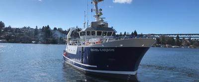
Blue Heron · UMN
Josef Werne · UPT
The Great Lakes hold about 20% of the freshwater on Earth and have been increasingly impacted by human activities in recent decades. Lake Erie suffers from large, annually recurring, toxic cyanobacterial blooms in summer, whereas Lake Superior experiences smaller, localized cyanobacterial blooms after storm events. Cyanobacterial blooms have harmful ecological, human health, and economic implications. These blooms are a global phenomenon, observed in lakes and oceans, and can lead to low oxygen conditions and the production of toxins, both of which can be harmful for ecosystems. Understanding how different types of cyanobacteria influence nutrient cycling remains a major knowledge gap. This project aims to provide a deeper understanding of the long-term state of the Great Lakes ecosystem. The research approach combines new and established methods. Project results and implications will be shared with local and regional water interests in partnership with the Pittsburgh Collaboratory for Water Research, Education, and Outreach, the Great Lakes Commission Harmful Algal Blooms Collaborative, and the Lake Erie Area Research Network. Education is a central part of this project and training opportunities target next generation of scientists, including postdoctoral, graduate, and undergraduate students. The students and postdoc will receive state-of-the-art training in the rapidly developing fields of biogeochemistry and geomicrobiology, while working with an interdisciplinary team of scientists.
Jul 8 – Jul 10, 2023 · 2 d
Western arm of Lake Superior, between Isle Royale and Apostle Islands
F.G. Walton Smith · UMIAMI
Christopher Kelble · NOAA
AOML SFP regional surveys over the southwest Florida shelf and the Florida Keys reef tract have been routinely performed via the University of Miami's R/V F. G. Walton Smith on a bimonthly basis. Sampling methodologies similar to those utilized on AOML SFP bay surveys (discrete sampling and flow-through measurements) have been employed on these regional research cruises.
Jul 8 – Jul 14, 2023 · 6 d
Miami, Keys reef tract , and West Florida Shelf
Mark Zumberge · SIO
Convective forces deep below Earth?s surface cause tectonic plates (continents and seafloor) to slowly move at many centimeters (several inches) each year. In places, the plate boundaries must slide past one another to accommodate this motion. Sometimes this occurs smoothly, but sometimes the plate edges are stuck together by friction and don't slide at all until enough stress builds to the point where the plates slip past each other suddenly in an earthquake. Over the past two decades, a different form of tectonic boundary slip has been studied in which built up stress is relaxed episodically, as in an earthquake, but at a much slower rate taking days, weeks, months, or even years to gradually slip. These events are called "slow slip events" or "slow earthquakes." Because the motions are gradual they do not generate seismic shaking (as normal earthquakes do), making them far less dangerous. However, slow slip events occurring near areas that are frictionally stuck may trigger large earthquakes, a phenomenon that requires further study. This study focuses on searching for slow slip events in the offshore, shallow part of the Cascadia subduction zone, which lies offshore the western United States stretching from northern California to north of the Canadian border. Here an oceanic tectonic plate is colliding with North America, producing very large destructive earthquakes and tsunamis every few hundred years. The lack of seismic shaking associated with slow slip events makes these events difficult to detect, especially offshore. On land they are evident in precise, continuous GPS records which show plate motions of several centimeters that start and stop over a few weeks. Such motions are much more difficult to observe on the seafloor because GPS signals do not penetrate sea water. Consequently alternative methods must be devised to detect offshore slow slip events. This research project will record very precisely the lengths of optical fibers stretched across the seafloor near the Oregon coast. If a slow slip event occurs in the region near the optical fibers, the associated optical length change will be recorded by a battery powered laser system at the end of each optical fiber. Studying such events offshore will help to build models of their influence on the timing and location of great earthquakes, and may lead to future advances in earthquake forecasting. The project supports the training of a student. Widespread deployments of GPS sensors in the past decade have helped identify Slow Slip Events (SSEs), especially near subduction zone faults in Cascadia, Costa Rica, Japan, and New Zealand. Understanding SSEs presents an opportunity to gain new insights into the mechanism governing locking and unlocking of subduction zone and other faults, and may be important in assessing the hazard levels presented from potential great earthquakes and tsunami. In particular, SSEs occurring at the downdip limit of the strongly locked zone may pose a risk of triggering large earthquake ruptures. It is therefore critical to search for SSEs occurring at the base of the locked zone, which in Cascadia (as in most subduction zones) lies offshore. In this study, two orthogonal optical fiber strainmeters will be installed on the seafloor above the Cascadia subduction zone to detect offshore SSEs. A recent study of the cumulative effect of SSEs in Cascadia using onshore GPS data indicates possible offshore slow slip at the base of the locked zone which is hypothesized to occur simultaneously with onshore SSEs. However, the detection of this slip using onshore GPS is very weak. Confirming the presence or absence of offshore slow slip in Cascadia is important for understanding the potential role of SSEs in influencing the timing and location of the next great earthquake. While GPS networks have sufficient sensitivity to map the location of SSEs onshore, they do not cover that portion of the crust under the oceans, nor are they able to distinguish the timing of sub-events because of the need for averaging over daily periods. In contrast, optical fiber strainmeters can be deployed offshore and have their best signal to noise ratio at shorter periods, complementing onshore GPS both in location and frequency band. Because SSEs evolve in complex patterns indicative of propagating stress fronts, it is important to resolve, both in scale and time, the deformation signals in order to understand more fully the evolution of the rupture plane. In conjunction with GPS, the availability of highly sensitive and stable strainmeters offshore will enable such characterizations. The measurements in this study will be timed with an expected onshore SSE to capture the hypothesized offshore slip, testing this model and others that address the extent of an offshore locked zone. In addition to the detection of SSEs, a number of other studies will become feasible following the deployment of this offshore strainmeter, including investigation of strain from traveling seismic waves and tidal observations for inferring local Earth structure. In addition, the work will advance the technology of optical fiber sensors and likely find applications in other disciplines
Jul 8 – Jul 13, 2023 · 6 d
Oregon Coast, Offshore and NW of Newport, Oregon
Mark Zumberge · SIO
Deformation of the seafloor is an important tectonic process, which can best be studied with marine geodetic techniques. The GNSS-Acoustic method is the technique chosen by a community workshop to investigate the following processes in Cascadia and Alaska: 1. Along-strike changes in coupling and relation to onshore deformation. A strong and widely spaced geodetic backbone offshore of existing on-land geodetic infrastructure, in regions not constrained by land stations could serve as the greatest return on investment for scientific and hazards understanding of megathrust subduction behavior. 2. Near-trench coupling and relation to tsunami earthquake(s) and down-dip behavior. While Alaska is the only of the two locales that has the known occurrence of a damaging tsunami earthquake (characterized by its outsized tsunami wave amplitude for earthquake magnitude) in 1946, it is understood that due to depth restrictions particularly in the 1946 rupture patch, much more of the near-trench environment off Cascadia can be evaluated using current instrument pool transponders. 3. Occurrence of shallow aseismic slip and its relation to earthquakes. The Cascadia subduction zone has clearly observable and large down-dip slow slip events, and an overall large near-trench exposure capable of observation with the geodetic instrument pool. 4. Postseismic time-dependent variations in coupling, including transients, afterslip, viscous relaxation, and recoupling. This was viewed as much more important in Alaska where recent large earthquakes allow for much greater potential for capturing discernable time-dependent variations in coupling behavior.
Jul 8 – Jul 13, 2023 · 6 d
Oregon Coast, Offshore and NW of Newport, Oregon
David Schmidt · UW
We are extending the time series of seafloor benchmarks at three sites on the accretionary prism in the Cascadia subduction zone offshore Oregon using the GNSS-Acoustic method. These seafloor sites were established in the past five years with varying numbers of surveys on each, yielding initial estimates of plate velocities at three of four sites along the margin. Three surveys will be performed with a GNSS-Acoustic-equipped Wave Glider in our two-year project. The Wave Glider approach greatly reduces the survey cost compared to that undertaken with a research vessel. As the uncertainty in a time series slope decreases linearly with the total duration or the data set and as the square-root of the number of samples, it is critical to maintain these time series to be able to reduce the uncertainties in local seafloor velocities. This will allow us to better distinguish among different models of plate locking. In addition to undertaking the geodetic surveys, we will explore means to improve the data processing through algorithms designed to mitigate biases from the acoustic velocity structure of the water column and by capitalizing on multi-GNSS data. Finally, we will perform a modeling exercise to estimate the amount of kinematic locking at the trench using elastic boundary element models, with the goal to identify if plate locking varies along strike and correlates with structurals features in the outer accretionary prism.
Jul 8 – Jul 13, 2023 · 6 d
Oregon Coast, Offshore and NW of Newport, Oregon
Jeff Book · NRL
Deployment and recovery of deep bottom lander moorings at depths > 1000 m
Jul 7 – Jul 8, 2023 · 1 d
Shelf Break on the California Shelf
Jan Newton · UW
Washington Ocean Acidification (WOAC) in Puget Sound
Jul 7 – Jul 12, 2023 · 4 d
Puget Sound
Blue Heron · UMN
Richard Ricketts · UMN
Sediment trap and McLane pumping work for microplastics
Jul 6 – Jul 8, 2023 · 2 d
Western Lake Superior
Rasmus Swalethorp · SIO
Conduct CalCOFI surveys off Southern California quarterly, two of these on UNOLS ships.
Brice Semmens · SIO
We aim to understand the transport, persistence and distribution of environmental DNA (eDNA) in marine environments from marine mammal targets. With support from the ONR Multidisciplinary University Research Initiatives (MURI) program, we will use ongoing and existing large-scale projects across the West Coast to understand eDNA on multiple spatial, vertical, and temporal scales, with a minimum of additional sampling effort. Our major objectives are: (1) to understand the fate and transport of eDNA and thereby interpret eDNA detections from marine mammals in a spatially and temporally explicit context; (2) to evaluate eDNA as a complement to -- or plausibly, as an alternative to -- traditional visual observations and acoustics detections for cetaceans; and, (3)To apply the lessons learned to map marine mammals along the US west coast using eDNA. As part of this effort we will integrate marine mammal eDNA sampling and detection protocols into quarterly CalCOFI (California Cooperative Oceanic Fisheries Investigations) ocean ecosystem monitoring cruises in the California Current Ecosystem. We will also pair eDNA marine mammal sampling with ongoing acoustic and visual surveys of marine mammals as part of the CalCOFI cruise plan. Collectively, these efforts will provide an unparalleled testbed for the validation and calibration of emerging eDNA sampling methods for cetacean detection and location prediction.
Katherine Barbeau · SIO
The California Current Ecosystem (CCE) Long-Term Ecological Research (LTER) site is a coastal upwelling biome and the site of a 73-year (ongoing) spatially-resolved ocean timeseries (CalCOFI) that has demonstrated physical forcing on multiple spatiotemporal scales with concomitant impacts on ocean biota. The CCE is part of the larger LTER Network, founded in 1980 by the National Science Foundation. CCE-LTER studies are making excellent progress towards diagnosing mechanisms of ecosystem change in a major upwelling ecosystem and developing a quantitative framework for forecasting future changes. Our field site is in the CA Current upwelling regime, centered around Point Conception, within the CalCOFI time series station plan. The CCE LTER field program includes several different elements: experimental process cruises, time series cruises (ship time augmented on existing CalCOFI cruises) and mooring servicing cruises to maintain the deep water CCE1 and CCE2 moorings. The science carried out on these field expeditions is highly interdisciplinary, involving elements of biological, chemical, and physical oceanography.
Pelican · LUMCON
Melissa Soldevilla · NOAA
This project uses a network of underwater microphones to record marine mammals throughout U.S. and Mexican waters in the Gulf of Mexico and gather information on their location and density throughout the year. The data from this comprehensive and long-term passive acoustic monitoring program will be used to identify the conditions that could be driving seasonal, annual, and decadal trends in the abundance of marine mammals, where they are located, and how densely they aggregate when they are there. This project will complement existing vessel-based surveys and expand on prior passive acoustic monitoring in the region. This project uses a multifaceted sampling approach. One part consists of acoustic data collection at four historic long-term reference sites and four additional long-term reference sites in the northwestern and southern Gulf of Mexico to obtain long-term trends in marine mammal distribution over time. The second part consists of random acoustic sampling across a grid of 20 short-term sites to obtain additional location information. The third part uses acoustic tracking arrays for short durations at long-term sites to measure acoustic animal behavior. This third part collects the information necessary to convert acoustic detections into estimated densities of marine mammal species. The project team is engaging with federal and state agencies, non-governmental organizations, and private industry to make sure their findings are reaching the people who are making decisions that impact marine mammal management. This project is also coordinated with the Reduce Impacts of Anthropogenic Noise on Cetaceans project supported by the Deepwater Horizon Natural Resources Damage Assessment Trustees. This project will 1) characterize seasonal, annual, and decadal trends and variability in marine mammal species in the Gulf of Mexico, 2) determine whether the processes driving the apparent declining trends are due to animal movements or population declines, 3) quantify the relationships between marine mammal density and ocean conditions and evaluate the oceanographic processes driving short-term and long-term variability in marine mammal density, and 4) quantify the relationships between marine mammal density and ambient noise conditions and evaluate the role of human activities in driving short-term and long-term trends in marine mammal density.
Jul 3 – Jul 19, 2023 · 16 d
Gulf of Mexico
Endeavor · URI
Angela Knapp · TAMU
Motivated by three prior cruises to the West Florida Shelf (WFS), the proposed work will quantify the flux and isotopic signatures of submarine groundwater (SGD)-derived dissolved organic nitrogen (DON) and dissolved iron (dFe) to the WFS as well as evaluate the bioavailability of this temporally variable DON and dFe source using four near-shore sampling campaigns and two cross-shelf cruises. The proposed work will evaluate whether SGD stimulates nitrogen fixation, and the potential for that nitrogen fixation to further modify the chemistry of DON and dFe on the WFS. The cross-shelf cruises will sample during hypothesized periods of both maximum SGD and Trichodesmium spp. abundance (June), and reduced river discharge and SGD (Feb.), providing comparison between the two distinct regimes. The four small boat sampling campaigns will sample submarine groundwater wells and the overlying seawater, as well as Tampa Bay and the Hillsborough and Caloosahatchee Rivers. The concentration, isotopic composition of DON and dFe, and in the case of DON, the molecular composition, will be characterized. Fluxes of DON and dFe from SGD and rivers across the WFS will be quantified with radium isotope mass balance budgets. These measurements will test the hypothesis that submarine ground water discharge (SGD) is the dominant source of bioavailable dissolved organic nitrogen (DON) and dissolved iron (dFe) on the WFS. This hypothesis will also be tested with incubations of submarine groundwater with phytoplankton communities collected at the 50 and 20 m isobaths. The proposed work will evaluate the potential for SGD, rivers, and nitrogen fixers to modify the DON and dFe imported into the Gulf of Mexico from the Atlantic Ocean.
Jul 1 – Jul 13, 2023 · 12 d
West Florida Shelf
Kilo Moana · UH
Russ Hopcroft · UAF
The research focus of the NGA LTER site will be on mechanistic understanding of processes that underlie environmental variability, and the role of the latter in promoting high productivity and resilience. Building on prior knowledge, the investigators will test three hypotheses centered on ecosystem emergent properties: 1. Changes in the hydrologic cycle affect spring bloom production through changes in cloud cover, the stratification/mixing balance, macro- and micronutrient supplies, and transport pathways. 2. Hot-spots of high summer primary and secondary production result from interactions between the fresher Alaska Coastal Current and more saline offshore waters as promoted by shelf morphology and regional winds; hot spot timing and magnitude will be influenced by changes in the hydrologic cycle. 3. Nutritional and life history patterns of NGA consumers minimize trophic mismatch, buffering spatial and temporal variability in lower trophic level production and leading to resilience in the face of long-term climate change. The investigators will address these hypotheses with an integrated research program that includes: a) seasonal time series studies addressing short- and long-term environmental and ecosystem variability through a spring-to-fall field cruise- and mooring-based observational program, building upon and enhancing the Seward Line times series, and leveraging existing collaborations to obtain higher trophic level data; b) process studies that focus on hypothesized mechanisms leading to variability and enhancement of NGA production in time and space; c) modeling studies that incorporate physical and biogeochemical observations, provide a framework for testing hypotheses, and predict ecosystem responses to projected environmental changes; d) a data management component that provides a public platform for data visualization and synthesis by LTER colleagues, educators & students, and resource managers.
Jun 29 – Jul 16, 2023 · 16 d
Northern Gulf of Alaska.
Atlantic Explorer · BIOS
Nicholas R. Bates · BIOS
Long-term observations over several decades are a powerful tool for investigating ocean physics, biology, and chemistry, and the response of the oceans to environmental change. The Bermuda Atlantic Time-Series Study, known as BATS, has been running continuously since 1988. The research goals of the BATS program are: (1) to improve our understanding of the time-varying components of the ocean carbon cycle and the cycles of related nutrient elements such as nitrogen, phosphorus, and silicon; and, (2) to identify the relevant physical, chemical and ecosystem properties responsible for this variability. In addition, the BATS program has strong and diverse broader impacts, contributing to the field of ocean sciences by providing high quality ocean observations and data for seagoing scientists and modelers, and a framework through which researchers can conceive and test hypotheses. This award will support the operations of the BATS program for five more years. The primary BATS research themes are as follows: (1) Quantify the role of ocean-atmosphere coupling and climate variability on air-sea exchange of CO2, and carbon export to the ocean interior; (2) Document trends and the controls on the interannual to decadal scale variability in carbon and nutrient cycles to their coupling in the surface and deep ocean via the Redfield Ratio paradigm; (3) Quantify the response of planktonic community structure and function, and impact on biogeochemical cycles to variability in surface fluxes and dynamical processes; (4) Facilitate development, calibration and validation of next generation oceanographic sensors, tools and technologies; and, (5) Generate a dataset that can be utilized by empiricists, modelers and students. This research integrates ocean physics, chemistry and biology into a framework for understanding oceanic processes and ocean change in the North Atlantic subtropical gyre. The existing 29 years of BATS data provide robust constraints on seasonal and interannual variability, the response of the Sargasso Sea ecosystem to natural climate variability, and signal detection of potential ocean changes. This project would extend the BATS program through years 31-35 to address a series of ten interlinked questions through integrated research approaches and a multitude of collaborative efforts. In addition to the themes above, and embedded into the ten questions and approaches, the BATS team will focus on, for example, coupling of particle production and biogeochemistry; revisiting the complexities of the biological carbon pump; oxygen decline; and changes in the hydrography, physics, ocean carbon cycle and biogeochemistry of the Sargasso Sea. The highest quality data observation and collection will be maintained and used to address these questions. Importantly, a wide range of collaborations at the BATS site, spanning the physical and biogeochemical disciplines, will aid these broad goals. Strong links to community stakeholders, and close collaboration (including methods intercomparisons and personnel exchanges) with the Hawaii Ocean Time-series are proposed. This work will extend the research findings of the project into educational and training opportunities within and beyond the oceanographic community, including training and mentorship of both undergraduate and graduate students.
Atlantic Explorer · BIOS
Nicholas R. Bates · BIOS
One of the longest open-ocean hydrographic stations in the world is maintained at the Hydrostation S site (formerly known as the Panulirus site) located ~25 km southeast of Bermuda in the North Atlantic Ocean. This program of repeat biweekly hydrographic observations began in 1954 (by Hank Stommel) and now, in its seventh decade, has proved to be the catalyst for numerous studies of ocean physics, biological processes and biogeochemistry. Hydrostation S continues to be recognized as one of the most important sustained ocean time–series. The renewal of the Hydrostation S program is proposed herein, extending this invaluable time–series of ocean hydrography to almost 70 years. The upper ocean warming trend has strengthened (about +1.4° C since the 1970's; ~+0.8°C in last decade) with significant salinification (+0.16). Deeper waters such as the Labrador Sea Water has cooled by a few tenths of a degree and freshened with a marked decadal oscillation. The signature of deoxygenation has been observed at Hydrostation S in the upper ocean (about 4 µmoles kg -1 decade -1 decrease in dissolved oxygen) as well as the oxygen minimum zone (~2.5 µmoles kg -1 decade -1 ). Hydrostation S also supports the longest global ocean CO 2 and acidification time-series (from 1983 to present) The major objective of the proposal is to continue Hydrostation S into the eighth decade with numerous questions related to warming and cooling, salinification and freshening, deoxygenation and insights on biogeochemical changes over time. This program constitutes frequent water column sampling of temperature, salinity, and dissolved oxygen (and indirectly, sampling of important ocean carbon time–series) of the North Atlantic subtropical gyre at the Hydrostation S site. Such work is complementary to other sustained observations such as the Bermuda Atlantic Time–series Study (BATS) and Ocean Flux Program (OFP). We propose to carry out a similar sampling format that has been followed for the past 68 years. As for the past ten years, we would continue to conduct two CTD profiles to better capture the deep–water variability while maintaining all the previous discrete depths. The first CTD cast will profile to full ocean depth (3,300–3,500 m) while the second CTD cast will profile to 500 m (to allow for instrumentation not rated for full ocean depth such as a PAR sensor). One indirect objective will be to continue to collaboratively evaluate a BIOS-based glider program with Hydrostation S data as critically important ground truthing data. The existing glider program has challenging issue, and the aim of this effort is to use robust and highly accurate Hydrostation S data to test the capability of emerging technologies over the next five to ten years.
Lynne D. Talley · SIO
GO-BGC will deploy 7 biogeochemical (BGC) Argo profiling floats along the transit from Goa to Fremantle, thus establishing the first BGC float array in the eastern Indian Ocean as part of a global array of BGC Argo floats. Each float carries the standard (core) Argo sensors (temperature and salinity), and sensors for oxygen, nitrate, pH, fluorescence and backscatter. The floats will drift at 1000 m depth, and will profile from approximately 2000 m to the sea surface every 10 days. The BGC data will be processed at Monterey Bay Aquarium Research Institute, and will be combined with the core Argo data from these floats that will be processed at U. Washington and Woods Hole Oceanographic institution. Data from the floats will be available in near real-time to the public. At each float deployment, a CTD/rosette station will be occupied, which will provide data that are very useful for validation of the calibration applied to each of the floats. The data that are directly used in the validation process are: CTD, nitrate, pH, HPLC, POC, and oxygen if it can be collected and analyzed. Salinity sampling from the rosette is also highly recommended for assessing quality of the other rosette sample data. All data from the CTD/rosette stations will be collected into a single data set that will be provided publicly at the cchdo.ucsd.edu data center for hydrographic data.
Hannah Delapp · SIO
Simon Thorrold · WHOI
We propose to design, build, and deploy technologically advanced bioacoustics and carbon flux sensor packages that will be used on state-of-the-art oceanographic moorings systems. These moorings will be co-located (operating in the same general water mass while remaining sufficiently separated to avoid acoustical and optical interference) to measure critical oceanographic parameters. This configuration will employ one shallow bioacoustics system (~300m) and one deep bioacoustics system (~700m) to achieve full-water-column coverage of the twilight zone. We will be adding the following instruments to the mooring package currently deployed that includes a SIMRAD EK80 and a sediment trap. Acoustic Doppler Current Profiler (ADCP). The addition of an ADCP will support measurements of ocean currents throughout the water column. An ADCP (Fig. 3) is a hydroacoustic current meter that measures the velocity of water currents over a range of depths. The ADCP will provide physical oceanographic data that can be used to interpret patterns of biomass and carbon flux measured at the mooring site. Install sediment traps and Underwater Vision Profiler (UVP) cameras on both deep and shallow moorings. A comprehensive understanding of the distribution, abundance, and dynamics of particulate matter and organisms in pelagic environments is crucial to predict the export and sequestration of biogenic carbon. These traps and cameras will take regular measurements of particles and organisms at sampling frequencies that are compatible with other standard oceanographic instruments. This approach holds great potential to reveal factors that regulate distribution and abundance patterns. The Underwater Vision Profiler (Fig. 4), a commercial, off-the-shelf device with integrated lighting systems, is designed to quantify large (>100 µm) aggregates and zooplankton at the same time in a known volume of water. Co-locating sediment traps with a UVP on both mooring systems will be a powerful technological advance for quantifying carbon fluxes through the twilight zone. Install high-definition camera systems adjacent to the bioacoustics systems on each mooring. Active acoustics represent a powerful tool for investigating biomass distributions and movements of organisms throughout the water column. Acoustic echograms contain little taxonomic information, however. Without knowledge of the types and aspects of fish and other organisms creating acoustical returns, it is not possible to gain comprehensive scientific understanding of life in the twilight zone. With simultaneous collection of optical data, it becomes possible to attribute the strength of the acoustic returns to specific organisms. This more comprehensive knowledge will contribute to the creation of an environmental model of migrating organisms, enabling refined biomass estimates and extrapolations that can impact fisheries management, carbon budgets, and other economically and socially significant concerns. We are currently in discussions with Juice Robotics, LLC to create a custom-designed camera system that will meet our needs. Juice Robotics produces a commercial off-the-shelf, economical camera system named DEEPi (Fig. 5) that may be a good candidate for customization and deployment as part of the OTZ Observation Network. This unit has a depth rating of 1000m, and includes onboard power, recording, and an output for a modular LED.
Jun 28 – Jul 1, 2023 · 3 d
Slope waters south of Cape Cod. Mooring to be recovered is at 39N 70.2W
Andrew Jessup · UW-APL
This proposal addresses the need to engage STEM students in Navy-centric educational opportunities in order to develop pathways to the Department of the Navy’s current and future workforce. The geosciences, and oceanography in particular, have significant underrepresentation of women and minorities with regard to recruitment, retention, and promotion in academic and research positions. Undergraduate internships can be especially effective in directing students to pursue new career paths because the participants tend to be eager to learn, open to new opportunities, and uncertain of their direction. APL-UW’s extensive and wide-ranging research programs can provide stimulating and life-changing experiences that broaden education beyond the classroom and motivate students to pursue STEM careers with Navy relevance. Our approach will be to establish the DID-NOW (Developing an Inclusive and Diverse Naval Oceanographic Workforce) program, a comprehensive summer undergraduate fellowship program that will provide (1) project-based research experience, (2) mentoring and support outside the research activity, (3) community building and support opportunities through peer-to-peer relationships, and (4) tools and strategies to navigate the pathways to a Navy-relevant career. This broad-based strategy is intended to go beyond the research experience itself by providing supplemental perspectives and resources to participants. Recruitment will target racial and ethnic minority students and military-connected students through community and Navy partnerships. Weekly meetings will include guest speakers in Navy-related jobs, tours of APL-UW laboratories and facilities, and career counselors familiar with DON STEM pathways. The program will include community-building activities to enable the intern cohort to strengthen peer to peer relationships. All interns will be given the opportunity to participate in a one-day training cruise on the UW research vessel R/V Rachel Carson in Puget Sound.
Jun 27 – Jun 30, 2023 · 3 d
Puget Sound
Collin McCaffery · SI
Our team intends to conduct an acoustic comms test utilizing two 2 surface expressions (Slocum Gliders) and two 2 moored-bottom nodes. The primary objective will be following the deployments where we are planning a 10 to 14 day equipment soak. This allows for longer duration testing, and multiple glider pattern evolutions. For this part 1 of a multi-part trip we anticipate a two 1 day mobilization, followed by a short transit (2 to 4 hours). 2 days of recovery activities, and return to port for a 1 day demobilization of the vessel.
Jun 27 – Jun 28, 2023 · 1 d
2 to 6 hours NW of San Diego
Hannah Delapp · SIO
Jun 23 – Jun 28, 2023 · 5 d
USWC
Tina Treude · UCLA
Tina Treude and David Valentine This study focuses on chemical processes that occur in oxygen-limited waters along the world's continental margins. These processes are influenced by the activities of microbes and control the fate of key elements that are deposited to sediments in these areas including carbon, nitrogen and sulfur. As a result, they are key to the health and function of the ocean. The intellectual merit of this research is to study the coupled chemical and microbial processes that occur in these environments by combining robotic technology with experiments that will be conducted at the ocean floor and in the shipboard laboratory. The broader impacts of this project will provide at-sea training and educational opportunities to undergraduate and graduate students and the results will be broadly distributed to stakeholders and interested parties. Results from this research promise to identify and quantify rates for key processes that couple carbon, nitrogen and sulfur in marine environments adjacent to the continents. The project addresses an important aspect of environmental change in the ocean (i.e., decreased oxygen due to warming and nutrient enrichment) and its influence on chemical and biological cycles and ocean ecosystems.
Jun 23 – Jul 12, 2023 · 19 d
So Cal Primarily in the Santa Barbara Basin
Pelican · LUMCON
Chris Gardner · NOAA
This cruise will support multiple aspects of the Mesophotic and Deep Benthic Communities (MDBC) Restoration goals as outlined by NRDA. Specifically, the Habitat Assessment and Evaluation and Coral Propagation Techniques Projects. The life histories, diversity, and population structures of MDBC species in the Gulf of Mexico are not well understood. The goal of this project is to fill those data gaps, determine baseline conditions, and characterize key community conditions at both injured and reference sites. This project would involve strategically designed field surveys, with subsequent laboratory-based analyses of MDBC. The surveys would support analyses of habitats and determinations of ages, growth rates, and reproductive potential of mesophotic and deepwater corals, as well as their health and condition. The most direct approach to restoring MDBC is to facilitate the growth of new corals of the same species as those damaged by the DWH oil spill. The objectives of the Coral Propagation Techniques project are to develop techniques that can be used for direct restoration of MDBC at a scale that is meaningful relative to the injury to these communities. Corals and their surrounding communities will be observed, habitats documented, and biological samples be collected. A limited number of snips from target species will be collected live from the parent colony and returned to the lab for husbandry studies
Jun 20 – Jun 30, 2023 · 10 d
Flower Gardens expansion area (East of main area between Ewing and Bright banks)
Nathan Bacheler · NOAA
SEFIS is a fishery-independent research group that surveys reef fish using traps and video from Cape Hatteras, NC, to St. Lucie Inlet, FL, from 15-115 m deep.
Jun 20 – Jun 30, 2023 · 10 d
Southeast US Atlantic continental shelf between NC and the east coast of FL.
Atlantic Explorer · BIOS
Nicholas R. Bates · BIOS
Long-term observations over several decades are a powerful tool for investigating ocean physics, biology, and chemistry, and the response of the oceans to environmental change. The Bermuda Atlantic Time-Series Study, known as BATS, has been running continuously since 1988. The research goals of the BATS program are: (1) to improve our understanding of the time-varying components of the ocean carbon cycle and the cycles of related nutrient elements such as nitrogen, phosphorus, and silicon; and, (2) to identify the relevant physical, chemical and ecosystem properties responsible for this variability. In addition, the BATS program has strong and diverse broader impacts, contributing to the field of ocean sciences by providing high quality ocean observations and data for seagoing scientists and modelers, and a framework through which researchers can conceive and test hypotheses. This award will support the operations of the BATS program for five more years. The primary BATS research themes are as follows: (1) Quantify the role of ocean-atmosphere coupling and climate variability on air-sea exchange of CO2, and carbon export to the ocean interior; (2) Document trends and the controls on the interannual to decadal scale variability in carbon and nutrient cycles to their coupling in the surface and deep ocean via the Redfield Ratio paradigm; (3) Quantify the response of planktonic community structure and function, and impact on biogeochemical cycles to variability in surface fluxes and dynamical processes; (4) Facilitate development, calibration and validation of next generation oceanographic sensors, tools and technologies; and, (5) Generate a dataset that can be utilized by empiricists, modelers and students. This research integrates ocean physics, chemistry and biology into a framework for understanding oceanic processes and ocean change in the North Atlantic subtropical gyre. The existing 29 years of BATS data provide robust constraints on seasonal and interannual variability, the response of the Sargasso Sea ecosystem to natural climate variability, and signal detection of potential ocean changes. This project would extend the BATS program through years 31-35 to address a series of ten interlinked questions through integrated research approaches and a multitude of collaborative efforts. In addition to the themes above, and embedded into the ten questions and approaches, the BATS team will focus on, for example, coupling of particle production and biogeochemistry; revisiting the complexities of the biological carbon pump; oxygen decline; and changes in the hydrography, physics, ocean carbon cycle and biogeochemistry of the Sargasso Sea. The highest quality data observation and collection will be maintained and used to address these questions. Importantly, a wide range of collaborations at the BATS site, spanning the physical and biogeochemical disciplines, will aid these broad goals. Strong links to community stakeholders, and close collaboration (including methods intercomparisons and personnel exchanges) with the Hawaii Ocean Time-series are proposed. This work will extend the research findings of the project into educational and training opportunities within and beyond the oceanographic community, including training and mentorship of both undergraduate and graduate students.
Atlantic Explorer · BIOS
Nicholas R. Bates · BIOS
One of the longest open-ocean hydrographic stations in the world is maintained at the Hydrostation S site (formerly known as the Panulirus site) located ~25 km southeast of Bermuda in the North Atlantic Ocean. This program of repeat biweekly hydrographic observations began in 1954 (by Hank Stommel) and now, in its seventh decade, has proved to be the catalyst for numerous studies of ocean physics, biological processes and biogeochemistry. Hydrostation S continues to be recognized as one of the most important sustained ocean time–series. The renewal of the Hydrostation S program is proposed herein, extending this invaluable time–series of ocean hydrography to almost 70 years. The upper ocean warming trend has strengthened (about +1.4° C since the 1970's; ~+0.8°C in last decade) with significant salinification (+0.16). Deeper waters such as the Labrador Sea Water has cooled by a few tenths of a degree and freshened with a marked decadal oscillation. The signature of deoxygenation has been observed at Hydrostation S in the upper ocean (about 4 µmoles kg -1 decade -1 decrease in dissolved oxygen) as well as the oxygen minimum zone (~2.5 µmoles kg -1 decade -1 ). Hydrostation S also supports the longest global ocean CO 2 and acidification time-series (from 1983 to present) The major objective of the proposal is to continue Hydrostation S into the eighth decade with numerous questions related to warming and cooling, salinification and freshening, deoxygenation and insights on biogeochemical changes over time. This program constitutes frequent water column sampling of temperature, salinity, and dissolved oxygen (and indirectly, sampling of important ocean carbon time–series) of the North Atlantic subtropical gyre at the Hydrostation S site. Such work is complementary to other sustained observations such as the Bermuda Atlantic Time–series Study (BATS) and Ocean Flux Program (OFP). We propose to carry out a similar sampling format that has been followed for the past 68 years. As for the past ten years, we would continue to conduct two CTD profiles to better capture the deep–water variability while maintaining all the previous discrete depths. The first CTD cast will profile to full ocean depth (3,300–3,500 m) while the second CTD cast will profile to 500 m (to allow for instrumentation not rated for full ocean depth such as a PAR sensor). One indirect objective will be to continue to collaboratively evaluate a BIOS-based glider program with Hydrostation S data as critically important ground truthing data. The existing glider program has challenging issue, and the aim of this effort is to use robust and highly accurate Hydrostation S data to test the capability of emerging technologies over the next five to ten years.
Endeavor · URI
Sharon Cooper · LDEO
The science, technology, engineering and mathematics (STEM) workforce is crucial to the U.S. health and economy, yet retention rates in STEM fields are poor, and the Geoscience community in particular is faced with a looming workforce shortage. Moreover, the Geoscience community continues to lack the diversity of the population at large. The STEM Student Experiences Aboard Ships (STEMSEAS) project is a 3-year partnership between the Indiana University of Pennsylvania, Lamont Doherty Earth Observatory at Columbia University, and the University National Oceanographic Laboratory System (UNOLS) aimed at addressing three priorities: (1) increasing the number and diversity of students pursuing degrees and careers in geosciences; (2) preparing students for all possible career trajectories in the geosciences; and, (3) contributing to the evidence base for effective student engagement, learning and retention in STEM. The STEMSEAS project is achieving these goals by taking advantage of unused berthing capacity available on UNOLS vessels as they transit between U.S. ports in preparation for their next scientific expedition. These short (~5-7 days) transits offer a unique mobile classroom setting where undergraduate non-STEM, undecided-STEM, and geoscience majors can be exposed to geoscience professional practice and career exploration. By partnering with UNOLS and campus ?champions" at universities, including minority-serving institutions (MSIs) and historically black colleges and universities (HBCUs), the project sends diverse cohorts of students to sea with a small team of geoscience faculty and mentors. STEMSEAS is built on a pilot-project that sent three cohorts (~10 undergraduate students each) selected from an applicant pool of ~875 students on three different research vessels during 2016. The pilot-project demonstrated the logistical feasibility of the program, and showed through preliminary data a strong potential for positive impact. While at sea, the students engage in a variety of hands-on activities that incorporate geoscience content, lab exercises, data collection/analysis, career exploration, and discussion/reflection. Upon completion of a transit, each participant is required to complete a post-expedition project, which they present back at their home institution, write a short article about their experiences, and participate in post-expedition webinars with other cohort members. The STEM Student Experiences Aboard Ships (STEMSEAS) project is a 3-year initiative aimed at addressing three priorities: (1) increasing the number and diversity of students pursuing degrees and careers in geosciences; (2) preparing students for all possible career trajectories in the geosciences; and, (3) contributing to the evidence base for effective student engagement, learning and retention in STEM. Application materials and evaluation surveys are providing data to assess the impact of the STEMSEAS project on student knowledge of and attitudes toward the geosciences and geoscience careers. The STEMSEAS project is designed to add to the evidence base regarding what kinds of experiences and interventions help to increase retention and persistence in geoscience-related majors, and what strategies are most effective at increasing the number and diversity of students entering the geoscience workforce pipeline. By creating innovative learning experiences on board charismatic research vessels, STEMSEAS is gathering data on the effectiveness of novel approaches for engaging students who may never have considered the geosciences as a field of study or career, students who are interested in the geosciences but are unsure of what direction to go, and STEM-interested students who may not have considered the specifics of the geosciences. Through these immersive experiences, STEMSEAS is exploring the effectiveness of short-term but intense learning activities.
Jun 19 – Jun 26, 2023 · 7 d
transit from Narragansett to Saint Petersburg