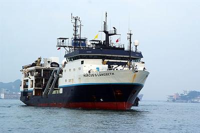
Completed
Endeavor · URI
Endeavor · URI
Endeavor · URI
Erich Gruebel · UNOLS
This research cruise will be a working engagement and training exercise between Trusted CI, the NSF Cybersecurity Center of Excellence and an Academic Research Fleet Vessel. The purpose of the cruise will be cross-training, information exchange, and security exercises between sailing marine technicians and Trusted CI.
Dec 7 – Dec 10, 2024 · 3 d
John Ruiz · EPA
At the request of the EPA Region 4 Water Division (WD), Oceans and Estuarine Management Section (OEMS), 61 Forsyth St. NW, Atlanta, Georgia 30303, the Laboratory Services and Applied Science Division (LSASD), Water Quality Section (WQS), 980 College Station Rd., Athens, Georgia 30605, will conduct a trend assessment survey at the Ft. Pierce, FL Ocean Dredged Material Disposal Site (ODMDS) to collect sediments to be analyzed for metals, semi-volatile organics (SVOAs), pesticides, PCBs, Total Organic Carbon (TOC), percent solids and macroinvertebrates. The purpose of the study will be to characterize the changes in chemical, biological and physical properties within and surrounding the disposal site. Sediment samples will be collected at all stations using a double 0.04m2 Young Grab, provided by R4 EPA. One side of the grab will be used for sediment chemistry and the other will be used for marine macroinvertebrates samples. Sediment samples will be collected and processed according to the LSASD Operating Procedure for Sediment Sampling. Marine macroinvertebrate samples will be collected at all stations. Samples will be collected utilizing a 0.04m2 Young Grab and processed according to LSASD Operating Procedure for Marine Macroinvertebrate Sampling. The sample will be sieved through a 0.5 mm screen. The remaining sample will be place in a cloth sample bag and preserved in NOTOXhisto™, non-toxic tissue preservative.
Dec 7 – Dec 11, 2024 · 4 d
Offshore dredge and disposal site located approximately 4.5 nmi off of Ft Pierce FL
Margaret Morris · SIO
The goal of this cruise is to obtain ancient soils from Goleta Slough and San Dieguito Lagoon to reconstruct Younger Dryas landscapes offshore Southern California. The Younger Dryas was a period of abrupt climate change (a return to near-glacial levels when the globe had been warming) with relatively stable sea levels for ~1000 years followed by a rapid increase in warming and sea level rise. The effect of this period on the coastal climate and landscape of Southern California is not well understood, but if we can study this effect, we may be able to learn something about how to adapt to the warming and sea level rise we see today. Ancient soils can hold a wealth of information about past climate conditions. We will collect sediment cores from two mapped offshore paleochannels: Goleta Slough and San Dieguito Lagoon. Previously collected co-located sediment cores and sub-bottom profiles offshore San Dieguito Lagoon allowed identification of the ancient shoreline from the Younger Dryas period along with broad reconstruction of the associated landscape. We identified areas in the sub-bottom profiles offshore San Dieguito that could contain ancient soils from the Younger Dryas period. The plan is to obtain cores core in these promising locations. We previously conducted a sub-bottom survey of the offshore portion of Goleta Slough, which had more complete survey coverage than the San Dieguito survey; However we did not obtain any sediment samples. We will return to Goleta Slough to take sediment samples to reconstruct the landscape and climate there as we have been doing for San Dieguito. The Goleta Slough survey lines display several promising locations for ancient sediments that could preserve climate information. By returning to both of these areas and taking sediment samples, we will be able to study climate conditions on coastal Southern California during the Younger Dryas with much greater detail than has been done before.
Rasmus Swalethorp · SIO
UC Ship Funds Program graduate student application by Max Titcomb (Scripps Institution of Oceanography) to collect sediment cores for reconstructing anchovy and sardine populations and their associated plankton communities using novel sedimentary ancient DNA analysis methods.
Jeff Pietro · WHOI
The Woods Hole Oceanographic Institution will assemble, deploy, operate and recover a near real‐time passive acoustic whale detection buoy near Savannah, Georgia. The buoy will be assembled at WHOI, transported to Savannah, and the turnaround operations conducted in the summer of 2023. The data from the buoy will be displayed in near real time on the robots4whales.whoi.edu website and reviewed daily by an experienced analyst. The results of this analysis will be displayed on the robots4whales.whoi.edu website, delivered by text and email to interested parties, displayed in the Whale Alert app, and made available to the Whale Safe system. The buoy turned around in the summer of 2023 will operate for one year and will be recovered during summer, 2024. Shortly after recovery (within hours or days), a replacement buoy will be deployed to limit downtime. This replacement system will operate until summer 2025, when it will be recovered. Dr. Mark Baumgartner is the point of contact for WHOI and will oversee the project and participate in all project meetings.
Dec 3 – Dec 4, 2024 · 1 d
31.9740' N 80.0789' W
Atlantic Explorer · BIOS
Nicholas R. Bates · BIOS
One of the longest open-ocean hydrographic stations in the world is maintained at the Hydrostation S site (formerly known as the Panulirus site) located ~25 km southeast of Bermuda in the North Atlantic Ocean. This program of repeat biweekly hydrographic observations began in 1954 (by Hank Stommel) and now, in its seventh decade, has proved to be the catalyst for numerous studies of ocean physics, biological processes and biogeochemistry. Hydrostation S continues to be recognized as one of the most important sustained ocean time–series. The renewal of the Hydrostation S program is proposed herein, extending this invaluable time–series of ocean hydrography to almost 70 years. The upper ocean warming trend has strengthened (about +1.4° C since the 1970's; ~+0.8°C in last decade) with significant salinification (+0.16). Deeper waters such as the Labrador Sea Water has cooled by a few tenths of a degree and freshened with a marked decadal oscillation. The signature of deoxygenation has been observed at Hydrostation S in the upper ocean (about 4 µmoles kg -1 decade -1 decrease in dissolved oxygen) as well as the oxygen minimum zone (~2.5 µmoles kg -1 decade -1 ). Hydrostation S also supports the longest global ocean CO 2 and acidification time-series (from 1983 to present) The major objective of the proposal is to continue Hydrostation S into the eighth decade with numerous questions related to warming and cooling, salinification and freshening, deoxygenation and insights on biogeochemical changes over time. This program constitutes frequent water column sampling of temperature, salinity, and dissolved oxygen (and indirectly, sampling of important ocean carbon time–series) of the North Atlantic subtropical gyre at the Hydrostation S site. Such work is complementary to other sustained observations such as the Bermuda Atlantic Time–series Study (BATS) and Ocean Flux Program (OFP). We propose to carry out a similar sampling format that has been followed for the past 68 years. As for the past ten years, we would continue to conduct two CTD profiles to better capture the deep–water variability while maintaining all the previous discrete depths. The first CTD cast will profile to full ocean depth (3,300–3,500 m) while the second CTD cast will profile to 500 m (to allow for instrumentation not rated for full ocean depth such as a PAR sensor). One indirect objective will be to continue to collaboratively evaluate a BIOS-based glider program with Hydrostation S data as critically important ground truthing data. The existing glider program has challenging issue, and the aim of this effort is to use robust and highly accurate Hydrostation S data to test the capability of emerging technologies over the next five to ten years.
Nov 30, 2024 · 1 d
Appxoimately 25 nm south east of the island of Bermuda
Kilo Moana · UH
David Sandwell · SIO
Here we request 4 days of ship time and additional 4 days of transit yo complete the multibeam coverage of the area of the Haxby Gravity Rolls. A brief report of the KM2401 follows. The objective of this study is to determine the origin of Haxby gravity lineaments, which are small, periodic undulations (150-250 km wavelength) in the gravity field. They are observed on the Pacific plate in areas with seafloor is devoid of large volcanoes and other topographic structures. We deployed 40 ocean bottom broadband magnetotelluric instruments to measure variations in mantle conductivity in the litho- sphere and asthenosphere, and mapped the seafloor topography and sonar backscatter, in a 130 km by 600 km area northeast of the Marquesas islands in the Pacific Ocean basin. By correlating the measured conductivity and bathymetry with the gravity anomalies, we will be able to distinguish between multiple competing models attempting to explain the Haxby lineaments. During the cruise we deployed 40 instruments. One failed to be recovered and 39 were recovered and had good data. We planned to map an area 600 by 200 km but only had time for 600 X 130 km because ship speed was curtailed due to a need to conserve fuel so the mapping time and, thus area covered, was reduced by 5.8 days. Nevertheless this combined MT/bathymetry data recovery is excellent. Other data collected include magnetic field during mapping and gravity during the entire cruise. In addition, multiple instruments on the ship recorded ocean surface temperature and other meteorological data.
Kilo Moana · UH
Ali Chase · UW
The SO-PACE project is a multi-year effort to collect optical and flow cytometry measurements on ships of opportunity. Our project aims to collect high-quality in situ measurements with broad spatial coverage in support of evaluating NASA PACE satellite mission science data products. The PACE mission launched in February 2024, and our team will use ships of opportunity to collect data for PACE product validation during 2024-2026. The primary measurements to be collected by SO-PACE are hyperspectral water-leaving reflectances (commonly referred to as remote-sensing reflectance; Rrs) and inherent optical properties (IOPs) of surface waters. In addition, phytoplankton metrics derived from flow cytometry measurements will be made using instruments that run continuously via connection to shipboard flowing seawater systems. The instruments that will be used in SO-PACE can be installed on opportunistic cruises to target regions poorly represented by existing optical observations and thus will improve the ability to assess and effectively use satellite data products. All instruments run continuously and thus provide data at relatively high spatial and temporal resolution. Data collected continuously also enable calculation of sub-pixel variability for determining uncertainties in satellite products. The SO-PACE team is experienced in deployment of instruments to be used in this project.
Daniela Di Iorio · UGA
Collaborative Research: Temporal Variability of Vertical Upwelling of a Natural Hydrocarbon Seep and its Connection to the Ocean Surface
Nov 24 – Dec 3, 2024 · 9 d
GC185 lease block in the Gulf of Mexico 2 nautical mile radius
Jessica Warren · UDel
This collaborative project is to explore the structure, seismicity, rheology, and magmatism within the slow-slipping Chain Transform Fault in the equatorial Atlantic. The formation of localized zones of deformation is a key attribute of plate tectonics. Oceanic transform faults are ideal laboratories for studying the mechanisms of localized deformation due to their relatively uniform composition and predictable motion. Many aspects of strain accommodation remain poorly understood, including (1) the extent to which cracking and seawater-driven reactions cause fault weakening deep into the fault, (2) the role of serpentine and other phyllosilicates in accommodating aseismic creep, and (3) the importance of melt infiltration and weakening within the fault zone. While existing samples of transform faults provide constraints on strain weakening mechanisms, very little sampling has been done in concert with the collection of structural and seismicity data to directly link fault behavior to rheology. An interdisciplinary field program to study the structure, composition, and seismicity of the Chain Transform Fault will be conducted through two research cruises. The first cruise, aboard the R/V Langseth, will collect multi-channel seismics to image sub-surface fault structures and the extent of magmatism in the fault domain. An ocean bottom seismometer array will be deployed during the cruise to determine the depth extent of microseismicity and the relationship between fault structures and seismicity. The second cruise will occur one year later to recover the OBS array. This cruise will dredge the fault zone to determine the composition and rheology of the fault and conduct surveys using AUV Sentry to identify the surface expression of the fault.
Nov 20 – Dec 19, 2024 · 29 d
Equatorial Atlantic at 1.5S and 15W.
Atlantic Explorer · BIOS
Steven Biller · WC
Microbial production and consumption of organic carbon play critical roles in the marine food web and global carbon cycling. Bacteria release organic matter in a variety of chemical forms and in diverse contexts, ranging from individual molecules to small aggregates and larger biological particles. In recent years we have come to understand that most, if not all, marine microbes release nanoscale structures called extracellular vesicles from their surfaces. These discrete particles, which are abundant in the oceans, are capable of transporting multiple classes of organic molecules between organisms and can serve as a potential nutrient source for other microbes. Extracellular vesicles thus represent a potentially important component of marine microbial food webs, but the magnitude and dynamics of this contribution are unknown. Further, the packaging of material within vesicles may influence the accessibility of this organic material as compared with truly 'dissolved' substances to different groups of marine organisms, potentially biasing nutrient exchanges. The goal of this project is to advance the understanding of the role that extracellular vesicles play in marine dissolved organic carbon pools and microbial food webs. To determine the contribution of vesicles to organic matter release by marine microbes, the investigators are quantifying the fraction of excreted carbon and nitrogen associated with vesicles released by multiple marine cyanobacteria and heterotrophs. The project is examining how vesicles are 'consumed; by heterotrophs to calculate a mass balance of vesicle utilization and produce detailed gene expression data to explore how cells respond to the presence of vesicles. Finally, experiments with coastal and oligotrophic marine communities are providing insights into which organisms utilize vesicles in the field, and whether they are broadly accessible to all microbes or are instead preferentially consumed by a subset of microbes. Collectively, these experiments are opening up a new area of research into the mechanisms underlying the microbial loop and provide foundational insights into the roles of extracellular vesicles in ocean ecosystems.
Nov 20 – Nov 26, 2024 · 6 d
BATS station. We need access to the BATS station, Sargasso Sea
Atlantic Explorer · BIOS
Nicholas R. Bates · BIOS
Long-term observations over several decades are a powerful tool for investigating ocean physics, biology, and chemistry, and the response of the oceans to environmental change. The Bermuda Atlantic Time-Series Study, known as BATS, has been running continuously since 1988. The research goals of the BATS program are: (1) to improve our understanding of the time-varying components of the ocean carbon cycle and the cycles of related nutrient elements such as nitrogen, phosphorus, and silicon; and, (2) to identify the relevant physical, chemical and ecosystem properties responsible for this variability. In addition, the BATS program has strong and diverse broader impacts, contributing to the field of ocean sciences by providing high quality ocean observations and data for seagoing scientists and modelers, and a framework through which researchers can conceive and test hypotheses. This award will support the operations of the BATS program for five more years. The primary BATS research themes are as follows: (1) Quantify the role of ocean-atmosphere coupling and climate variability on air-sea exchange of CO2, and carbon export to the ocean interior; (2) Document trends and the controls on the interannual to decadal scale variability in carbon and nutrient cycles to their coupling in the surface and deep ocean via the Redfield Ratio paradigm; (3) Quantify the response of planktonic community structure and function, and impact on biogeochemical cycles to variability in surface fluxes and dynamical processes; (4) Facilitate development, calibration and validation of next generation oceanographic sensors, tools and technologies; and, (5) Generate a dataset that can be utilized by empiricists, modelers and students. This research integrates ocean physics, chemistry and biology into a framework for understanding oceanic processes and ocean change in the North Atlantic subtropical gyre. The existing 29 years of BATS data provide robust constraints on seasonal and interannual variability, the response of the Sargasso Sea ecosystem to natural climate variability, and signal detection of potential ocean changes. This project would extend the BATS program through years 31-35 to address a series of ten interlinked questions through integrated research approaches and a multitude of collaborative efforts. In addition to the themes above, and embedded into the ten questions and approaches, the BATS team will focus on, for example, coupling of particle production and biogeochemistry; revisiting the complexities of the biological carbon pump; oxygen decline; and changes in the hydrography, physics, ocean carbon cycle and biogeochemistry of the Sargasso Sea. The highest quality data observation and collection will be maintained and used to address these questions. Importantly, a wide range of collaborations at the BATS site, spanning the physical and biogeochemical disciplines, will aid these broad goals. Strong links to community stakeholders, and close collaboration (including methods intercomparisons and personnel exchanges) with the Hawaii Ocean Time-series are proposed. This work will extend the research findings of the project into educational and training opportunities within and beyond the oceanographic community, including training and mentorship of both undergraduate and graduate students.
Nov 20 – Nov 26, 2024 · 6 d
BATS station. We need access to the BATS station, Sargasso Sea
Atlantic Explorer · BIOS
Nicholas R. Bates · BIOS
One of the longest open-ocean hydrographic stations in the world is maintained at the Hydrostation S site (formerly known as the Panulirus site) located ~25 km southeast of Bermuda in the North Atlantic Ocean. This program of repeat biweekly hydrographic observations began in 1954 (by Hank Stommel) and now, in its seventh decade, has proved to be the catalyst for numerous studies of ocean physics, biological processes and biogeochemistry. Hydrostation S continues to be recognized as one of the most important sustained ocean time–series. The renewal of the Hydrostation S program is proposed herein, extending this invaluable time–series of ocean hydrography to almost 70 years. The upper ocean warming trend has strengthened (about +1.4° C since the 1970's; ~+0.8°C in last decade) with significant salinification (+0.16). Deeper waters such as the Labrador Sea Water has cooled by a few tenths of a degree and freshened with a marked decadal oscillation. The signature of deoxygenation has been observed at Hydrostation S in the upper ocean (about 4 µmoles kg -1 decade -1 decrease in dissolved oxygen) as well as the oxygen minimum zone (~2.5 µmoles kg -1 decade -1 ). Hydrostation S also supports the longest global ocean CO 2 and acidification time-series (from 1983 to present) The major objective of the proposal is to continue Hydrostation S into the eighth decade with numerous questions related to warming and cooling, salinification and freshening, deoxygenation and insights on biogeochemical changes over time. This program constitutes frequent water column sampling of temperature, salinity, and dissolved oxygen (and indirectly, sampling of important ocean carbon time–series) of the North Atlantic subtropical gyre at the Hydrostation S site. Such work is complementary to other sustained observations such as the Bermuda Atlantic Time–series Study (BATS) and Ocean Flux Program (OFP). We propose to carry out a similar sampling format that has been followed for the past 68 years. As for the past ten years, we would continue to conduct two CTD profiles to better capture the deep–water variability while maintaining all the previous discrete depths. The first CTD cast will profile to full ocean depth (3,300–3,500 m) while the second CTD cast will profile to 500 m (to allow for instrumentation not rated for full ocean depth such as a PAR sensor). One indirect objective will be to continue to collaboratively evaluate a BIOS-based glider program with Hydrostation S data as critically important ground truthing data. The existing glider program has challenging issue, and the aim of this effort is to use robust and highly accurate Hydrostation S data to test the capability of emerging technologies over the next five to ten years.
Nov 20 – Nov 26, 2024 · 6 d
BATS station. We need access to the BATS station, Sargasso Sea
Kevin Kavanagh · UNOLS
Robert Stern · UTD
The sinking of oceanic lithosphere in subduction zones drives the fundamental Earth process of plate tectonics. To understand plate tectonics, it is important to understand how new subduction zones form. This project will study a new example of subduction initiation in the Western Pacific near the Challenger Deep and Guam USA using a research vessel and a tethered remotely-operated vehicle (ROV) capable of working down to 3 miles deep. Investigators will study 9 sites during a 23-day expedition. Collected samples will be subjected to several laboratory tests. The team of young and senior geoscientists will provide important training of new marine geoscientists and an unusually strong internet connectivity will allow a handicapped geoscientist to participate in expeditionary science. How new subduction zones form is a key topic of geoscientific research that requires identifying and studying active examples. Investigators in this study will conduct a novel interdisciplinary marine geologic study of a newly recognized active example of subduction initiation in the Western Pacific. They will study the Challenger Deep Forearc Segment (CDFS) located in the inner trench wall of the Mariana Trench SW of Guam. ROV Jason/Medea will be used to study 9 sites distributed along 220 km of the CDFS above 6500m water depth. They will sample and examine a full cross-section of oceanic crust and upper mantle rocks during a 23-day marine expedition. The CDFS formed by extension associated with opening of the Mariana Trough backarc basin over the past 5 Ma or so, suggesting an extension rate of ~40mm/y. Such strong extension in a forearc is very unusual and provides an opportunity to investigate a wide range of important tectonic and magmatic processes that will advance understanding of the role of water in lithospheric extension and how new subduction zones form, at the same time explore a new region for Moho exposures and forearc seeps and vent communities. The investigators hypothesize that, because subduction is more advanced in the eastern CDFS than in the west, there will be measurable along-strike changes in water contents, trace element compositions, rock fabrics, thermal histories, and oxygen fugacity in rocks from the mantle, lower crust, and upper crust and perhaps the distribution of forearc venting. They expect to collect ~450 samples of young basalts, Eocene crust, and upper mantle and will study a subset of these petrographically, for mineral abundances and compositions, for major and trace element compositions, for radiometric ages, for mantle fabrics, and for water concentrations in mantle and young fresh basaltic glass. The team of young and senior geoscientists will provide important training of new marine geoscientists and an unusually strong internet connectivity will allow a handicapped geoscientist to participate in expeditionary science.
F.G. Walton Smith · UMIAMI
Lisa Beal · UMIAMI
FOCUS will investigate the relationship between sea-level changes in coastal Florida and variations in Gulf Stream transport of water and heat through Florida Straits. To address this goal, the project will use in-situ measurements of velocity, pressure and sound signals along a cross-section between Florida and The Bahamas. These measurements will lead to a better understanding of how 'sunny-day' flooding events in South Florida are linked to oceanic conditions offshore. Results will also illuminate links between variations in different components of Gulf Stream transport and the gyre and overturning circulation and heat content at basin scale. Investigators will interact closely with resilience program managers of a county in southeast Florida that is affected by increasingly frequent flooding from the ocean.
Nov 19 – Nov 21, 2024 · 3 d
Florida Straits
Blue Heron · UMN
Richard Ricketts · UMN
These cruises utilize funding provided by the University of Minnesota. Chief Scientists will be completing seed research cruises or using their ship time to take graduate and undergraduate students on the research vessel Blue Heron.
Nov 18, 2024 · 1 d
Western Lake Superior
Rasmus Swalethorp · SIO
We aim to understand the transport, persistence and distribution of environmental DNA (eDNA) in marine environments from marine mammal targets. With support from the ONR Multidisciplinary University Research Initiatives (MURI) program, we will use ongoing and existing large-scale projects across the West Coast to understand eDNA on multiple spatial, vertical, and temporal scales, with a minimum of additional sampling effort. Our major objectives are: (1) to understand the fate and transport of eDNA and thereby interpret eDNA detections from marine mammals in a spatially and temporally explicit context; (2) to evaluate eDNA as a complement to -- or plausibly, as an alternative to -- traditional visual observations and acoustics detections for cetaceans; and, (3)To apply the lessons learned to map marine mammals along the US west coast using eDNA. As part of this effort we will integrate marine mammal eDNA sampling and detection protocols into quarterly CalCOFI (California Cooperative Oceanic Fisheries Investigations) ocean ecosystem monitoring cruises in the California Current Ecosystem. We will also pair eDNA marine mammal sampling with ongoing acoustic and visual surveys of marine mammals as part of the CalCOFI cruise plan. Collectively, these efforts will provide an unparalleled testbed for the validation and calibration of emerging eDNA sampling methods for cetacean detection and location prediction.
Rasmus Swalethorp · SIO
Conduct CalCOFI surveys off Southern California quarterly, two of these on UNOLS ships.
Katherine Barbeau · SIO
The California Current Ecosystem (CCE) Long-Term Ecological Research (LTER) site is a coastal upwelling biome and the site of a 73-year (ongoing) spatially-resolved ocean timeseries (CalCOFI) that has demonstrated physical forcing on multiple spatiotemporal scales with concomitant impacts on ocean biota. The CCE is part of the larger LTER Network, founded in 1980 by the National Science Foundation. CCE-LTER studies are making excellent progress towards diagnosing mechanisms of ecosystem change in a major upwelling ecosystem and developing a quantitative framework for forecasting future changes. Our field site is in the CA Current upwelling regime, centered around Point Conception, within the CalCOFI time series station plan. The CCE LTER field program includes several different elements: experimental process cruises, time series cruises (ship time augmented on existing CalCOFI cruises) and mooring servicing cruises to maintain the deep water CCE1 and CCE2 moorings. The science carried out on these field expeditions is highly interdisciplinary, involving elements of biological, chemical, and physical oceanography.
Blue Heron · UMN
Richard Ricketts · UMN
These cruises utilize funding provided by the University of Minnesota. Chief Scientists will be completing seed research cruises or using their ship time to take graduate and undergraduate students on the research vessel Blue Heron.
Nov 14, 2024 · 1 d
Western Lake Superior
Rick Chandler · WHOI
ALVIN engineering dive during Bowles cruise
Nov 14 – Dec 20, 2024 · 37 d
Southern East Pacific Rise -- between 17°20'S and 19°25'S
Julie Bowles · UWM
The proposed work aims to address fundamental questions about eruptive timing on the superfast-spreading southern East Pacific Rise (SEPR) by answering the following questions: 1) What are the age and size distributions of eruptions on the superfast SEPR and are they quantifiably different from what is observed at the fast spreading northern EPR (9°N)?; 2) Does this distribution vary along the SEPR as axial morphology varies?; 3) Can flow distributions be parameterized in a way that provides information on fundamental melt generation and distribution processes?; and 4) What are the spatial and temporal scales of petrogenetic processes at superfast spreading ridges? To answer these questions, we plan to integrate submersible observations and near-bottom geophysics with absolute age dates, geochemistry, and statistical analyses and modeling. Absolute age constraints of surface flows are provided by geomagnetic paleointensity, and flow discrimination is further aided by visual observations and a cluster analysis that incorporates geochemical data. High-resolution bathymetry and side-scan data provide additional relative age information and allow for the extrapolation of observed flow contacts, while magnetic anomaly data give depth/time-integrated information on flow distributions. Combined, this will allow us to determine flow units, quantify eruptive frequency, and assess accretionary processes.
Nov 14 – Dec 20, 2024 · 37 d
Southern East Pacific Rise -- between 17°20'S and 19°25'S
Blue Heron · UMN
Richard Ricketts · UMN
These cruises utilize funding provided by the University of Minnesota. Chief Scientists will be completing seed research cruises or using their ship time to take graduate and undergraduate students on the research vessel Blue Heron.
Nov 12, 2024 · 1 d
Western Lake Superior
Blue Heron · UMN
Richard Ricketts · UMN
These cruises utilize funding provided by the University of Minnesota. Chief Scientists will be completing seed research cruises or using their ship time to take graduate and undergraduate students on the research vessel Blue Heron.
Nov 9, 2024 · 1 d
Western Lake Superior
F.G. Walton Smith · UMIAMI
Ian Smith · NOAA
AOML SFP regional surveys over the southwest Florida shelf and the Florida Keys reef tract have been routinely performed via the University of Miami's R/V F. G. Walton Smith on a bimonthly basis. Sampling methodologies similar to those utilized on AOML SFP bay surveys (discrete sampling and flow-through measurements) have been employed on these regional research cruises.
Nov 9 – Nov 18, 2024 · 9 d
Miami, Keys reef tract , and West Florida Shelf
Blue Heron · UMN
Richard Ricketts · UMN
These cruises utilize funding provided by the University of Minnesota. Chief Scientists will be completing seed research cruises or using their ship time to take graduate and undergraduate students on the research vessel Blue Heron.
Nov 7, 2024 · 1 d
Western Lake Superior
Atlantic Explorer · BIOS
Heidi Sosik · WHOI
NES-LTER cross-shelf transect cruises are conducted between Martha’s Vineyard and the continental shelf break directly south. The overarching goal of the NES-LTER is to understand and predict how planktonic food webs change through space and time in response to changes in the physical environment, and how those changes impact ecosystem productivity, including of higher trophic levels. Observations and models are focused on processes and mechanisms that structure pelagic food webs, trophic transformations, and productivity, as well as the key interactions and feedbacks that modulate relationships among them. NES-LTER transect process cruises are focused on characterizing cross-shelf distributions of physical properties, nutrients, production rates, and plankton. Approximately 11 stations will be occupied in waters depths typically less than 200 m, but up to ~1600 m. Operations will include underway sampling of biological and chemical properties with science-provided instruments, CTD/rosette casts, net tows, on-deck incubations, and deployment of a towed vehicle.
Nov 6 – Nov 11, 2024 · 5 d
New England Shelf
Caitlin Whalen · UW
Not yet available from the NSF award page.
Nov 5 – Dec 8, 2024 · 33 d
Central Equatorial Pacific near 140°W
Blue Heron · UMN
Richard Ricketts · UMN
These cruises utilize funding provided by the University of Minnesota. Chief Scientists will be completing seed research cruises or using their ship time to take graduate and undergraduate students on the research vessel Blue Heron.
Nov 5, 2024 · 1 d
Western Lake Superior
Marc Frischer · UGA
Organism aggregation, resource patchiness, and layering have long been recognized as fundamental ecosystem properties, especially in dynamic marine pelagic systems. However, integrating fine-scale (1-10 m) water column structure into our understanding of the forces that regulate marine ecosystems has proved challenging. Specifically, an overwhelming majority of marine organisms (plankton) experience their environment at fine spatial scales, which are difficult to sample, yet most measurements of chemical and biological parameters that define the structure of food webs and the flow of energy are averaged over much larger portions of the water column. This mismatch hinders our ability to understand the trophic consequences of fine-scale variability. Addressing this challenge will help to resolve key, and potentially predictable, sequences of events that change community structure and have trophic consequences that propagate throughout the food web in productive continental shelf environments. The trophic consequences of layers and patches depends on the proliferation of the zooplankton groups that exploit them. Conversely, other groups may proliferate in environments lacking vertical structure. One key trophic link on continental shelves is occupied by grazers such as doliolids and copepods – the relative abundance of these groups can determine if carbon is vertically exported or recycled within the microbial loop. Our long-term goals are to understand the ecological role of doliolids and the conditions that favor their proliferation (compared to copepods and other crustaceans). Because doliolids aggregate on fine spatial scales in several ecosystems, biological measurements need to be made on similar spatial scales and through time. Obtaining these measurements within different oceanographic contexts can answer several fundamental questions. For example, what are the trophic consequences of fine scale structure? Do these structures favor particular zooplankton communities above and below, and over what temporal and spatial scales do these structures persist or extend? Answering these questions requires sampling with complementary techniques, and will advance the fundamental understanding of how ecosystems will respond to changes in oceanographic structure, placing seemingly chaotic zooplankton communities into a predictive framework. We propose an ambitious field campaign in two shelf ecosystems with similar zooplankton taxa yet contrasting oceanographic regimes where doliolids are known to form blooms. The sampling will encompass two seasons (summer and winter) with contrasting degrees of stratification. Innovative molecular and stable-isotope measurements will allow for a robust coupling to oceanographic features and zooplankton abundance and community composition, elucidating the trophic consequences of vertical structure, layering, and mixing. In addition to primary research cruises, the multi-cruise plan will also include cruises that will be focused on optimizing the use of novel and proto-type equipment (sea trials) and several education cruises for graduate students and K-12 educators.
Nov 4 – Nov 23, 2024 · 19 d
South Atlantic Bight middle shelf
Blue Heron · UMN
Richard Ricketts · UMN
These cruises utilize funding provided by the University of Minnesota. Chief Scientists will be completing seed research cruises or using their ship time to take graduate and undergraduate students on the research vessel Blue Heron.
Nov 4, 2024 · 1 d
Western Lake Superior