VesselConnect
  • Completed

    Sikuliaq · UAF

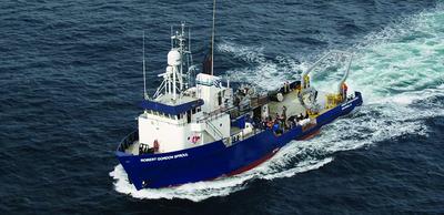
    NGA LTER -2022 Summer

    Russ Hopcroft · UAF

    The research focus of the NGA LTER site will be on mechanistic understanding of processes that underlie environmental variability, and the role of the latter in promoting high productivity and resilience. Building on prior knowledge, the investigators will test three hypotheses centered on ecosystem emergent properties: 1. Changes in the hydrologic cycle affect spring bloom production through changes in cloud cover, the stratification/mixing balance, macro- and micronutrient supplies, and transport pathways. 2. Hot-spots of high summer primary and secondary production result from interactions between the fresher Alaska Coastal Current and more saline offshore waters as promoted by shelf morphology and regional winds; hot spot timing and magnitude will be influenced by changes in the hydrologic cycle. 3. Nutritional and life history patterns of NGA consumers minimize trophic mismatch, buffering spatial and temporal variability in lower trophic level production and leading to resilience in the face of long-term climate change. The investigators will address these hypotheses with an integrated research program that includes: a) seasonal time series studies addressing short- and long-term environmental and ecosystem variability through a spring-to-fall field cruise- and mooring-based observational program, building upon and enhancing the Seward Line times series, and leveraging existing collaborations to obtain higher trophic level data; b) process studies that focus on hypothesized mechanisms leading to variability and enhancement of NGA production in time and space; c) modeling studies that incorporate physical and biogeochemical observations, provide a framework for testing hypotheses, and predict ecosystem responses to projected environmental changes; d) a data management component that provides a public platform for data visualization and synthesis by LTER colleagues, educators & students, and resource managers.

    Jul 7 – Jul 24, 2022 · 17 d

    Northern Gulf of Alaska. From/to Seward, AK. Inner shelf to slope transects from Kodiak Island to east of Kayak Island

    Sails with 1 other project

  • Completed

    Sikuliaq · UAF

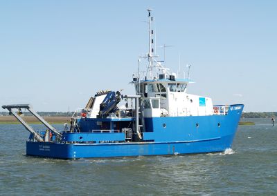
    ASP-2022

    Doug Baird · UAF

    Augment additional days for the at-sea research for the NSF funded Northern Gulf of Alaska Long-Term Ecological Research (NGA LTER) program

    Jul 7 – Jul 24, 2022 · 17 d

    Northern Gulf of Alaska. From/to Seward, AK. Inner shelf to slope transects from Kodiak Island to east of Kayak Island
    Sails with 1 other project

  • Completed

    Pelican · LUMCON

    LISTEN GoMex - Long-term Investigations into Soundscape Trends, cetacean Ecology, and Noise in the Gulf of Mexico

    Melissa Soldevilla · NOAA

    This project uses a network of underwater microphones to record marine mammals throughout U.S. and Mexican waters in the Gulf of Mexico and gather information on their location and density throughout the year. The data from this comprehensive and long-term passive acoustic monitoring program will be used to identify the conditions that could be driving seasonal, annual, and decadal trends in the abundance of marine mammals, where they are located, and how densely they aggregate when they are there. This project will complement existing vessel-based surveys and expand on prior passive acoustic monitoring in the region. This project uses a multifaceted sampling approach. One part consists of acoustic data collection at four historic long-term reference sites and four additional long-term reference sites in the northwestern and southern Gulf of Mexico to obtain long-term trends in marine mammal distribution over time. The second part consists of random acoustic sampling across a grid of 20 short-term sites to obtain additional location information. The third part uses acoustic tracking arrays for short durations at long-term sites to measure acoustic animal behavior. This third part collects the information necessary to convert acoustic detections into estimated densities of marine mammal species. The project team is engaging with federal and state agencies, non-governmental organizations, and private industry to make sure their findings are reaching the people who are making decisions that impact marine mammal management. This project is also coordinated with the Reduce Impacts of Anthropogenic Noise on Cetaceans project supported by the Deepwater Horizon Natural Resources Damage Assessment Trustees. This project will 1) characterize seasonal, annual, and decadal trends and variability in marine mammal species in the Gulf of Mexico, 2) determine whether the processes driving the apparent declining trends are due to animal movements or population declines, 3) quantify the relationships between marine mammal density and ocean conditions and evaluate the oceanographic processes driving short-term and long-term variability in marine mammal density, and 4) quantify the relationships between marine mammal density and ambient noise conditions and evaluate the role of human activities in driving short-term and long-term trends in marine mammal density.

    Jul 7 – Jul 24, 2022 · 17 d

    Gulf of Mexico

  • Completed

    BIOS-SCOPE

    Craig A. Carlson · UCSB

    Funding agency: Simons Foundation International

    Jul 7 – Jul 10, 2022 · 3 d

    In the vicinity of BATS and Hydrostation S in the northwestern Sargasso Sea

  • Completed

    SBB Benthic forams

    Joan Bernhard · WHOI

    Benthic and water column sampling in Santa Barbara Basin.

    Jul 6 – Jul 11, 2022 · 5 d

    SBB Center and NE area of Santa Barbara Basin.

  • Completed

    Atlantis · WHOI

    ALVIN Sea Trials 2022

    Bruce Strickrott · WHOI

    Sea trials following repair of ALVIN syntactic foam in early 2022.

    Jul 5 – Jul 23, 2022 · 18 d

    Eastern seaboard between Woods Hole and San Juan

  • Completed

    SIO295L Summer Cruises

    Greg Rouse · SIO

    We propose two 1 day cruises on the RV Robert Gordon Sproul to introduce students to different aspects of oceanographic research and to provide samples for laboratory study during shore-based part of the course. The cruises need to be on the same weekend with the following elements (1) Plankton (bongo net) haul; (2) Otter trawl near the Coronado bank ~ 400 meters, (depth switched each day); (3) Multicore near Coronado Banks at ~700 meters, (depth switched each day); (4) Midwater trawl.; (5) Van Veen grab/s on Coronado Bank at 450-500 m.

    Jul 2 – Jul 4, 2022 · 2 d

    Off San Diego

  • Completed

    Blue Heron · UMN

    UMN cruise 2022 Bertossi

    Richard Ricketts · UMN

    These cruises utilize funding provided by the University of Minnesota. Chief Scientists will be completing seed research cruises or using their ship time to take graduate and undergraduate students on the research vessel Blue Heron.

    Jul 1, 2022 · 1 d

    Western Lake Superior

  • Completed

    Savannah · SkIO

    Alkalinity flux summer 2022

    Martial Taillefert · GaTech

    Ocean acidification is the process that lowers the pH of the ocean over time due to uptake of atmospheric carbon dioxide. This project investigates how chemical reactions in marine sediments exposed to high riverine sediment loads influence ocean acidification in coastal waters. Although we know that ocean acidification affects marine life and commercial fisheries in coastal waters, little is known about how acidification processes in the water column are influenced by reactions occurring in sediments on the sea floor. The role of large sediment deposits from rivers in these processes has also never been investigated. This study will be conducted in the Mississippi River and Gulf of Mexico. The Mississippi River transports a high sediment load to the continental shelf in the Gulf of Mexico and plays an important role in the economy of the southern coast of the United States. Results from this study will be useful to the oceanographic community for increasing understanding of ocean acidification processes in delta and shelf environments. It will also benefit decision makers interested in predicting the role of sediments on the nutrient -rich Louisiana shelf for discharge control purposes. This project also has an important educational component by training undergraduate, graduate, and postdoctoral students, providing experiences at sea for undergraduates, and conducting outreach activities with K-12 students. The geochemical and microbiological processes responsible for the transformation of particles deposited on the seafloor will be characterized near the Mississippi River mouth and along the nearby continental slope. The release of acids (CO2) and bases (alkalinity) from the sediment will be quantified using autonomous instruments deployed on the seafloor to determine whether sediments contribute to the acidity of the surrounding water column or instead provide bases to buffer the water column from atmospheric CO2 inputs. As the Mississippi River discharge during the later Winter and Spring provides much more sediment to the coastal zone compared to the rest of the year, research cruises will be taken twice a year to determine how seasonal variations in riverine discharge affect the release of acids and bases into the water column. Mathematical models will then be used to predict the effect of seasonal variations on acids or bases release to the water column. This study will therefore provide a quantitative understanding of the role of large sediment depositions to the seafloor on sediment geochemical and microbiological processes and their feedback to the overlying waters. Simultaneously, a large data set will be generated and used to calibrate mathematical models and better characterize benthic-pelagic interactions. Such efforts are needed to predict how continental margins respond to constantly increasing stress from anthropogenic activities.

    Jul 1 – Jul 29, 2022 · 28 d

    Louisiana Shelf

  • Completed

    Optical Velocimeter

    Jules Jaffe · SIO

    To test an optical velocimeter and provide hands on field experience for the Marine Physical Laboratory’s (MPL) summer undergraduate interns.

    Jun 30, 2022 · 1 d

    SoCal

  • Completed

    Blue Heron · UMN

    SeaGrant 2022 2

    Richard Ricketts · UMN

    These cruises utilize funding provided by Minnesota SeaGrant to take secondary teachers out to learn about limnology.

    Jun 30, 2022 · 1 d

    Western Lake Superior

  • Completed

    Blue Heron · UMN

    SeaGrant 2022 1

    Richard Ricketts · UMN

    These cruises utilize funding provided by Minnesota SeaGrant to take secondary teachers out to learn about limnology.

    Jun 29, 2022 · 1 d

    Western Lake Superior

  • Completed

    Blue Heron · UMN

    UMN cruise 2022 Breckenridge

    Richard Ricketts · UMN

    These cruises utilize funding provided by the University of Minnesota. Chief Scientists will be completing seed research cruises or using their ship time to take graduate and undergraduate students on the research vessel Blue Heron.

    Jun 28, 2022 · 1 d

    Western Lake Superior

  • Completed

    WOAC-2022-Summer

    Jan Newton · UW

    Jun 27 – Jul 2, 2022 · 4 d

    Puget Sound

  • Completed

    HS - 2022 - 08

    Nicholas R. Bates · BIOS

    he physical properties of the ocean from the surface layers to the abyssal water masses are changing in concert with natural and anthropogenically influenced physical forcing and sustained observations of the ocean are critically important to establish these rates of change. One of the longest open-ocean hydrographic stations in the world is maintained at the Hydrostation S site (formerly known as the Panulirus site) located about 25 km southeast of Bermuda in the North Atlantic Ocean. This repeat biweekly hydrographic observations was initiated by Henry Stommel and co-workers in 1954. Now, in its seventh decade, it continues to be recognized as one of the most important sustained ocean time-series and provides an invaluable metric for the long-term state of the North Atlantic subtropical gyre in relation to the meridional overturning circulation, western boundary transport, and gyre recirculation. For example, the upper ocean warming trend has strengthened (about 0.8° C since the 1970's) while the deep Labrador Sea has cooled by a few tenths of a degree. The signature of deoxygenation has been observed at Hydrostation S in the upper ocean (about 7 micro-moles/kg/decade decrease in dissolved oxygen) as well as an intensification and expansion of the oxygen minimum zone. These changes suggest that the North Atlantic subtropical gyre is experiencing deoxygenation as in the Pacific Ocean as a result of increased upper ocean stratification and reduced solubility of oxygen in warmer waters. The Hydrostation S program and its data set are managed as a service to the ocean community, being openly distributed and used as a resource in understanding processes and patterns of variability in the ocean, as well as for education, mentorship and outreach activities. The Hydrostation S project will contribute to the research and training of six research specialists and research technicians at BIOS and contribute to the research projects of at least three Ph.D. students through on-going educational partnership with Princeton University and the University of Southampton in the U.K. The one-day Hydrostation S research cruises are an ideal platform for testing new sensors and for providing hand-on training to undergraduate students enrolled in summer programs. The Hydrostation S project is designed to address the overarching hypothesis that the physical properties of the upper-ocean to deep-ocean are changing in concert with natural and anthropogenically influenced physical forcing. Sustained observations of the ocean, such as those from Hydrostation S, remain critically important to establish rates of change to provide quantitative empirical data for myriad regional and global ocean synthesis and modeling of ocean processes and future ocean change. The major objective of Hydrostation S into the seventh decade is to continue the frequent water column sampling of temperature, salinity, and dissolved oxygen (and indirectly, sampling of important ocean carbon time?series) of the North Atlantic subtropical gyre. Such work is complementary to other sustained observations such as the Bermuda Atlantic Time-series Study (BATS) and Ocean Flux Program (OFP). As for the past five years, two CTD profiles will be conducted to better capture the deep-water variability while maintaining all the previous discrete depths. The first CTD cast will profile to full ocean depth (3,200-3,500 m) while the second CTD cast will profile from the surface to 500 m to allow for biogeochemical instrumentation not rated for full ocean depth and to support ancillary studies of ocean physics, biological processes and biogeochemistry. A secondary objective will be to build upon the collaborative comparison of physical data collected as part of two autonomous sensor projects. In the latter stages of the project, as ocean glider deployment becomes more sustainable and reliable, collaborative and comparative efforts will be used to test the capability of ocean gliders to provide data of sufficient quality to detect long-term oceanic change in a "virtual" mooring time-series mode. The robust and highly accurate Hydrostation S data will be used to test the capability of emerging technologies over the next five to ten years.

    Jun 27 – Jul 1, 2022 · 4 d

    Off of Bermuda

    Sails with 1 other project

  • Completed

    BATS 2022 - 5of12

    Nicholas R. Bates · BIOS

    Long-term observations over several decades are a powerful tool for investigating ocean physics, biology, and chemistry, and the response of the oceans to environmental change. The Bermuda Atlantic Time-Series Study, known as BATS, has been running continuously since 1988. The research goals of the BATS program are: (1) to improve our understanding of the time-varying components of the ocean carbon cycle and the cycles of related nutrient elements such as nitrogen, phosphorus, and silicon; and, (2) to identify the relevant physical, chemical and ecosystem properties responsible for this variability. In addition, the BATS program has strong and diverse broader impacts, contributing to the field of ocean sciences by providing high quality ocean observations and data for seagoing scientists and modelers, and a framework through which researchers can conceive and test hypotheses. This award will support the operations of the BATS program for five more years. The primary BATS research themes are as follows: (1) Quantify the role of ocean-atmosphere coupling and climate variability on air-sea exchange of CO2, and carbon export to the ocean interior; (2) Document trends and the controls on the interannual to decadal scale variability in carbon and nutrient cycles to their coupling in the surface and deep ocean via the Redfield Ratio paradigm; (3) Quantify the response of planktonic community structure and function, and impact on biogeochemical cycles to variability in surface fluxes and dynamical processes; (4) Facilitate development, calibration and validation of next generation oceanographic sensors, tools and technologies; and, (5) Generate a dataset that can be utilized by empiricists, modelers and students. This research integrates ocean physics, chemistry and biology into a framework for understanding oceanic processes and ocean change in the North Atlantic subtropical gyre. The existing 29 years of BATS data provide robust constraints on seasonal and interannual variability, the response of the Sargasso Sea ecosystem to natural climate variability, and signal detection of potential ocean changes. This project would extend the BATS program through years 31-35 to address a series of ten interlinked questions through integrated research approaches and a multitude of collaborative efforts. In addition to the themes above, and embedded into the ten questions and approaches, the BATS team will focus on, for example, coupling of particle production and biogeochemistry; revisiting the complexities of the biological carbon pump; oxygen decline; and changes in the hydrography, physics, ocean carbon cycle and biogeochemistry of the Sargasso Sea. The highest quality data observation and collection will be maintained and used to address these questions. Importantly, a wide range of collaborations at the BATS site, spanning the physical and biogeochemical disciplines, will aid these broad goals. Strong links to community stakeholders, and close collaboration (including methods intercomparisons and personnel exchanges) with the Hawaii Ocean Time-series are proposed. This work will extend the research findings of the project into educational and training opportunities within and beyond the oceanographic community, including training and mentorship of both undergraduate and graduate students.

    Jun 27 – Jul 1, 2022 · 4 d

    Off of Bermuda

    Sails with 1 other project

  • Completed

    Coastal Methane

    John D. Kessler · Rochester

    his project will determine global methane emissions from coastal marine environments, one of the most uncertain natural sources of methane to the atmosphere. Methane is a greenhouse gas whose impact on future climate warming will depend on emissions from both human sources and the changing natural environment. It is therefore critical to understand the baseline emission rates of natural methane sources to the atmosphere as well as their sensitivity to change. While the open ocean environment is thought to emit only minor amounts of methane to the atmosphere, concentrations and emission rates of methane increase substantially approaching coastlines. Coastal ocean methane emissions are potentially significant at the global scale but remain highly uncertain due to a lack of observations that accurately capture coastal distributions. Furthermore, the source of methane emitted from coastal surface waters is not well known, limiting our ability to predict how emissions will change in the future. This project will determine the source and global emission rate of methane from the coastal ocean to the atmosphere, and establish a framework to predict future emission rates in a warming climate. In addition to these scientific and societal impacts, this project will have strong educational impacts as it will provide undergraduate students the opportunity to experience the entire scientific process from idea conception to publication of the final results. A sequence of classes has been established by the PI at the University of Rochester to guide students through this process from an ocean science perspective. This project will serve as the focus for the next iteration of the class sequence, and participating students will be vital contributors to the research. When conducted previously, this educational outreach has empowered undergraduates to pursue their own scientific interests and has led to significant numbers of students pursuing graduate careers in the ocean sciences. This project will also support a Ph.D. student in a truly unique experience whereby she/he will have the opportunity to conduct meaningful research in both sea-going measurement as well as modeling laboratories, and thus integrate into two often disparate communities.

    Jun 23 – Jul 19, 2022 · 26 d

    Coastal US Survey from Lewes, DE to Gulf of Mexico

  • Completed

    OOI Irminger 2022

    Al Plueddemann · WHOI

    Annual service required, driven by power systems and by instrument degradation (biofouling and calibration)

    Jun 20 – Jul 16, 2022 · 25 d

    Irminger Sea. 100nm Op Area Size/Dia

    Sails with 1 other project

  • Completed

    OSNAP-GDWBC Moorings

    Amy Bower · WHOI

    Variability in the transport of heat, freshwater and mass in the North Atlantic has been linked to a number of societally relevant factors including sea level change, the melting of sea and glacial ice, and anthropogenic carbon storage in the deep ocean. However, the current understanding of the drivers of such changes is limited, making an investigation of overturning in the Sub-polar region a key ocean research priority. This field program explicitly addresses this gap. Furthermore, by engaging the larger international community studying the North Atlantic, Overturning in the Sub-polar North Atlantic Program (OSNAP) is playing a key role in catalyzing scientific progress by promoting international collaborations, synthesis, and the sharing of resources and by training future generations. The overall goal of this field project, in conjunction with other measurements in the North Atlantic, is to establish determination of the linkage between intermediate and deep water formation and the overturning circulation--a connection that is present in climate models, but has yet to be observed. This project will also provide the first comprehensive view of spreading pathways for the deep waters in the Sub-polar basin. Starting in 2014, the US-led international project, Overturning in the Sub-polar North Atlantic Program (OSNAP), provides a continuous record of the full-water column, trans-basin fluxes of heat, mass and freshwater in the Sub-polar North Atlantic, in partnership with the UK, Netherlands, Canada, Germany and China. Data from the first 21 months of the full OSNAP observing system has been used to produce an initial time series of the meridional overturning, heat and freshwater fluxes for the Sub-polar basin. These preliminary results reveal a highly variable overturning in the basin, interior pathways for overflow waters, surprisingly energetic boundary current systems on timescales from days to months, and a strong overflow plume in the Iceland Basin. The additional two years of OSNAP observations will cover a time frame sufficient to make comparisons with other overturning time series and optimize the OSNAP measurement system--all necessary tasks prior to a request for longer term measurements. This component of OSNAP (OSNAP East) is for the eastern array between Greenland and Scotland in coordination with the UK and the Netherlands. The US contribution includes the East Greenland inshore and offshore arrays, the Iceland Basin array, and the integration of all OSNAP measurements. The sub-goal for OSNAP East is to quantify the structure and transport of the boundary currents off the east coast of Greenland and within the Iceland Basin, as well as determine their variability and forcing mechanisms.

    Jun 20 – Jul 16, 2022 · 25 d

    Irminger Sea. 100nm Op Area Size/Dia

    Sails with 1 other project

  • Completed

    Deformation at Axial

    Scott L. Nooner · UNCW

    This research project continues long-term study and monitoring of the most active submarine volcano in the world. Axial Seamount is located about 300 miles off the coast of Oregon and represents one of the best places to study how volcanoes work because it erupts frequently and repetitively and has numerous monitoring instruments linked to shore via cable which is part of the newly commissioned National Science Foundation's Ocean Observing Initiative. This research focuses on continuing the present time series data collection effort and using the data to understand how magma (molten rock) is stored in the shallow crust at volcanoes, how it is delivered to the surface, how eruptions are triggered, and how eruptions can be successfully forecast. Field work involves use of newly developed, precise, pressure sensors and autonomous underwater vehicles using geodetics to measure vertical movements of the seafloor, which take place as Axial Seamount, gradually inflates like a balloon, with magma seeping in and filling its subterranean magma chamber a few kilometers below the seafloor. During inflation (the present situation) and deflation (loss of volume due to eruption of lavas on the seafloor, the last of which occurred in 2015) the seafloor moves up and down as much as 8-12 feet. As observed in Axial's last two eruption cycles, when the volcano is fully "re-inflated" it is ready to erupt again. Monitoring for almost two decades has shown that Axial Seamount inflates to a similar amount before each eruption. This allowed the two previous eruptions to be successfully forecast months in advance. Collection of this new data will be complemented by geodynamic modeling focused on understanding how volcano inflation influences the deformation field around it. Broader impacts of this research have broad implications for the understanding of volcano hazards, utilizes the new Ocean Observing Initiative's cabled array and complementary sensor suites, helps build infrastructure for science, and provides training for students. It will also result in a new software package to enable autonomous underwater vehicles to perform terrain-following grids of features on the seafloor. Results from this study may have important implications for better understanding magma chamber filling and eruption associated with volcanoes on land where the continental crust, many times, adds complexity to fundamental magma generation and magma chamber filling processes. Axial Seamount is on the Juan de Fuca Ridge off the coast of the northwestern United States. It erupted in 1998, 2011, and most recently again in April 2015. It has been instrumented for this period of time with sensors that can detect ground motion and changes in elevation over time. It is now hooked to the undersea data cable and junction box of the National Science Foundation's Ocean Observing Initiative's cabled array. Thus, Axial Seamount is an ideal natural laboratory for the long-term study of active processes of submarine volcanos in a mid-ocean ridge setting. Long-term research and monitoring of Axial has created a remarkable time-series dataset of bottom pressure observations that have revealed repeated cycles of inflation and deflation that have been used to forecast eruptions with increasing accuracy. The 2015 eruption was the first captured in real time by the network of sensors now installed inside the volcano's caldera and on its flanks. These installations have revealed the inner workings of the volcano in unprecedented detail. This research will follow up on recent work by using autonomous underwater vehicles that generate high-resolution bathymetric maps that show the Axial deformation field extends well beyond its summit caldera. These new data complement the continuous, but spatially limited, pressure sensor measurements and put them into a geologic, morphological framework. This research will continue the pressure measurements and further develop a new autonomous underwater vehicle navigation technique to improve seafloor survey reliability and reproducibility. Results of this will be used to advance modeling of the deformation of the Axial subsurface magmatic system. It will also explore new quantitative numerical methods for improving eruption forecasts.

    Jun 20 – Jul 2, 2022 · 13 d

    In and around the summit of Axial Seamount

    Sails with 1 other project

  • Completed

    Axial Compliance

    Spahr Webb · LDEO

    Axial Volcano, a large, very active undersea volcano offshore the US West Coast is currently monitored using sensors that transmit data through the NSF supported Ocean Observatories Initiative cable to shore. Sensors on these cables measured changes in the compliance of seafloor preceding and following an eruption in 2015 associated with changes in the magma chamber, but the noise level of these sensors limited the sensitivity of the observations and the observation period to the winter months when the compliance signal was larger. New compliance sensors with better sensitivity and a lower noise level will be constructed using more optimal sensors and placed on the seafloor beneath large shields that protect the sensors from noise from ocean currents. Compliance, a measure the deformation of the seafloor under the loading of long period ocean waves, depends on the elastic properties of the underlying Earth and thereby to the fraction of magma within the magma chamber. The current shielding developed will also have applicability for reducing the noise levels for the horizontal components of broadband seismometers installed on the seafloor. Ocean bottom seismometers are critical to understanding many Earth processes, but the high noise levels due to ocean floor currents limits the types and quality of observations that can be made.

    Jun 20 – Jul 2, 2022 · 13 d

    In and around the summit of Axial Seamount

    Sails with 1 other project

  • Completed

    Pelican · LUMCON

    Resonant GoM NIOs - 2022 Pelican

    Robert Hetland · TAMU

    This project will use field observations from ship and numerical modeling to study circulation variability in the Mississippi-Atchafalaya River plume in the northern Gulf of Mexico. The region is characterized by a strong sea breeze which leads to the flow and wave variations on relatively small spatial scales of less than 1 km. The observations will take place during two field campaigns including ship, moored, and autonomous platforms. The modeling will include both realistic and idealized models for testing the hypotheses. Two graduate students and two postdocs will participate in the research. In addition, summer research experiences in the field will be provided to 2-3 undergraduates through the TAMU Summer Research Program for Undergraduates, for which applications from underrepresented groups and from local community colleges will be encouraged. The PIs will visit local, minority-serving undergraduate institutions to give presentations on the research and engage students in the summer research program. The project is a collaboration between the US and the United Kingdom (UK) with the UK component being supported by the UK National Environmental Research Council (NERC) through an agreement with NSF. Recently theories for ocean dynamics posit that submesoscale flows interacting with near-inertial motions are important for understanding the dynamics of both phenomena. This project will test theories of energy exchange at the submesoscale by studying circulation patterns in the Mississippi-Atchafalaya river plume in the northern Gulf of Mexico using a pair of field campaigns and idealistic and realistic numerical models. Observations from ship, moorings, and autonomous platforms will be made during two field campaigns. The modeling will include a hydrostatic ROMS model and idealized, non-hydrostatic Large Eddy Simulations (LES). The objective will be to characterize, quantify, and understand the energy exchanges between balanced and unbalanced motions and the turbulent cascade that can result from the interaction. Wave-mean flow interactions in the Mississippi-Atchafalaya river plume system could enhance mixing and vertical exchange, which are important for understanding coastal hypoxia and the dispersal of pollutants in the northern Gulf of Mexico. This award reflects NSF's statutory mission and has been deemed worthy of support through evaluation using the Foundation's intellectual merit and broader impacts review criteria.

    Jun 17 – Jul 6, 2022 · 19 d

    Northern GOM

  • Completed

    An Embedded Cytomete 1 of 3 2022

    Ginger Armbrust · UW

    he photosynthetic microbes ? the phytoplankton ? generate about 50% of the oxygen and organic matter produced on Earth each year and serve as the base of marine food webs. Flow cytometers are essential oceanographic instruments that rapidly and accurately measure the abundance, size and fluorescent characteristics of individual phytoplankton cells. For example, flow cytometry led to the discovery of Prochloroccocus, the most abundant photosynthetic organism on Earth. However, thirty-seven years after the first description of a flow cytometer designed specifically for the measurement of phytoplankton in the field, the complexity of flow cytometry, and the multi-parametric data it produces continues to be an obstacle to its evolution towards common use as an oceanographic field instrument. PipeCyte is a miniature, low-power flow cytometer instrument that was designed to perform autonomous measurements of 0.5-10 µm diameter phytoplankton while deployed on autonomous oceanographic measurement platforms. In this first deployment project, the PipeCyte instrument will be immersed at depths of up to 100 meters while tethered to a surface buoy. A surface buoy is a low-cost platform that is simple to deploy from a research vessel. In this project, several buoy deployed PipeCyte instruments will be released in the open ocean to perform measurements of the phytoplankton community at multiple depths. These measurements will provide an unprecedented view of the relation between environmental features and phytoplankton communities along the water column.

    Jun 15, 2022 · 1 d

    Puget Sound

  • Completed

    Savannah · SkIO

    SEFIS - 2022 - June

    Nathan Bacheler · NOAA

    The Southeast Fishery-Independent Survey carries out fishery-independent surveys of reef-associated fish species in the US South Atlantic. The survey uses baited chevron traps outfitted with video cameras to index reef fish abundance, and CTD casts to determine environmental conditions. Survey data is combined with data from SCDNR to better manage fish species in the region.

    Jun 14 – Jun 23, 2022 · 9 d

    Southeastern US Atlantic continental shelf

  • Completed

    TPADS22

    Jennifer MacKinnon · SIO

    We are seeking ship time for at sea testing of a new phased array doppler sonar system.

    Jun 12 – Jun 14, 2022 · 1 d

    An hour steam offshore of San Diego, in water 200 m or deeper

  • Completed

    Pelican · LUMCON

    REU-OTO

    Jessica Fitzsimmons · TAMU

    Texas A&M University's Department of Oceanography in College Station TX will host a Research Experience for Undergraduates (REU) Site program from 2019-2021 (extended until 2022 due to pandemic). The program will focus on "Observing the Ocean" and will bring ten undergraduates to TAMU for a 10-week internship each summer. Mentors will be selected from the Departments of Oceanography, Geography, and Civil Engineering, and the Geochemical and Environmental Research Group (GERG), and students will have access to a variety of ocean observing instrumentation and data. They will participate in a cruise aboard the R/V Pelican to collect samples and data from the nearshore and offshore environments. Seminars and training modules will focus on data analysis, graphical representation of oceanographic data, data management, science writing and professional development. Students will present at weekly REU seminars and at the final REU Student Research Symposium, and they will complete a research proposal and either a final poster or written report. Student recruitment will focus on rising Sophomores and Juniors. The TAMU REU Site will provide a total of thirty undergraduates with internships over a three-year period. The program conducts a national search for applicants and seeks to engage students who are from schools with limited research opportunities. Most of the funding provided supports student stipends, housing and travel to attend the program. The focus of potential research projects for REU students at TAMU includes ocean observing technologies and analytical skills used to understand ocean issues such as hypoxia, early warning of harmful algal blooms, effects of oil spills and other pollutants, climate-induced variability in hydrography, and effects of ocean acidification. This project supports national goals of developing the next generation of scientists and the scientific workforce.

    Jun 12 – Jun 14, 2022 · 2 d

    Transect from LUMCON to Flower Garden Banks National Marine Sanctuary, to station off Galvestion, and back to LUMCON

  • Completed

    Savannah · SkIO

    INST

    Clark Alexander · SkIO

    Ship time dedicated to facilitate experiential learning for UGA and USG graduate and undergraduate students.

    Jun 11, 2022 · 1 d

    South Atlantic Bight - USA

  • Completed

    Savannah · SkIO

    DolMICROBE JUN, 23 2022

    Marc Frischer · UGA

    The significance of doliolid microbial interactions: Do doliolids fundamentally alter the trophic structure and productivity of sub-tropical continental shelf food webs? The long-term goal of this project is to understand the ecological function of doliolids on subtropical continental shelves and their influence on microbial processes. In association with monthly oceanographic field expeditions on the mid-continental shelf at 31°N and two longer longitudinal expeditions complemented with experimental studies, the project investigates the relationship between doliolid abundance and life stage composition, their spatial relationships to marine snow aggregates and other zooplankton, water column microbial activity, bacterial production, and net system productivity. Utilizing a constellation of modern and classical approaches in microbial and zooplankton ecology, including deployment of an in situ zooplankton imaging system in the South Atlantic Bight, microbial metagenomics and transcriptomics, and stable isotope-based tracer experiments, these studies will allow the testing of three fundamental hypotheses. First, independent of total shelf productivity, the presence and abundance of doliolids is correlated with heterotrophy compared to periods when doliolids are not abundant. Second, doliolids predictably shape continental shelf microbial communities, activity, and function, and third, doliolids are detrital feeders benefiting nutritionally from the consumption of microbial enriched aggregated particles and fecal material - the pool to which they also contribute.

    Jun 10, 2022 · 1 d

    SAB Shelf Gray's Reef National Marine Sanctuary

NewerPage 50 of 55Older