VesselConnect
  • Completed

    ICONIC - 1 of 5

    Kristen Buck · OSU

    Our joint NSF-NERC collaborative research project will integrate field observations from the Bermuda Atlantic Time-series Study (BATS) and Cape Verde Ocean Observatory (CVOO) study regions with targeted experimental studies and a state-of-the-art ocean biogeochemical model to constrain the processes that modulate interactions of iron with dissolved and particulate organic matter, and advance our ability to model the global iron cycle and the vertical export of iron and carbon in the upper ocean. We will collect seasonally resolved water column (upper 3,500 m) datasets from BATS during five cruises, shared with the monthly BATS program, spanning a full annual cycle. In late spring (cruise 3 of 5), we will augment the work at BATS with additional water column sampling along the way to, and at, the Cape Verde Ocean Observatory in the eastern North Atlantic, which provides a natural laboratory for contrasting iron speciation and subsurface oxygen conditions with the BATS region. Laboratory-based and shipboard incubation experiments will target the role that specific pools of organic ligands, dissolved organic carbon, and detrital particulate organic carbon play in water-column iron cycling. The resulting data, together with ancillary data provided by the BATS program, will be used to inform the biogeochemical model, thereby advancing our ability to model the global ocean cycling of iron and carbon, and better predict their sensitivity to environmental changes.

    Nov 12 – Nov 18, 2025 · 6 d

    North Atlantic near Bermuda

    Sails with 2 other projects

  • Completed

    Hydro S - 2025 21of24

    Nicholas R. Bates · BIOS

    One of the longest open-ocean hydrographic stations in the world is maintained at the Hydrostation S site (formerly known as the Panulirus site) located ~25 km southeast of Bermuda in the North Atlantic Ocean. This program of repeat biweekly hydrographic observations began in 1954 (by Hank Stommel) and now, in its seventh decade, has proved to be the catalyst for numerous studies of ocean physics, biological processes and biogeochemistry. Hydrostation S continues to be recognized as one of the most important sustained ocean time–series. The renewal of the Hydrostation S program is proposed herein, extending this invaluable time–series of ocean hydrography to almost 70 years. The upper ocean warming trend has strengthened (about +1.4° C since the 1970's; ~+0.8°C in last decade) with significant salinification (+0.16). Deeper waters such as the Labrador Sea Water has cooled by a few tenths of a degree and freshened with a marked decadal oscillation. The signature of deoxygenation has been observed at Hydrostation S in the upper ocean (about 4 µmoles kg -1 decade -1 decrease in dissolved oxygen) as well as the oxygen minimum zone (~2.5 µmoles kg -1 decade -1 ). Hydrostation S also supports the longest global ocean CO 2 and acidification time-series (from 1983 to present) The major objective of the proposal is to continue Hydrostation S into the eighth decade with numerous questions related to warming and cooling, salinification and freshening, deoxygenation and insights on biogeochemical changes over time. This program constitutes frequent water column sampling of temperature, salinity, and dissolved oxygen (and indirectly, sampling of important ocean carbon time–series) of the North Atlantic subtropical gyre at the Hydrostation S site. Such work is complementary to other sustained observations such as the Bermuda Atlantic Time–series Study (BATS) and Ocean Flux Program (OFP). We propose to carry out a similar sampling format that has been followed for the past 68 years. As for the past ten years, we would continue to conduct two CTD profiles to better capture the deep–water variability while maintaining all the previous discrete depths. The first CTD cast will profile to full ocean depth (3,300–3,500 m) while the second CTD cast will profile to 500 m (to allow for instrumentation not rated for full ocean depth such as a PAR sensor). One indirect objective will be to continue to collaboratively evaluate a BIOS-based glider program with Hydrostation S data as critically important ground truthing data. The existing glider program has challenging issue, and the aim of this effort is to use robust and highly accurate Hydrostation S data to test the capability of emerging technologies over the next five to ten years.

    Nov 12 – Nov 18, 2025 · 6 d

    North Atlantic near Bermuda

    Sails with 2 other projects

  • Completed

    BATS 2025 - 10of12

    Nicholas R. Bates · BIOS

    Long-term observations over several decades are a powerful tool for investigating ocean physics, biology, and chemistry, and the response of the oceans to environmental change. The Bermuda Atlantic Time-Series Study, known as BATS, has been running continuously since 1988. The research goals of the BATS program are: (1) to improve our understanding of the time-varying components of the ocean carbon cycle and the cycles of related nutrient elements such as nitrogen, phosphorus, and silicon; and, (2) to identify the relevant physical, chemical and ecosystem properties responsible for this variability. In addition, the BATS program has strong and diverse broader impacts, contributing to the field of ocean sciences by providing high quality ocean observations and data for seagoing scientists and modelers, and a framework through which researchers can conceive and test hypotheses. This award will support the operations of the BATS program for five more years. The primary BATS research themes are as follows: (1) Quantify the role of ocean-atmosphere coupling and climate variability on air-sea exchange of CO2, and carbon export to the ocean interior; (2) Document trends and the controls on the interannual to decadal scale variability in carbon and nutrient cycles to their coupling in the surface and deep ocean via the Redfield Ratio paradigm; (3) Quantify the response of planktonic community structure and function, and impact on biogeochemical cycles to variability in surface fluxes and dynamical processes; (4) Facilitate development, calibration and validation of next generation oceanographic sensors, tools and technologies; and, (5) Generate a dataset that can be utilized by empiricists, modelers and students. This research integrates ocean physics, chemistry and biology into a framework for understanding oceanic processes and ocean change in the North Atlantic subtropical gyre. The existing 29 years of BATS data provide robust constraints on seasonal and interannual variability, the response of the Sargasso Sea ecosystem to natural climate variability, and signal detection of potential ocean changes. This project would extend the BATS program through years 31-35 to address a series of ten interlinked questions through integrated research approaches and a multitude of collaborative efforts. In addition to the themes above, and embedded into the ten questions and approaches, the BATS team will focus on, for example, coupling of particle production and biogeochemistry; revisiting the complexities of the biological carbon pump; oxygen decline; and changes in the hydrography, physics, ocean carbon cycle and biogeochemistry of the Sargasso Sea. The highest quality data observation and collection will be maintained and used to address these questions. Importantly, a wide range of collaborations at the BATS site, spanning the physical and biogeochemical disciplines, will aid these broad goals. Strong links to community stakeholders, and close collaboration (including methods intercomparisons and personnel exchanges) with the Hawaii Ocean Time-series are proposed. This work will extend the research findings of the project into educational and training opportunities within and beyond the oceanographic community, including training and mentorship of both undergraduate and graduate students.

    Nov 12 – Nov 18, 2025 · 6 d

    North Atlantic near Bermuda

    Sails with 2 other projects
  • Completed

    Pelican · LUMCON

    GF-Fall-25

    Lance Renoux · LaWLF

    The Southeast Area Monitoring and Assessment Program (SEAMAP) Shrimp/Groundfish trawl surveys are conducted throughout the Gulf of Mexico to provide fishery-independent monitoring and assessment information on shrimp and groundfish assemblages associated with low relief soft bottom habitats. These data are essential to the management of the fisheries resources in the Gulf of Mexico. Louisiana Department of Wildlife and Fisheries (LDWF), as well as SEAMAP state partners, sample in conjunction with the National Marine Fisheries Service (NMFS) to provide a Gulf-wide trawl survey each summer and fall.

    Nov 11 – Nov 14, 2025 · 3 d

    Coastal waters of Louisiana

  • Completed

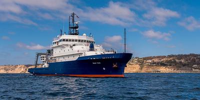
    Sally Ride · SIO

    CalCOFI MMARINeDNA Fall Cruise 2025

    Rasmus Swalethorp · SIO

    We aim to understand the transport, persistence and distribution of environmental DNA (eDNA) in marine environments from marine mammal targets. With support from the ONR Multidisciplinary University Research Initiatives (MURI) program, we will use ongoing and existing large-scale projects across the West Coast to understand eDNA on multiple spatial, vertical, and temporal scales, with a minimum of additional sampling effort. Our major objectives are: (1) to understand the fate and transport of eDNA and thereby interpret eDNA detections from marine mammals in a spatially and temporally explicit context; (2) to evaluate eDNA as a complement to -- or plausibly, as an alternative to -- traditional visual observations and acoustics detections for cetaceans; and, (3)To apply the lessons learned to map marine mammals along the US west coast using eDNA. As part of this effort we will integrate marine mammal eDNA sampling and detection protocols into quarterly CalCOFI (California Cooperative Oceanic Fisheries Investigations) ocean ecosystem monitoring cruises in the California Current Ecosystem. We will also pair eDNA marine mammal sampling with ongoing acoustic and visual surveys of marine mammals as part of the CalCOFI cruise plan. Collectively, these efforts will provide an unparalleled testbed for the validation and calibration of emerging eDNA sampling methods for cetacean detection and location prediction.

    Nov 9 – Nov 18, 2025 · 9 d

    Southern California Current System.

    Sails with 2 other projects

  • Completed

    Sally Ride · SIO

    CalCOFI Summer Fall 2025

    Rasmus Swalethorp · SIO

    Conduct CalCOFI surveys off Southern California quarterly, two of these on UNOLS ships.

    Nov 9 – Nov 18, 2025 · 9 d

    Southern California Current System.

    Sails with 2 other projects

  • Completed

    Sally Ride · SIO

    CCE-LTER IV - CalCOFI Fall25

    Katherine Barbeau · SIO

    The California Current Ecosystem (CCE) Long-Term Ecological Research (LTER) site is a coastal upwelling biome and the site of a 73-year (ongoing) spatially-resolved ocean timeseries (CalCOFI) that has demonstrated physical forcing on multiple spatiotemporal scales with concomitant impacts on ocean biota. The CCE is part of the larger LTER Network, founded in 1980 by the National Science Foundation. CCE-LTER studies are making excellent progress towards diagnosing mechanisms of ecosystem change in a major upwelling ecosystem and developing a quantitative framework for forecasting future changes. Our field site is in the CA Current upwelling regime, centered around Point Conception, within the CalCOFI time series station plan. The CCE LTER field program includes several different elements: experimental process cruises, time series cruises (ship time augmented on existing CalCOFI cruises) and mooring servicing cruises to maintain the deep water CCE1 and CCE2 moorings. The science carried out on these field expeditions is highly interdisciplinary, involving elements of biological, chemical, and physical oceanography.

    Nov 9 – Nov 18, 2025 · 9 d

    Southern California Current System.

    Sails with 2 other projects

  • Completed

    Blue Heron · UMN

    GLaME 2025 Fall

    John D. Kessler · Rochester

    This project will make high-resolution measurements of dissolved CH4 partial pressure in surface waters of all five Great Lakes on three new research cruises, using a novel underway system that calibrates a Gas Membrane Contactor (GMC) against equilibrator and discrete vial measurements. The new measurements will be merged with existing data collected using a similar system on previous cruises, yielding a CH4 archive that captures the seasonal cycle and covers potential hotspots associated with river discharge and gas wells. This archive will be used to train machine learning models to map CH4 disequilibrium between the lake surface and air, allowing the lake-atmosphere CH4 flux to be calculated at high resolution across the Great Lakes. We will also conduct incubation experiments and stable isotope analyses to construct mixed layer CH4 budgets for each Great Lake, and employ radiocarbon fingerprinting to trace the contribution of fossil CH4 through the Lake Erie water column. These analyses will allow us to partition the roles of in situ aerobic methanogenesis, leakage from oil and gas wells, and other external CH4 sources (sediments, runoff), in driving CH4 emissions.

    Nov 4 – Nov 25, 2025 · 21 d

    Lakes Superior, Michigan, Huron, Erie, and Ontario

  • Completed

    Sargasso Mercury

    Robert Mason · U.Conn

    Air-sea exchange is the major source for, and sink for, ocean mercury (Hg) although the details of these processes are still poorly understood. The proposed research is designed to extend and enhance observations made in the North Atlantic on prior cruises as well as reinforce findings from the studies under GEOTRACES in the Pacific and Arctic Oceans. The techniques to be used on the cruises have been refined on these prior endeavors. The research project is aimed at measuring the air-sea exchange of mercury in the ocean and atmosphere in and around Bermuda. Samples will also be collected at the Bermuda atmospheric station and on the research cruises on the RV Atlantic Explorer. Some equipment will also be deployed on the regular BATS cruises on the Atlantic Explorer but these are not part of the current request. The support of BIOS has been obtained to enable the collections at the atmospheric station and for the sampling on the BATS cruises and these are not part of the current request. Samples will eb collected in air and water continuously while the ship is moving as well as at specific stations where the upper water column will eb sampled. it is expected that the majority of teh time will eb spent with the ship underway.

    Nov 3 – Nov 8, 2025 · 5 d

    North Atlantic northwest of Bermuda

  • Completed

    Hawaii Abyssal Nodules

    Kira Mizell · USGS

    Oceanographic and geologic criteria indicate that abyssal manganese nodules may occur in the abyssal regions of the southeastern portion of the Exclusive Economic Zone of Hawaii, which has been largely unmapped and unexplored. The goals of this research project are to ground truth the occurrence of abyssal manganese nodules, determine what water column, seafloor, and sub-seafloor features exist in these abyssal regions, observe nodule distribution and abundance as well as the concomitant fauna, and collect physical samples of nodules, sediments, and biology. These data will help characterize the geological and biological environment in this prospective abyssal nodule region and inform critical mineral and ecosystem resource potential.

    Oct 30 – Nov 14, 2025 · 15 d

    abyssal regions within the southeastern EEZ of Hawaii

  • Completed

    OOI-Pioneer Fall 2025

    Deidra Emrich · WHOI

    First major infrastructure deployment at the Mid-Atlantic Bight, off of North Carolina, for the Pioneer Array of the National Science Foundation’s Ocean Observatories Initiative (OOI). The Pioneer MAB Array includes a network of moorings and autonomous robotic vehicles to monitor the waters of the continental shelf, slope, and the shelf break front where nutrients and other properties are exchanged between the coast and deep ocean. Data from the Pioneer Array will provide new insights into coastal ocean processes such as shelf/slope nutrient exchange, air-sea property exchange, carbon cycling, and ocean acidification that are important to the North Carolina shelf and to continental ecosystems world wide. For further information, see http://www.oceanobservatories.org

    Oct 30 – Nov 19, 2025 · 20 d

    Approximately 35-50 nm east of Nags Head, NC

  • Completed

    Blue Heron · UMN

    UMN cruise 2025

    Richard Ricketts · UMN

    These cruises utilize funding provided by the University of Minnesota. Chief Scientists will be completing seed research cruises or using their ship time to take graduate and undergraduate students on the research vessel Blue Heron.

    Oct 28, 2025 · 1 d

    Western Lake Superior

  • Completed

    Hydro S - 2025 3of24

    Nicholas R. Bates · BIOS

    One of the longest open-ocean hydrographic stations in the world is maintained at the Hydrostation S site (formerly known as the Panulirus site) located ~25 km southeast of Bermuda in the North Atlantic Ocean. This program of repeat biweekly hydrographic observations began in 1954 (by Hank Stommel) and now, in its seventh decade, has proved to be the catalyst for numerous studies of ocean physics, biological processes and biogeochemistry. Hydrostation S continues to be recognized as one of the most important sustained ocean time–series. The renewal of the Hydrostation S program is proposed herein, extending this invaluable time–series of ocean hydrography to almost 70 years. The upper ocean warming trend has strengthened (about +1.4° C since the 1970's; ~+0.8°C in last decade) with significant salinification (+0.16). Deeper waters such as the Labrador Sea Water has cooled by a few tenths of a degree and freshened with a marked decadal oscillation. The signature of deoxygenation has been observed at Hydrostation S in the upper ocean (about 4 µmoles kg -1 decade -1 decrease in dissolved oxygen) as well as the oxygen minimum zone (~2.5 µmoles kg -1 decade -1 ). Hydrostation S also supports the longest global ocean CO 2 and acidification time-series (from 1983 to present) The major objective of the proposal is to continue Hydrostation S into the eighth decade with numerous questions related to warming and cooling, salinification and freshening, deoxygenation and insights on biogeochemical changes over time. This program constitutes frequent water column sampling of temperature, salinity, and dissolved oxygen (and indirectly, sampling of important ocean carbon time–series) of the North Atlantic subtropical gyre at the Hydrostation S site. Such work is complementary to other sustained observations such as the Bermuda Atlantic Time–series Study (BATS) and Ocean Flux Program (OFP). We propose to carry out a similar sampling format that has been followed for the past 68 years. As for the past ten years, we would continue to conduct two CTD profiles to better capture the deep–water variability while maintaining all the previous discrete depths. The first CTD cast will profile to full ocean depth (3,300–3,500 m) while the second CTD cast will profile to 500 m (to allow for instrumentation not rated for full ocean depth such as a PAR sensor). One indirect objective will be to continue to collaboratively evaluate a BIOS-based glider program with Hydrostation S data as critically important ground truthing data. The existing glider program has challenging issue, and the aim of this effort is to use robust and highly accurate Hydrostation S data to test the capability of emerging technologies over the next five to ten years.

    Oct 28 – Oct 29, 2025 · 1 d

    Appxoimately 25 nm south east of the island of Bermuda

  • Completed

    WFIP-3 Lidar

    Anthony Kirincich · WHOI

    This work seeks to recover a previously deployed surface buoy and mooring system offshore of Nantucket, MA which hosted a vertical lidar wind profiler.

    Oct 27 – Oct 28, 2025 · 1 d

    Coastal Waters Southwest of Nantucket, MA

  • Completed

    JP Student Cruise

    Lilli Enders · WHOI

    The coastal ocean of the Northeast US is marked by complex circulation patterns on the continental shelf and along the shelfbreak. This region has seen substantial changes recently, including instances of marine heatwaves, biological shifts, and increased shelfbreak exchange events. Although many factors contribute to these changes, increased formation of GS WCRs, in concert with the northward shift in GS position, have resulted in increased interaction between WCRs and shelf topography, dictating shifts in the circulation and stratification structures on the shelf and slope and related biological, chemical, and physical properties in the region. The overarching goal of this project is to c haracterize the structure of a WCR as it interacts with the shelfbreak front, and to identify impacts of this interaction on horizontal transport and vertical mixing of nutrients and phytoplankton. This survey will also serve as a training opportunity for Joint Program students. Project organization and execution will be led by a team of students, with support from WHOI’s Academic Programs Office. The educational goals of this cruise are to (1) provide students with experience using shipboard research techniques that they may encounter in their tenure in the JP, and (2) to serve as a community building opportunity.

    Oct 24 – Oct 26, 2025 · 2 d

    North Atlantic Shelfbreak (OOI Pioneer I Array)

  • Completed

    HOT7 25

    angelicque white · UH

    Systematic long-term (greater than a few decades in length) time-series observations of aquatic and terrestrial environments have led to a more comprehensive understanding of the natural ecosystem variability and have enabled an assessment of human impacts on ecosystem dynamics. Because of their ability to store and transport large amounts of heat and to absorb carbon dioxide from the atmosphere, the world's oceans play a critical role in modulating environmental conditions for the sustained well-being of both land-based and marine organisms including humans. Despite their recognized scientific and societal importance, long-term records of key ocean processes are rare. In 1988, the Hawaii Ocean Time-series (HOT) program, near Hawaii was established. For over three decades, teams of scientists based at the University of Hawaii have made critical measurements of the 'state of our sea.' These long-term observations have established a baseline against which future states can be compared. The ship-based HOT program complements other diverse ocean observation programs including remote-sensing via satellites, moored buoys, profiling floats, and autonomous underwater vehicles. All HOT program data are publicly available and are frequently used by researchers and policy makers around the world.

    Oct 22 – Oct 27, 2025 · 5 d

    Station ALOHA (22.75N, 158W)

  • Completed

    Sally Ride · SIO

    Jason Engineering - Sally Ride

    Kevin Kavanagh · UNOLS

    24 hrs. of Jason engineering time to piggy-back on the CA Seabed project - SME 23/3789 on Sally Ride in September '25. Preferably to take place before operations for the start of the primary project.

    Oct 21 – Nov 2, 2025 · 12 d

    Central CA slope

    Sails with 1 other project

  • Completed

    Sally Ride · SIO

    CA Seabed (Jason)

    Kelly Dorgan · DISL

    Naval and engineering applications in the deep sea require an improved, integrative understanding of the seabed that includes short-term changes driven by biological and hydrodynamic processes, as well as tools for remote sensing of seabed properties. Our interdisciplinary team proposes to test the overarching hypothesis that organic matter input to the deep sea drives biological processes that modify geotechnical and geoacoustic properties of the surface layer of sediments. In testing this hypothesis, we will explore the spatial and temporal variability and relationships among these properties within a highly productive region of the deep sea, the central California slope. This region experiences seasonal and interannual variability in organic matter and sediment deposition to the seabed and spatial variability in the infaunal community driven by oxic conditions and organic matter input. We plan to combine seasonal sampling of geological, geotechnical, geoacoustic, biological, and biogeochemical properties along a spatial gradient with high temporal resolution sampling of the bottom boundary layer and seabed surface. Our results will provide insight on the patterns of seabed properties and the mechanisms driving those patterns and will improve our ability to predict and remotely detect changes in deep sea sediments.

    Oct 21 – Nov 2, 2025 · 12 d

    Central CA slope

    Sails with 1 other project

  • Completed

    Blue Heron · UMN

    MNDNR Survey

    Richard Ricketts · UMN

    Annual survey using trawling and hydroacoustics to survey the health of the fisheries in Minnesota waters of Lake Superior

    Oct 21 – Oct 24, 2025 · 3 d

    Western Lake Superior

  • Completed

    Savannah · SkIO

    DolLAYER_10 (Un-stratified GOM)

    Marc Frischer · UGA

    Organism aggregation, resource patchiness, and layering have long been recognized as fundamental ecosystem properties, especially in dynamic marine pelagic systems. However, integrating fine-scale (1-10 m) water column structure into our understanding of the forces that regulate marine ecosystems has proved challenging. Specifically, an overwhelming majority of marine organisms (plankton) experience their environment at fine spatial scales, which are difficult to sample, yet most measurements of chemical and biological parameters that define the structure of food webs and the flow of energy are averaged over much larger portions of the water column. This mismatch hinders our ability to understand the trophic consequences of fine-scale variability. Addressing this challenge will help to resolve key, and potentially predictable, sequences of events that change community structure and have trophic consequences that propagate throughout the food web in productive continental shelf environments. The trophic consequences of layers and patches depends on the proliferation of the zooplankton groups that exploit them. Conversely, other groups may proliferate in environments lacking vertical structure. One key trophic link on continental shelves is occupied by grazers such as doliolids and copepods – the relative abundance of these groups can determine if carbon is vertically exported or recycled within the microbial loop. Our long-term goals are to understand the ecological role of doliolids and the conditions that favor their proliferation (compared to copepods and other crustaceans). Because doliolids aggregate on fine spatial scales in several ecosystems, biological measurements need to be made on similar spatial scales and through time. Obtaining these measurements within different oceanographic contexts can answer several fundamental questions. For example, what are the trophic consequences of fine scale structure? Do these structures favor particular zooplankton communities above and below, and over what temporal and spatial scales do these structures persist or extend? Answering these questions requires sampling with complementary techniques, and will advance the fundamental understanding of how ecosystems will respond to changes in oceanographic structure, placing seemingly chaotic zooplankton communities into a predictive framework. We propose an ambitious field campaign in two shelf ecosystems with similar zooplankton taxa yet contrasting oceanographic regimes where doliolids are known to form blooms. The sampling will encompass two seasons (summer and winter) with contrasting degrees of stratification. Innovative molecular and stable-isotope measurements will allow for a robust coupling to oceanographic features and zooplankton abundance and community composition, elucidating the trophic consequences of vertical structure, layering, and mixing. In addition to primary research cruises, the multi-cruise plan will also include cruises that will be focused on optimizing the use of novel and proto-type equipment (sea trials) and several education cruises for graduate students and K-12 educators.

    Oct 21 – Nov 15, 2025 · 25 d

    Northern Gulf of Mexico between Biloxi, MS and the West Florida Shelf

  • Completed

    OFP time-series 2 of 6

    Rut Pedrosa Pamies · MBL

    Since 1978, the Oceanic Flux Program (OFP) has been continuously measuring particle fluxes in the deep Sargasso Sea, with a >90% temporal coverage of the 3200 m flux over its 45 years. The OFP is the longest-running time-series of its kind and has generated an exceptional record of temporal variability in the "biological pump", a term loosely applied here to material transfer from the surface to deep ocean resulting from upper ocean biological and physical processes. Two overarching goals drive core activities funded under the OFP grant. The first is to extend the time-series by collecting new samples of the highest quality, while ensuring they have a comprehensive oceanographic context. The second is to elucidate the processes that drive oceanic particle flux through comparative studies of flux magnitude and composition with concurrent observations of external forcing (e.g., synoptic scale meteorology, climate patterns), surface water physics and biology (e.g., mesoscale features, blooms), and interior processes (e.g., biological particle aggregation/disaggregation, elemental scavenging, authigenic mineralization). As the OFP heads into the future, increasingly sophisticated OFP mooring instrumentation (ADCP current profiling and backscatter (a zooplankton proxy), MicroCAT T, S, O2 measurements) and advances in digital imaging and analytical tools (chemical and genomic) to probe the recovered flux materials continue to reveal novel, fundamental information about the oceanic particle flux and its controls.

    Oct 21 – Oct 26, 2025 · 5 d

    NA06 - SW of Bermuda (exact location is known by ship operator)

  • Completed

    Atlantis · WHOI

    CCE-LTER IV - process 2

    Katherine Barbeau · SIO

    The California Current Ecosystem (CCE) Long-Term Ecological Research (LTER) site is a coastal upwelling biome and the site of a 73-year (ongoing) spatially-resolved ocean timeseries (CalCOFI) that has demonstrated physical forcing on multiple spatiotemporal scales with concomitant impacts on ocean biota. The CCE is part of the larger LTER Network, founded in 1980 by the National Science Foundation. CCE-LTER studies are making excellent progress towards diagnosing mechanisms of ecosystem change in a major upwelling ecosystem and developing a quantitative framework for forecasting future changes. Our field site is in the CA Current upwelling regime, centered around Point Conception, within the CalCOFI time series station plan. The CCE LTER field program includes several different elements: experimental process cruises, time series cruises (ship time augmented on existing CalCOFI cruises) and mooring servicing cruises to maintain the deep water CCE1 and CCE2 moorings. The science carried out on these field expeditions is highly interdisciplinary, involving elements of biological, chemical, and physical oceanography.

    Oct 18 – Nov 17, 2025 · 30 d

    Southern California, within CalCOFI grid

  • Completed

    SIO280 2025

    Andrew Allen · SIO

    This is a class cruise to introduce graduate students in SIOB280 Biological Oceanography to sampling and organisms at sea. We will conduct CTD profiles, plankton net hauls, and an otter trawl, during two one-day cruises. The data will be used in class projects and exams.

    Oct 18 – Oct 20, 2025 · 1 d

    West of San Diego

  • Completed

    NES-LTER-2025-4of4

    Heidi Sosik · WHOI

    NES-LTER cross-shelf transect cruises are conducted between Martha’s Vineyard and the continental shelf break directly south. The overarching goal of the NES-LTER is to understand and predict how planktonic food webs change through space and time in response to changes in the physical environment, and how those changes impact ecosystem productivity, including of higher trophic levels. Observations and models are focused on processes and mechanisms that structure pelagic food webs, trophic transformations, and productivity, as well as the key interactions and feedbacks that modulate relationships among them. NES-LTER transect process cruises are focused on characterizing cross-shelf distributions of physical properties, nutrients, production rates, and plankton. Approximately 11 stations will be occupied in waters depths typically less than 200 m, but up to ~1600 m. Operations will include underway sampling of biological and chemical properties with science-provided instruments, CTD/rosette casts, net tows, on-deck incubations, and deployment of a towed vehicle.

    Oct 18 – Oct 23, 2025 · 5 d

    New England Shelf

  • Completed

    SFER 2025 - 5 of 6

    Ian Smith · NOAA

    AOML SFP regional surveys over the southwest Florida shelf and the Florida Keys reef tract have been routinely performed via the University of Miami's R/V F. G. Walton Smith on a bimonthly basis. Sampling methodologies similar to those utilized on AOML SFP bay surveys (discrete sampling and flow-through measurements) have been employed on these regional research cruises.

    Oct 18 – Oct 24, 2025 · 6 d

    Miami, Keys reef tract , and West Florida Shelf

  • Completed

    Sikuliaq · UAF

    Arctic Freeze-up 2025

    Maddie Smith · WHOI

    Arctic coastal zones are experiencing rapid changes in the annual duration of sea-ice cover, with implications for the duration of wave exposure and strength of wave energy reaching the coast each year. These effects have important implications for coastal stability and the character of seafloor habitats, with related impacts on nutrient transfer and ecosystem health. In the shallow shelf regions of the coastal Arctic, sea ice that is both attached to the land and grounded on the seafloor (known as landfast ice) has an outsized impact on regional sea ice, ocean, and sediment dynamics. Landfast ice has been trending towards later freeze-up, coinciding more closely with the stormier season with high sediment transport rates, and likely increasing the connection with the off-shelf forcing. The overarching aim is to understand the feedbacks between sea ice, upper ocean processes – particularly, surface waves – and sediment transport during the highly spatially and temporally heterogeneous landfast ice formation period. The field experiment will focus on ice formation within an approximately 75 km x 50 km region on the Alaskan Beaufort shelf, centered on the 150N line extending northwards from the coast at Oliktok Point near Prudhoe Bay. Our research will take a nested approach to capture the spatial and temporal variability of physical feedbacks during the freeze-up. The expected outcomes of this project include better predictions of the atmospheric and off-shelf conditions that lead to landfast ice formation, and improved understanding of the sediment pathways on the Beaufort Shelf during the period of high transport and ice formation.

    Oct 17 – Nov 13, 2025 · 27 d

    Beaufort Shelf, Prudhoe Bay, Alaska

  • Completed

    Blue Heron · UMN

    UMN cruise 2025

    Richard Ricketts · UMN

    These cruises utilize funding provided by the University of Minnesota. Chief Scientists will be completing seed research cruises or using their ship time to take graduate and undergraduate students on the research vessel Blue Heron.

    Oct 16, 2025 · 1 d

    Western Lake Superior

  • Completed

    Blue Heron · UMN

    Met Buoy Recovery

    Richard Ricketts · UMN

    Cruise to recovery Western Lake Superior meteorological buoys prior to winter.

    Oct 14, 2025 · 1 d

    Western Lake Superior

  • Completed

    WBTS - FLS 27N - 2025 4 of 6

    Ryan Smith · AOML

    Researchers from NOAA's Atlantic Oceanographic and Meteorological Laboratory (AOML) in Miami, FL, conduct regular bimonthly hydrographic surveys at 27N in the Florida Straits to monitor the transport and water-mass properties of the Florida Current. The Florida Current is part of the Gulf Stream system, which is the upper limb of the western boundary current system in the North Atlantic Ocean. These cruises are a part of the laboratory’s long-running Western Boundary Time Series (WBTS) project and directly measure the Florida Current at nine locations across the Straits of Florida at 27N, between Jupiter, Florida, and the Little Bahama Bank in the Bahamas. WBTS 27N hydrographic sections, conducted bimonthly throughout the year, are critical to improving our understanding of the North Atlantic Subtropical Gyre circulation and the Atlantic Meridional Overturning Circulation (AMOC). Importantly, data collected during these cruises and others are also used to calibrate the 27N submarine cable system which publicly provides daily transport estimates of the Florida Current . The AMOC is a significant factor in climate change, oceanic carbon sequestration, and sustainable fisheries.

    Oct 14 – Oct 15, 2025 · 1 d

    Straits of Florida

NewerPage 10 of 55Older