DMB
Completed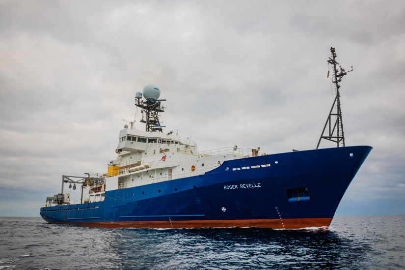
Planned route: 97 segments · ~22 days steaming · 94 stations
Operating area: Mozambique and Madagascar Basins
Route: Cape Town (Western Cape) - South Africa → Port Louis - Mauritius
Projects aboard (2)
DMB
The deep oceans play a crucial role in regulating the Earth's climate on long timescales by exchanging heat and chemical compounds with the atmosphere and moving them globally. Sometimes surface waters are carried into the deepest ocean areas where they are sequestered from further exchanges with the atmosphere over long time periods, but where our knowledge of how water moves are incomplete. For instance, twenty years ago, in the Madagascar Basin of the southwest Indian Ocean, deep waters were undisturbed by human influence. But newer measurements in 2018 showed significant amounts of human-made chemical compounds there. These inert compounds enter the ocean at the sea surface from the atmosphere, so when and where the surface water sinks, it carries those compounds to the deep sea. The presence of such compounds in the deep Madagascar Basin after only twenty years counters our previous knowledge about the region. A possible explanation is that deep currents, as we understood them, may have changed course and strength in the last twenty years. For solving this puzzle, this project will measure the deep currents in the region for the first time, using shipboard instruments during a three-week cruise and with two types of in-water robotic technologies to follow these currents over several years. By combining these novel measurements with computer simulations, this study will identify the pathways that deep waters travel in the Madagascar Basin and examine what causes such circulation patterns. It will focus on currents starting near Antarctica, where the water sinks, through fracture zones in the Southwest Indian Ridge and into the Madagascar Basin, and then on how these abyssal waters spread to fill the basin. The findings from this project will explain why this part of the ocean is changing so fast, advance the knowledge of abyssal ocean circulation, and help define how heat and chemical compounds are moved around within the ocean. The proposed research will be a US contribution to the 2nd International Indian Ocean Expedition (IIOE-2) and will provide the first direct estimate of the abyssal circulation and temperature variability in the Deep Madagascar Basin on a basin scale. The project will support two undergraduate students that will be selected to participate in the DMB cruise. The PIs will also host and mentor undergraduate students each summer. Moreover, the cruise will be available to the community for piggyback projects. The proposed research will investigate the largely unknown Deep Madagascar Basin (DMB) abyssal circulation, how abyssal temperature varies in the interior, and the effects of the tortuous seafloor topography in steering the abyssal flows. The primary objective is to find out by which pathway(s) the younger abyssal water that enters through deep fracture zones in the Southwest Indian Ridge spreads in the basin, which is crucial for a better understanding of the Indian Ocean Meridional Overturning Circulation and its variability. To determine the pathways and the transformation of the abyssal waters in the basin interior, an array of 75 floats ballasted to drift at 4000-m for two years and 3 deep (sea surface to 6000 m) profiling floats will be deployed, complemented by high-resolution hydrographic sections (including tracer analysis) across the mid-basin and the fracture zones. The in-situ observations will be paired with a state-of-art modeling component, which will be used to investigate the underlying dynamics and time evolution of the deep flow field. After validation using the new observational dataset, the model will be used to perform particle tracking simulations to answer some specific questions that are beyond the scope of the in-situ observations alone.
People aboard
DMB
- Viviane Menezes · Principal investigator
EMC
- Viviane Menezes · Principal investigator
Party size: 20
Estimated vacant berths: 17
Equipment
Aboard the vessel
- Dynamic Positioning (DP)
- Underway Seawater System
- Meteorological Data
- ADCP/UHDAS – range 500-750m (e.g. 75kHz)
- Multibeam - Deep Water (EM122, EM124)
- Multibeam - Mid-Water (EM302/304)
- Dynamic Positioning (DP)
- Meteorological Data
- ADCP/UHDAS – range 500-750m (e.g. 75kHz)
- ADCP/UHDAS – range 250-350m (e.g. 150kHz)
Pooled / portable
- CTD
- Ocean Data Facility (ODF)
- CTD
- Ocean Data Facility (ODF)
Schedule data from UNOLS Marine Facilities Planning · operator cruise code RR2303 Menezes · MFP references 21/099, 21/632 · synced Sep 30, 2026