2022 DFO Hydrographic Mission
Completed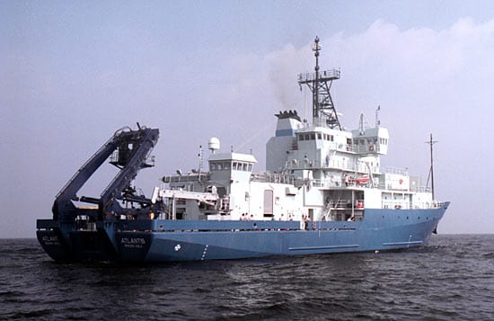
Operating area: Atlantic Canada, Labrador Sea, Greenland
›2 legs· Halifax (Nova Scotia) - Canada → Saint-John's (Newfoundland and Labrador) - Canada
- 1Halifax (Nova Scotia) - Canada→Sydney (Nova Scotia) - CanadaMar 22 – Apr 5, 2022 · 14 d
- 2Sydney (Nova Scotia) - Canada→Saint-John's (Newfoundland and Labrador) - CanadaApr 5 – Apr 7, 2022 · 2 d
Woods Hole Oceanographic Institution
Project aboard
This mission involves the collection of physical, biological and chemical oceanographic data onboard oceanographic surveys conducted in 3 different geographic regions: Gulf of Maine and Scotian Shelf and Slope (Maritimes Region AZMP, AZOMP), Newfoundland and Labrador Shelf (Newfoundland and Labrador Region AZMP), and in the Labrador Sea from the Labrador Shelf, Canada to Cape Desolation on the Greenland shelf (AZOMP). Through the collection of an array of physical, chemical, and biological oceanographic data, this mission aims to: Characterize and understand the causes of oceanic variability at the seasonal, inter-annual and decadal scales across the northwest Atlantic. Provide multidisciplinary datasets that can be used to establish relationships among biological, chemical and physical oceanographic variables. Provide quality data for the validation of oceanographic model outputs and calibration of remote-sensed observations from gliders, Argo floats, and satellite imagery. Provide quality data to support sound decision-making on key government priorities such as climate change, marine protected areas, species at risk and fisheries resource management. Recover and re-deploy oceanographic moorings placed in areas to study ocean properties along with movements of marine mammals (NL AZMP). Recover oceanographic moorings located at 53 North in support of the Overturning in the Subpolar North Atlantic Program (OSNAP), an international effort involving both DFO and WHOI scientists to quantify the subpolar AMOC and its intra-seasonal to inter-annual variability via overturning metrics, including associated fluxes of heat and freshwater (AZOMP).
People aboard
- Marc Ringuette · Chief scientist
- Chantelle Layton · Principal investigator
- Lindsay Beazley · Chief scientist
- Stephen Snook · Chief scientist
- Gary Maillet · Chief scientist
Party size: 24
Estimated vacant berths: 13
Equipment
Aboard the vessel
- Dynamic Positioning (DP)
- Underway Seawater System
- Meteorological Data
- Echosounder, 12kHz
- Echosounder, 3.5kHz CHIRP
- ADCP/UHDAS – range < 80m (eg. 300kHz)
- ADCP/UHDAS – range 500-750m (e.g. 75kHz)
- Multibeam - Deep Water (EM122, EM124)
- Biological multi-frequency echosounder - EK80
Pooled / portable
- CTD
- XBT
- Towed or Vertical Net System
- Winch Pool Portable Winch
Science party brings
- Science Supplied Portable Winch
Schedule data from UNOLS Marine Facilities Planning · operator cruise code AT48_2 thru 5 · MFP reference 22/1480 · synced Sep 24, 2026