Cascadia forearc
Completed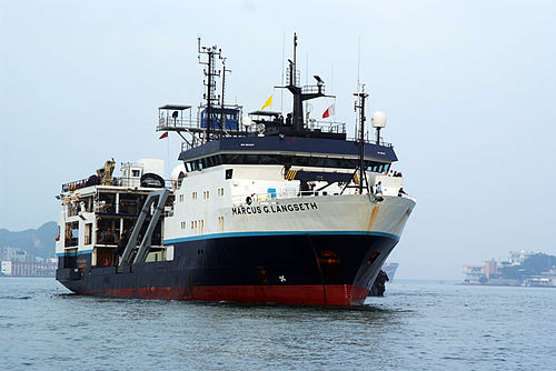
Operating area: Offshore Oregon
Route: Newport (Oregon) - United States → Newport (Oregon) - United States
Project aboard
Geologic hazards such as large megathrust earthquakes and tsunamis occur at convergent margins where tectonic forces push and drag one tectonic plate beneath another. One example of a convergent margin is the Cascadia Subduction Zone off western North America, where the slow ongoing descent of the Juan de Fuca plate beneath coastal northern California, Oregon, Washington and British Columbia has generated large earthquakes and associated tsunamis in the past. Knowledge of the structural and physical properties of the sediments that are being scraped off the Juan de Fuca plate and pushed onto the North American plate is of great importance because the presence of thick sediments increases the potential for great megathrust earthquakes. The scraped off sediments along the Cascadia margin contain significant amounts of naturally occurring methane gas and other fluids. The presence and variations of these fluids along the margin have a large impact on how the seabed responds and shakes during an earthquake. The goal of this project is to acquire an open-access, marine wide-angle seismic reflection/refraction dataset across the Cascadia accretionary wedge encompassing the full length of the margin. These surveys consist of the deployment and recovery of short-period ocean bottom seismometers (OBSs) and a large-N array of ocean bottom nodes (OBNs) leased from a commercial provider using a remotely operated vehicle. The sensors will record human-made acoustic signals of a seismic reflection survey off the Cascadia margin, as well as signals from naturally occurring seismicity. The data recorded by these sensors will allow researchers to document variations in earthquake shaking properties of the sediments off the US west coast. Such information is critical for predicting shaking along the western US under hypothetical scenarios of future large earthquake rupture and assessing tsunami and submarine landslide hazards caused by earthquakes. This project is being conducted in partnership with the USGS. The OBS survey was completed in May-July, 2021, during R /V M. Langseth cruise MGL2103 and R/V Oceanus cruise OC2106A. The OBSs recorded natural seismicity and the controlled-source acoustic signals of the R/V M. Langseth reflection survey (cruise MGL2104, June-July, 2021). The second part of the project will deploy sensors (ocean bottom nodes) on the seabed along a survey line extending from near the coastline out to ~100 miles offshore Oregon to record signals from controlled-source acoustic pulses from a continuation of the seismic reflection survey off the Cascadia margin planned for Spring 2022. The project leverages the location of Langseth prior to its movement to the Atlantic Ocean in 2022, and already funded seismic reflection survey of the Cascadia margin, increasing the scientific return by enabling a whole new suite of scientific data to be collected and broadening the base of potential users for these complementary open-access data sets. The OBN data collected will be open-access and will be released to the community immediately after acquisition and checked for quality control. The data will be reduced to standard digital formats as well as provided as a raw continuous digital time series. The nodal array will sample the seismic wavefields at very high-resolution (hundreds-of- meters lateral resolution) across a transect representative of accretionary wedge structural deformation for central Cascadia. The project will provide much needed data to create accurate, multi-resolution models of the subsurface structure of the Cascadia accretionary prism, filling a critical knowledge gap for improving earthquake and tsunami hazard assessments for Cascadia. The data will enable researchers to develop models using a variety of state-of-the-art methodologies, including multi-parameter 2-D elastic full waveform inversion, to address multiple scientific problems of high importance, such as: (a) Documenting variations in accretionary wedge site response, which is critical for predicting earthquake-triggered shaking along the western US and assessing tsunami/landslide hazards under hypothetical scenarios of future megathurst rupture, and to test proposed linkages between paleo great earthquakes and distribution of turbidites. (b) Determining accretionary sediment properties (Vp, Vs, density, porosity, and fluid pore pressure) indicative of fluid expulsion and/or retention, drainage networks, and their relation to structural style and seafloor fluid seepage.
People aboard
- Pablo Canales · Principal investigator
Party size: 5
Estimated vacant berths: 30
Equipment
Pooled / portable
- Ocean Bottom Seismometers - Other
- Other ROV
Schedule data from UNOLS Marine Facilities Planning · MFP reference 21/1212 · synced Sep 24, 2026