OOI Endurance Array OM Fall 2023
Completed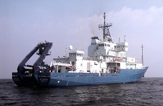
Operating area: Oregon and Washington shelf and slope
›3 legs· Astoria (Oregon) - United States → Astoria (Oregon) - United States
- 1Astoria (Oregon) - United States→Astoria (Oregon) - United StatesSep 21 – Sep 23, 2023 · 2 d
- 2Astoria (Oregon) - United States→Astoria (Oregon) - United StatesSep 27 – Oct 1, 2023 · 4 d
- 3Astoria (Oregon) - United States→Astoria (Oregon) - United StatesOct 2 – Oct 7, 2023 · 5 d
Project aboard
Located in the Northeast Pacific Ocean off the coasts of Oregon and Washington, the Endurance Array is part of a regional observatory network that includes OOI, Station Papa, and Ocean Networks Canada. Measurements taken by this network collectively capture variability of ocean properties across a broad range of temporal and spatial scales. They allow examination of ocean health issues, including hypoxia, ocean acidification, and harmful algal blooms. The Coastal Endurance Array is made up of two cross-shelf moored array lines. The Oregon Line, off the coast of Newport, Oregon, is located at 44° 35’N, from 125°W to coast. The Washington Line, off Grays Harbor Washington, is located at 47oN, from 125oW to the coast. Gliders move and collect data around, along, and between these lines. Two Endurance Array sites include platforms connected to OOI’s Regional Cabled Array. The Coastal Endurance Array is designed to observe cross-shelf and along-shelf variability in the region. Each line contains three sites spanning the slope (~500-600 m), shelf (~80-90 m) and inner-shelf (~25-30 m). The three sites across the shelf and slope are associated with characteristic physical, geological, and biological processes. All six sites contain fixed sensors at the top and bottom of the water column paired with an adjacent water column profiler. The Oregon and Washington Lines are both affected by wind-driven upwelling and downwelling, but shelf stratification and upper-ocean properties are influenced differently by the Columbia River. The Washington Line is north of the Columbia River outflow and the Oregon Line is south of it. Observations on both sides of the river outflow allow for a greater understanding of regional coastal ocean ecosystem responses. Mooring lines provide synoptic, multi-scale observations of the eastern boundary current regime. Coastal gliders bridge the distances between the fixed sites and allow for adaptive sampling.
People aboard
- Edward Dever · Principal investigator
Party size: 15
Estimated vacant berths: 22
Equipment
Aboard the vessel
- Dynamic Positioning (DP)
- ADCP/UHDAS – range 500-750m (e.g. 75kHz)
Pooled / portable
- Winch Pool Portable Winch
Science party brings
- Science-provided vans
Schedule data from UNOLS Marine Facilities Planning · operator cruise code AT50-16_A,B&C_Dever · MFP reference 21/043 · synced Sep 24, 2026